
PROJECT / ACTIVITY
Enroll to start learning
You’ve not yet enrolled in this course. Please enroll for free to listen to audio lessons, classroom podcasts and take practice test.
Interactive Audio Lesson
Listen to a student-teacher conversation explaining the topic in a relatable way.
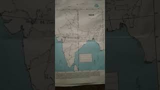
Geographical Position of India
🔒 Unlock Audio Lesson
Sign up and enroll to listen to this audio lesson

Today, we will discuss India's geographical position. Can anyone tell me the latitudinal and longitudinal extent of India?

Is it between 8° 4'N and 37° 6'N for latitude?
Correct! And the longitude is from 68° 7'E to 97° 25'E. This vast area influences our climate and time zones. Can anyone explain how?

It affects how long daylight lasts in different regions, right?
Exactly! The difference in latitude means that Arunachal Pradesh experiences sunrises two hours before Gujarat, although both states use the same time.

Why do we use the Standard Meridian at 82° 30'E?
Great question! This meridian is chosen as a standard to provide uniform time across the entire country. Let's remember it as the 'Time Standard of India'!

It's like how different time zones exist globally!
True! And with India's varied geography, we have different climatic zones, influencing everything from food production to festivals. Let's wrap up this session with a summary: India is strategically placed between various countries, affecting trade and cultural exchange.
Size and Land Boundaries
🔒 Unlock Audio Lesson
Sign up and enroll to listen to this audio lesson

Now that we know about latitude and longitude, let's talk about the size and boundaries of India. What do you think is India's total area?
Is it around 3.28 million square kilometers?
Exactly! This makes India the seventh largest country in the world. Who can tell me about its land boundaries?
India has about 15,200 km of land boundaries, right?
Perfect! And it shares borders with Pakistan, Afghanistan, China, Nepal, Bhutan, Myanmar, and Bangladesh. Why is this important?
It allows for trade and cultural exchange, right?
Yes! India has a strategic location that enhances trade routes. Remember, the Deccan Peninsula even extends into the Indian Ocean, connecting us with countries in the East and West.
So, other countries depend on us for resources too?
Absolutely! In summary, India's size and location play a crucial role in fostering international relationships and improving trade routes throughout history.
India and the Indian Ocean
🔒 Unlock Audio Lesson
Sign up and enroll to listen to this audio lesson
Let's delve into the Indian Ocean. Why do you think India’s position in this ocean is significant?
Because it connects us to many trading partners in Africa and Asia!
Right! India’s coastline facilitates maritime trade and enables cultural exchanges. Can anyone name the island groups in the Indian Ocean?
The Andaman and Nicobar Islands!
And Lakshadweep!
Exactly! The proximity to these islands enhances trade connections with neighboring countries. Remember, the opening of the Suez Canal decreased the distance to Europe drastically. What does that tell you?
That our trade routes became busier and more efficient!
Very good! To summarize, India’s position by the Indian Ocean makes it a pivotal player in trading routes, allowing cultural exchanges and commerce to flourish.
Introduction & Overview
Read summaries of the section's main ideas at different levels of detail.
Quick Overview
Standard
The section elaborates on India's geographical location, highlighting its size, boundaries, and the impact of its position on trade and relations with neighboring countries. It also mentions key geographic points like the Tropic of Cancer and the Indian Ocean, reinforcing India’s strategic importance.
Detailed
PROJECT / ACTIVITY
India is positioned uniquely on the globe, straddling both the Tropic of Cancer and the Southern Hemisphere. It has a significant landmass of 3.28 million sq km, accounting for about 2.4% of the total geographical area of the world, making it the seventh-largest country. Geographically, the country is bordered to the northwest by young fold mountains, with a coastline stretching over 7,516 km. The latitudinal extent of about 30° demonstrates the diverse climatic zones across the country, which influences the duration of day and night as well.
India's position in the Indian Ocean enhances its importance in global trade, especially with the opening of the Suez Canal. The country shares land boundaries with various nations such as Pakistan, Nepal, and Bangladesh, while Sri Lanka and the Maldives are located to the south across the sea. Different states within India have substantial variances in their geographic and demographic features, further contributing to the country's rich cultural landscape. The section ends with project ideas like discovering the longitudinal and latitudinal measures of one’s state and exploring important historical trade routes.
Youtube Videos


Audio Book
Dive deep into the subject with an immersive audiobook experience.
Finding the Extent of Latitudinal and Longitudinal Coordinates
Chapter 1 of 3
🔒 Unlock Audio Chapter
Sign up and enroll to access the full audio experience
Chapter Content
Find out the longitudinal and latitudinal extent of your state.
Detailed Explanation
In this chunk, the task is to identify and report the longitudinal and latitudinal coordinates of your state. Longitude refers to the imaginary lines that run from the North pole to the South pole, measuring the distance west or east of the Prime Meridian. Latitude, on the other hand, are the lines that run horizontally, measuring the distance north or south of the Equator.
Examples & Analogies
Think of it as locating a house on a map. Just like a house has a specific address that helps you find it, states have their own coordinates that pinpoint their exact location on a globe.
Exploring the Silk Route
Chapter 2 of 3
🔒 Unlock Audio Chapter
Sign up and enroll to access the full audio experience
Chapter Content
Collect information about the ‘Silk Route’.
Detailed Explanation
The Silk Route refers to a network of trade routes that connected the East and West from China to Europe. This route not only facilitated trade of silk but also other goods, ideas, and cultures. Researching this topic involves looking into its history, key locations, and its importance in enabling interactions between different civilizations.
Examples & Analogies
Imagine it like a giant highway that allowed travelers to connect with different communities. Just as a highway brings people together from various regions, the Silk Route was a means for diverse cultures to meet, trade and share their customs.
Modern Developments in Communication Routes
Chapter 3 of 3
🔒 Unlock Audio Chapter
Sign up and enroll to access the full audio experience
Chapter Content
Find out the new developments, which are improving communication routes in the regions of high altitude.
Detailed Explanation
This chunk focuses on discovering the latest enhancements in communication routes, especially in mountainous or high altitude areas. These developments could include advancements in technology, construction of new roads, or improved telecommunications that make it easier for people in remote locations to connect with the rest of the world.
Examples & Analogies
Consider how, in the past, people in high mountains had trouble communicating with those in the valleys. With modern technology like satellites and mobile networks, it's like giving them a bridge to cross the mountain — now they can easily share information and connect with others, no matter how rugged the terrain.
Key Concepts
-
Geographical location: India lies entirely in the Northern Hemisphere with variegated latitudinal and longitudinal extents.
-
Tropic of Cancer: It divides the country and affects climatic conditions and time zones.
-
Size of India: India ranks as the seventh largest country, influencing its diversity and international relations.
-
Coastline: India's coastline enhances maritime trade and connects it with various global regions.
Examples & Applications
The southernmost point of India, Indira Point, was submerged in 2004 during the tsunami, showing the impact of natural occurrences on geography.
The distance between the Deccan Peninsula and the eastern and western countries showcases India’s central location in trade.
Memory Aids
Interactive tools to help you remember key concepts
Rhymes
In India’s land, oceans embrace; trade flows like a lively race.
Stories
Imagine a young traveler named Aria, who sails from the Deccan Peninsula to trade spices with traders from Africa and East Asia, discovering the importance of India’s location.
Memory Tools
Remember 'TENC' - Tropic of Cancer, Extent, North/South, Coastline for key geographical features.
Acronyms
Use 'INDIA' to remember
'India Neighbors Diverse International Areas' for its international relationships.
Flash Cards
Glossary
- Tropic of Cancer
A line of latitude located at 23° 30'N, marking the northernmost point where the sun can be directly overhead.
- Land Boundary
The geographic line that forms the border of a country's land area.
- Standard Meridian
A meridian that defines the standard time for a country; for India, it is at 82° 30'E.
- Deccan Peninsula
A large plateau in India that extends into the Indian Ocean, significant for maritime trade.
- Union Territory
A type of administrative division in India that is governed directly by the Central Government.
Reference links
Supplementary resources to enhance your learning experience.