
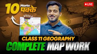
Map Work
Enroll to start learning
You’ve not yet enrolled in this course. Please enroll for free to listen to audio lessons, classroom podcasts and take practice test.
Interactive Audio Lesson
Listen to a student-teacher conversation explaining the topic in a relatable way.
Introduction to Maps
🔒 Unlock Audio Lesson
Sign up and enroll to listen to this audio lesson

Welcome class! Today we're diving into the world of maps. Can anyone tell me what a map is?

Isn’t it just a picture of roads?
Good try! A map is much more. It's a visual representation of the Earth or parts of it, showing features like landforms and bodies of water. Think of it like a 2D view of our 3D world!

Why are maps important?
Maps help us navigate, manage resources, and understand geography. They highlight everything from continents to local streets.

Wait, so maps are used in urban planning too?
Exactly! Urban planners depend on maps to design cities. To remember this, think of the acronym MAP: 'Map for Arrangement and Planning'!
That’s a helpful way to remember it!
Great! So, maps are more than just pictures; they are essential for various applications. Let’s summarize: Maps give us a 2D view of locations and help in navigation and planning.
Types of Maps
🔒 Unlock Audio Lesson
Sign up and enroll to listen to this audio lesson

Now, let’s discuss types of maps. Can anyone name one type of map?
Physical maps show landforms, right?
That's correct! Physical maps depict natural features like mountains and rivers. Another type is political maps, which indicate human-made boundaries. Can someone give me an example of a political feature?

Countries and cities!
Exactly! Political maps are essential for understanding geography. What about thematic maps?
Those show specific themes, like population density!
Well done! Thematic maps are designed to convey data about particular subjects. Remember the term 'TAP': Thematic for Analysis of Population!
That's a catchy way to remember!
To summarize, we’ve covered the importance of physical, political, and thematic maps and a few examples. Considering their respective roles helps us understand the world better.
Map Elements
🔒 Unlock Audio Lesson
Sign up and enroll to listen to this audio lesson
Let's dive into map elements. What's one essential element of a map?
The scale?
Correct! The scale shows the relationship between distances on the map and the actual ground. Who can explain the different types of scales?
There are linear scales, RF, and verbal scales!
Spot on! Each type serves a purpose in understanding distances. Can anyone tell me about map symbols?
They represent different features, like roads or rivers.
Exactly! The map key explains these symbols. Remember this key phrase: 'Signifies with Symbols!'
That's easy to remember.
Lastly, we have direction and contours—vital for understanding where things are located. To wrap it up, we learned about scale, symbols, and direction, which are essential for reading maps accurately.
Reading and Interpreting Maps
🔒 Unlock Audio Lesson
Sign up and enroll to listen to this audio lesson
Reading and interpreting maps correctly is important. Who can tell me how we start with physical maps?
We identify natural features like mountains and rivers.
Great! Now, how do we read political maps?
We look for boundaries and major cities.
Exactly! Political maps show important human-made features. Thematic maps present data; what’s the key to interpreting them?
We focus on the themes and data they present.
Right! Maps rely on a grid of coordinates that help identify exact points. For a mnemonic: 'Coordinate to Locate!' Let’s summarize: Identifying features, understanding boundaries, and interpreting data are essential for reading any map.
Introduction & Overview
Read summaries of the section's main ideas at different levels of detail.
Quick Overview
Standard
In this section, readers learn about various aspects of maps, including definitions, types like physical and political maps, map elements such as scale and symbols, and their practical applications in navigation, urban planning, and environmental studies.
Detailed
Map Work: An Overview
This section, titled Map Work, delves into the essential components and functionalities of maps. A map is defined as a visual representation of the Earth’s surface, drawn to scale, enabling the understanding of spatial relationships, distances, and geographical features. The importance of maps spans various fields including navigation, resource management, and urban planning, making them vital tools for understanding physical and political features.
1. Types of Maps
Maps are categorized into several types:
- Physical Maps illustrate natural features like mountains and rivers.
- Political Maps detail human-created boundaries, showing countries and cities.
- Thematic Maps focus on specific themes, such as population density.
- Topographic Maps provide a detailed view of terrain, including contours and elevation.
- Climatic and Weather Maps exhibit average weather conditions and current weather information.
2. Map Elements
Key elements of maps include:
- Scale: Establishes the relationship between map distance and real-world distance, vital for accurate interpretation.
- Symbols and Keys: Use standardized symbols to represent geographical features, explained in a legend.
- Direction: Indicated by a compass rose, essential for orientation.
- Contours and Elevation: Contour lines on topographical maps depict elevation, aiding in understanding landforms.
3. Reading and Interpreting Maps
Students learn the methods of interpreting physical features, recognizing political boundaries, and analyzing thematic data through coordinates.
4. Practical Applications
Maps find applications in geography, fieldwork, navigation, environmental understanding, and urban planning, supporting diverse decision-making processes. Overall, this section emphasizes the significance of map literacy in various sectors, enhancing spatial awareness and understanding of our world.
Youtube Videos

Audio Book
Dive deep into the subject with an immersive audiobook experience.
Introduction to Maps
Chapter 1 of 6
🔒 Unlock Audio Chapter
Sign up and enroll to access the full audio experience
Chapter Content
Introduction to Maps
● What is a Map?
A map is a visual representation of the Earth's surface or part of it, drawn to scale and showing geographical features such as landforms, bodies of water, roads, and boundaries.
Maps are two-dimensional representations of the Earth’s three-dimensional surface, helping to understand spatial relationships, distances, and locations.
● Importance of Maps
Maps provide essential information for navigation, resource management, urban planning, environmental studies, and geographic analysis.
They are tools for depicting the physical and political features of regions, and can show everything from continents to local streets.
Detailed Explanation
Maps are images that help us understand where things are on Earth. They show important features like mountains, rivers, and cities, making it easier for us to navigate and study different places. Maps are created to fit on paper (2D), even though the Earth is a round (3D) shape. This allows us to easily figure out distances and locations on the surface of the Earth. They serve many purposes, such as helping travelers find their way, assisting city planners in developing infrastructure, and helping scientists study the environment.
Examples & Analogies
Think of a map like a treasure map. Just as a treasure map helps you find hidden treasure by showing you the way with symbols and directions, regular maps guide us to different locations and features in the real world, without any hidden treasure.
Types of Maps
Chapter 2 of 6
🔒 Unlock Audio Chapter
Sign up and enroll to access the full audio experience
Chapter Content
Types of Maps
● Physical Maps
Physical maps represent natural features like mountains, rivers, lakes, and deserts. They often use color gradients to show elevation and depth, with darker shades representing higher elevations.
Example: A map showing the topography of the Himalayas.
● Political Maps
Political maps show countries, states, cities, and towns, along with boundaries like international borders and administrative divisions. These maps are essential for understanding the political organization of a region.
Example: A map of the world showing countries and capitals.
● Thematic Maps
Thematic maps focus on specific themes or topics such as population density, climate, vegetation, or economic activity. These maps are designed to convey data about a specific subject.
Example: A map showing the population density of India.
● Topographic Maps
Topographic maps provide detailed, large-scale features of a particular area, including natural and man-made features, with accurate representations of land elevation, contour lines, and roads.
These maps often use contour lines to show elevation and depict physical features like valleys, hills, and plains.
● Climatic and Weather Maps
Climatic maps show the average weather conditions, such as temperature and rainfall, of a specific region over a long period.
Weather maps provide current weather conditions, including temperature, wind direction, and atmospheric pressure.
Detailed Explanation
There are various types of maps that serve different purposes. Physical maps highlight natural features, allowing us to visualize mountains and rivers. Political maps show boundaries and cities important for understanding governance and administration. Thematic maps provide focused information on specific topics, such as population or climate patterns, while topographic maps depict land formations and elevations using contour lines. Lastly, climatic maps show average weather over time, and weather maps give current conditions, helping us understand both the long-term and short-term aspects of our environment.
Examples & Analogies
Imagine going on a hike in the mountains. You would need a physical map to see the elevation changes, but if you wanted to know which state you are in or where the nearest town is, a political map would help. If you're curious about how many people live in the area, a thematic map would be great. It’s like having different tools in a toolbox that help you solve different problems.
Map Elements
Chapter 3 of 6
🔒 Unlock Audio Chapter
Sign up and enroll to access the full audio experience
Chapter Content
Map Elements
● Scale of a Map
The scale of a map represents the relationship between the distances on the map and the actual distances on the Earth's surface. It helps to determine the real-world size of features depicted on the map.
Types of Scales:
- Linear Scale: A bar scale that represents the distance on the ground.
- Representative Fraction (RF): Expresses the scale as a fraction or ratio (e.g., 1:50,000 means 1 unit on the map equals 50,000 units on the ground).
- Verbal Scale: Describes the scale in words (e.g., '1 inch equals 1 mile').
● Symbols and Keys
Maps use symbols to represent various geographical features. A map key or legend explains what each symbol represents.
Symbols for features such as rivers, mountains, cities, roads, and railways are standardized so they can be understood universally.
● Direction
Maps include a directional indicator or compass rose to show cardinal directions (North, South, East, and West) and intermediate directions (e.g., NE, SW). It helps to orient the map.
The bearing system (degrees) can also be used for precise navigation.
● Contours and Elevation
Contour lines are used on topographic maps to represent elevation. Each line connects points of equal height above sea level.
Index Contours: These are every fifth contour line and are usually labeled with their elevation.
Detailed Explanation
Every map contains specific elements that help us understand it better. The scale tells us how distance on the map relates to actual distance on the ground, allowing us to measure things accurately. Symbols and keys are like a map's language; they provide a quick reference to identify various features like rivers and roads. Direction indicators, including a compass rose, help us understand which way is which on a map. Finally, contour lines on topographic maps illustrate elevation changes, helping us visualize how terrain varies in height.
Examples & Analogies
Think of a treasure hunt with a map. The scale helps you understand the distances you'll need to walk, symbols let you know where the treasure is buried if it’s hidden near a 'X', and the compass rose tells you to go 'north' to find it. Without these elements, the map would be confusing, and you might miss your treasure!
Practical Map Work
Chapter 4 of 6
🔒 Unlock Audio Chapter
Sign up and enroll to access the full audio experience
Chapter Content
Practical Map Work
● Drawing Maps
Drawing a map involves understanding the key features to be represented (such as rivers, cities, roads, or mountains) and placing them correctly according to scale.
Start with a skeleton map showing major boundaries or outlines, then add physical and political features.
● Marking Latitude and Longitude
Marking specific locations on maps using latitude and longitude coordinates is essential for understanding global positioning and navigation.
● Using a Compass for Directions
In real-world map work, a compass is often used to determine direction. When navigating or using maps for fieldwork, understanding the orientation of features relative to cardinal and intermediate directions is critical.
Detailed Explanation
Practical skills in map work involve creating and utilizing maps effectively. When drawing maps, it is crucial to begin with a basic outline and to accurately represent geographical and political features using the correct scale. Marking latitude and longitude adds precision, allowing users to pinpoint locations around the globe easily. Additionally, using a compass is vital in navigating using a map, ensuring you can find the right direction when exploring or surveying an area.
Examples & Analogies
Imagine you are planning a neighborhood park. Drawing a map would involve sketching out where the trees, playground, and paths go. Once you have that, you can use latitude and longitude to know exactly where the park is located. If you were to visit the park, a compass would help you find your way from your house to the park, making your journey simpler!
Applications of Map Work
Chapter 5 of 6
🔒 Unlock Audio Chapter
Sign up and enroll to access the full audio experience
Chapter Content
Applications of Map Work
● Geography and Fieldwork
Maps are extensively used in fieldwork for geographical surveys, planning, and analysis. They help geographers, urban planners, and environmentalists in planning sustainable developments and monitoring changes in the environment.
● Navigation and Travel
Maps are critical tools for travelers, helping them navigate both familiar and unknown terrains. Road maps, hiking maps, and navigational charts for air and sea travel are essential for safe and efficient movement.
● Understanding Environmental Issues
Maps help in understanding environmental issues such as deforestation, water bodies, climate zones, and urban sprawl. Thematic maps play a crucial role in highlighting the impact of these issues.
● Urban Planning and Development
Urban planners use maps to design cities, ensuring that infrastructure such as roads, water systems, and utilities are optimally laid out. Maps help in zoning areas for residential, commercial, and industrial development.
Detailed Explanation
Map work finds its applications in various fields, enhancing our understanding of geography and improving planning and navigation. Geographers and environmental analysts use maps for conducting surveys and monitoring environmental changes to promote sustainable development. For travelers, maps assist in safely navigating unknown areas. Maps also highlight pressing environmental issues and assist urban planners in designing effective cities by organizing infrastructure and space usage strategically.
Examples & Analogies
Think of a city's map like a recipe for a successful dish. Just as a recipe tells you the ingredients and steps needed for cooking, maps provide critical information for planners to develop a city. They show where to put roads and parks or how to best conserve water resources to keep the city healthy and thriving.
Conclusion
Chapter 6 of 6
🔒 Unlock Audio Chapter
Sign up and enroll to access the full audio experience
Chapter Content
Conclusion
● Summary of Key Points
Map work involves the study and interpretation of maps, which are essential for understanding geographical features and spatial relationships.
Key elements of map work include reading maps, understanding scales, symbols, projections, and the ability to draw and interpret maps accurately.
Maps are invaluable tools for various applications such as navigation, urban planning, environmental management, and education.
● Practical Use of Maps
Mastery of map work enhances spatial thinking and understanding of the world around us, supporting better decision-making in various sectors like geography, urban development, environmental conservation, and disaster management.
Detailed Explanation
In summary, map work is a vital aspect of geography that helps us interpret and utilize maps effectively. It includes understanding their elements, various types, and practical applications, enabling us to navigate, plan, and analyze our environment better. Mastery of map skills promotes spatial awareness and informed decision-making, which is essential across numerous fields, from city planning to environmental conservation.
Examples & Analogies
Just as learning to read is essential for accessing a world of knowledge, mastering map work equips us with vital skills to 'read' our physical world. It empowers us to explore, navigate, and understand reality more deeply, leading to greater awareness and better choices in our everyday lives.
Key Concepts
-
Map: A representation of the Earth's surface.
-
Scale: Establishes the proportion of map distances to real-world distances.
-
Types of Maps: Various categories such as physical, political, thematic, topographic, and climatic.
-
Map Elements: Components including scale, symbols, direction, and contours.
-
Reading Maps: Techniques for interpreting different types of maps effectively.
Examples & Applications
A physical map showing the Himalayas highlights natural elevations and landforms.
A political map of the United States shows states and major cities.
A thematic map of India displays population density using color gradients.
Memory Aids
Interactive tools to help you remember key concepts
Rhymes
Maps give us a view, from mountains to blue, showing features anew!
Stories
Once upon a time, explorers used maps drawn on ancient pots to find their way home, just like we do today with physical and political maps guiding our travels.
Memory Tools
To remember different map types: 'PPTT' - Physical, Political, Thematic, Topographic.
Acronyms
MAP
'Map for Arrangement and Planning' helps us understand urban planning.
Flash Cards
Glossary
- Map
A visual representation of the Earth's surface, showing geographical features.
- Scale
The relationship between distances on the map and actual distances on the Earth's surface.
- Physical Maps
Maps that represent natural features like mountains and rivers.
- Political Maps
Maps that show human-made boundaries such as countries and cities.
- Thematic Maps
Maps focusing on specific themes or topics, such as population density.
- Contour Lines
Lines used in topographic maps to represent elevation.
- Coordinates
Values that determine the specific location on a map using latitude and longitude.
Reference links
Supplementary resources to enhance your learning experience.