
Factors Affecting Climate
Enroll to start learning
You’ve not yet enrolled in this course. Please enroll for free to listen to audio lessons, classroom podcasts and take practice test.
Interactive Audio Lesson
Listen to a student-teacher conversation explaining the topic in a relatable way.
Latitude's Role in Climate
🔒 Unlock Audio Lesson
Sign up and enroll to listen to this audio lesson

Let's begin by discussing latitude, which plays a crucial role in determining climate. Can anyone tell me how latitude affects the angle of sunlight?

I think the closer you are to the equator, the more direct sunlight you receive?
Exactly! The equator receives direct sunlight year-round, making it much warmer. This is why tropical regions experience hot climates.

What about places like Canada? They're so cold!
Great question! Canada is at a higher latitude, where sunlight hits at a more oblique angle, leading to cooler temperatures. You might remember this with the mnemonic 'Closer equals warmer.'

So latitude is like a temperature thermometer?
Exactly! Latitude acts like a gauge for temperature differences across the globe. Let's recap: lower latitudes have higher temperatures due to direct sunlight, while higher latitudes are cooler.
Altitude's Impact on Climate
🔒 Unlock Audio Lesson
Sign up and enroll to listen to this audio lesson

Now, let’s talk about altitude. Raise your hand if you know how altitude can change temperature.

Higher altitudes are colder, right?
Correct! As we ascend into the atmosphere, temperatures typically drop. This is due to the thinner atmosphere at higher altitudes having less ability to hold heat.
Is that why it’s cold on mountain tops?
Absolutely! A good way to remember this is: 'Altitudes chill; valleys fill.' Cities at higher elevations often have much cooler climates than those at sea level.
What difference does it make on weather?
It's significant! Higher elevations can experience distinct weather patterns, often leading to increased precipitation in mountainous areas. Let's summarize: higher elevations lead to cooler temperatures due to decreased air pressure.
Influence of Proximity to Water
🔒 Unlock Audio Lesson
Sign up and enroll to listen to this audio lesson
Next, we will explore how proximity to water influences climate. Who can explain how large bodies of water can change temperature?
Water moderates temperatures, right? Like, it keeps coastal areas from becoming too hot or too cold?
Exactly! Water has a high heat capacity, absorbing and releasing heat slowly. This results in milder climates along coasts compared to inland areas. Remember the catchy phrase: 'Land heats and cools fast, water takes its time!'
So, do coastal cities have fewer temperature extremes?
Yes, very few! This moderating effect prevents extreme temperature variations, which is crucial for agriculture. To sum up, proximity to water leads to less variability in temperatures.
Ocean Currents' Impact on Climate
🔒 Unlock Audio Lesson
Sign up and enroll to listen to this audio lesson
Now let’s discuss ocean currents and how they influence coastal climates. What are ocean currents?
They’re like rivers in the ocean that move warm or cold water around?
Exactly! Ocean currents can either warm or cool coastal regions. For example, the Gulf Stream carries warm water across the Atlantic, affecting climate in Europe.
Is that how some places like Florida are warmer than others?
Yes! The warm waters of the Gulf Stream play a significant role in Florida's mild climate. Think of the acronym 'WARM': Water’s Action Regulates Meteorology.
What happens on the other hand with cold currents?
Cold currents can lead to cooler climates, like the cold California current, which keeps coastal temperatures lower than areas further inland. So, let's recap: ocean currents distribute heat globally and significantly impact climate.
Introduction & Overview
Read summaries of the section's main ideas at different levels of detail.
Quick Overview
Standard
Climate is shaped by several key factors that interact to create diverse climatic conditions around the world. Latitude affects sunlight incidence, altitude impacts temperature, proximity to water moderates climate, and ocean currents, wind, and landforms further influence regional climates.
Detailed
Factors Affecting Climate
Climate refers to long-term patterns of weather in a region, and various geographical factors influence these patterns. This section discusses the primary factors affecting climate, which include:
- Latitude: Latitude determines the angle at which sunlight hits the Earth, directly influencing its temperature. Generally, areas near the equator receive more direct sunlight and warmer temperatures compared to the poles.
- Altitude: As elevation increases, the temperature tends to decrease. This gradient results in cooler conditions in mountainous areas compared to surrounding lowland regions.
- Proximity to Water: Oceans and large bodies of water moderate climate, typically leading to milder conditions in coastal areas compared to inland regions. Water has a high heat capacity, which means it absorbs heat during the day and releases it at night, stabilizing temperatures.
- Ocean Currents: The movement of ocean currents can significantly impact climate by distributing heat across different regions. For example, warm currents can lead to higher temperatures in coastal areas, while cold currents do the opposite.
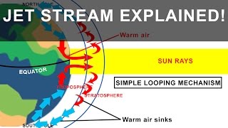
- Wind and Air Circulation: Wind patterns play a crucial role in redistributing heat and moisture, thereby affecting local climates. The direction of prevailing winds can steer weather systems and precipitation patterns.
- Topography: The physical features of the land, such as mountains and valleys, affect climate through phenomena like the rain shadow effect, where one side of a mountain range may receive heavy rainfall while the other remains dry.
Understanding these factors is vital for comprehending the complex interactions that shape the Earth's climates, essential for studying climate change and its global impact.
Youtube Videos


Audio Book
Dive deep into the subject with an immersive audiobook experience.
Latitude
Chapter 1 of 6
🔒 Unlock Audio Chapter
Sign up and enroll to access the full audio experience
Chapter Content
○ Latitude: Determines the angle at which the sun's rays strike the Earth, influencing temperature.
Detailed Explanation
Latitude refers to how far north or south you are from the equator. The Earth is tilted, which means that areas close to the equator receive sunlight more directly compared to those near the poles, where the sunlight is more spread out. This difference in sunlight intensity affects regions' temperatures, causing equatorial areas to be warmer while polar regions remain cooler.
Examples & Analogies
Think of a flashlight shining on a flat surface. If you hold it directly above the center, the light spot is bright and warm. But if you tilt the flashlight, the light spreads out, making it dimmer and cooler at the edges. This is similar to how sunlight affects different latitudes on Earth.
Altitude
Chapter 2 of 6
🔒 Unlock Audio Chapter
Sign up and enroll to access the full audio experience
Chapter Content
○ Altitude: The higher the altitude, the cooler the temperature.
Detailed Explanation
Altitude is the height of a location above sea level. As altitude increases, the atmosphere becomes thinner, which means it holds less heat. As a result, temperatures typically drop the higher you go. For example, mountainous regions are often cooler than the lowlands.
Examples & Analogies
Imagine if you've climbed a mountain. The higher you go, the cooler it feels, even if the weather at the base of the mountain is warm and sunny. This is because at higher altitudes, there’s less air pressure and the air is less able to hold warmth.
Proximity to Water
Chapter 3 of 6
🔒 Unlock Audio Chapter
Sign up and enroll to access the full audio experience
Chapter Content
○ Proximity to Water: Oceans and seas moderate temperatures, causing coastal areas to have milder climates than inland areas.
Detailed Explanation
Water has a high heat capacity, which means it can absorb and store heat longer than land. This causes coastal areas to experience milder temperatures year-round compared to inland areas, which can experience more extreme temperature changes. The ocean cools the air in summer and warms it in winter, making coastal climates less variable.
Examples & Analogies
Think of a wet sponge and a dry towel. The sponge retains moisture and stays cooler, while the towel dries out quickly and can get hot in the sun. Similarly, coastal areas, which are near large bodies of water, remain more stable in temperature compared to dry, inland areas.
Ocean Currents
Chapter 4 of 6
🔒 Unlock Audio Chapter
Sign up and enroll to access the full audio experience
Chapter Content
○ Ocean Currents: Warm and cold ocean currents affect coastal climates, making them warmer or cooler.
Detailed Explanation
Ocean currents are large-scale movements of water within the oceans. Warm currents can raise temperatures of coastal regions, while cold currents can make them cooler. For example, the Gulf Stream warms parts of the North Atlantic, affecting climates in Europe.
Examples & Analogies
Imagine a giant conveyor belt under the ocean, moving warm and cold water around the planet. Just like a heater blowing warm air into a room, warm currents can influence the climate of the lands they touch.
Wind and Air Circulation
Chapter 5 of 6
🔒 Unlock Audio Chapter
Sign up and enroll to access the full audio experience
Chapter Content
○ Wind and Air Circulation: Winds redistribute heat and moisture, impacting regional climates.
Detailed Explanation
Winds are driven by the uneven heating of the Earth's surface. They carry heat and moisture from one place to another. For instance, trade winds can bring warm, moist air to coastal regions, impacting weather patterns and precipitation levels.
Examples & Analogies
Think of blowing on a bowl of hot soup to cool it down. The wind moves the warm air away, just like winds redistribute heat and moisture in the atmosphere, altering temperatures and weather in different regions.
Topography
Chapter 6 of 6
🔒 Unlock Audio Chapter
Sign up and enroll to access the full audio experience
Chapter Content
○ Topography: Mountains can block air masses, creating different climates on each side (e.g., rain shadow effect).
Detailed Explanation
Topography refers to the arrangement of the natural and artificial physical features of an area. Mountains can interfere with weather patterns; when air rises over a mountain, it cools and precipitates on one side, creating a wet climate, while the other side, in the rain shadow, remains dry.
Examples & Analogies
Imagine a giant wall blocking wind. On one side, it gets lots of rain and is lush, while on the other side, there’s little rain and it remains dry, like two different landscapes split by a mountain range.
Key Concepts
-
Latitude: The position on Earth that influences solar heating.
-
Altitude: Higher heights lead to cooler temperatures.
-
Proximity to Water: Water bodies lead to milder climates and reduced temperature fluctuations.
-
Ocean Currents: Movement of ocean waters can warm or cool nearby areas.
-
Wind Patterns: The distribution of heat and moisture through atmospheric movements.
-
Topography: The landscape’s features can create varied climates.
Examples & Applications
Tropical regions near the equator experience consistently high temperatures due to direct sunlight.
Mountainous environments are cooler than surrounding areas because of high altitude.
Coastal cities have milder climates compared to inland cities due to the moderating effects of nearby oceans.
Memory Aids
Interactive tools to help you remember key concepts
Rhymes
Latitude's light shines bright, making equator's warmth, day and night.
Stories
Imagine climbing a mountain: as you rise, the air gets cooler just like the temperature drops as you move from the equator up towards the poles.
Memory Tools
PALOT for climate factors: Proximity to Water, Altitude, Latitude, Ocean Currents, and Topography.
Acronyms
WARM - Water Affects Regional Meteorology.
Flash Cards
Glossary
- Climate
The long-term patterns of temperature, humidity, wind, and precipitation in an area.
- Latitude
The distance north or south of the equator, affecting sunlight and temperature.
- Altitude
The height of an area above sea level, impacting temperature and weather.
- Proximity to Water
The closeness to large bodies of water, which moderates local climate.
- Ocean Currents
Continuous movements of seawater that distribute heat around the planet.
- Wind Patterns
The direction and speed of winds that influence climate and weather.
- Topography
The physical features of the land that can create climate variations.
Reference links
Supplementary resources to enhance your learning experience.