
Understanding Maps
Enroll to start learning
You’ve not yet enrolled in this course. Please enroll for free to listen to audio lessons, classroom podcasts and take practice test.
Interactive Audio Lesson
Listen to a student-teacher conversation explaining the topic in a relatable way.
Introduction to Maps and Their Importance
🔒 Unlock Audio Lesson
Sign up and enroll to listen to this audio lesson

Today we're going to explore maps! Can anyone tell me what a map is?

A map is a drawing of a place!
Great! More specifically, a map is a two-dimensional representation of the Earth's surface. It simplifies complex geographical information. Why do you think maps are important in Geography?

They help us understand where things are located!
Exactly! Understanding location is crucial. Maps help represent geographical features, human settlements, and environmental details. Let's remember: M.A.P. stands for 'Mapping All Places'.
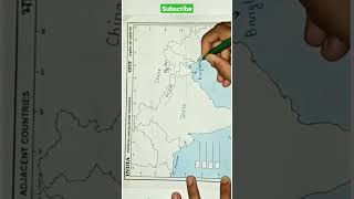
Types of Maps
🔒 Unlock Audio Lesson
Sign up and enroll to listen to this audio lesson

Now, let’s talk about the different types of maps. Who can name one type of map?

Political maps!
Right! Political maps show countries and cities. What about another type?

Physical maps, because they show mountains and rivers!
Great! Physical maps emphasize natural features. Here’s a memory aid: think of ‘P for Political’ and ‘F for Features’ to remember the two types.
Components of a Map
🔒 Unlock Audio Lesson
Sign up and enroll to listen to this audio lesson
Let’s now examine the components found in maps. Can anyone name one component?
The title!
Correct! The title provides context. What about another component?
The scale, which helps us measure distances!
Exactly! Remembering that 'T for Title' and 'S for Scale' can help you recall these components. What’s one way you use the scale?
To find out how far places are from each other!
Techniques of Map Reading
🔒 Unlock Audio Lesson
Sign up and enroll to listen to this audio lesson
Now it’s about applying our knowledge—how do we read maps? What’s the first thing we look for?
The physical features like mountains and rivers!
Correct! Colors usually indicate elevation, like blue for rivers. Also, how can we measure distances?
By using the scale!
Well said! Let’s tie this back to our memory aid: on maps, it’s 'Features First, Distance Next'—remember this order as you read!
Applications of Map Work
🔒 Unlock Audio Lesson
Sign up and enroll to listen to this audio lesson
Lastly, let's discuss the real-world importance of map work. Can anyone think of where maps are used outside the classroom?
For traveling, to find directions!
Yes, traveling is a great example! Maps help with urban planning, too. Who can remember what 'U for Urban' relates to?
Designing city maps and avoiding traffic jams!
Exactly! Maps are vital for planning and management in various fields. Let’s recap: maps are crucial tools we can use almost everywhere!
Introduction & Overview
Read summaries of the section's main ideas at different levels of detail.
Quick Overview
Youtube Videos

Audio Book
Dive deep into the subject with an immersive audiobook experience.
What is a Map?
Chapter 1 of 1
🔒 Unlock Audio Chapter
Sign up and enroll to access the full audio experience
Chapter Content
A map is a two-dimensional representation of the Earth's surface. Unlike a globe, which is a three-dimensional model of the Earth, maps simplify the complexity of the Earth's surface to make it easier to understand and study.
Detailed Explanation
A map provides a flat, simplified view of the Earth’s geography. While a globe accurately depicts the Earth in three dimensions, it is difficult to use for specific locations or detailed geographical features. Maps condense this information into a manageable size, allowing for easier visualization and study of locations, human settlements, and environmental features.
Examples & Analogies
Think of a map like a detailed blueprint for a house. Just as a blueprint shows important dimensions and room placements on a flat sheet of paper, a map shows geographical features, locations, and boundaries flattened out for easy reading and understanding.
Key Concepts
-
Types of Maps: Political, Physical, Topographical, and Thematic maps serve different purposes.
-
Map Components: Essential parts include title, scale, legend, latitude/longitude, and compass rose.
-
Techniques of Map Reading: Involves identifying features, measuring distances, and understanding political boundaries.
-
Map Projections: Different methods to represent the Earth's surface onto flat surfaces, each with advantages and disadvantages.
-
Contour Maps: Display land elevation through contour lines, indicating landforms.
Examples & Applications
A political map shows the countries of Europe and their capitals.
A physical map illustrates the Rocky Mountains and rivers in the United States.
A thematic map represents population density in various regions.
A topographical map details the hilly terrain and road layout of a national park.
Memory Aids
Interactive tools to help you remember key concepts
Rhymes
In maps we trust, both near and far, to guide our way like a North Star.
Stories
Once upon a time in a land of maps, a curious child learned reading them was key to adventures and city traps!
Memory Tools
Please Remember Some Maps - 'P' for Political, 'R' for Physical, 'S' for Scale.
Acronyms
M.A.P.S. - 'Mapping All Places and Symbols' to remember different aspects of map reading.
Flash Cards
Glossary
- Map
A two-dimensional representation of the Earth's surface.
- Political Map
Maps showing the world's countries, boundaries, and capitals.
- Physical Map
Maps that represent natural features like mountains and rivers.
- Topographical Map
Detailed maps showing elevation, vegetation, and human structures.
- Thematic Map
Maps that present specific themes or data analyses, such as climate or population density.
- Scale
A ratio that represents the relationship between map distances and actual distances.
- Legend
Section of a map explaining symbols for features depicted.
- Latitude and Longitude
The grid system for identifying locations on Earth; latitude runs east-west while longitude runs north-south.
- Compass Rose
Symbol on a map indicating the cardinal directions.
- Contour Map
Maps that show elevation levels using contour lines.
Reference links
Supplementary resources to enhance your learning experience.