
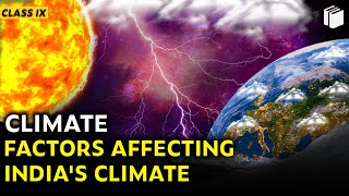
Factors Affecting India's Climate
Enroll to start learning
You’ve not yet enrolled in this course. Please enroll for free to listen to audio lessons, classroom podcasts and take practice test.
Interactive Audio Lesson
Listen to a student-teacher conversation explaining the topic in a relatable way.
Introduction to Climate and Weather
🔒 Unlock Audio Lesson
Sign up and enroll to listen to this audio lesson

Today, we will discuss the fundamental differences between climate and weather. Who can share what they think climate means?

Climate is like the long-term weather, right? Like what we expect over the years?
Exactly! Climate is the average atmospheric conditions over a long time, while weather changes from day to day. Can anyone give an example?

Like it being rainy today is weather, but during the winter, if it’s usually cold, that’s climate?
Nice example! To remember this, think: 'Weather is what you get, climate is what you expect.'

So, India has a monsoon climate, right?
Yes! We'll explore that in detail in today's session. Remember, 'Monsoon' refers to seasonal wind reversals which significantly affect our climate.

Why is the monsoon so important for India?
Great question! The monsoon brings most of our annual rainfall, essential for agriculture and water resources. Let's remember this: 'Monsoons = Water for India.'
Geographical Influences on Climate
🔒 Unlock Audio Lesson
Sign up and enroll to listen to this audio lesson

Now, let's discuss latitude. India is divided by the Tropic of Cancer. Can someone explain what that means?
Oh, it means part of India is tropical while another part is subtropical?
Exactly! The southern half enjoys a tropical climate, while the northern parts have subtropical features. Why do you think this matters?
It can affect how hot or cold different places feel throughout the year!
Correct! Additionally, altitude plays a role. Higher regions like the Himalayas can experience much colder temperatures. Can anyone think of the impact that has?
Maybe it affects the crops grown in those areas?
Absolutely! That's a key point. Remember: 'Altitude = Temperature Difference.'
Pressure Systems and Winds
🔒 Unlock Audio Lesson
Sign up and enroll to listen to this audio lesson
Next, let's talk about pressure systems. Who can describe what happens during different seasons?
In winter, there’s high pressure and it’s dry, right?
Correct! High pressure brings dry conditions. And what about summer?
That's when low pressure attracts moisture-laden winds!
Exactly! The interchange of these pressures creates our seasonal shifts, including the famous southwest monsoon.
So the winds coming from the ocean bring rain?
Right! This water is crucial for us. Remember: 'Pressure and Wind = Rain for India.'
Monsoon Dynamics
🔒 Unlock Audio Lesson
Sign up and enroll to listen to this audio lesson
Now let’s focus on the monsoon itself. What happens when it arrives in India?
The winds change and we get a lot of rain.
Correct! These southwest winds blow in from the oceans, bringing moisture. Do we remember when the monsoon typically starts?
Around June, right?
Exactly! Remember: 'June = Monsoon Starts.' What about the variability of the monsoon?
Sometimes it rains a lot, and at other times, hardly at all?
Yes! This variability can lead to droughts or floods, depending on the year. That's why understanding the monsoon is vital for planning.
Regional Variations and Conclusion
🔒 Unlock Audio Lesson
Sign up and enroll to listen to this audio lesson
Finally, let’s explore regional climate diversity. Why do you think conditions differ from the coast to the desert?
It’s because of things like distance from the sea and elevation!
Great point! For example, the western coast receives heavy rainfall, whereas the Thar Desert remains dry. What’s the takeaway here?
Climate is very affected by geography, and this shapes our lives in India.
Precisely! Remember: 'Geography Shapes Climate.'
Introduction & Overview
Read summaries of the section's main ideas at different levels of detail.
Quick Overview
Standard
India's climate is primarily influenced by its geographical factors such as latitude and altitude, which affect temperature and precipitation variances across the country. The monsoon season plays a critical role in shaping weather patterns, while regional variations arise from differing weather conditions due to geographical features.
Detailed
Detailed Summary
This section delves into the climatic factors affecting India, elaborating on how spatial and atmospheric conditions contribute to the country’s diverse climatic zones.
Key Concepts:
- Climate vs. Weather: Climate denotes the long-term atmospheric conditions of a region, while weather refers to short-term variations. India's climate, characterized as 'monsoon-type', exhibits both tropical and subtropical features due to its geographic positioning.
- Latitude: The Tropic of Cancer bisects India, marking the boundaries between tropical and subtropical zones. This division significantly influences temperature and seasonal weather patterns across different regions.
- Altitude: The presence of the Himalayas has a notable impact, blocking cold winds from Central Asia, leading to milder winters in the subcontinent.
- Pressure Systems and Winds: High-pressure conditions in winter lead to dry weather, while summer sees a reversal of winds, bringing moisture-laden air from oceans.
- Monsoon Dynamics: India primarily experiences rain from southwest monsoons between June and September, with variations based on geographical location and relief features. Coastal areas may experience less temperature contrast, while interior regions experience greater seasonal fluctuations.
- Regional Variations: Precipitation varies greatly, from over 400 cm in Meghalaya to less than 10 cm in regions like Ladakh and western Rajasthan, affecting agriculture and habitation patterns.
Such climatic understanding is crucial for comprehension of India's diverse ecological landscape and its societal implications.
Youtube Videos


Audio Book
Dive deep into the subject with an immersive audiobook experience.
Latitude and Tropical Regions
Chapter 1 of 6
🔒 Unlock Audio Chapter
Sign up and enroll to access the full audio experience
Chapter Content
The Tropic of Cancer passes through the middle of the country from the Rann of Kuchchh in the west to Mizoram in the east. Almost half of the country, lying south of the Tropic of Cancer, belongs to the tropical area. All the remaining area, north of the Tropic, lies in the subtropics. Therefore, India’s climate has characteristics of tropical as well as subtropical climates.
Detailed Explanation
In this chunk, we learn that the Tropic of Cancer divides India into two climate zones: tropical and subtropical. The part of India that is south of this line experiences a tropical climate, which is typically warm and humid, while the northern part has a subtropical climate, which has more variation in temperature and seasonality. This division is important because it helps explain why different areas in India have different types of weather.
Examples & Analogies
Think of India as a big cake divided into two sections. One half is tropical, like a warm and sweet fruit layer, and the other half is subtropical, like a denser chocolate layer with variability. Just as the flavors change in different sections of the cake, the climate changes across India.
Altitude and Temperature Variation
Chapter 2 of 6
🔒 Unlock Audio Chapter
Sign up and enroll to access the full audio experience
Chapter Content
India has mountains to the north, which have an average height of about 6,000 metres. India also has a vast coastal area where the maximum elevation is about 30 metres. The Himalayas prevent the cold winds from Central Asia from entering the subcontinent. It is because of these mountains that this subcontinent experiences comparatively milder winters as compared to central Asia.
Detailed Explanation
This section discusses how altitude affects climate, emphasizing the role of the Himalayas in blocking cold winds from Central Asia. High mountains maintain warmer winter temperatures in India compared to regions at similar latitudes elsewhere. The variation in altitude—from high Himalayas to low coastal areas—also leads to different climates within the country.
Examples & Analogies
Imagine the Himalayas as a big, cozy blanket that keeps warm air in and cold air out of India. Just like how a thick blanket keeps you warm on a cold night, the mountains help ensure winters in India are not as harsh as they might be in other places.
Pressure and Wind Systems
Chapter 3 of 6
🔒 Unlock Audio Chapter
Sign up and enroll to access the full audio experience
Chapter Content
The climate and associated weather conditions in India are governed by the following atmospheric conditions: Pressure and surface winds; Upper air circulation; and Western cyclonic disturbances and tropical cyclones.
Detailed Explanation
This part introduces the key elements driving India’s weather, focusing on pressure systems and winds. The interplay of high and low-pressure areas creates wind patterns that affect temperature and precipitation. For example, the southwest monsoon winds bring rain to large parts of India during the summer months, while pressure variations also influence the temperature and storms.
Examples & Analogies
Consider pressure systems and winds as the engine of a car that drives the weather. Just as different gears and speeds change how the car moves, variations in atmospheric pressure influence how winds blow, bringing about different weather conditions in various regions.
The Role of Maritime Influence and Continentality
Chapter 4 of 6
🔒 Unlock Audio Chapter
Sign up and enroll to access the full audio experience
Chapter Content
The sea exerts a moderating influence on climate: As the distance from the sea increases, its moderating influence decreases and the people experience extreme weather conditions. This condition is known as continentality (i.e. very hot during summers and very cold during winters). Ocean currents along with onshore winds affect the climate of the coastal areas.
Detailed Explanation
This section explains how being close to the sea affects the climate of coastal areas, making temperatures milder compared to inland regions. When moving away from the coast, areas experience more extreme temperatures in both summer and winter—this phenomenon is called continentality. The impact of ocean currents can also additionally warm or cool coastal climates.
Examples & Analogies
Think of living near a beach in summer versus living further inland. The beach tends to be cooler because of the ocean's temperature, while inland can be sweltering. Similarly, the ocean acts as a climate buffer, absorbing heat in the summer and releasing it in the winter.
Weather Patterns and Variability
Chapter 5 of 6
🔒 Unlock Audio Chapter
Sign up and enroll to access the full audio experience
Chapter Content
In general, coastal areas experience less contrasts in temperature conditions. Seasonal contrasts are more in the interior of the country. There is decrease in rainfall generally from east to west in the Northern Plains.
Detailed Explanation
This chunk highlights the differences in temperature and rainfall patterns between coastal and interior regions. Coastal areas tend to have stable temperatures throughout the year, while interior regions experience more significant seasonal temperature changes. It also notes that rainfall diminishes from the eastern parts of India to the western areas, which shapes the types of agriculture and livelihoods in those spaces.
Examples & Analogies
Imagine living in a coastal town where it rarely gets very hot or very cold, versus residing in a place far away from the ocean with hot summers and chilly winters. Just like these two types of locations, India has areas with stable weather near the coast and areas with more variability as you move inland.
Relief and its Climatic Influence
Chapter 6 of 6
🔒 Unlock Audio Chapter
Sign up and enroll to access the full audio experience
Chapter Content
Finally, relief too plays a major role in determining the climate of a place. High mountains act as barriers for cold or hot winds; they may also cause precipitation if they are high enough and lie in the path of rain-bearing winds. The leeward side of mountains remains relatively dry.
Detailed Explanation
In this final chunk, we explore how the geographical relief, particularly mountains, affects weather patterns. Mountains obstruct wind flow and can create patterns of rainfall. In areas where winds are forced to rise over mountains, precipitation occurs, while the leeward side remains drier, resulting in distinct climatic conditions across small geographical areas.
Examples & Analogies
Think of tall mountains as giant walls. When wind approaches a wall, it has to go up and over. As it rises, it cools and drops rain on the windward side, just like how a wall creates a change in airflow. The other side of the wall, however, may just be dry and sunny.
Key Concepts
-
Climate vs. Weather: Climate denotes the long-term atmospheric conditions of a region, while weather refers to short-term variations. India's climate, characterized as 'monsoon-type', exhibits both tropical and subtropical features due to its geographic positioning.
-
Latitude: The Tropic of Cancer bisects India, marking the boundaries between tropical and subtropical zones. This division significantly influences temperature and seasonal weather patterns across different regions.
-
Altitude: The presence of the Himalayas has a notable impact, blocking cold winds from Central Asia, leading to milder winters in the subcontinent.
-
Pressure Systems and Winds: High-pressure conditions in winter lead to dry weather, while summer sees a reversal of winds, bringing moisture-laden air from oceans.
-
Monsoon Dynamics: India primarily experiences rain from southwest monsoons between June and September, with variations based on geographical location and relief features. Coastal areas may experience less temperature contrast, while interior regions experience greater seasonal fluctuations.
-
Regional Variations: Precipitation varies greatly, from over 400 cm in Meghalaya to less than 10 cm in regions like Ladakh and western Rajasthan, affecting agriculture and habitation patterns.
-
Such climatic understanding is crucial for comprehension of India's diverse ecological landscape and its societal implications.
Examples & Applications
In summer, temperatures can reach up to 50°C in Rajasthan, whereas in J&K, it may be around 20°C.
Meghalaya receives over 400 cm of rainfall, while western Rajasthan has less than 10 cm.
Memory Aids
Interactive tools to help you remember key concepts
Rhymes
When monsoon winds blow, rain will flow, from sea to land they go.
Stories
Imagine a farmer waiting eagerly for the monsoon clouds, knowing they bring life to his crops with every drop of rain.
Memory Tools
LATITUDE: L-A-T to remember Latitude Affects Temperature and Uniform Distribution.
Acronyms
MPC
Monsoon Precipitation Cycle – summarizing the process of moisture intake from oceans leading to rainfall.
Flash Cards
Glossary
- Climate
The long-term pattern of weather conditions in a particular area.
- Weather
The short-term atmospheric conditions, including temperature and precipitation.
- Monsoon
Seasonal wind patterns that bring heavy rains, especially in South Asia.
- Latitude
The distance from the equator, affecting climate and temperature.
- Altitude
The height above sea level, influencing temperature and weather patterns.
- Pressure Systems
Areas of high or low pressure that influence wind and weather patterns.
Reference links
Supplementary resources to enhance your learning experience.