
The Tapi Basin
Enroll to start learning
You’ve not yet enrolled in this course. Please enroll for free to listen to audio lessons, classroom podcasts and take practice test.
Interactive Audio Lesson
Listen to a student-teacher conversation explaining the topic in a relatable way.
Introduction to the Tapi River
🔒 Unlock Audio Lesson
Sign up and enroll to listen to this audio lesson

Today, class, we will discuss the Tapi Basin. Can anyone tell me where the Tapi River starts?

Isn't it in Madhya Pradesh, near the Satpura ranges?
That's right! The Tapi River originates in the Satpura ranges. Now, does anyone know which direction it flows?

It flows westward, doesn't it?
Correct! The Tapi flows westward through a rift valley. This is a key feature that it shares with the Narmada. Let's remember these geographical aspects, like the acronym 'WIND' – Westward flow, originating in the Satpura, in Rift valley, and Descriptive basin.

What states does the Tapi Basin cover?
Great question! The basin covers Madhya Pradesh, Gujarat, and Maharashtra. Understanding the states it covers helps us discuss its economic and environmental significance.

How is the Tapi different from the Narmada?
Excellent inquiry! The Tapi is much shorter in length compared to the Narmada. We will delve more into that later.
Geographical Significance of the Tapi Basin
🔒 Unlock Audio Lesson
Sign up and enroll to listen to this audio lesson

In our last session, we discussed the origin of the Tapi. Now, let’s explore its geographical significance. Can anyone name the geographical feature that the Tapi and Narmada share?
Both flow through rift valleys?
Exactly! This rift valley influences their flow. Can someone tell me why the length of a river is important?
A longer river can influence larger areas and possibly carry more water?
Good point! The Narmada is much longer than the Tapi, which means it has a greater impact on the ecology and economy of its basin.
What about the coastal plains? Are they affected by these rivers?
Absolutely! Particularly between the Western Ghats and the Arabian Sea, the narrow coastal plains contribute to the short length of many rivers, including the Tapi.
So, the geographical features significantly shape the rivers and their basins?
Yes, that’s the takeaway! Let's summarize: both the Tapi and Narmada illustrate how geography influences river characteristics and their roles in surrounding environments.
Economic Importance of the Tapi Basin
🔒 Unlock Audio Lesson
Sign up and enroll to listen to this audio lesson
Today, we'll wrap up our discussion by looking at the economic activities around the Tapi Basin. What are your thoughts on how rivers contribute to economies?
They provide water for irrigation!
Right! Agriculture is a significant economic activity. The Tapi provides essential water resources to agricultural regions.
Are there any industries that rely on the Tapi?
Yes! Industries near the basin also depend on its water supply. Remember the acronym 'WATER' – Water supply, Agriculture, Transport, Economic activities, and Recreation.
What recreational activities do people do on the Tapi?
Excellent question! Fishing, boating, and tourism are common. Thus, the Tapi has both economic and recreational significance.
Can the state governments do anything to better manage the river?
Indeed! Sustainable practices and conservation efforts are crucial for maintaining its significance. Let’s recap: economic activities rely heavily on the Tapi’s water provision, impacting both agriculture and industry.
Introduction & Overview
Read summaries of the section's main ideas at different levels of detail.
Quick Overview
Standard
The Tapi River, rising in the Satpura ranges, flows westward through a rift valley and its basin encompasses parts of Madhya Pradesh, Gujarat, and Maharashtra. Compared to the Narmada, the Tapi is shorter and less extensive but shares many geographical features with it, reflecting the diversity of India's river systems.
Detailed
The Tapi Basin
The Tapi or Tapti River is significant in understanding India's diverse drainage system. Originating in the Satpura ranges, the Tapi flows towards the west in a rift valley, parallel to the Narmada River. Despite its shorter length compared to the Narmada, the Tapi's basin covers important areas of Madhya Pradesh, Gujarat, and Maharashtra, making it an essential water source for these states. The contrast in the landscapes that these river basins encounter also shapes their behavior and flow, contributing to the unique ecological dynamics of western India.
Youtube Videos


Audio Book
Dive deep into the subject with an immersive audiobook experience.
Introduction to the Tapi River
Chapter 1 of 4
🔒 Unlock Audio Chapter
Sign up and enroll to access the full audio experience
Chapter Content
The Tapi rises in the Satpura ranges, in the Betul district of Madhya Pradesh.
Detailed Explanation
The Tapi River originates from the Satpura range in Madhya Pradesh, starting its journey there. It is important to understand that rivers often rise from mountainous areas due to gravitational forces, and the Satpura range provides a significant elevation for this river.
Examples & Analogies
Imagine how a ball rolls down a hill. Just like this ball, the water flows down from the higher land of the Satpura ranges, creating the Tapi River.
Characteristics of the Tapi River
Chapter 2 of 4
🔒 Unlock Audio Chapter
Sign up and enroll to access the full audio experience
Chapter Content
It flows in a rift valley parallel to the Narmada but it is much shorter in length. Its basin covers parts of Madhya Pradesh, Gujarat and Maharashtra.
Detailed Explanation
The Tapi River flows in a rift valley, which is a type of valley formed due to geological faults in the earth's crust. This river flows parallel to the Narmada River, another major river in India. However, the Tapi is shorter in length compared to the Narmada. Its drainage basin includes areas in three states: Madhya Pradesh, Gujarat, and Maharashtra, indicating its geographical significance.
Examples & Analogies
Think of roads that run parallel to each other; just like those roads, the Tapi and Narmada rivers flow alongside one another, but one is much shorter than the other.
Geographical Significance of Coastal Plains
Chapter 3 of 4
🔒 Unlock Audio Chapter
Sign up and enroll to access the full audio experience
Chapter Content
The coastal plains between Western Ghats and the Arabian Sea are very narrow. Hence, the coastal rivers are short.
Detailed Explanation
The coastal plains near the Western Ghats and the Arabian Sea are described as narrow. This means there isn't much flat land for rivers to flow. As a result, rivers originating in this area, including the Tapi, are generally shorter than those in broader plains. Coastal rivers often have swift currents and shorter courses due to the constricted geography.
Examples & Analogies
Imagine trying to walk down a narrow hallway: you have less space to move around. Similarly, the rivers don't have much room in the narrow coastal plains, which is why they tend to be shorter.
Major Neighboring Rivers
Chapter 4 of 4
🔒 Unlock Audio Chapter
Sign up and enroll to access the full audio experience
Chapter Content
The main west flowing rivers are Sabarmati, Mahi, Bharathpuzha and Periyar. Find out the states in which these rivers drain the water.
Detailed Explanation
Besides the Tapi, several other rivers flow westward from the Western Ghats, such as the Sabarmati, Mahi, Bharathpuzha, and Periyar. These rivers also drain into the Arabian Sea and are important for local irrigation and ecosystems. Each river has its unique basin and supports different regions, making understanding their flow patterns vital for geography.
Examples & Analogies
Think of a big garden with different plants. Each plant needs different amounts of water. Similarly, each river has its own 'garden' (area) that it waters, supporting various ecosystems and communities.
Key Concepts
-
Tapi River: A key west-flowing river in India that showcases unique geographical features.
-
Economic Role: The Tapi plays a crucial role in supporting agriculture and local industries.
-
Geographical Features: The flow pattern and the surrounding landscape significantly influence the characteristics of the Tapi River.
Examples & Applications
The Tapi River supports agrarian communities in Gujarat through irrigation.
Industries along the Tapi Basin utilize its waters for production processes.
Memory Aids
Interactive tools to help you remember key concepts
Rhymes
In the west where the waters flow, Tapi's path is set aglow.
Stories
Once, the Tapi River was a little stream in the Satpura, dreaming of reaching the Arabian Sea, helping farmers with every twist and turn.
Memory Tools
TAPI = TAwning the Path to Irrigation.
Acronyms
Tapi Helping
for Travel (west)
for Agricultural support
for People
for Industry.
Flash Cards
Glossary
- Tapi River
A river in western India that flows westward into the Arabian Sea, originating from the Satpura ranges.
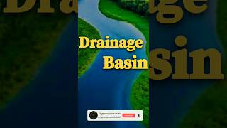
- Drainage Basin
The area of land where precipitation collects and drains into a single body of water.
- Rift Valley
A lowland region caused by divergence of tectonic plates, where the Tapi and Narmada flow.
Reference links
Supplementary resources to enhance your learning experience.