
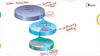
Distribution of Precipitation in India
Enroll to start learning
You’ve not yet enrolled in this course. Please enroll for free to listen to audio lessons, classroom podcasts and take practice test.
Interactive Audio Lesson
Listen to a student-teacher conversation explaining the topic in a relatable way.
Spatial Distribution of Precipitation
🔒 Unlock Audio Lesson
Sign up and enroll to listen to this audio lesson

Today, we will explore the spatial distribution of precipitation in India. Can anyone tell me why it's important to understand where rainfall occurs?

I think it helps us manage water resources better.
Exactly! Precipitation is essential for managing both surface and groundwater. Now, let's look at the range of rainfall across India. Did you know that Cherrapunji receives over 11,000 mm of rain annually?

That's more than a meter of rain every month!
Yes! And compare that to western Rajasthan, which gets less than 100 mm. This highlights how uneven precipitation can be. We can remember this with the acronym 'HIGH LOW' for 'High in the Northeast, Low in Rajasthan'.

What are the high rainfall areas again, teacher?
Great question! They include the Northeastern states, the Western Ghats, and parts of West Bengal. Let's summarize: Understanding these high and low rainfall zones helps us in agriculture and flood management!
Temporal Distribution of Precipitation
🔒 Unlock Audio Lesson
Sign up and enroll to listen to this audio lesson

Now, let's shift our focus to the temporal distribution of precipitation. Can anyone share when most of India's rain falls?

During the monsoon, right?
That's correct! About 75-90% of annual rainfall occurs during the Southwest Monsoon from June to September. We can use the mnemonic 'M for Monsoon, M for Most!' to help remember this key detail.
What about the rest of the rainfall?
Good follow-up! The remaining precipitation happens during winter and pre-monsoon thunderstorms. This knowledge helps in planning irrigation and agriculture effectively. Remember, the majority happens when the monsoon is active!
Introduction & Overview
Read summaries of the section's main ideas at different levels of detail.
Quick Overview
Standard
The distribution of precipitation in India is highly uneven both spatially and temporally. Spatially, rainfall can vary from less than 100 mm to over 11,000 mm annually, and temporally, a large portion occurs during the Southwest Monsoon. Understanding these distributions is essential for effective water resource management and agricultural planning.
Detailed
Distribution of Precipitation in India
Overview
This section discusses the distribution of precipitation in India, focusing on its spatial and temporal characteristics. The precipitation levels across India are highly varied, influenced by geographical factors and climatic conditions. Spatially, India exhibits significant disparities where regions like Cherrapunji receive extensive rainfall while others in Rajasthan receive very little.
Spatial Distribution
- Annual Rainfall Variation: India experiences annual rainfall from less than 100 mm in western Rajasthan to over 11,000 mm in Cherrapunji, Meghalaya.
- Major Rainfall Zones:
- High Rainfall Areas: Northeastern states, Western Ghats, parts of West Bengal.
- Low Rainfall Areas: Rajasthan, parts of Gujarat, Leh-Ladakh.
Temporal Distribution
- Seasonal Concentration: Between 75-90% of the annual rainfall occurs during the Southwest Monsoon (June-September).
- Other Rainfall Periods: Remaining rainfall occurs during the Northeast Monsoon (winter months) and pre-monsoon thunderstorms.
Understanding these patterns is crucial for various applications such as hydrological engineering, irrigation planning, and managing water resources effectively.
Youtube Videos


Audio Book
Dive deep into the subject with an immersive audiobook experience.
Spatial Distribution
Chapter 1 of 2
🔒 Unlock Audio Chapter
Sign up and enroll to access the full audio experience
Chapter Content
• Highly Uneven: Annual rainfall varies from less than 100 mm in western Rajasthan to over 11,000 mm in Cherrapunji, Meghalaya.
• Major Rainfall Zones:
– High Rainfall Areas: Northeastern states, Western Ghats, and parts of West Bengal.
– Low Rainfall Areas: Rajasthan, parts of Gujarat, Leh-Ladakh.
Detailed Explanation
The spatial distribution of precipitation in India is characterized by significant variations across the country. Annual rainfall can be as low as 100 mm in regions like western Rajasthan, while places such as Cherrapunji in Meghalaya can receive more than 11,000 mm annually. This stark contrast highlights the diverse climatic conditions across different regions.
Key zones can be identified based on rainfall:
1. High Rainfall Areas: Northeastern states, Western Ghats, and parts of West Bengal are known for high levels of precipitation due to various geographical and climatic factors.
2. Low Rainfall Areas: In contrast, regions like Rajasthan and parts of Gujarat, as well as Leh-Ladakh, experience much lower rainfall, influencing agriculture, water supply, and overall climate resilience in these areas.
Examples & Analogies
Think of India like a giant landscape painting where some areas are filled with lush green forests, while others are just dry deserts. The Northeastern states are like a vibrant, colorful part of the painting, receiving abundant rain, while Rajasthan resembles the arid sections. This uneven distribution affects how people live, farm, and use water resources, similar to how different colors on a canvas impact the overall visual experience.
Temporal Distribution
Chapter 2 of 2
🔒 Unlock Audio Chapter
Sign up and enroll to access the full audio experience
Chapter Content
• Seasonal Concentration: About 75–90% of annual rainfall occurs during the Southwest Monsoon (June–September).
• Remaining Rainfall: During winter (Northeast Monsoon) and pre-monsoon thunderstorms.
Detailed Explanation
Temporal distribution refers to how rainfall varies over time throughout the year. In India, approximately 75-90% of the total annual rainfall happens during the Southwest Monsoon season, which spans from June to September. This monsoon season is crucial for farmers, as it provides the majority of the water needed for crops.
Besides this main monsoon season, the country also experiences additional rainfall at other times of the year, such as:
1. Winter Rainfall: Known as the Northeast Monsoon, which occurs from October to December, bringing moisture to states like Tamil Nadu and Andhra Pradesh.
2. Pre-Monsoon Thunderstorms: Occurring prior to the monsoon season, these storms can deliver essential rainfall that helps farmers prepare for the main growing season.
Examples & Analogies
Imagine a sponge that soaks up water – during the monsoon, the sponge gets saturated quickly because it receives most of its water at once. This is similar to how Indian rainfall is concentrated in one season. Just like a sponge may receive occasional splashes of water throughout the year, India also has light rain events at times other than the monsoon, helping to replenish the land and prepare it for the more significant monsoon downpours.
Key Concepts
-
Spatial Distribution: Refers to how precipitation varies in different geographical areas across India.
-
Temporal Distribution: Refers to the timing and seasonal concentration of rainfall throughout the year.
-
Southwest Monsoon: The period when a bulk of the rainfall occurs in India, typically from June to September.
Examples & Applications
Cherrapunji, Meghalaya is known for receiving over 11,000 mm of rainfall annually, making it one of the wettest places on Earth.
Western Rajasthan experiences extreme aridity with annual rainfall less than 100 mm, contributing to its desert landscape.
Memory Aids
Interactive tools to help you remember key concepts
Rhymes
In Cherrapunji, rain does fall, while Rajasthan sees very little at all.
Stories
Once in a land where the rain was shy, Cherrapunji danced under a cloudy sky, while Rajasthan wished for a drop, oh my!
Memory Tools
I remember 'M for Monsoon, M for Most' for the heavy rains of summer.
Acronyms
HIGH LOW - High rainfall in Northeast, Low in Rajasthan.
Flash Cards
Glossary
- Spatial Distribution
The variation in precipitation across different geographical areas.
- Temporal Distribution
The timing and duration of precipitation over specific periods.
- Southwest Monsoon
The primary rainy season in India, occurring from June to September.
- Annual Rainfall
The total amount of precipitation that falls in a year, measured in millimeters.
Reference links
Supplementary resources to enhance your learning experience.