
Global Water Budget Estimation Techniques
Enroll to start learning
You’ve not yet enrolled in this course. Please enroll for free to listen to audio lessons, classroom podcasts and take practice test.
Interactive Audio Lesson
Listen to a student-teacher conversation explaining the topic in a relatable way.
Introduction to Global Water Budget Estimation Techniques
🔒 Unlock Audio Lesson
Sign up and enroll to listen to this audio lesson

Today, we're discussing the essential techniques for estimating the global water budget. Understanding how we quantify water is crucial. Can anyone tell me why assessing our water resources is important?

It's important for managing water resources, especially during droughts.
Exactly! Water resources management relies on accurate estimations. Let's explore the first technique: satellite remote sensing.

What kind of data do satellites collect?
Satellites like TRMM and GRACE collect data on precipitation, snow cover, and even soil moisture. This helps us observe changes in water systems globally.
Ground-Based Observations
🔒 Unlock Audio Lesson
Sign up and enroll to listen to this audio lesson

Now, let's shift to ground-based observations. Why do you think these methods are still relevant?

They provide local data that can confirm what satellites see!
Right! Instruments like rain gauges and stream gauges help us collect precise data. What happens if we don't have this data?

We might miss important local variations!
Correct! Local observations are vital for accurate water management. Let's move on to hydrological modeling.
Hydrological Modeling
🔒 Unlock Audio Lesson
Sign up and enroll to listen to this audio lesson
Finally, we have hydrological modeling. Can anyone name a popular hydrological model?
I've heard of the SWAT model!
Great! SWAT and others like VIC and WEAP simulate how water moves in various landscapes. Why is this important?
It helps predict changes in water systems under different climate scenarios!
Exactly! These models help us plan for future water resource management and climate impacts. To sum up, satellite remote sensing, ground observations, and modeling are crucial for estimating the global water budget.
Introduction & Overview
Read summaries of the section's main ideas at different levels of detail.
Quick Overview
Standard
The section explains three primary techniques employed to estimate the global water budget: satellite remote sensing, which gathers data on precipitation and soil moisture; ground-based observations through instruments like rain gauges and stream gauges; and hydrological modeling, which uses computational models to estimate the water balance. Each technique plays a key role in enhancing our understanding of global water resources.
Detailed
Global Water Budget Estimation Techniques
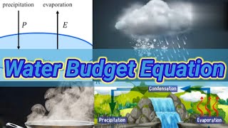
The global water budget estimation techniques are essential for understanding the distribution and movement of water across the planet. By employing various methods, researchers can quantify and monitor the water balance, which is crucial for managing water resources effectively. This section highlights the following techniques:
- Satellite Remote Sensing: Advanced satellites provide invaluable data on rainfall, snow cover, and soil moisture levels using systems like TRMM (Tropical Rainfall Measuring Mission) and GRACE (Gravity Recovery and Climate Experiment). This method allows scientists to observe vast areas and gather information that would be difficult to measure using ground methods alone.
- Ground-Based Observations: Traditional instruments such as rain gauges, stream gauges, and piezometers help collect on-the-ground data. These observations are pivotal in understanding local water cycles and affirming satellite data accuracy.
- Hydrological Modeling: Computational models, such as VIC (Variable Infiltration Capacity), SWAT (Soil and Water Assessment Tool), and WEAP (Water Evaluation and Planning), simulate watershed processes and estimate water balance. These models allow for the integration of various hydrological data, providing insights into future water scenarios under differing climate conditions.
In summary, utilizing a combination of satellite technology, ground observations, and modeling techniques fosters a comprehensive understanding of the global water budget.
Youtube Videos


Audio Book
Dive deep into the subject with an immersive audiobook experience.
Satellite Remote Sensing
Chapter 1 of 3
🔒 Unlock Audio Chapter
Sign up and enroll to access the full audio experience
Chapter Content
• Data on precipitation, snow cover, soil moisture (e.g., TRMM, GRACE)
Detailed Explanation
This technique uses satellites to gather data about various aspects of the Earth's water system. Satellites can measure precipitation patterns, determine how much snow is covering land areas, and evaluate the moisture in the soil. For instance, TRMM (Tropical Rainfall Measuring Mission) focuses on rainfall, while GRACE (Gravity Recovery and Climate Experiment) helps measure changes in water storage by detecting variations in Earth's gravity field caused by water accumulation or depletion.
Examples & Analogies
Think of satellites as the eyes in the sky, constantly watching over large areas of Earth. Just like a weather report tells us if it's raining or snowing, satellites provide scientists with vital information about water on our planet, allowing for better predictions and management of water resources.
Ground-Based Observations
Chapter 2 of 3
🔒 Unlock Audio Chapter
Sign up and enroll to access the full audio experience
Chapter Content
• Rain gauges, stream gauges, piezometers
Detailed Explanation
Ground-based observations are traditional methods of collecting data about water budget components directly from the Earth. Rain gauges measure rainfall amounts in specific locations, stream gauges monitor the flow of water in rivers, and piezometers measure groundwater levels. These tools provide accurate, site-specific data that is essential to understand local water resources and contribute to the overall water budget assessment.
Examples & Analogies
Imagine these tools as measuring cups in your kitchen. Just as you would measure ingredients for a recipe to get the best results, scientists use rain gauges, stream gauges, and piezometers to measure water input and movement to ensure they manage water resources effectively.
Hydrological Modelling
Chapter 3 of 3
🔒 Unlock Audio Chapter
Sign up and enroll to access the full audio experience
Chapter Content
• Large-scale models (e.g., VIC, SWAT, WEAP) for estimating water balance.
Detailed Explanation
Hydrological modeling involves creating computer simulations of water movement and storage within a given area, helping scientists estimate various components of the water budget. Models like VIC (Variable Infiltration Capacity), SWAT (Soil and Water Assessment Tool), and WEAP (Water Evaluation and Planning) integrate data from both remote sensing and ground-based observations to assess how water flows through an ecosystem and predicts how it might change under different scenarios such as climate change or land development.
Examples & Analogies
Think of hydrological modeling like a video game simulation where you control resources and see how changes affect the game world. Just as gamers manipulate elements to see different outcomes, scientists use hydrological models to foresee potential water conditions, ensuring a sustainable approach to managing one of our most vital resources.
Key Concepts
-
Satellite Remote Sensing: Technology used for collecting extensive data on water-related parameters.
-
Ground-Based Observations: Local data collection methods that validate satellite measurements.
-
Hydrological Modeling: Systems that use data to simulate water flows and manage resources.
Examples & Applications
The use of TRMM satellites to monitor rainfall patterns in different regions globally.
Ground-based rain gauges providing local precipitation data that enhances global models.
Memory Aids
Interactive tools to help you remember key concepts
Rhymes
Satellites high in the sky, track the water as it flows by.
Stories
Imagine a team of remote computers mapping water across the globe using satellites, while local fields measure the rain and confirm the story.
Memory Tools
SSH - Satellite, Surface, Hydrology. Remember these three techniques!
Acronyms
GRASP - Ground-based, Remote, Acknowledge, Simulate, Predict – Techniques to estimate the global water budget.
Flash Cards
Glossary
- Satellite Remote Sensing
The use of satellite technology to collect data on precipitation, snow cover, and soil moisture from a distance.
- GroundBased Observations
Measurements taken using instruments like rain gauges and stream gauges to gather data on local water cycles.
- Hydrological Modeling
The simulation of water movement and storage in landscapes through computational models to estimate water balance.
Reference links
Supplementary resources to enhance your learning experience.