
Unmanned Aerial Vehicles (UAVs)
Enroll to start learning
You’ve not yet enrolled in this course. Please enroll for free to listen to audio lessons, classroom podcasts and take practice test.
Interactive Audio Lesson
Listen to a student-teacher conversation explaining the topic in a relatable way.
Introduction to UAVs
🔒 Unlock Audio Lesson
Sign up and enroll to listen to this audio lesson

Today, we're going to talk about Unmanned Aerial Vehicles, or UAVs. Can anyone explain what a UAV is?

A UAV is a drone that operates without a human pilot on board.
Exactly! UAVs are pivotal in inspecting infrastructure after disasters like earthquakes or floods. Why do you think UAVs are preferred over traditional methods?

They can go to places humans can't easily reach.

And they can collect data much faster!
Well said! UAVs can quickly cover large areas and provide real-time data, making them essential for rapid assessments.
Capabilities and Technologies of UAVs
🔒 Unlock Audio Lesson
Sign up and enroll to listen to this audio lesson

UAVs are equipped with technologies like HD cameras and thermal sensors. Can anyone tell me how these sensors enhance inspections?

Thermal sensors can detect heat signatures, which might show where damage or leaks are.
That's correct! UAVs also use LiDAR for creating precise maps. How does this help in inspections?
It helps in 3D mapping of structures, showing detailed damage.
Exactly! The detailed data helps engineers make informed decisions faster.
Applications of UAVs in Disaster Scenarios
🔒 Unlock Audio Lesson
Sign up and enroll to listen to this audio lesson
Now let's discuss some applications of UAVs. Can anyone give me an example of where UAVs have been used for disaster inspection?
They were used to inspect buildings after the earthquake in Nepal!
And during Hurricane Harvey, they assessed the flooding.
Great examples! UAVs are essential as they allow for comprehensive damage assessment without putting human inspectors at risk.
Benefits of UAV Utilization
🔒 Unlock Audio Lesson
Sign up and enroll to listen to this audio lesson
Lastly, let's talk about benefits. What are some advantages UAVs have over manual inspections?
They can operate in dangerous conditions without risking lives.
They save time and can cover much more ground!
Exactly, UAVs enhance safety and efficiency, transforming how we conduct post-disaster assessments. Understanding these benefits is critical for future disaster management.
Introduction & Overview
Read summaries of the section's main ideas at different levels of detail.
Quick Overview
Standard
UAVs play a crucial role in infrastructure inspection after disasters by offering capabilities such as aerial mapping, real-time monitoring, and accessing hard-to-reach areas. Their use enhances efficiency and safety in assessing damage to structures like buildings, bridges, and pipelines.
Detailed
Unmanned Aerial Vehicles (UAVs)
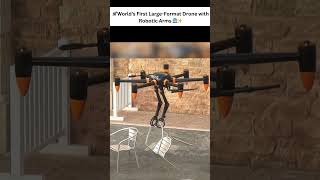
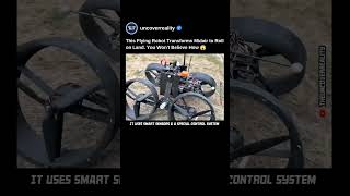
UAVs, commonly known as drones, are equipped with advanced technologies including high-definition cameras, thermal sensors, and LiDAR systems, making them indispensable tools for post-disaster inspections. The importance of UAVs stems from their ability to quickly cover large areas, perform aerial mapping, and conduct roof inspections in environments that may be unsafe for human inspectors. They are particularly effective in monitoring flooded regions and assessing damage to collapsed structures.
The integration of UAVs into disaster management not only enhances the speed and accuracy of damage assessments but also significantly reduces risks associated with traditional inspection methods. By employing UAVs, emergency response teams can gather essential data rapidly, which aids in informed decision-making regarding relief operations and infrastructure restoration.
Youtube Videos


Audio Book
Dive deep into the subject with an immersive audiobook experience.
Introduction to UAVs
Chapter 1 of 4
🔒 Unlock Audio Chapter
Sign up and enroll to access the full audio experience
Chapter Content
• Equipped with HD cameras, thermal sensors, and LIDAR.
Detailed Explanation
Unmanned Aerial Vehicles (UAVs), commonly known as drones, are sophisticated machines designed to fly without a human pilot on board. They come equipped with high-definition (HD) cameras for capturing detailed images and video footage, thermal sensors for detecting heat variations, and LIDAR technology, which uses laser light to measure distances and create precise 3D maps of the environment.
Examples & Analogies
Think of UAVs like a superhero that can fly high above a city. Just like a superhero can see the entire city from above, UAVs can provide a bird's-eye view of disaster areas, helping us see potential dangers and damage that humans on the ground might miss.
Applications of UAVs
Chapter 2 of 4
🔒 Unlock Audio Chapter
Sign up and enroll to access the full audio experience
Chapter Content
• Used for aerial mapping, roof inspections, and monitoring inaccessible areas.
Detailed Explanation
UAVs serve various important functions, especially in disaster response contexts. They can conduct aerial mapping to create maps of affected regions, perform roof inspections to assess damage on buildings, and monitor areas that are hard to reach due to obstacles or hazardous conditions, thereby ensuring comprehensive coverage and evaluation.
Examples & Analogies
Imagine if you were trying to check the roof of a tall building after a storm, but you can't climb up safely. A UAV acts like a digital eye, flying up to take pictures and assess any damage without putting anyone at risk.
Efficiency of UAVs
Chapter 3 of 4
🔒 Unlock Audio Chapter
Sign up and enroll to access the full audio experience
Chapter Content
• Capable of covering large regions quickly.
Detailed Explanation
One of the standout features of UAVs is their speed and efficiency. They can cover large geographical areas in a significantly shorter amount of time compared to traditional methods. This rapid movement is crucial during disaster response, where timely data can make the difference between life and death.
Examples & Analogies
Think of comparing a UAV to a car versus a bicycle. While a bicycle might take you on a long route to see what's happening in a neighborhood, a UAV can quickly fly over that entire area, giving you a complete picture almost instantly.
Real-World Applications of UAVs
Chapter 4 of 4
🔒 Unlock Audio Chapter
Sign up and enroll to access the full audio experience
Chapter Content
• Example Applications: Inspecting collapsed buildings, monitoring flooded zones.
Detailed Explanation
In real-world scenarios, UAVs have been deployed to inspect collapsed structures, such as buildings that have fallen due to earthquakes, ensuring teams can assess the situation from a safe distance. They also monitor flooded regions, helping locate stranded individuals or assessing the extent of water damage.
Examples & Analogies
Imagine a scenario where a building has crumbled after a disaster. Rescue teams can’t safely approach immediately, but a UAV can fly overhead, taking images and providing data about safe pathways or trapped individuals, ensuring that help can be dispatched effectively.
Key Concepts
-
UAVs: Drones used for inspections in hard-to-reach areas, enhancing safety and efficiency.
-
Thermal Sensors: Instruments that detect heat to identify structural issues.
-
LiDAR: Technology enabling detailed mapping and assessment of infrastructure.
-
Aerial Mapping: The process of creating maps from aerial data, essential for analysis post-disaster.
Examples & Applications
Using UAVs to inspect the collapsed ruins of buildings after an earthquake to evaluate structural safety.
Monitoring flood zones with UAVs to quickly assess roadway conditions and assess disaster impacts.
Memory Aids
Interactive tools to help you remember key concepts
Rhymes
UAVs in the sky, working without a guy, mapping the land, helping the rescue hand.
Stories
Once upon a time, drones flew high in the skies, helping teams assess damage below without any cries of danger.
Memory Tools
UAV - Unblock Access Virtually: Remember, they unblock hard-to-reach places virtually.
Acronyms
UAV
Unmanned Aerial Vehicle - 'Ultimate Aerial Vision!'
Flash Cards
Glossary
- UAV
Unmanned Aerial Vehicle, commonly known as a drone, which operates without a human pilot on board.
- Thermal Sensors
Devices that detect heat signatures to identify issues such as heat leaks or structural damage.
- LiDAR
Light Detection and Ranging; a remote sensing method that uses light in the form of a pulsed laser to measure variable distances to the Earth.
- Aerial Mapping
A technique that employs UAVs to create maps from aerial images, useful in assessing damage and planning responses.
Reference links
Supplementary resources to enhance your learning experience.