
Roles and Functions of Robots in Disaster Zones
Enroll to start learning
You’ve not yet enrolled in this course. Please enroll for free to listen to audio lessons, classroom podcasts and take practice test.
Interactive Audio Lesson
Listen to a student-teacher conversation explaining the topic in a relatable way.
Search and Rescue Operations
🔒 Unlock Audio Lesson
Sign up and enroll to listen to this audio lesson

Today, we’re going to discuss search and rescue operations using robots. Can anyone tell me why robots are beneficial in disasters?

They can go into places that are dangerous for humans!
Exactly! They can operate without risking human lives. Robots typically use technology like thermal imaging and CO₂ sensors to find survivors. Did you know what a CO₂ sensor does?

It detects carbon dioxide levels, right?
Correct! High CO₂ levels can indicate trapped individuals. Also, some robots, like snake robots, can fit into narrow spaces. Why might that be important?

Because survivors might be stuck in tight spots where rescue teams can’t reach!
Right! Now let’s remember this function using the acronym SAR: Search And Rescue. Can anyone summarize what we discussed?

Robots help find survivors using thermal imaging and CO₂ sensors, and can access narrow spaces.
Great summary! Robots really enhance our capacity in emergencies.
Surveillance and Reconnaissance
🔒 Unlock Audio Lesson
Sign up and enroll to listen to this audio lesson

Next, let’s talk about how UAVs and drones contribute to disaster situations. Who wants to start by defining what UAV stands for?
Unmanned Aerial Vehicle!
Right! UAVs are essential during surveillance and reconnaissance tasks. What functions can they perform?
They can stream live videos and map terrains!
Absolutely! These capabilities allow responders to get real-time data. Can anyone think of why mapping terrain might be useful?
It helps responders plan their routes to reach victims!
Exactly! Let’s create the mnemonic ‘DREAM’ for Drone Reconnaissance: D for Data, R for Real-time, E for Efficiency, A for Access, and M for Mapping. Who can summarize what we learned?
UAVs provide real-time data through video streaming and mapping, which helps responders.
Well done! UAVs enhance situational awareness significantly.
Structural Integrity Assessment
🔒 Unlock Audio Lesson
Sign up and enroll to listen to this audio lesson
Let’s explore structural integrity assessments using robots today. Why do you think assessing structure safety is critical after a disaster?
To ensure buildings are safe before people can enter them!
Exactly! Robots like climbing robots are employed to scan buildings for cracks or instabilities. What technology do you think they might use?
Is it Ground Penetrating Radar?
Yes! GPR helps detect subsurface anomalies. Another technology used is LiDAR. Can anyone explain what LiDAR does?
It creates 3D models of structures, right?
Correct! So now let’s use the acronym ‘SIC’ for Structural Integrity Check to remember this function. Who can summarize?
Robots check for structural safety using GPR and LiDAR.
Fantastic! These assessments are crucial for safety.
Hazard Detection
🔒 Unlock Audio Lesson
Sign up and enroll to listen to this audio lesson
Now, let’s discuss hazard detection. Why is it important to detect hazards during a disaster response?
To protect responders from dangerous environments!
Exactly! Robots equipped with CBRN sensors can detect chemical, biological, and radiological threats. Can anyone guess what CBRN stands for?
Chemical, Biological, Radiological, and Nuclear!
Correct! Drones are also used for atmospheric monitoring. How do you think this helps emergency responders?
It tells them if the air is safe or if there are toxins!
Great point! Let’s remember this using the acronym ‘DIME’: Detection, Intelligence, Monitoring, and Evaluation. Can anyone recall what we discussed?
Robots detect hazards using CBRN sensors and drones for monitoring.
Excellent recap! Hazard detection is vital for safety.
Debris Removal and Delivery
🔒 Unlock Audio Lesson
Sign up and enroll to listen to this audio lesson
In our final section, let’s look at debris removal and delivery. Why might clearing debris be important after a disaster?
To make paths clear for rescue teams!
Right! Autonomous bulldozers and tracked robots play a critical role in this. Can anyone think of what they might deliver?
Emergency medical kits and food!
Exactly! Having robots do this can free human responders to focus on more challenging tasks. Let’s remember this with the acronym ‘CLEAR’: Clearing, Logistics, Emergency, Access, and Recovery. Who can summarize for us?
Robots clear debris and deliver supplies like food and medical kits.
Great job! Debris removal and delivery are essential for effective disaster response.
Introduction & Overview
Read summaries of the section's main ideas at different levels of detail.
Quick Overview
Standard
Robots play crucial roles in disaster response operations by identifying survivors during search and rescue, providing surveillance and reconnaissance, assessing structural integrity, detecting hazards, and assisting in debris removal and delivery of essential supplies. Each function utilizes advanced technologies to ensure efficient and safe operation in hazardous environments.
Detailed
Roles and Functions of Robots in Disaster Zones
In disaster-stricken areas, the deployment of robots serves a multitude of critical functions that enhance efficiency and ensure safety for human responders. This section elaborates on five primary roles:
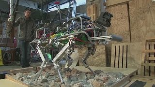
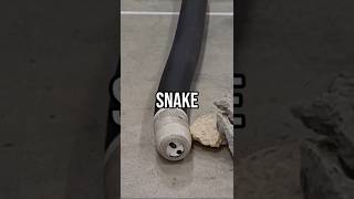
- Search and Rescue Operations: Robots are invaluable tools in locating survivors in challenging environments. Utilizing thermal imaging, CO₂ sensors, and audio detection, they are designed to detect human presence even in debris-laden landscapes. Notably, snake robots and small unmanned ground vehicles (UGVs) are adept at maneuvering through tight spaces to reach those in need.
- Surveillance and Reconnaissance: Unmanned Aerial Vehicles (UAVs) and drones play a pivotal role in disaster assessment. They are equipped for live video streaming, terrain mapping, and victim identification, enabling responders to gather crucial information on the ground situation safely and rapidly.
- Structural Integrity Assessment: The safety of buildings post-disaster is paramount. Climbing robots can navigate vertical structures to scan for cracks and instabilities, while advanced technologies like Ground Penetrating Radar (GPR) and LiDAR are integrated to enhance the analysis of structural integrity.
- Hazard Detection: Addressing potential chemical, biological, radiological, and nuclear (CBRN) threats is essential during disaster response. Robots with specialized sensors detect hazardous environments, while drones facilitate atmospheric monitoring to provide real-time data on emerging dangers.
- Debris Removal and Delivery: Robotic systems such as autonomous bulldozers and tracked robots are deployed to clear rubble and facilitate the delivery of essential supplies like emergency medical kits, food, and water. By performing these labor-intensive tasks, robots alleviate the burden on human responders, allowing them to focus on critical rescue operations.
Each of these functions exemplifies how robots extend the capabilities of human responders in disaster situations, ensuring quicker and safer intervention as they navigate complex and often perilous environments.
Youtube Videos


Audio Book
Dive deep into the subject with an immersive audiobook experience.
Search and Rescue Operations
Chapter 1 of 5
🔒 Unlock Audio Chapter
Sign up and enroll to access the full audio experience
Chapter Content
Use of robots to identify survivors using thermal imaging, CO₂ sensors, audio detection, etc.
Deployment of snake robots and small unmanned ground vehicles (UGVs) into narrow crevices.
Detailed Explanation
In disaster situations, the primary goal is often to locate and rescue survivors. Robots play a crucial role in these search and rescue operations. They are equipped with advanced tools such as thermal imaging cameras, which can detect heat signatures from trapped individuals, and CO₂ sensors that can indicate human presence by measuring carbon dioxide levels. Additionally, audio detection systems can pick up sounds made by people calling for help. Furthermore, specialized robots, like 'snake robots,' and smaller unmanned ground vehicles (UGVs) are designed to navigate through tight spaces and crevices that humans cannot access. These technologies help rescuers identify survivors quickly and efficiently, enhancing the chances of rescue without exposing human responders to danger.
Examples & Analogies
Consider a scenario where a building has collapsed due to an earthquake. It's similar to finding a needle in a haystack. Instead of searching with human eyes alone, which is dangerous and might miss someone trapped in a small space, we use robots. Imagine a snake robot slithering through the rubble, using its thermal camera to spot a warm body and alerting the rescue team. This way, the robot acts like a dedicated search dog but is more equipped to handle the rubble safely.
Surveillance and Reconnaissance
Chapter 2 of 5
🔒 Unlock Audio Chapter
Sign up and enroll to access the full audio experience
Chapter Content
Use of Unmanned Aerial Vehicles (UAVs) and drones for:
- Live video streaming
- Terrain mapping
- Victim identification
Detailed Explanation
In disaster zones, obtaining a clear understanding of the environment is vital for formulating effective response strategies. Unmanned Aerial Vehicles (UAVs) and drones are deployed for surveillance and reconnaissance tasks. These flying robots can provide live video feeds, allowing response teams to assess the situation in real-time from safe locations. They can also map the terrain, helping identify accessible routes and potential hazards. Furthermore, drones are equipped to identify victims from above, using various sensors that can recognize shapes and heat signatures, thus aiding ground teams in locating individuals in need of assistance.
Examples & Analogies
Imagine you're in a forest during a severe storm, and many paths are blocked by fallen trees. Instead of sending rescue teams into these potentially dangerous areas, teams deploy drones. These drones act like a bird’s eye view, flying overhead to capture live video footage, mapping out safe routes, and showing where people are stuck. This is similar to how hikers might use a map to find their way, but the drones provide a dynamic, real-time view that adapts as conditions change.
Structural Integrity Assessment
Chapter 3 of 5
🔒 Unlock Audio Chapter
Sign up and enroll to access the full audio experience
Chapter Content
Climbing robots for vertical structures to scan cracks or instabilities.
Ground Penetrating Radar (GPR) and LiDAR integration.
Detailed Explanation
After a disaster, assessing the structural integrity of buildings and infrastructure is critical to ensure safety during rescue operations. Climbing robots are designed to scale vertical surfaces and can inspect buildings for cracks or weaknesses that indicate potential collapses. These robots can carry sensors that employ Ground Penetrating Radar (GPR) and LiDAR technologies. GPR allows for imaging below the surface to detect voids or anomalies within structures, while LiDAR provides accurate 3D maps of the environment, helping engineers assess damage effectively. This information is crucial for deciding whether it is safe for human responders to enter an area.
Examples & Analogies
Think of a climbing robot as a superhero that can scale walls and inspect skyscrapers after a disaster. Imagine one of these robots attaching itself to the side of a building, examining it for cracks just like a doctor checking for signs of illness using an X-ray. The robot uses radar and lasers to look inside the structure, ensuring that it is safe before sending human responders in—kind of like a safety check before going on a roller coaster.
Hazard Detection
Chapter 4 of 5
🔒 Unlock Audio Chapter
Sign up and enroll to access the full audio experience
Chapter Content
Equipped with chemical, biological, radiological, and nuclear (CBRN) sensors.
Drones for atmospheric monitoring.
Detailed Explanation
Disasters can introduce various hazardous materials into the environment, making it essential to detect these dangers quickly. Robots in disaster zones are often equipped with advanced sensors capable of identifying chemical, biological, radiological, and nuclear (CBRN) threats. These include sensors that can detect toxic gases and radiation. Drones also play a role in atmospheric monitoring, analyzing air quality and identifying potential hazards from above. This capability helps responders ascertain safe zones and avoid areas where dangerous materials are present.
Examples & Analogies
Imagine a scenario where a chemical plant has exploded, potentially releasing toxic fumes. Just like how firefighters use meters to test the air quality, robots equipped with specialized sensors are sent in to assess the danger. They can fly around the pollution cloud like a bee checking flowers for toxins, sending back information to ensure human responders are safe from hazards before they approach.
Debris Removal and Delivery
Chapter 5 of 5
🔒 Unlock Audio Chapter
Sign up and enroll to access the full audio experience
Chapter Content
Autonomous bulldozer robots or tracked robots for rubble clearing.
Delivery of emergency medical kits, water, and food.
Detailed Explanation
After a disaster, debris removal is critical for accessing survivors and providing aid. Autonomous bulldozer robots and tracked robots are employed to clear rubble and obstacles safely. These robots can operate independently or under human guidance, effectively moving heavy debris that would be unsafe for human responders to manage. Additionally, robots can also be tasked with delivering essential supplies such as medical kits, food, and water directly to those in need, ensuring that aid reaches victims quickly and efficiently.
Examples & Analogies
Imagine after a landslide, roads are blocked with large boulders and mud. Instead of risking people’s safety to clear the path, imagine sending a bulldozer robot that can autonomously navigate and push away the debris, making way for rescue teams. Simultaneously, smaller robots deliver bottles of water and first aid kits to trapped individuals—like a helpful friend bringing you what you need when you can’t reach it yourself.
Key Concepts
-
Search and Rescue: Use of robots to locate survivors using sensors and imaging technology, enhancing safety and efficiency.
-
Surveillance and Reconnaissance: Use of UAVs for real-time data collection and mapping in disaster zones.
-
Structural Integrity Assessment: Assessing building safety using robotic technologies like GPR and LiDAR.
-
Hazard Detection: Identifying chemical and biological hazards with specialized sensors to ensure responder safety.
-
Debris Removal and Delivery: Robots assist in clearing rubble and providing essential supplies to those in need.
Examples & Applications
The PackBot robot is commonly used in search and rescue operations due to its capability to navigate debris fields while carrying sensors.
Drones like the DJI Mavic are employed for live mapping and aerial surveys in disaster-affected areas.
Memory Aids
Interactive tools to help you remember key concepts
Rhymes
When disaster strikes and there's a call, robots will help, they’ll answer it all.
Stories
In a town hit by an earthquake, a snake robot slinked through the rubble, finding a trapped kid with its thermal eyes, bringing hope to the rescue crew. This shows how technology saves lives!
Memory Tools
Use the mnemonic DRILLS: D for Detection of hazards, R for Rescue operations, I for Integrity assessments, L for Logistics in delivery, and S for Surveillance.
Acronyms
SAR - Search And Rescue, highlighting robots' roles in locating survivors.
Flash Cards
Glossary
- UAV (Unmanned Aerial Vehicle)
An aircraft that operates without a human pilot onboard, commonly used for surveillance and reconnaissance.
- CO₂ Sensor
A device that detects the concentration of carbon dioxide in the environment, often used to locate trapped survivors.
- GPR (Ground Penetrating Radar)
A geophysical method that uses radar pulses to image the subsurface, useful for detecting structural anomalies.
- LiDAR (Light Detection and Ranging)
A remote sensing method that uses light in the form of a pulsed laser to measure distances to the Earth, creating detailed 3D representations.
- CBRN Sensors
Sensors used to detect chemical, biological, radiological, and nuclear hazards.
- Thermal Imaging
A technology that detects radiation in the infrared range of the electromagnetic spectrum to create an image based on temperature differences.
- Debris
Scattered pieces of waste or remains of something that has been destroyed or discarded.
Reference links
Supplementary resources to enhance your learning experience.