
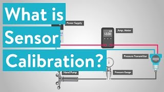
Instrument Calibration and Error Management
Enroll to start learning
You’ve not yet enrolled in this course. Please enroll for free to listen to audio lessons, classroom podcasts and take practice test.
Interactive Audio Lesson
Listen to a student-teacher conversation explaining the topic in a relatable way.
Importance of Calibration
🔒 Unlock Audio Lesson
Sign up and enroll to listen to this audio lesson

Today, we're going to explore the significance of calibrating surveying instruments like Total Stations and GPS receivers. Why do you think calibration is essential in surveying?

Maybe because it ensures that the measurements are accurate?
Exactly! Calibration helps maintain precision by accounting for various errors. Can anyone name some areas in which inaccuracies could be critical?

In construction projects, if the measurements are off, it could lead to structural issues.

And in legal surveys, it might affect property boundaries.
Great points! Remember, both instrument errors and environmental factors can lead to significant issues in surveying. This highlights how vital calibration is.
Calibration of Total Station
🔒 Unlock Audio Lesson
Sign up and enroll to listen to this audio lesson

Let’s delve into the calibration process for Total Stations. What are some checks we conduct during calibration?

We check for collimation error and measure angles against known references.
Correct! We also perform EDM calibration, comparing distance measurements against a standard. What about the plummet check, why is it important?
It ensures the instrument is correctly aligned over the survey point.
Exactly right! A well-calibrated instrument ensures our measurements are trustworthy.
To help remember, think of PLUM: P for Plummet check, L for Leveling angles, U for EDM and M for Mechanical design checks. This captures our calibration essentials!
Calibration of GPS Equipment
🔒 Unlock Audio Lesson
Sign up and enroll to listen to this audio lesson
Now let’s move on to calibrating GPS equipment. Who can tell me some of the key calibrations we perform?
We do a baseline check and verify the antenna height.
And we also need to update the receiver firmware.
Right! And we must consider environmental conditions as well. These affect how satellites communicate with our devices. How could that impact accuracy?
Weather can distort signals, making it hard to get accurate readings.
Spot on! Knowing these factors can help us correct for potential errors.
Managing Errors
🔒 Unlock Audio Lesson
Sign up and enroll to listen to this audio lesson
Finally, let's address error management. What types of errors do we encounter with Total Stations and GPS?
There are instrumental errors and environmental errors.
And systematic errors can come from factors we can’t always control.
Good answers! It's crucial to manage these errors through regular calibration and by using reliable methods. What are some methods we could implement to minimize these errors?
Implementing periodic checks and keeping equipment maintained should help.
Absolutely! Consistency in checking and calibrating our equipment leads to better results over time.
Introduction & Overview
Read summaries of the section's main ideas at different levels of detail.
Quick Overview
Standard
The section discusses the significance of instrument calibration and error management in surveying, detailing calibration procedures for Total Stations and GPS equipment. Emphasis is placed on various types of errors that can occur and methods for ensuring accuracy in high-stakes engineering projects.
Detailed
Instrument Calibration and Error Management
Instrument calibration is crucial in surveying as it ensures that devices such as Total Stations and GPS receivers provide accurate and reliable data. Regular calibration helps in accounting for instrumental, systematic, and environmental errors, which is especially important in high-stakes engineering projects.
Importance of Calibration
Calibration involves checking and adjusting the instruments to maintain their precision. It helps in identifying potential errors that can impact surveying results.
Calibration of Total Station
- Collimation Error Check: Verification of the alignment between the optical and mechanical axes.
- Horizontal and Vertical Angle Calibration: Comparing observed angles against known references to ensure accuracy.
- EDM Calibration: Checking distance measurements against a standard baseline to confirm precision.
- Plummet Check: Ensuring that the plummet aligns correctly with the vertical axis.
Calibration of GPS Equipment
- Baseline Check: Comparing measurements over known distances to ensure accuracy.
- Antenna Height Verification: Confirming the correct input of antenna height to avoid elevation errors.
- Receiver Firmware Update: Keeping the device updated to minimize computational errors.
- Environmental Conditions: Adjusting for temperature, humidity, and satellite conditions.
This careful approach to calibration contributes to the overall reliability and credibility of surveying work, ensuring that engineers and surveyors can rely on data gathered from these tools.
Youtube Videos


Audio Book
Dive deep into the subject with an immersive audiobook experience.
Importance of Calibration
Chapter 1 of 3
🔒 Unlock Audio Chapter
Sign up and enroll to access the full audio experience
Chapter Content
Surveying instruments like Total Stations and GPS receivers must be calibrated regularly to maintain precision. Calibration ensures that instrumental, systematic, and environmental errors are accounted for, especially in high-stakes engineering projects.
Detailed Explanation
Calibration is a process where surveying instruments are adjusted and checked to ensure they provide accurate measurements. This is crucial because if the instruments are not calibrated, the measurements could be wrong. Regular calibration helps to detect and correct errors that could affect surveying results, particularly in projects where precision is critical, such as construction and engineering. By identifying systematic errors (errors that are consistent and predictable) and environmental errors (errors due to changing conditions like temperature), surveyors can ensure the reliability of their measurements.
Examples & Analogies
Think of calibration like tuning a piano. Just as a piano must be tuned regularly to ensure that it plays the right notes, surveying instruments must be calibrated to ensure they measure accurately. If the piano goes out of tune, the music will sound off, similar to how inaccurate measurements can lead to issues in construction or design.
Calibration of Total Station
Chapter 2 of 3
🔒 Unlock Audio Chapter
Sign up and enroll to access the full audio experience
Chapter Content
• Collimation Error Check: Verifying the alignment of optical axis with the mechanical axis.
• Horizontal and Vertical Angle Calibration: Comparing observed angles with known angular references.
• EDM Calibration: Checking distance measurement against a standard baseline.
• Plummet Check: Ensuring optical or laser plummet is correctly aligned with the vertical axis.
Detailed Explanation
Calibrating a Total Station involves several steps to ensure it operates correctly. The collimation error check involves making sure that the optical axis (what you look through) aligns perfectly with the mechanical axis (the instrument's physical structure). If they are misaligned, all angular measurements could be off. The horizontal and vertical angle calibration involves comparing the measurements taken against known angles, ensuring the instruments report angles accurately. EDM calibration checks the distances measured by the instrument against a standard to ensure accuracy. Finally, the plummet check ensures the instrument is perfectly vertical when mounted, which is crucial for accurate measurements.
Examples & Analogies
Imagine you’re setting up a laser level for a construction project. If the laser beam isn't perfectly level (like the mechanical and optical axes in the collimation check), everything you build could end up crooked. Just like you take time to level the laser, calibration ensures that a Total Station provides reliable measurements.
Calibration of GPS Equipment
Chapter 3 of 3
🔒 Unlock Audio Chapter
Sign up and enroll to access the full audio experience
Chapter Content
• Baseline Check: Comparing measurements over known distances.
• Antenna Height Verification: Ensuring correct input of antenna height to avoid elevation errors.
• Receiver Firmware Update: Keeping the device updated to minimize computational and satellite decoding errors.
• Environmental Conditions: Adjusting for temperature, humidity, and satellite constellation status.
Detailed Explanation
When calibrating GPS equipment, several key steps ensure accurate positioning. The baseline check involves measuring known distances to ensure the GPS is accurately capturing the distances it calculates. Verifying the antenna height is crucial because any mistake in height input can lead to significant elevation errors in positioning. Updating the receiver's firmware is like updating software on your phone; it helps fix bugs and improve performance, minimizing potential errors in measuring. Lastly, environmental conditions can affect GPS accuracy, so calibrating involves adjusting for factors such as temperature and humidity, along with the current satellites used for positioning.
Examples & Analogies
Think of calibrating GPS equipment like making sure your smartphone's GPS is accurate. If your phone's GPS settings are off, you might end up lost just a few blocks from home. Similarly, if a surveyor's GPS isn't calibrated properly, they might end up measuring the wrong location entirely.
Key Concepts
-
Calibration: Ensures that surveying instruments provide accurate measurements.
-
Collimation Error: A type of error that affects the alignment of measurements.
-
EDM Calibration: Checking the electronic distance measurement accuracy.
Examples & Applications
Example 1: A Total Station needs calibration when it shows a consistent measurement error over known distances.
Example 2: GPS equipment shows discrepancies in distance when the antenna height is entered incorrectly.
Memory Aids
Interactive tools to help you remember key concepts
Rhymes
Calibration's no chore, it opens accuracy's door.
Stories
Imagine a carpenter who never checks his tools; he'd build crooked doors! Calibration keeps surveying instruments precise, ensuring that every angle is right.
Memory Tools
Remember the acronym CALIBRATE for calibration: C for Collimation check, A for Angle check, L for Leveling, I for Instrument height, B for Baseline check, R for Receiver updates, A for Antenna height, T for Temperature adjustments, and E for Error management.
Acronyms
PLUM
for Plummet Check
for Leveling angles
for EDM
for Mechanical checks.
Flash Cards
Glossary
- Calibration
The process of adjusting an instrument to ensure its accuracy in measurements.
- EDM (Electronic Distance Measurement)
A technology used in surveying to measure distances electronically.
- Collimation Error
An alignment error between the optical axis and the mechanical axis of the instrument.
Reference links
Supplementary resources to enhance your learning experience.