
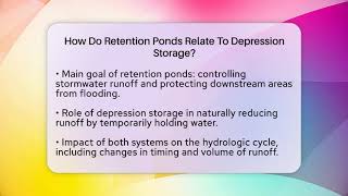
Depression Storage
Enroll to start learning
You’ve not yet enrolled in this course. Please enroll for free to listen to audio lessons, classroom podcasts and take practice test.
Interactive Audio Lesson
Listen to a student-teacher conversation explaining the topic in a relatable way.
Introduction to Depression Storage
🔒 Unlock Audio Lesson
Sign up and enroll to listen to this audio lesson

Today, we’re going to explore depression storage. Can anyone tell me what it means in hydrology?

Isn't it about how water collects in small areas after it rains?
Exactly! Depression storage refers to the amount of water retained in depressions like puddles before it evaporates or contributes to runoff. This is crucial because it impacts initial losses in hydrology.

So, it's important for understanding how much water will actually make it into the soil?
Yes, that’s right! The water stored affects the effective precipitation available for infiltration and runoff. Remember, before runoff occurs, the depression storage must be filled!

What are some common examples of these depressions?
Great question! Examples include puddles, potholes, and rills. Keep those in mind!

It sounds important for engineers and hydrologists.
Absolutely! Understanding depression storage assists in flood assessments and watershed management.
Factors Affecting Depression Storage
🔒 Unlock Audio Lesson
Sign up and enroll to listen to this audio lesson

Let’s discuss the factors that influence depression storage. Can anyone guess what influences it?
Surface features? Like how bumpy the ground is?
Exactly! Rough surfaces have more storage capacity. Additionally, land use, such as forests and urban areas, plays a crucial role.
Why do urban areas have less storage?
Good point! Urban areas often have smooth, impervious surfaces which limit storage compared to vegetated areas.
What about soil types?
Excellent! Clayey soils retain water longer, while compacted soils reduce storage. Keep noting these points, they’re significant for managing water resources!
How does rainfall intensity fit into this?
Great observation! High-intensity rain can overwhelm depression storage, leading to runoff before the storage is filled. That's critical knowledge for hydrologic design!
Quantification of Depression Storage
🔒 Unlock Audio Lesson
Sign up and enroll to listen to this audio lesson
Now, let’s turn to how we measure depression storage. Who can suggest a method?
Can we use formulas or something from experiments?
Yes! We use empirical values derived from field experiments for different land types. For example, forests typically have a depression storage of 2-5 mm.
What’s an empirical value?
Good question! Empirical values are based on observed data to estimate depression storage. In addition to these, we can use experimental methods, like double ring infiltrometers.
How about newer technologies?
Exactly! Technologies like LIDAR help model micro-topography and calculate potential storage. This is an exciting advancement in hydrology!
That sounds really useful for engineers!
Yes, it's essential for accurate modeling. Incorporating these techniques allows for better flood management and resource planning.
Role in Hydrological Modeling
🔒 Unlock Audio Lesson
Sign up and enroll to listen to this audio lesson
How do you think depression storage fits into hydrological models?
Maybe it affects how they calculate runoff?
Exactly! It’s a vital part of simulating runoff accurately. Models like SWAT and HEC-HMS include it as an initial loss in their calculations.
What’s an HRU?
HRU stands for Hydrologic Response Unit. It helps estimate depression storage for different land uses and slopes in distributed models.
Are there specific designs that consider this too?
Yes! In engineering designs, such as stormwater management systems, understanding depression storage contributes significantly to their performance.
It’s amazing how interconnected everything in hydrology is!
Absolutely! Remember, every aspect of hydrology depends on these foundational concepts, so keep making those connections!
Impact on Watershed Management
🔒 Unlock Audio Lesson
Sign up and enroll to listen to this audio lesson
Finally, let’s talk about the impact of depression storage on watershed management. What benefits can it provide?
It helps with flood control, right?
Yes! It can reduce peak discharge during storms, which is crucial for flood mitigation.
What about soil erosion?
Great point! It can help control soil erosion by reducing flow velocities, preventing soil detachment.
And does it help groundwater recharge too?
Exactly! By increasing the residence time of water on the surface, depression storage enhances infiltration, contributing to groundwater recharge.
These all seem like really important factors!
They are! Understanding depression storage is vital in creating effective water resource management strategies. Keep these benefits in mind as you study further!
Introduction & Overview
Read summaries of the section's main ideas at different levels of detail.
Quick Overview
Standard
This section explores the concept of depression storage, its influencing factors, methods for quantification, and its implications for hydrological modeling and watershed management. Understanding this concept is crucial for professionals involved in water resources, flood management, and civil engineering.
Detailed
Detailed Summary
Depression storage is defined as the volume of water that accumulates in small surface depressions after rainfall and is crucial for understanding hydraulic losses. It is a key component of initial abstraction and must be filled before runoff occurs. Depression storage can be influenced by several factors:
1. Surface Topography: Rough or uneven surfaces can enhance storage capacity.
2. Land Use and Cover: Areas like forests and cultivated lands with furrows retain more water compared to urban settings.
3. Soil Type and Condition: Clayey and compacted soils tend to retain water longer.
4. Rainfall Intensity: The type and amount of rainfall affect how much water can be stored in depressions.
5. Vegetative Cover: Dense vegetation helps in retaining water in these areas.
Several methods are employed to quantify depression storage, including empirical values for different land uses, experimental techniques such as infiltrometers, and analytical methods like the SCS Curve Number Method. In hydrological modeling, this storage is essential for accurately simulating runoff, particularly in urban areas where natural depressions are minimal. In these settings, green infrastructure solutions can help increase storage capacity. High-resolution Digital Elevation Models are also useful for identifying and quantifying potential storage sites.
Finally, recognizing the impact of depression storage on watershed management is critical for flood mitigation, soil erosion control, and enhancing groundwater recharge.
Youtube Videos


Audio Book
Dive deep into the subject with an immersive audiobook experience.
Introduction to Depression Storage
Chapter 1 of 10
🔒 Unlock Audio Chapter
Sign up and enroll to access the full audio experience
Chapter Content
Depression storage refers to the portion of rainfall that is temporarily retained in small surface depressions such as puddles, potholes, rills, and micro-topographic features before it either evaporates, infiltrates into the soil, or contributes to surface runoff. It is an important concept in surface hydrology as it plays a crucial role in determining initial abstraction losses and the amount of effective precipitation available for infiltration and runoff.
Detailed Explanation
Depression storage is the water that collects in small holes or low areas after it rains. It doesn't go directly into rivers or streams; instead, it might soak into the ground or evaporate. Understanding this helps hydrologists and engineers know how much water is available to move into the soil or run off into rivers later. These calculations are important for managing water resources and predicting flooding.
Examples & Analogies
Imagine a sponge placed in a shallow bowl of water. When you pour water into the bowl, the sponge absorbs some of the water, which represents depression storage. The water that doesn't get absorbed and overflows the bowl symbolizes runoff.
Definition and Concept of Depression Storage
Chapter 2 of 10
🔒 Unlock Audio Chapter
Sign up and enroll to access the full audio experience
Chapter Content
Depression storage is defined as the amount of water that collects in surface depressions during rainfall and does not contribute to surface runoff. It must be filled before any runoff can occur. It is considered part of initial losses in hydrological accounting.
• Initial abstraction = depression storage + interception + infiltration (before runoff starts).
• Typical examples: water in potholes, ploughed fields, ruts, low-lying areas, etc.
Detailed Explanation
This chunk explains that depression storage is the water collected in tiny dips and holes on the ground after it rains. This water doesn't directly become runoff (the water that flows over the surface). Before any water can flow away, these depressions need to fill up first. The initial absorption of water from rainfall is referred to as 'initial abstraction,' which includes depression storage as one of its components.
Examples & Analogies
Think of a sponge in a plate: initially, the sponge soaks up some water, and until it's filled, no water spills over the edge of the plate. This is similar to how rainwater is stored in depressions before any runoff occurs.
Factors Affecting Depression Storage
Chapter 3 of 10
🔒 Unlock Audio Chapter
Sign up and enroll to access the full audio experience
Chapter Content
Several factors influence the magnitude of depression storage. These include:
25.2.1 Surface Topography
• Rough, uneven surfaces have more storage capacity.
• Micro-relief features such as mounds and pits increase depression storage.
25.2.2 Land Use and Land Cover
• Forested areas and agricultural fields with furrows and tillage features have higher depression storage.
• Urban areas with smooth impervious surfaces have minimal depression storage.
25.2.3 Soil Type and Surface Condition
• Clayey soils with low infiltration retain water longer.
• Compacted or crusted soils reduce depression storage.
25.2.4 Rainfall Intensity and Duration
• Short, low-intensity rain may get completely absorbed in depressions.
• High-intensity rain may quickly exceed depression storage capacity, leading to runoff.
25.2.5 Vegetative Cover
• Dense vegetation may help retain water in surface depressions and increase retention time.
Detailed Explanation
This section lists the factors that affect how much water can be stored in surface depressions. Surface topography means that uneven ground can hold more water than flat ground. Land use, like fields with crops or forests, retains more water than pavement in cities. Soil type matters too; clay soils can hold moisture longer, whereas compacted soils can’t hold much water. The intensity and duration of rainfall also play a role; lighter rains can fill depressions, while heavy downpours overflow them. Finally, plants can keep more water in depressions by slowing down runoff.
Examples & Analogies
Imagine a basket (depression storage) filled with different items. If the basket has a hole (compact soil), it won't hold much water. If the basket is made of a sponge (clay soil), it will retain more water. Just like how different conditions affect how much water the basket can hold, various environmental factors affect depression storage.
Quantification of Depression Storage
Chapter 4 of 10
🔒 Unlock Audio Chapter
Sign up and enroll to access the full audio experience
Chapter Content
Different land uses have typical empirical values of depression storage derived from field experiments:
Land Use Type Depression Storage (mm)
Forest 2 – 5 mm
Cultivated Land 1 – 3 mm
Grassland 1 – 2 mm
Urban Surfaces ~0 mm
25.3.2 Experimental Methods
• Double ring infiltrometers and rain simulators are used in laboratory or field to measure depression storage.
• LIDAR and photogrammetry are increasingly used to model micro-topography and calculate potential depression storage.
25.3.3 Analytical Methods
• Depression storage can be estimated using:
– SCS Curve Number Method: Indirectly accounts for depression storage through the initial abstraction (Ia).
– Ia = 0.2S where S is potential maximum retention after runoff begins. In SCS method, Ia includes depression storage and interception losses.
Detailed Explanation
This chunk covers how depression storage is measured and quantified in different types of land. For example, forests typically hold more water (2-5 mm) compared to urban areas (~0 mm). It also describes the methods used to measure depression storage; researchers use tools like double ring infiltrometers and rain simulators in tests, while technology like LIDAR helps visualize and quantify land surface depressions. In particular, the SCS Curve Number Method gives predictions of how much water can be stored based on practical calculations.
Examples & Analogies
Think of measuring the amount of water a sponge can hold - researchers test different sponges (or land types). Using tools, they fill these sponges until they can't hold any more water, and that tells them the 'depression storage' for that sponge's type. Similar tests help predict how much water can be stored in different land types.
Role in Hydrological Modelling
Chapter 5 of 10
🔒 Unlock Audio Chapter
Sign up and enroll to access the full audio experience
Chapter Content
Depression storage is considered in various hydrologic models to simulate runoff accurately. 25.4.1 Conceptual Models
• Include depression storage as an initial loss.
• Models such as SWAT, HEC-HMS, and MIKE SHE allow explicit inclusion of depression storage.
25.4.2 Hydrologic Response Units (HRUs)
• In distributed models, HRUs help in estimating depression storage for each unit based on land use, soil, and slope.
Detailed Explanation
In hydrology, models that forecast how water moves through an area must consider depression storage to predict runoff accurately. Some models specifically integrate depression storage in their calculations, treating it as a loss from the total rainfall. Also, 'Hydrologic Response Units' help break down areas into smaller units to estimate how each piece of land contributes to depression storage based on its use and characteristics.
Examples & Analogies
Think of a complicated water maze where water runs through different paths. To successfully navigate the maze (hydrological model), you must understand where the water can get stuck or absorbed, like in pits (depressions). Each path (HRU) can have different rules based on its surface type or shape!
Depression Storage and Urban Hydrology
Chapter 6 of 10
🔒 Unlock Audio Chapter
Sign up and enroll to access the full audio experience
Chapter Content
Urban areas are typically considered to have negligible depression storage due to impervious surfaces. However:
• Green Infrastructure (GI) interventions like rain gardens, bio-swales, and permeable pavements are designed to increase depression storage and reduce peak runoff.
• Micro-topographic features in urban designs (e.g., recessed planting areas) can help simulate natural depression storage.
Detailed Explanation
Urban development often leads to surfaces that don’t absorb water, resulting in low depression storage. However, modern practices like rain gardens and permeable pavements aim to mimic natural drainage systems to increase water retention. These features and slight topographical changes in urban landscapes help regulate water flow and avoid quick runoff, making cities more resilient to heavy rains.
Examples & Analogies
Imagine an urban area like a giant parking lot, where rainwater just forms puddles and runs off. Now, picture adding pieces of sponge-like materials (green infrastructure) and designing the lot with small dips (micro-topography). These changes help the parking lot act more like a natural area, where water can soak in instead of rushing away.
Estimation Using Digital Elevation Models (DEMs)
Chapter 7 of 10
🔒 Unlock Audio Chapter
Sign up and enroll to access the full audio experience
Chapter Content
High-resolution DEMs (e.g., from drones or satellites) are used to compute depression storage:
• Fill and pit removal algorithms (e.g., Planchon-Darboux method) help identify depressions.
• Software such as ArcGIS and QGIS can model surface depressions and estimate potential depression storage.
Detailed Explanation
Digital Elevation Models (DEMs) created from technological sources like drones and satellites are powerful tools for understanding land features, including depressions. The algorithms convert elevation information into practical designs, marking where water might collect. Software like ArcGIS is used to simulate and visualize these depressions, giving estimates of how much water can be stored.
Examples & Analogies
Consider using a 3D map of your neighborhood that shows all the different hills and dips on the ground. Just like using that map to find where rain might collect in depressions, DEMs show where water might pool and helps hydrologists plan better.
Impact on Watershed Management
Chapter 8 of 10
🔒 Unlock Audio Chapter
Sign up and enroll to access the full audio experience
Chapter Content
• Flood mitigation: Depression storage reduces peak discharge during storm events.
• Soil erosion control: Helps reduce flow velocities and prevents detachment of soil particles.
• Groundwater recharge: Enhances infiltration by increasing residence time of water on the surface.
Detailed Explanation
Depression storage is critical in managing watersheds because it influences how water behaves during storms. By holding water temporarily, these depressions mitigate the risk of flooding and help soil stay in place, reducing erosion. Additionally, the water that is stored can gradually soak into the ground, replenishing groundwater supplies.
Examples & Analogies
Imagine a sponge on a rainy day. Instead of letting water pour straight into your house and causing a flood, the sponge soaks it up, relieving the water flow. Similarly, depression storage acts as a natural sponge in a watershed.
Case Studies and Field Observations
Chapter 9 of 10
🔒 Unlock Audio Chapter
Sign up and enroll to access the full audio experience
Chapter Content
Several research studies have quantified depression storage across different terrains:
• Agricultural Fields: Furrow depth and row orientation significantly influence depression storage.
• Deserts and Arid Lands: Surface crusting reduces depression storage.
• Tropical Forests: Litter layer and fallen logs increase storage.
These studies validate the importance of accounting for depression storage in rainfall-runoff models.
Detailed Explanation
Research has shown that depression storage varies significantly across different environments and land uses. In agriculture, how the soil is prepared can impact how much water can be stored. In arid regions, hard crusts can hinder water retention, while in tropical forests, organic debris can enhance storage capacity. These findings emphasize the necessity of incorporating depression storage into models that predict how rainwater will move.
Examples & Analogies
Think of a garden under various conditions: a well-prepared vegetable patch holds more water than a dry, cracked desert! Each environment has its unique effects on how much water can be stored, just as different gardens perform differently during a rain.
Design Considerations in Engineering
Chapter 10 of 10
🔒 Unlock Audio Chapter
Sign up and enroll to access the full audio experience
Chapter Content
Civil engineers must account for depression storage in the following designs:
• Stormwater management systems
• Irrigation field layouts
• Watershed development structures
• Detention and retention basins
Depression storage is often neglected in preliminary designs but can significantly influence performance and sustainability.
Detailed Explanation
In engineering, considering depression storage is critical in designing systems that handle water effectively. This includes structures like stormwater management systems, which need to account for how much water will be stored in depressions to avoid flooding. If these elements are overlooked during the design phase, it can lead to systems that don't work correctly when faced with heavy rain, resulting in inefficiencies.
Examples & Analogies
Imagine planning a city park: if you don’t plan for areas where water can collect (depression storage), you may end up with a flooded park after a rainstorm. Just like good planners design spaces for water, engineers must include depression storage in their designs.
Key Concepts
-
Depression Storage: The volume of water that pools in surface depressions and must be accounted for in hydrology.
-
Initial Abstraction: This includes depression storage and other losses before runoff is calculated.
-
Factors Influencing Storage: Surface topography, land use, soil type, rainfall intensity, and vegetative cover all affect depression storage.
Examples & Applications
In an agricultural field, the furrows and tilled soil can enhance depression storage compared to smooth impervious urban surfaces.
During a rainstorm, a pothole can hold several millimeters of water, reflecting the concept of depression storage in practice.
Memory Aids
Interactive tools to help you remember key concepts
Rhymes
When rain falls down and puddles form, depression storage keeps water warm.
Stories
Imagine a thirsty plant waiting for rain. The puddles around its base are the rain’s gift, temporarily holding water before it sinks into the soil, helping the plant grow strong.
Memory Tools
Remember 'SLOTV' for factors affecting depression storage: Surface topography, Land use, Organisms (vegetative cover), Type of soil, and Rainfall intensity.
Acronyms
MIRE helps you remember
Measure
Identify
Retain
and Evaluate depression storage.
Flash Cards
Glossary
- Depression Storage
The volume of water temporarily stored in small surface depressions following rainfall.
- Initial Abstraction
The sum of various losses (depression storage, interception, infiltration) before runoff occurs.
- Hydrologic Response Unit (HRU)
A distinct area of land use, soil type, and slope used for estimating watershed responses in hydrological models.
- LIDAR
Light Detection and Ranging, a remote sensing technology used to examine the earth's surface.
- SCS Curve Number Method
A method for estimating runoff from rainfall that accounts for initial abstraction, including depression storage.
Reference links
Supplementary resources to enhance your learning experience.