
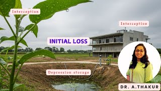
Quantification of Depression Storage
Enroll to start learning
You’ve not yet enrolled in this course. Please enroll for free to listen to audio lessons, classroom podcasts and take practice test.
Interactive Audio Lesson
Listen to a student-teacher conversation explaining the topic in a relatable way.
Understanding Empirical Values
🔒 Unlock Audio Lesson
Sign up and enroll to listen to this audio lesson

Today, we're diving into how we quantify depression storage across different types of land use. To start, can anyone tell me what empirical values are?

Are they measurements we get from experiments?
Exactly, Student_1! For example, forests can retain between 2 to 5 mm of water, while urban areas often have almost no storage. Why do you think that might be?

Urban areas have a lot of buildings and roads, right? That means water can't soak into the ground.
Correct! Just remember: In urban settings, very little water is stored due to impervious surfaces. These figures emphasize how land use impacts hydrology. Let's summarize: Forests > Cultivated Land > Grassland > Urban when it comes to storage!
Experimental Techniques for Measuring Storage
🔒 Unlock Audio Lesson
Sign up and enroll to listen to this audio lesson

Now that we understand the empirical values, let’s talk about how we gather this data. Can anyone mention a tool used for measuring depression storage?

What about double ring infiltrometers?
Good job, Student_3! These are used for measuring how much water infiltrates and how much is stored. Can anyone think of any other methods?

Rain simulators could be one, where they simulate rainfall and measure retention!
Exactly right! They help control conditions to gather precise data. And modern methods like LIDAR can map out the micro-topography for accurate assessments as well. Let's recap: Algorithms, infiltrometers, and simulators are all key methods for measuring storage!
Analytical Methods in Quantification
🔒 Unlock Audio Lesson
Sign up and enroll to listen to this audio lesson
We’ve looked at how experimental methods function; now let’s consider the SCS Curve Number Method. Who can summarize how this method relates to depression storage?
Isn't it about calculating initial abstraction based on potential retention?
Perfect! The equation **Ia = 0.2S** implies initial losses include storage and interception. Why do you think knowing this is critical in hydrological modeling?
It helps predict how much water will run off after it rains.
Exactly! Accurate runoff predictions are crucial for managing water resources. Remember: storage influences our system design in engineering and planning. In summary, both empirical and analytical approaches to quantification are instrumental in hydrology!
Introduction & Overview
Read summaries of the section's main ideas at different levels of detail.
Quick Overview
Standard
The quantification of depression storage involves understanding empirical values derived from land experiments, experimental methods using tools like infiltrometers, and analytical methods such as the SCS Curve Number Method. The section outlines how these approaches contribute to hydrologic modeling and watershed management.
Detailed
Quantification of Depression Storage
In this section, we focus on how depression storage is quantified across different land use types, emphasizing empirical measurements and methodologies used in diverse contexts.
1. Empirical Values
Field experiments provide typical empirical values for depression storage across various land uses, summarized as follows:
- Forest: 2 – 5 mm
- Cultivated Land: 1 – 3 mm
- Grassland: 1 – 2 mm
- Urban Surfaces: ~0 mm
These values illustrate that forested and agricultural areas tend to retain more water compared to urban landscapes, which usually have minimal storage capability.
2. Experimental Methods
To measure depression storage effectively, scientists employ:
- Double Ring Infiltrometers: Used to simulate and measure infiltration and storage in both laboratory and field settings.
- Rain Simulators: Allow for controlled rainfall experiments to assess how much water is retained in surface depressions.
- LIDAR and Photogrammetry: Advanced technologies that model micro-topographical features to determine potential depression storage capacity.
3. Analytical Methods
Quantification can also be achieved analytically using models:
- SCS Curve Number Method: This method indirectly accounts for depression storage through the initial abstraction (Ia), with the following relationship: Ia = 0.2S, where S represents the maximum potential retention after runoff begins. The method incorporates effective depression storage and interception losses into hydrological assessments.
Summary
Understanding the quantification of depression storage is crucial in hydrologic modeling, impacting predictions related to runoff, flood management, and water resource planning.
Youtube Videos


Audio Book
Dive deep into the subject with an immersive audiobook experience.
Empirical Values of Depression Storage
Chapter 1 of 3
🔒 Unlock Audio Chapter
Sign up and enroll to access the full audio experience
Chapter Content
Different land uses have typical empirical values of depression storage derived from field experiments:
| Land Use Type | Depression Storage (mm) |
|---|---|
| Forest | 2 – 5 mm |
| Cultivated Land | 1 – 3 mm |
| Grassland | 1 – 2 mm |
| Urban Surfaces | ~0 mm |
Detailed Explanation
Empirical values refer to the average amount of water that different types of land can store in surface depressions after rainfall. For instance, forests can retain between 2 to 5 millimeters of water. Cultivated lands hold a bit less, typically between 1 to 3 millimeters, and grasslands manage 1 to 2 millimeters. Urban areas, with their concrete surfaces, usually offer little to no depression storage at about 0 millimeters. Understanding these values helps in managing water resources effectively in various land-use scenarios.
Examples & Analogies
Think of different land uses as different types of containers for water. A forest is like a large sponge that soaks up water well, whereas an urban area is like a metal plate that can't hold any water at all.
Experimental Methods for Measuring Depression Storage
Chapter 2 of 3
🔒 Unlock Audio Chapter
Sign up and enroll to access the full audio experience
Chapter Content
• Double ring infiltrometers and rain simulators are used in laboratory or field to measure depression storage.
• LIDAR and photogrammetry are increasingly used to model micro-topography and calculate potential depression storage.
Detailed Explanation
To measure how much water can be retained in depressions, scientists use specific tools like double ring infiltrometers and rain simulators. These tools help replicate rainfall conditions and measure the amount of water that stays in surface depressions. Additionally, advanced technologies like LIDAR (Light Detection and Ranging) and photogrammetry help in creating detailed models of the land surface to estimate potential depression storage by analyzing micro-topographical features.
Examples & Analogies
Imagine using a sponge in a controlled setup to test how much water it can absorb. Similarly, scientists set up experiments in nature to quantify water retention using specialized tools.
Analytical Methods for Estimating Depression Storage
Chapter 3 of 3
🔒 Unlock Audio Chapter
Sign up and enroll to access the full audio experience
Chapter Content
• Depression storage can be estimated using:
– SCS Curve Number Method: Indirectly accounts for depression storage through the initial abstraction (Ia).
– Ia = 0.2S where S is potential maximum retention after runoff begins.
– In SCS method, Ia includes depression storage and interception losses.
Detailed Explanation
Another way to estimate depression storage is through analytical methods like the SCS Curve Number Method. This method uses a formula to determine the initial abstraction, which includes depression storage. The formula indicates that initial abstractions can be viewed as a percentage (20%) of the maximum potential water retention of a certain area. This mathematical approach helps hydrologists estimate how much water will be absorbed before any runoff occurs.
Examples & Analogies
Think of this method like a budgeting system. You can only spend your total income after accounting for some savings. Similarly, hydrologists first calculate how much water can be 'saved' in depressions before any 'spending' or runoff occurs.
Key Concepts
-
Empirical Values: Measurements from field experiments that indicate typical storage quantities for different land uses.
-
Experimental Methods: Techniques like infiltrometers and rain simulators used to measure depression storage quantitatively.
-
Analytical Methods: Mathematical models like the SCS Curve Number Method that estimate storage based on initial abstraction.
Examples & Applications
A forest can retain 2-5 mm of water during precipitation, significantly impacting local hydrology.
Urban areas may show negligible depression storage due to impervious surfaces, which affects surface runoff significantly.
Memory Aids
Interactive tools to help you remember key concepts
Rhymes
Forest and grass, watch water amass. Urban's smooth layout, won’t let rain out.
Stories
Imagine a forest filled with water-holding ponds. In contrast, picture a city where puddles disappear, leaving no trace. This shows how different landscapes handle rainfall.
Memory Tools
F-5, C-3, G-2. Remember: Forests, Cultivated, Grassland values in mm.
Acronyms
F-C-G-U
Forest
Cultivated
Grassland
Urban — this helps remember land types and their storage potentials!
Flash Cards
Glossary
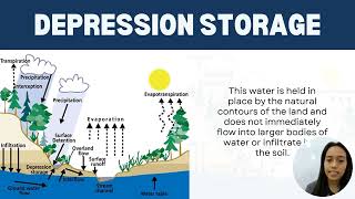
- Depression Storage
The portion of rainfall that is retained in surface depressions before it evaporates, infiltrates, or contributes to runoff.
- Empirical Values
Data obtained from experiments that represent typical measurements in specific contexts.
- SCS Curve Number Method
A methodology that estimates the runoff potential of a watershed by calculating initial abstraction losses.
- LIDAR
A remote sensing method that uses light to measure distances and model surface topography.
- Infiltrometer
A device used to measure the rate at which water infiltrates into the soil.
Reference links
Supplementary resources to enhance your learning experience.