
Methods to Estimate Root Zone Soil Moisture
Enroll to start learning
You’ve not yet enrolled in this course. Please enroll for free to listen to audio lessons, classroom podcasts and take practice test.
Interactive Audio Lesson
Listen to a student-teacher conversation explaining the topic in a relatable way.
Introduction to Estimation Methods
🔒 Unlock Audio Lesson
Sign up and enroll to listen to this audio lesson

Today, we’ll discuss the methods we use to estimate root zone soil moisture. This is important because knowing how much water is available helps in efficient irrigation management. Can anyone tell me why knowing soil moisture is crucial?

It helps in planning irrigation and predicting droughts, right?
Exactly! Proper estimation helps optimize water use. We categorize methods into direct and indirect methods. Let's start with the gravimetric method. Can anyone summarize what it entails?

It involves weighing soil samples before and after drying to find moisture content.
Great! While it's very accurate, it’s also destructive and time-consuming. Our next method is neutron scattering. Does anyone know what that process involves?

It measures hydrogen atoms in the soil, and it’s non-destructive.
Correct! Calibration is essential here for accurate readings. Let’s move on to TDR. Can someone explain how it works?

TDR assesses the dielectric constant of the soil to get moisture levels.
That's right! It’s widely used and gives real-time data which is very useful for our purposes.
Advanced Methods: Remote Sensing
🔒 Unlock Audio Lesson
Sign up and enroll to listen to this audio lesson

Now let’s discuss remote sensing techniques. What do you think are the benefits of using satellite-based methods for estimating root zone moisture?
They can cover large areas and give us data over time.
Exactly! Technologies like MODIS and SMAP allow us to estimate surface moisture efficiently. However, we often need to combine this data with modeling techniques for better accuracy. Why do you think that is?
Because surface moisture isn’t the same as root zone moisture?
Correct! Surface conditions can vary, so models help us estimate moisture deeper in the soil. Can you each remember one key aspect of the four methods we’ve discussed?
Gravimetric is accurate but destructive.
Neutron scattering is non-destructive, but requires calibration.
TDR gives real-time data!
Remote sensing covers a broad area and needs modeling for accuracy.
Fantastic! It’s crucial to weigh these characteristics when selecting a method.
Introduction & Overview
Read summaries of the section's main ideas at different levels of detail.
Quick Overview
Standard
Several methods are available for estimating root zone soil moisture, which include the gravimetric method, neutron scattering, time-domain reflectometry, and remote sensing techniques. Each method has its accuracy, applications, and prerequisites, impacting its suitability for different research or agricultural needs.
Detailed
Methods to Estimate Root Zone Soil Moisture
Estimating root zone soil moisture is essential for efficient water resource management and agricultural practices. This section elaborates on several methodologies, categorizing them into direct and indirect methods:
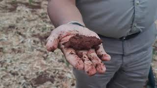
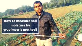
1. Gravimetric Method
The gravimetric method involves weighing soil samples before and after drying them to determine moisture content. While this method is highly accurate, it is also destructive and time-consuming, requiring significant labor and careful handling.
2. Neutron Scattering
This non-destructive method measures the density of hydrogen atoms within the soil, allowing for an estimation of moisture content without having to remove samples from the soil. Calibration is necessary for accurate results, making this method more suitable for research environments.
3. Time Domain Reflectometry (TDR)
TDR is a widely accepted technique that estimates moisture content by measuring the dielectric constant of soil. This method is precise, allowing for real-time measurements, beneficial in agricultural planning and water management.
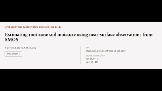
4. Remote Sensing & Satellite-Based Estimation
Using tools like MODIS and SMAP, satellite technologies provide estimates of surface moisture content. These estimates are often integrated with models to extrapolate root zone soil moisture across extensive areas, which is invaluable for broader water resource planning.
Overall, understanding the strengths and limitations of each method helps in selecting the appropriate technology for specific applications in agriculture and hydrology.
Youtube Videos
Audio Book
Dive deep into the subject with an immersive audiobook experience.
Gravimetric Method
Chapter 1 of 4
🔒 Unlock Audio Chapter
Sign up and enroll to access the full audio experience
Chapter Content
• Weighing soil samples before and after drying.
• Most accurate but destructive and time-consuming.
Detailed Explanation
The gravimetric method involves taking soil samples from the root zone, weighing them to determine their mass, and then drying them completely to remove all moisture. After drying, the samples are weighed again. The difference in weight before and after drying gives the amount of water present in the soil sample. While this method is considered to provide the most accurate measurement of soil moisture, it has limitations such as being destructive (the soil cannot be returned to its original state) and time-consuming (it requires drying time).
Examples & Analogies
Think of the gravimetric method like cooking pasta. Just as you weigh the pasta before and after cooking to determine how much water it absorbed, we weigh soil samples before and after drying to understand the moisture content. However, once you cook the pasta, you can't go back to its original form, similar to how you can't reuse the soil once you've taken the sample.
Neutron Scattering
Chapter 2 of 4
🔒 Unlock Audio Chapter
Sign up and enroll to access the full audio experience
Chapter Content
• Measures hydrogen atoms in soil.
• Requires calibration, non-destructive, commonly used in research.
Detailed Explanation
Neutron scattering is a non-destructive method that estimates soil moisture by measuring the presence of hydrogen atoms in the soil. When neutrons are emitted and collide with hydrogen, they lose energy, and detecting this loss helps to estimate the moisture content. This technique requires careful calibration to provide accurate readings and is widely used in research settings due to its effectiveness without disturbing the soil structure.
Examples & Analogies
You can think of neutron scattering like using a special type of radar that detects the water in a sponge. Just as radar can tell how much water is inside the sponge without squeezing it, neutron scattering can measure soil moisture without removing the soil from its place.
Time Domain Reflectometry (TDR)
Chapter 3 of 4
🔒 Unlock Audio Chapter
Sign up and enroll to access the full audio experience
Chapter Content
• Measures dielectric constant to estimate moisture content.
• Precise and widely adopted.
Detailed Explanation
Time Domain Reflectometry (TDR) is a technique that measures the dielectric constant of the soil to estimate its moisture content. The dielectric constant reflects how much moisture is present since water has a much higher dielectric constant than dry soil. By sending electromagnetic pulses through the soil and measuring the time it takes for the pulse to return, TDR can calculate how much moisture is present with high precision. This method is popular due to its accuracy and ease of use in field conditions.
Examples & Analogies
Imagine TDR as sending a signal through a water slide. If the slide is dry, the signal travels slowly; if it’s wet, it travels faster. By measuring how quickly the signal comes back, we can determine how wet the slide (or soil) is.
Remote Sensing & Satellite-Based Estimation
Chapter 4 of 4
🔒 Unlock Audio Chapter
Sign up and enroll to access the full audio experience
Chapter Content
• MODIS, SMAP, and other satellites estimate surface moisture.
• Combined with modeling for root zone estimates.
Detailed Explanation
Remote sensing uses satellites equipped with sensors to estimate surface soil moisture over large areas. Instruments like MODIS (Moderate Resolution Imaging Spectroradiometer) and SMAP (Soil Moisture Active Passive) help to collect data from different locations by measuring the radiation emitted from the Earth's surface. This data is then combined with hydrological models to extrapolate root zone moisture content. This technique allows for quick and vast regional assessments that are impossible to achieve using ground methods alone.
Examples & Analogies
Think of remote sensing as having a bird's-eye view of a large city. From a high vantage point, a bird can see traffic patterns and the state of the roads without needing to get into every car. Similarly, satellites can measure soil moisture levels across vast regions without needing to physically sample each area.
Key Concepts
-
Gravimetric Method: A precise but destructive method to obtain soil moisture content via mass measurements.
-
Neutron Scattering: A non-destructive technique to estimate moisture by detecting hydrogen atoms in the soil.
-
TDR: A quick and accurate method for measuring soil moisture using dielectric readings.
-
Remote Sensing: Satellite technology for obtaining large-scale moisture data incorporates modeling for accurate root zone estimates.
Examples & Applications
Using the gravimetric method, a scientist takes a soil sample, weighs it, dries it in an oven, and weighs it again to calculate moisture content.
A researcher utilizes neutron scattering to assess moisture levels in agricultural fields without disturbing the soil structure.
Memory Aids
Interactive tools to help you remember key concepts
Rhymes
Gravimetric's weight takes to measure, for soil moisture it's a treasure.
Stories
Imagine a scientist who weighs a dirty bucket of soil, dries it out under the sun, and weighs it again to discover how much moisture was in there, learning that measurement is key for crops to thrive.
Memory Tools
Think 'GNT-R' to remember methods: G for Gravimetric, N for Neutron, T for TDR, and R for Remote Sensing.
Acronyms
GRAVITY - Gravimetric, Remote sensing, And Very Important TDR for Yield.
Flash Cards
Glossary
- Gravimetric Method
A method of estimating soil moisture content by weighing soil samples before and after drying.
- Neutron Scattering
An indirect method that measures hydrogen atoms in the soil to estimate moisture content.
- Time Domain Reflectometry (TDR)
A method that estimates soil moisture by measuring the dielectric constant of the soil.
- Remote Sensing
The use of satellite or aerial sensors to estimate surface and root zone moisture.
Reference links
Supplementary resources to enhance your learning experience.