
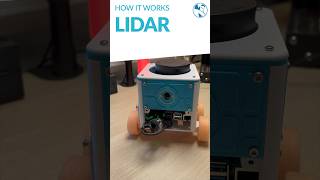
Mobile LiDAR Systems
Enroll to start learning
You’ve not yet enrolled in this course. Please enroll for free to listen to audio lessons, classroom podcasts and take practice test.
Interactive Audio Lesson
Listen to a student-teacher conversation explaining the topic in a relatable way.
Introduction to Mobile LiDAR Systems
🔒 Unlock Audio Lesson
Sign up and enroll to listen to this audio lesson

Today, we'll explore Mobile LiDAR Systems. Can anyone tell me what they think LiDAR stands for?

I think it’s Light Detection and Ranging!
Correct! Mobile LiDAR uses laser light to measure distances. This method allows us to create accurate 3D models of environments. Why do you think that might be useful in civil engineering?

It helps with planning and ensures structures are built correctly based on the terrain!
Exactly! Remember that acronym—LiDAR helps us quickly assess land features which is critical for projects like road alignment and bridge inspections.

How does it work, though?
Great question! LiDAR emits laser pulses, which bounce back from surfaces. By measuring the time it takes for the pulse to return, we can calculate distances accurately.
To summarize, LiDAR stands for Light Detection and Ranging, and it creates 3D models using laser technology, which enhances civil engineering applications.
Applications of Mobile LiDAR
🔒 Unlock Audio Lesson
Sign up and enroll to listen to this audio lesson

Now that we understand how Mobile LiDAR works, let’s talk about its applications. Can anyone name one way we use Mobile LiDAR in civil engineering?

For road alignment?
Yes! It assists with road alignment and inspections. What about other structures like bridges?
It can inspect bridges too, right?
Correct! Mobile LiDAR is particularly useful here due to its high accuracy. Let’s remember this acronym: BRIDGE – Bridges Remain Incredibly Dependable with Great Engineering. It summarizes the importance of regular inspections.
How does it do that?
Mobile LiDAR systems quickly gather detailed surface data, which allows engineers to evaluate structural integrity in a non-invasive way. Therefore, it enhances overall project efficiency and safety.
In summary, Mobile LiDAR is vital for road alignment and bridge inspections, providing efficient and accurate data for civil engineering projects.
Significance of Mobile LiDAR in Project Execution
🔒 Unlock Audio Lesson
Sign up and enroll to listen to this audio lesson
Let’s discuss why Mobile LiDAR is significant for project execution. How do you think it changes the way we approach surveying?
It must speed up the data collection process!
Absolutely! The speed of data collection means projects can move faster. Think of the acronym SPEED: Surveying Projects Efficiently Engages Development.
That acronym is really helpful! What about accuracy?
Good observation! The accuracy reduces the need for reworks or corrections during construction, saving time and resources. This efficiency is key in our increasingly fast-paced industry.
So, it has a big impact on cost as well?
Yes! By reducing the time and resources needed, it can significantly cut costs. To wrap up, remember that Mobile LiDAR enhances speed, accuracy, and cost-effectiveness in civil engineering applications.
Introduction & Overview
Read summaries of the section's main ideas at different levels of detail.
Quick Overview
Standard
Mobile LiDAR Systems, mounted on vehicles or drones, utilize laser scanning technology to produce precise 3D models of various terrains and structures. This technology is critical for applications such as road alignment, bridge inspection, and land development, significantly improving data acquisition and project efficiency.
Detailed
Mobile LiDAR Systems
Mobile LiDAR Systems, short for Light Detection and Ranging, are advanced surveying techniques that leverage laser scanning technology to capture detailed 3D representations of the surrounding environment. These systems can be mounted on various platforms, including vehicles and drones, enabling flexibility and efficiency in data collection. The technology shines in applications such as road alignment assessments, bridge inspections, and comprehensive land development analysis.
By emitting laser pulses and measuring the time it takes for the pulses to bounce back from surfaces, Mobile LiDAR Systems can calculate distances very accurately. As a result, they help civil engineers and surveyors to swiftly generate topographic maps, create 3D models for analysis, and support decision-making processes in urban planning and infrastructure development. Additionally, the high level of precision and efficiency offered by Mobile LiDAR reduces the time and labor required for traditional surveying methods, allowing for faster project execution.
Youtube Videos


Audio Book
Dive deep into the subject with an immersive audiobook experience.
Introduction to Mobile LiDAR Systems
Chapter 1 of 2
🔒 Unlock Audio Chapter
Sign up and enroll to access the full audio experience
Chapter Content
Mounted on vehicles or drones, LiDAR (Light Detection and Ranging) systems produce accurate 3D models of terrain and structures for applications like road alignment, bridge inspection, and land development.
Detailed Explanation
Mobile LiDAR systems are advanced technologies that utilize laser light to measure distances to objects on the Earth's surface. By being mounted on vehicles or drones, these systems can quickly collect vast amounts of data about the geography of an area. The collected data is then processed to create detailed 3D models of the terrain and any structures present, which are invaluable for various applications. For instance, they can help in planning new roads, inspecting the integrity of bridges, or assessing land for development projects.
Examples & Analogies
Think of Mobile LiDAR as a high-tech flashlight. Just like how you can use a flashlight to illuminate and observe the details of your surroundings in the dark, Mobile LiDAR projects laser beams onto the ground to gather information, even in broad daylight. Imagine you’re using a drone equipped with this technology to fly over a forested area; it would scan the terrain and reveal a 3D map that clearly depicts the lay of the land—something not visible to the naked eye.
Applications of Mobile LiDAR Systems
Chapter 2 of 2
🔒 Unlock Audio Chapter
Sign up and enroll to access the full audio experience
Chapter Content
Applications include road alignment, bridge inspection, and land development.
Detailed Explanation
The applications of Mobile LiDAR systems are extensive, significantly impacting civil engineering projects. For road alignment, these systems can provide precise measurements that help engineers design safer and more efficient roadways. In bridge inspection, Mobile LiDAR can detect structural issues by creating detailed scans that highlight potential problems. For land development, this technology aids in environmental assessments and zoning plans by accurately mapping the terrain, allowing developers to make informed decisions about how to proceed with construction.
Examples & Analogies
Imagine you’re an urban planner preparing to build a new highway. Using Mobile LiDAR, you obtain a detailed map of the terrain including trees, hills, and potential obstacles. This data helps you decide the best route for the highway while minimizing impact on the environment and ensuring safety. It’s like using GPS for a road trip, but instead of just directions, you’re getting a detailed view of the landscape to plan the best route.
Key Concepts
-
Mobile LiDAR Systems: These utilize laser technology to create 3D models of terrain and structures.
-
Applications: Key uses include road alignment and bridge inspections, offering significant efficiency and accuracy.
-
Data Collection Speed: Mobile LiDAR allows for rapid collection of detailed information, speeding up project timelines.
Examples & Applications
A civil engineering team uses Mobile LiDAR to inspect an aging bridge without interrupting traffic, allowing for seamless analysis.
Road construction companies deploy Mobile LiDAR on vehicles to quickly survey land and aid in planning and design.
Memory Aids
Interactive tools to help you remember key concepts
Rhymes
LiDAR's light will reach the height, mapping land both day and night.
Stories
Once upon a time, in a bustling city, engineers needed to survey the land to build roads. They discovered a magic box called LiDAR that could measure distances quickly and accurately, transforming their projects forever.
Memory Tools
Use 'LiDAR' to remember: L = Light, D = Detection, A = And, R = Ranging—key aspects of the technology.
Acronyms
BRIDGE
Bridges Remain Incredibly Dependable with Great Engineering
underscoring inspection importance.
Flash Cards
Glossary
- Mobile LiDAR Systems
Technology that uses laser scanning to create accurate 3D models of terrain and structures.
- 3D Modeling
The process of creating a three-dimensional representation of a physical object or environment.
- Laser Scanning
A technique that captures physical objects by using laser beams to measure distances.
Reference links
Supplementary resources to enhance your learning experience.