
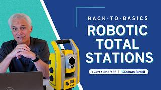
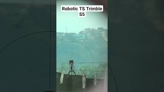
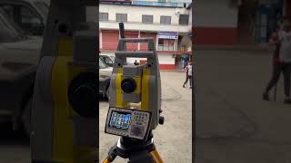
Robotic Total Stations
Enroll to start learning
You’ve not yet enrolled in this course. Please enroll for free to listen to audio lessons, classroom podcasts and take practice test.
Interactive Audio Lesson
Listen to a student-teacher conversation explaining the topic in a relatable way.
Introduction to Robotic Total Stations
🔒 Unlock Audio Lesson
Sign up and enroll to listen to this audio lesson

Today, we're diving into Robotic Total Stations, a crucial tool in modern surveying. Can anyone tell me what they think a Total Station does?

Isn't it just a device that measures distances and angles?
Exactly! A Total Station measures angles and distances but what makes Robotic Total Stations special is their ability to automatically track targets. Can someone explain why that might be beneficial?

It could speed up the surveying process, right?
Yes! This leads us to increased productivity. Think of how much time traditional methods can waste by needing multiple operators. Robotic Total Stations allow for a single user to manage the survey.

Is that common in big construction projects?
Definitely! They are increasingly used in civil engineering projects such as road construction and building layouts. Its efficiency is a game-changer.
"To remember the benefits, think of the acronym 'FAST':
Applications and Integration of Robotic Total Stations
🔒 Unlock Audio Lesson
Sign up and enroll to listen to this audio lesson

Now that we know how Robotic Total Stations work, let’s discuss their integration with other technologies like GPS and CAD. Why do you think that’s important?
It probably helps in creating more accurate maps and designs.
Exactly! This integration allows engineers to analyze terrain more effectively and design structures that fit the landscape perfectly. Can anyone see a challenge in using traditional methods instead?
Maybe the data wouldn't be as accurate or they'd take longer?
Well put! Automation is a key advantage, making decisions based on real-time data more reliable than before. Think of the possible issues if measurements are off in major construction projects!
So, these tools are essential for ensuring safety and compliance?
Yes! They're vital for regulatory compliance, ensuring that surveys meet legal standards. It’s a win-win!
Remember, integration means smooth transitions from data collection to actionable insights in civil engineering.
Introduction & Overview
Read summaries of the section's main ideas at different levels of detail.
Quick Overview
Standard
Robotic Total Stations represent an advancement in surveying technology that enhances productivity through automatic tracking of reflectors and single-operator usage, making them invaluable for topographic and layout surveys in civil engineering projects.
Detailed
Detailed Summary
Robotic Total Stations are innovative surveying instruments that automate the process of locating and recording measurements of points in a designated area. They allow for real-time data collection, which enhances the accuracy and efficiency of topographic and layout surveys. The key features include:
- Automatic Tracking: Robotic Total Stations can automatically track targets (reflectors) as they are moved, which significantly speeds up the data collection process.
- Single-Operator Usage: These instruments are designed for operation by a single user. This stands as a notable advancement, reducing the manpower needed for traditional surveying tasks.
The use of Robotic Total Stations in civil engineering not only decreases the time spent on surveying activities but also increases the precision of measurements, enabling projects to be executed with greater confidence and fewer errors. Their ability to integrate with other technologies, such as GPS and CAD software, further enhances their utility in modern civil engineering practices.
Youtube Videos
Audio Book
Dive deep into the subject with an immersive audiobook experience.
What are Robotic Total Stations?
Chapter 1 of 1
🔒 Unlock Audio Chapter
Sign up and enroll to access the full audio experience
Chapter Content
These systems automatically track reflectors and provide real-time data collection for topographic and layout surveys. They enhance productivity by enabling single-operator usage.
Detailed Explanation
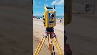
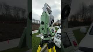
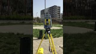
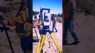
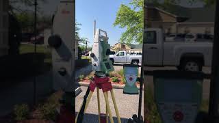
Robotic Total Stations (RTS) are advanced surveying instruments that combine the functionality of traditional total stations with robotic technology. This means they can automatically follow (or track) a specific reflector that the surveyor holds. This automation allows for surveys to be conducted much more efficiently. Instead of requiring multiple people to operate the surveying equipment, one operator can manage the RTS. This not only saves time but also reduces the need for extra personnel on-site, making the operation smoother and less costly.
Examples & Analogies
Think of a robotic total station like a smart camera that follows a person as they move. Just as a smart camera can adjust its focus and zoom to keep the subject clear in the frame, a robotic total station adjusts its angle and readings to ensure it is constantly tracking the correct point or reflector in the survey. This capability allows surveyors to work faster and with more precision, which is vital in construction and land development.
Key Concepts
-
Automatic Tracking: The ability of Robotic Total Stations to follow reflectors automatically, speeding up the data collection process.
-
Real-Time Data Collection: The capacity to gather and analyze data instantly for immediate use in surveying.
-
Single-Operator Efficiency: Refers to how a single user can efficiently manage a Robotic Total Station, reducing labor needs.
Examples & Applications
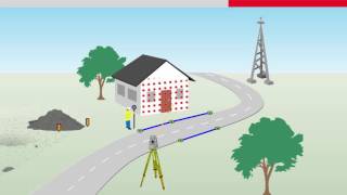
Robotic Total Stations are used in the construction of complex buildings where precision in layout is critical.
They are also utilized in road projects to ensure accurate alignment and grading.
Memory Aids
Interactive tools to help you remember key concepts
Rhymes
A total station’s great; it tracks with flair, measures at speed, and shows that it cares!
Stories
Imagine being a surveyor on a construction site. You have a Robotic Total Station named Rob which tracks reflectors smoothly as you move around, collecting data quicker than your team can manage manually. Rob helps you complete the project ahead of schedule!
Memory Tools
To remember the functions of Robotic Total Stations: 'T.A.S.K.' - Tracking, Accurate, Single-operator, Knowledgeable.
Acronyms
FAST
Faster Surveys
Automatic Tracking
Single Operator
Topographic Data Collection.
Flash Cards
Glossary
- Robotic Total Station
An advanced surveying instrument capable of automatically tracking targets and enabling real-time data collection.
- SingleOperator Usage
The ability for one individual to operate equipment that traditionally required multiple users.
- Topographic Survey
The process of mapping the contours and features of a landscape or area.
Reference links
Supplementary resources to enhance your learning experience.