
UAVs for Post-Disaster Assessment
Enroll to start learning
You’ve not yet enrolled in this course. Please enroll for free to listen to audio lessons, classroom podcasts and take practice test.
Interactive Audio Lesson
Listen to a student-teacher conversation explaining the topic in a relatable way.
Introduction to UAVs in Disaster Scenarios
🔒 Unlock Audio Lesson
Sign up and enroll to listen to this audio lesson

Today, we're discussing how Unmanned Aerial Vehicles, or UAVs, are used in post-disaster assessments. Can anyone tell me what they think the primary purpose of using UAVs in these situations is?

I think they help to see the damage from above, which is important.
Exactly! UAVs allow for rapid aerial assessments. They can quickly capture images of the damage. What might be some specific advantages of using UAVs over traditional methods?

Drones can get into places that might be dangerous for people to go.
Correct! They also cover large areas swiftly, saving time when every moment counts. Remember, ‘Drones Diminish Danger’ - a simple way to recall their safety advantage!
Operational Efficiency of UAVs
🔒 Unlock Audio Lesson
Sign up and enroll to listen to this audio lesson

Now that we see the safety benefits, let’s talk about efficiency. How do you think UAVs can help improve the efficiency of damage assessments?

They probably provide fast data to the engineers, so they know where to focus first.
Exactly! UAVs can provide real-time data that helps prioritize areas in need of immediate attention. Think of the acronym 'FAST' - Fast Aerial Survey Technology. This highlights how UAVs expedite the surveying process.

And they can collect high-resolution images!
Right! High-resolution imagery is crucial for assessing damage accurately. This allows engineers to make informed decisions quickly.
Implementation Challenges and Solutions
🔒 Unlock Audio Lesson
Sign up and enroll to listen to this audio lesson
As we know, implementing UAV technology isn't without challenges. What do you think some issues might be when using UAVs in disaster scenarios?
Maybe there’s bad weather that could affect flying?
Great point! Bad weather can certainly pose a challenge. Additionally, there are regulatory issues and the need for skilled operators. The mnemonic 'WEATHER' can help: Weather, Equipment, Training, Hazard regulations, Examination of surroundings, and Response time. Do you see how these factors can work together?
Yes, all these factors are important for making sure the drones work effectively.
Exactly! And effective training can help operators deal with adverse conditions.
Conclusion and Real-World Applications
🔒 Unlock Audio Lesson
Sign up and enroll to listen to this audio lesson
To wrap up, let's discuss how UAVs have been utilized in real-life scenarios. Can anyone give an example?
I remember hearing about drones being used after hurricanes for damage assessment.
Exactly! UAVs have been deployed in various disasters, including hurricanes and earthquakes, to assess damage efficiently. Can you relate that back to what we learned about their benefits?
They help quickly assess damage so that recovery efforts can start sooner.
Perfect! Remember, UAVs are a vital tool for disaster management. Let's remember this key phrase: 'UAVs Help Us Assess Recovery'.
Introduction & Overview
Read summaries of the section's main ideas at different levels of detail.
Quick Overview
Standard
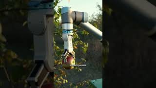
Unmanned Aerial Vehicles (UAVs), commonly known as drones, are increasingly utilized for post-disaster damage assessment. They cover large areas quickly, providing vital data to engineers and authorities that helps in prioritizing repair efforts based on the extent of damage observed from the sky.
Detailed
UAVs for Post-Disaster Assessment
In the wake of natural or man-made disasters, Unmanned Aerial Vehicles (UAVs) or drones have become instrumental tools for assessing damage across large geographic areas. They offer a rapid deployment capability, allowing for immediate aerial reconnaissance and data collection that is critical for effective disaster response and recovery. By capturing high-resolution images and mapping the affected regions, UAVs assist engineers and authorities in prioritizing repair and rehabilitation efforts. This capability not only speeds up the recovery process but also provides insights into safety assessments, enabling a more organized response to restore affected infrastructures.
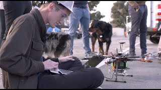
Youtube Videos


Audio Book
Dive deep into the subject with an immersive audiobook experience.
Introduction to UAVs in Post-Disaster Assessment
Chapter 1 of 2
🔒 Unlock Audio Chapter
Sign up and enroll to access the full audio experience
Chapter Content
Drones rapidly assess damage across large areas, helping engineers and authorities prioritize repair and rehabilitation.
Detailed Explanation
Unmanned Aerial Vehicles (UAVs), commonly known as drones, are used in post-disaster situations to quickly evaluate the extent of damage over vast regions. The speed at which drones can cover large areas far surpasses that of ground teams, allowing for a swift assessment of infrastructure and environmental impacts caused by disasters, like earthquakes or floods. The data collected by drones provides engineers and emergency responders with essential insights needed to determine priorities for repairs and restoration efforts.
Examples & Analogies
Imagine a post-earthquake scenario where buildings are collapsed, and roads are blocked. Ground teams might take days to assess the damage, moving slowly and carefully to avoid hazards. In contrast, drones can quickly fly over the affected area, capturing high-resolution images and videos, showing officials where the most critical repairs are needed. This is similar to using a bird’s-eye view to get the entire picture of a puzzle, rather than piecing it together from the ground up — the drone provides the complete view rapidly.
The Role of Engineers and Authorities
Chapter 2 of 2
🔒 Unlock Audio Chapter
Sign up and enroll to access the full audio experience
Chapter Content
The insights provided by UAVs are critical for engineers and authorities to make informed decisions regarding rehabilitation.
Detailed Explanation
The data gathered from UAV assessments is crucial for engineers and authorities who are tasked with coordinating disaster response and recovery operations. By analyzing the visual data captured by UAVs, authorities can identify the most severely damaged infrastructures, such as roads, bridges, and buildings. This information allows them to allocate resources efficiently, ensuring that the areas most in need of immediate attention are prioritized. Additionally, UAV data can aid in planning effective rehabilitation strategies, helping to ensure a smooth recovery process.
Examples & Analogies
Think of a scenario where an extreme flood occurs. Emergency responders need to decide which areas need immediate intervention — a challenging task without clear data. With UAVs providing detailed aerial images, decision-makers can spot which neighborhoods are entirely submerged and where access routes are blocked, allowing them to deploy rescue teams and supplies more effectively. It’s like having a map of a maze where only one path leads out — UAVs provide that crucial map, helping guide the way to safety.
Key Concepts
-
Rapid assessment: UAVs provide quick data for immediate evaluation.
-
High-resolution imagery: Essential for accurate damage monitoring.
-
Operational efficiency: Drones speed up assessment processes.
-
Deployment challenges: Weather and regulatory issues can affect operations.
Examples & Applications
Using UAVs in the aftermath of Hurricane Harvey to assess flooding damage.
Deployment of drones in earthquake-affected areas to evaluate structural integrity.
Memory Aids
Interactive tools to help you remember key concepts
Rhymes
When disaster strikes, make no fuss, UAVs help assess thus!
Stories
Imagine a city devastated by a storm. A drone zips through the air, capturing images of wrecked homes, guiding teams to safety, making recovery less of a nightmare.
Memory Tools
Remember 'FAST' for UAV assessments: Fast Aerial Surveys Thorough.
Acronyms
UAV
Unmanned Aerial Views for disaster data.
Flash Cards
Glossary
- UAVs (Unmanned Aerial Vehicles)
Drones used for various purposes, including aerial surveying and damage assessment in disaster recovery.
- PostDisaster Assessment
The process of evaluating damage to structures and environments following a disaster.
Reference links
Supplementary resources to enhance your learning experience.