
EGNOS, Europe
Enroll to start learning
You’ve not yet enrolled in this course. Please enroll for free to listen to audio lessons, classroom podcasts and take practice test.
Interactive Audio Lesson
Listen to a student-teacher conversation explaining the topic in a relatable way.
Introduction to EGNOS
🔒 Unlock Audio Lesson
Sign up and enroll to listen to this audio lesson

Welcome everyone! Today we'll be discussing the European Geostationary Navigation Overlay Service, or EGNOS for short. Who can tell me what EGNOS is used for?

Is it used to improve navigation accuracy?
Exactly! EGNOS enhances the performance of GNSS like GPS and Galileo, ensuring that users can navigate safely. Can anyone explain how EGNOS actually does this?

Doesn't it use reference stations to gather data?
Yes, great observation! EGNOS collects GNSS measurements from reference stations across Europe, which help in providing corrective information and assessing the integrity of the signals.

What kind of corrections does it provide?
EGNOS supplies corrections related to satellite ephemeris, clock errors, and even ionospheric delays. This information is vital for high-accuracy positioning.

What about safety? How does it ensure safety for users?
EGNOS provides integrity information, meaning it can notify users if the signal quality is acceptable or if there’s an issue. This is especially important in safety-of-life applications like aviation.
To summarize, EGNOS significantly enhances GNSS accuracy and provides essential safety information that is critical for reliable navigation.
EGNOS Operations
🔒 Unlock Audio Lesson
Sign up and enroll to listen to this audio lesson

Now let's delve deeper into how EGNOS operates. Can anyone explain the flow of information from reference stations to users?
The reference stations collect measurements and send them to a central computing center.
Correct! The central computing center analyzes these measurements to calculate the necessary corrections. What happens next?
The results are broadcasted via geostationary satellites!
Absolutely! This broadcasting ensures that users across a wide area can receive the corrections in real time.
How does the ionosphere affect signal accuracy?
Great question! Ionospheric delays can vary based on atmospheric conditions. EGNOS helps to estimate these delays, improving positional accuracy.
In review, EGNOS collects data from ground reference stations, processes it for corrections, and broadcasts this information to enhance GNSS performance for users across Europe.
Impact and Applications of EGNOS
🔒 Unlock Audio Lesson
Sign up and enroll to listen to this audio lesson
Let’s explore the impact of EGNOS on various sectors. What sectors can benefit from more accurate GNSS services?
Aviation, maritime, and even land-based navigation!
That's right! EGNOS is particularly vital for safety-of-life services in aviation. Can someone explain how mariners benefit from EGNOS?
They can navigate more accurately, which is essential for docking and open sea navigation.
Exactly! Enhanced positioning leads to safer operations in all navigation sectors, including agriculture and land management. Why do you think land users would need this service?
For precision farming and surveying!
Correct! EGNOS's ability to extend its services to neighboring countries will also expand these benefits. In summary, EGNOS has a profound impact across aviation, maritime, land-use and many other sectors by enhancing the accuracy and reliability of GNSS.
Introduction & Overview
Read summaries of the section's main ideas at different levels of detail.
Quick Overview
Standard
The European Geostationary Navigation Overlay Service (EGNOS) significantly augments the performance of global navigation satellite systems (GNSS) like GPS and Galileo by providing essential corrections and integrity information. It improves positioning services for aviation, maritime, and land-based users, ensuring high reliability and safety across most of Europe.
Detailed
EGNOS, Europe
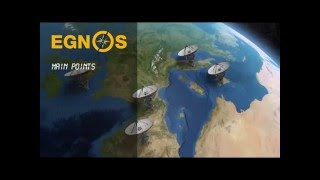
The European Geostationary Navigation Overlay Service (EGNOS) is a critical component of Europe's satellite-based augmentation system (SBAS), designed to enhance the performance of Global Navigation Satellite Systems (GNSS) such as GPS and Galileo. EGNOS seeks to provide safety-of-life navigation services to various sectors, including aviation, maritime, and terrestrial users throughout most of Europe.
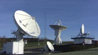
EGNOS works by augmenting the L1 Coarse/Acquisition (C/A) civilian signals from GNSS. It delivers crucial correction and integrity information relating to satellite ephemeris data, clock errors, and atmospheric effects, particularly ionospheric delays. The service utilizes precise measurements gathered by strategically located reference stations across Europe, which relay this data to a central processing facility. Here, it calculates the necessary differential corrections and integrity messages, broadcasting them via geostationary satellites to ensure enhanced accuracy and reliability.
Moreover, EGNOS maintains the provision of a highly accurate universal time signal and is poised to extend its services to nearby regions in Europe, further promoting safety and efficiency in navigation.
Youtube Videos


Audio Book
Dive deep into the subject with an immersive audiobook experience.
Overview of EGNOS
Chapter 1 of 5
🔒 Unlock Audio Chapter
Sign up and enroll to access the full audio experience
Chapter Content
The European Geostationary Navigation Overlay Service (EGNOS) is Europe's SBAS that is used to improve the performance of GNSSs, such as GPS and Galileo. It will be used to provide the safety of life navigation services to aviation, maritime and land-based users over most of Europe.
Detailed Explanation
EGNOS is a system developed to enhance the functionalities of Global Navigation Satellite Systems (GNSS) like GPS and Galileo. It specifically focuses on improving the accuracy, reliability, and safety of navigation services. Think of EGNOS as a helper to GPS: just like you might ask a friend for directions to find your way more precisely, EGNOS refines navigation signals coming from satellites, making them more dependable for users such as airplanes, ships, and ground vehicles across Europe.
Examples & Analogies
Imagine you're using a map app on your phone while driving. Sometimes the app might say you're 'one mile away', but it’s not as precise as it needs to be. EGNOS adds a layer of guidance, like a co-pilot who clarifies the directions for your specific route, ensuring that the 'one mile' means 'precisely one mile', and helping you avoid detours or wrong turns.
Functionality of EGNOS
Chapter 2 of 5
🔒 Unlock Audio Chapter
Sign up and enroll to access the full audio experience
Chapter Content
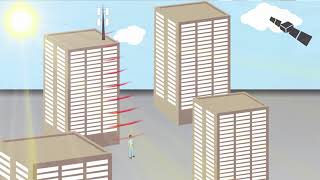
The EGNOS augments the GNSS L1 Coarse/Acquisition (C/A) civilian signal by providing corrections and integrity information for space vehicles (ephemeris, clock errors) and most importantly, information to estimate the ionosphere delays affecting the observations.
Detailed Explanation
EGNOS works by enhancing the basic signals that GNSS satellites already send out. It does this by correcting errors related to satellite positions, timing, and atmospheric conditions, notably the ionosphere, which can delay signals as they travel to Earth. By knowing these errors, users can get more accurate location information, which is crucial for navigation.
Examples & Analogies
Consider a person pouring water into a glass. If they pour too fast (like a satellite signal), some of the water goes out of the glass and makes a mess (errors in positioning). EGNOS is like a steady hand that helps guide the water into the glass accurately, preventing spills and ensuring the glass gets filled correctly. Similarly, EGNOS ensures the navigation signals avoid 'spills' of inaccurate data.
Mechanism of EGNOS
Chapter 3 of 5
🔒 Unlock Audio Chapter
Sign up and enroll to access the full audio experience
Chapter Content
The EGNOS uses GNSS measurements taken by accurately located reference stations installed across Europe. All measured GNSS errors are transferred to a central computing centre, where differential corrections and integrity messages are calculated, and results broadcasted over the covered area using geostationary satellites that serve as an augmentation to the original GNSS message.
Detailed Explanation
EGNOS consists of a network of reference stations that continuously monitor GNSS signals. These stations collect data about the signals' accuracy and send this information to a central facility. The facility processes the data, calculates necessary corrections, and then sends these enhanced signals back out via satellites, allowing users to receive accurate location information across a wide geographic area.
Examples & Analogies
Think of a quality control process in a factory. Here, machines (reference stations) measure the output (GNSS signals) to ensure they meet set standards (accuracy and integrity). If any output is flawed, it gets corrected before it reaches the customers (users) through a streamlined delivery system (the satellites). This process ensures that users always receive 'top quality' navigation data.
Advantages of EGNOS
Chapter 4 of 5
🔒 Unlock Audio Chapter
Sign up and enroll to access the full audio experience
Chapter Content
As a result, the EGNOS improves the accuracy and reliability of GNSS positioning, while also providing a crucial integrity message regarding the continuity and availability of a signal. In addition, the EGNOS also transmits an extremely accurate universal time signal.
Detailed Explanation
One of the significant impacts of EGNOS is that it greatly enhances both the accuracy and reliability of information provided by GNSS systems. It not only helps users know their exact position but also assures them that the signals they receive are trustworthy. Moreover, EGNOS provides precise timekeeping, which is essential for synchronization in various applications including navigation, communications, and financial transactions.
Examples & Analogies
Imagine playing a game where timing is crucial, such as a musical chair. You need to know precisely when the music stops to react and secure a seat. EGNOS acts similarly by providing accurate timing signals, ensuring that players (users) get a clear understanding of when to act, thus enabling smooth and efficient navigation in various applications.
Future Expansion of EGNOS Services
Chapter 5 of 5
🔒 Unlock Audio Chapter
Sign up and enroll to access the full audio experience
Chapter Content
The services will be progressively extended to the European neighbourhood countries.
Detailed Explanation
EGNOS is not only beneficial for Europe but is also set to expand its services to neighboring countries. This means that more areas will gain access to enhanced navigation signals, further broadening the safety and efficiency of navigation across more regions. The expansion signifies an effort to connect more regions, making navigation seamless across borders.
Examples & Analogies
Picture a neighborhood where one house has a bright streetlight that lights up the road. As the neighborhood grows and more streetlights are added, everyone benefits from better visibility. Similarly, by expanding EGNOS services to neighboring countries, more users will enjoy improved navigation visibility, leading to safer travels across larger areas.
Key Concepts
-
EGNOS: A satellite-based augmentation system for GNSS, improving navigation accuracy.
-
Safety-of-life services: Vital applications of EGNOS in aviation and maritime navigation.
-
Ionospheric corrections: EGNOS provides corrections for ionospheric delays affecting GNSS signals.
-
Geostationary satellites: Satellites stationed in a fixed position relative to the Earth to relay information.
Examples & Applications
An aircraft uses EGNOS for precise landing in low visibility conditions.
A ship navigates safely in busy ports using EGNOS for accurate positioning.
Memory Aids
Interactive tools to help you remember key concepts
Rhymes
EGNOS helps you go, safely in the air or sea flow.
Stories
Imagine a ship lost in a dense fog. EGNOS helps it find its way safely to the harbor by providing them accurate navigation, showing how vital this service is.
Memory Tools
Remember: Every Good Navigator Opens Safely – EGNOS provides essential navigation safety.
Acronyms
EGNOS - European GNSS Navigation Overlay System. Think of it as Europe’s guiding star for accurate navigation.
Flash Cards
Glossary
- EGNOS
European Geostationary Navigation Overlay Service, a satellite-based augmentation system providing GNSS enhancements.
- GNSS
Global Navigation Satellite System, a satellite system that provides autonomous geographic position to a GPS receiver.
- SBAS
Satellite-Based Augmentation System, used to improve the accuracy and integrity of GNSS signals.
- Integrity Information
Data that ensures the reliability and accuracy of navigation signals.
- Ionospheric Delays
Delays in GNSS signals caused by variations in the Earth's ionosphere.
Reference links
Supplementary resources to enhance your learning experience.