
Measurement of Levels
Enroll to start learning
You’ve not yet enrolled in this course. Please enroll for free to listen to audio lessons, classroom podcasts and take practice test.
Interactive Audio Lesson
Listen to a student-teacher conversation explaining the topic in a relatable way.
Introduction to Levelling
🔒 Unlock Audio Lesson
Sign up and enroll to listen to this audio lesson

Today, we're going to explore the concept of levelling in surveying. Can anyone explain what levelling is?

Is it about finding how high or low a point is compared to other points?
Exactly, Student_1! Levelling is determining and establishing the elevations of points on the surface or beneath the Earth. Why do you think this is important in engineering?

It helps in planning buildings and roads, making sure they are at the right heights.
That's correct! Accurate elevation measurements are crucial for the success of many engineering projects!

What's a Bench Mark in this context?
Great question, Student_3! A Bench Mark is a point with a known elevation that we use as a reference for all other measurements in levelling.
To summarize, levelling is key for establishing point elevations and relies on known references like Bench Marks.
Key Technical Terms in Levelling
🔒 Unlock Audio Lesson
Sign up and enroll to listen to this audio lesson

Now let's discuss some important terms in levelling. What is a 'level surface'?

Isn’t it a surface that’s perpendicular to gravity at all points?
Exactly! And can anyone explain what Mean Sea Level (MSL) is?
It's the average height of the sea level after averaging tide heights over a long period.
Well done! MSL is important as it serves as a datum for many surveys. Next, what about the term 'horizontal plane'?
It’s where the plane is normal to the direction of gravity.
Correct! Remember, these terms are foundational, so let’s recap. A level surface is perpendicular to gravity, MSL is our reference, and a horizontal plane is normal to gravity.
Instruments and Their Functions
🔒 Unlock Audio Lesson
Sign up and enroll to listen to this audio lesson
Let's dive into the types of leveling instruments. What can you tell me about the Dumpy Level?
It's a type of level with a rigidly fixed telescope.
Great! What about the Auto Level?
Auto levels can automatically adjust to the horizontal line of sight!
Exactly! Auto levels are very popular because they save a lot of time. What are some other types?
There are also Digital levels and Laser levels!
Wonderful! To summarize, we discussed Dumpy, Auto, Digital, and Laser levels, each serving specific functions in levelling operations.
Adjustment Procedures for Levels
🔒 Unlock Audio Lesson
Sign up and enroll to listen to this audio lesson
Before taking measurements, we need to adjust the levels correctly. Can anyone tell me the first step?
First, we set up the tripod!
That's right! What’s next?
Then we need to level the instrument to make sure the bubble is centered.
Absolutely! And finally, what do we focus on?
Focusing the cross-hairs and the staff for clear sighting.
Exactly! Setting up, leveling, and focusing are the three key steps before we take any observation. This ensures accurate measurements.
Methods for Reducing Levels
🔒 Unlock Audio Lesson
Sign up and enroll to listen to this audio lesson
Now, let’s talk about methods for reducing levels. Who can explain the Rise and Fall method?
In this method, we compare the back sight and fore sight readings to calculate rises or falls.
Correct! And how does the Height of Instrument method work?
It involves calculating the height of the instrument plus back sight to find the reduced levels.
Absolutely! The Rise and Fall method requires careful computation at each point, while the Height of Instrument method is primarily about deriving heights from a known elevation. A great summary!
Introduction & Overview
Read summaries of the section's main ideas at different levels of detail.
Quick Overview
Standard
This section explains the significance of levelling in surveying, detailing the importance of establishing elevations and the methods of measurement used in various applications, including road and building construction. It also covers key technical terms, types of levelling instruments, adjustment procedures, and methods for reducing levels.
Detailed
Measurement of Levels
Levelling is a critical branch of surveying that focuses on vertical measurements to determine the elevations of various points on the Earth's surface. The success of many engineering projects relies on accurately determining these elevations. Essential to this process is the identification of a known elevation point, termed as a Bench Mark (BM), relative to which all other elevations are calculated.
Key Points:
- Definition and Importance of Levelling: Levelling allows engineers to establish the correct elevations necessary for construction, influencing decisions on plinth levels, alignments, and gradients.
- Technical Terminology: A variety of technical terms are crucial in understanding levelling operations, such as Mean Sea Level (MSL), horizontal and vertical planes, and other fundamental concepts related to measurements.
- Instruments Used: Different levels, including Dumpy, tilting, engineer’s, auto, digital, and laser levels, are described, highlighting their functions and applications in determining point elevations.
- Adjustment Procedures: Temporary adjustments of the instrument are outlined to ensure accuracy in readings, which involve setting, leveling, and focusing the equipment before taking measurements.
- Methods of Reducing Levels: The two primary methods for reducing levels, the Rise and Fall and Height of Instrument methods, are detailed, including the processes and checks involved.
- Types of Direct Levelling: Various direct levelling techniques are discussed, such as simple levelling and differential levelling, each serving distinct purposes in surveying.
- Errors in Levelling: Potential errors arising from instrumental, personal, and natural causes are examined, emphasizing the importance of rigorous standards in surveying practices.
Youtube Videos


Audio Book
Dive deep into the subject with an immersive audiobook experience.
Introduction to Levelling
Chapter 1 of 6
🔒 Unlock Audio Chapter
Sign up and enroll to access the full audio experience
Chapter Content
Levelling is a branch of surveying which deals with measurements in vertical planes. It is the operation performed to determine and establish the elevations of points on the surface or beneath the Earth. It is also done to determine differences in elevation between points to draw the contours, find out the slope, and control the grades during construction. Levelling is of prime importance to the engineers for both design as well as execution of a project on the ground. The success of many engineering projects would depend upon accurate determination of elevations.
Detailed Explanation
Levelling is a crucial aspect of surveying that focuses on measuring differences in height. When engineers design structures like buildings or roads, knowing how much higher or lower one point is compared to another helps them create accurate plans. It allows for the proper grading of land and ensures that each point is built at the right elevation, which is essential for the structural integrity and functionality of the project.
Examples & Analogies
Imagine building a playground on a hill. If you don't know how steep the hill is, you might end up with a slide that is too high or a swing that tips over. Just like in construction, knowing the heights of different parts of the playground helps ensure everything is safe and fun for the kids.
Bench Mark (BM) Definition
Chapter 2 of 6
🔒 Unlock Audio Chapter
Sign up and enroll to access the full audio experience
Chapter Content
The pre-requisite to compute the elevations of ground points is that the elevation of at least one point should be known with respect to which the elevations of other points can be computed. The point whose elevation is known to start the levelling work is known as the Bench Mark (BM).
Detailed Explanation
A Bench Mark is a reference point with a known elevation. It's essential for any levelling process because it serves as the starting point for determining the heights of other locations. By knowing one fixed elevation, surveyors can calculate the relative elevations of various other points in the area, ensuring accuracy in their measurements.
Examples & Analogies
Think of a surveyor starting at sea level when measuring the height of a mountain. The sea level is the bench mark, allowing the surveyor to determine how high the mountain is in relation to that base point.
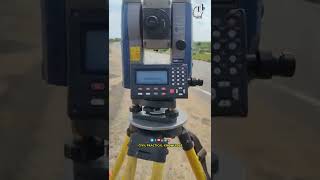
Levelling Instruments: Level and Levelling Staff
Chapter 3 of 6
🔒 Unlock Audio Chapter
Sign up and enroll to access the full audio experience
Chapter Content
The instrument used to measure the elevations is known as Level, which is used along with a Levelling staff or Levelling rod. The object is of levelling, therefore, is to; (i) determine the elevations of given points with respect to a datum, and (ii) establish the points of required height above or below the datum line.
Detailed Explanation
A leveling instrument helps determine the height of points by creating a straight line of sight. The leveling staff, or rod, is used to take measurements against this line. When the level is set correctly, surveyors can read the staff to see how far above or below the reference height each point is, ensuring accurate construction and planning.
Examples & Analogies
Imagine you're trying to hang pictures on a wall. You have a level tool to ensure the pictures are straight. The level indicates a straight line, while the staff is like the wall where you take your measurements to ensure everything hangs evenly.
Applications of Levelling
Chapter 4 of 6
🔒 Unlock Audio Chapter
Sign up and enroll to access the full audio experience
Chapter Content
The levelling is used for many applications, such as; (i) to determine or to set the plinth level of a building, (ii) to decide or set the road, railway, canal or sewage line alignment, (iii) to determine or to set various levels of dams, towers, etc., and (iv) to determine the capacity of a reservoir.
Detailed Explanation
Levelling has a wide variety of applications in civil engineering and construction. It helps engineers decide how high to build foundations for buildings, set the proper angle for roads, and ensure that water systems are constructed at the right heights for drainage and effectiveness. Each application relies on precise measurements to ensure that everything functions as intended.
Examples & Analogies
When building a dam, engineers need to know how deep to dig and how high to build the walls. If they miscalculate, the dam could overflow or collapse. Levelling ensures everything is built perfectly to control water levels effectively.
Technical Terms in Levelling
Chapter 5 of 6
🔒 Unlock Audio Chapter
Sign up and enroll to access the full audio experience
Chapter Content
It is necessary to understand few technical terms often used in levelling. These are explained below (Refer to Figure 1.18). (a) Level surface: It is a surface perpendicular to the direction of gravity at all points. The surface of a still lake is a good example of level surface.
Detailed Explanation
Understanding the technical terms used in levelling helps professionals accurately communicate and perform their work. For instance, a 'level surface' is crucial because all measurements in levelling are based on the premise that this surface is flat and even. Knowing what a level surface is allows surveyors to align their tools and measurements accordingly.
Examples & Analogies
Consider a large, still pond. The water's surface is perfectly flat, just like a level surface in surveying. If you were to build a dock over the pond, you would want it to be straight and aligned with that level surface so that boats can float evenly without tipping over.
Types of Levelling Instruments
Chapter 6 of 6
🔒 Unlock Audio Chapter
Sign up and enroll to access the full audio experience
Chapter Content
Various types of leveling instruments are: (a) Dumpy level (b) Tilting level (c) Engineers level (d) Automatic level (e) Digital level (f) Laser level.
Detailed Explanation
There are different types of levelling tools suited for various tasks in surveying. Each type, such as the Dumpy level or Auto level, has specific features that make it ideal for certain situations, like ease of use, accuracy, or the ability to automatically adjust to level. Understanding these instruments allows surveyors to select the best tool for their specific requirements.
Examples & Analogies
Think of a toolbox filled with different tools. Just like a carpenter chooses a specific saw or hammer for a job, a surveyor selects a particular leveling instrument based on the needs of the project, like setting up a foundation or determining a road's grade.
Key Concepts
-
Levelling: The process of determining the elevation of points.
-
Bench Mark: A reference point with a known elevation.
-
Mean Sea Level (MSL): The average sea level used as a datum.
-
Horizontal Plane: The plane that is perpendicular to the direction of gravity.
Examples & Applications
An engineer uses a bench mark at an elevation of 100m to establish the elevation of a new building site.
A leveling survey is conducted to determine the height of a bridge above a river.
Memory Aids
Interactive tools to help you remember key concepts
Rhymes
To know the heights where buildings stand, we level points across the land.
Stories
Imagine a surveyor with a magic stick (the level) who helps builders make structures perfectly high, marking on the ground with a known point (BM) to guide their way.
Memory Tools
Remember the acronym B.M.L. for Bench Mark, Levelling, and Measurements.
Acronyms
M.L.E.D. - Measurement, Levelling, Elevations, Datum.
Flash Cards
Glossary
- Levelling
The branch of surveying that deals with measurements in vertical planes.
- Bench Mark (BM)
A point with a known elevation used as a reference for levelling.
- Mean Sea Level (MSL)
The average height of the sea level, used as a datum for surveys.
- Horizontal Plane
A plane that is tangent to a level surface and normal to gravity.
- Rise and Fall Method
A method of reducing levels by comparing back sight and fore sight readings to calculate rises and falls.
- Height of Instrument Method
A method that determines the reduced levels from the height of the instrument plus back sight.
- Auto Level
A self-levelling instrument that automatically adjusts the line of sight.
Reference links
Supplementary resources to enhance your learning experience.