
Surveying
Enroll to start learning
You’ve not yet enrolled in this course. Please enroll for free to listen to audio lessons, classroom podcasts and take practice test.
Interactive Audio Lesson
Listen to a student-teacher conversation explaining the topic in a relatable way.
Principle of Surveying
🔒 Unlock Audio Lesson
Sign up and enroll to listen to this audio lesson

Today, we will start with the principles of surveying. Can anyone tell me what the two basic principles are?

I think it's about measuring angles and distances?
Close! The two principles are: working from whole to part and establishing points with independent measurements. Working from whole to part helps avoid errors in larger areas. Can anyone suggest why this is beneficial?

Because if we make a mistake in a small area, it's easier to correct it than if we do it all at once?
Exactly! This way, we can control and minimize errors effectively. Remember, using a triangle formation is a helpful mnemonic, 'Triangular Control' can remind you that each segment can fix individual errors.

And what are some examples of establishing points?
Great question! Establishing new points can be done using linear or angular measurements from two known points. Think of it as triangulation! Let's summarize: today we've learned how to manage survey errors effectively.
Instruments Used in Surveying
🔒 Unlock Audio Lesson
Sign up and enroll to listen to this audio lesson

Next, let’s delve into the instruments used in surveying. Can anyone name one?

How about the theodolite?
Correct! Theodolites are crucial for measuring horizontal and vertical angles. Who can tell me another instrument?
Levels? They help find different elevations!
Right! Levels are vital for determining elevation differences. A simple way to remember this is 'Lift with Levels'—it’s all about elevating measurement accuracy! What can you tell me about chains and tapes?
Chains were used historically but now tapes are preferred for their accuracy and ease!
Exactly! Chains were traditionally made of metal, but tapes have become far more effective. Let's recall—each instrument is tailored for specific measurement tasks.
Types of Surveying
🔒 Unlock Audio Lesson
Sign up and enroll to listen to this audio lesson
Now, we’ll explore the types of surveying: can anyone differentiate between plane and geodetic surveying?
Plane surveying treats the Earth like a flat surface, right?
Exactly! This is used for smaller areas. And what about geodetic surveying?
That considers the Earth's curvature for larger areas, providing more accuracy!
Correct! A useful acronym here could be 'P-G'—for Plane and Geodetic. Remember, the type of surveying affects equipment use and accuracy needs!
What kind of projects would use these methods?
Great question! Smaller engineering projects would typically utilize plane surveying, while larger national infrastructure projects might require geodetic surveying to ensure precision.
Introduction & Overview
Read summaries of the section's main ideas at different levels of detail.
Quick Overview
Standard
Surveying is crucial in civil engineering, encompassing techniques for measuring distances, angles, and elevations to accurately map terrain and establish construction benchmarks. This section details various surveying methods, equipment (like theodolites, levels, and GPS), types of mappings, and their applications.
Detailed
Overview of Surveying
Surveying is a foundational aspect of civil engineering, consisting of the techniques used to determine the relative position of features on the Earth's surface. It encompasses direct measurements of distances, angles, and elevations to inform construction planning and land use.
Key Points Covered in this Section
- Principle of Surveying: The two core principles include working from whole to part and establishing points through independent measurements.
- Historical Background: The development of surveying tools and techniques from ancient times through modern advancements.
- Types of Surveying: Differentiates between plane surveying and geodetic surveying based on the Earth’s curvature considerations.
- Instruments: Introduces various survey instruments, including chains, tapes, levels, theodolites, and modern technologies like GPS and drones.
- Error Minimization: Discussed are error adjustment methods in measurements and observations.
- Map Creation: Details the significance of contour mapping and various types of maps produced from survey data.
Understanding these concepts is essential for civil engineers as surveying lays the groundwork for successful engineering projects.
Youtube Videos


Audio Book
Dive deep into the subject with an immersive audiobook experience.
Introduction to Surveying
Chapter 1 of 5
🔒 Unlock Audio Chapter
Sign up and enroll to access the full audio experience
Chapter Content
Surveying is a core subject of civil engineering and it has an important role to play. It is the starting point of many projects, such as roads and railways, buildings, bridges, pipelines, transmission lines, dams, and many more. Surveying is “the technique of accurately determining the relative position of natural and man-made features above or below the surface of the Earth, by means of direct or indirect elevation, distance and angular measurements.” According to the American Congress on Surveying and Mapping (ACSM), ‘Surveying is the science and art of making all essential measurements to determine the relative position of points or physical and cultural details above, on, or beneath the surface of the Earth, and to depict them in a usable form.'
Detailed Explanation
Surveying involves the measurement of distances, angles, and elevations to assess the space around us. Civil engineering projects, such as roads or buildings, begin with surveying to gather initial data. This process determines the locations and dimensions of features on the Earth, both natural (like hills) and man-made (like buildings), ensuring that construction can proceed accurately.
Examples & Analogies
Imagine planning to build a playground in your neighborhood. Before construction, you need to measure the space to understand where to place swings, slides, and other features. Surveying is like that measurement process but on a larger, professional scale. Surveyors use their tools and skills to ensure that everything is in the right place.
Objectives of Surveying
Chapter 2 of 5
🔒 Unlock Audio Chapter
Sign up and enroll to access the full audio experience
Chapter Content
As surveying allows us to acquire data on the relative positions, horizontal distances, and elevations of points, the objectives of surveying can be stated as follows: 1. Collect and record data about the relative positions of points/objects on the surface of the Earth. 2. Establish horizontal and vertical controls required for accurate mapping and subsequently for construction. 3. Prepare maps required for various civil engineering projects. 4. Compute areas and volumes of earthwork, required in various projects. 5. Layout of various engineering works on the ground using survey data.
Detailed Explanation
Surveying serves several key objectives: it helps gather data about where things are located on the Earth, which aids in the creation of maps. The mapping aspect is crucial for civil engineering projects ensuring they are built accurately. Additionally, calculating areas and volumes is necessary for planning resources and budget.
Examples & Analogies
Think of a treasure hunt. Before finding the treasure, you need to know the area well enough to avoid pitfalls and plan your route. Surveying gives you the map and tools you need to navigate, ensuring the treasure (in this case, a construction project) is built properly and efficiently.
Importance of Land Surveying
Chapter 3 of 5
🔒 Unlock Audio Chapter
Sign up and enroll to access the full audio experience
Chapter Content
Ever since the mankind acquired the sense of possessing the land and property, the art of surveying and mapping came into existence. In the early days, the demarcation of land and defining the boundaries were extremely difficult tasks, and done as rough representation using conventional devices. With the growth of knowledge, skill and technology, development of surveying instruments and techniques of data collection and analysis improved considerably. Today, surveying is of vital importance as accurate planning and design of all civil engineering projects are based upon the quality of surveying measurements.
Detailed Explanation
Land surveying is crucial because it helps establish land boundaries accurately. This accuracy prevents disputes and errors in land ownership. As technology has developed, surveying methods have also evolved, allowing for precise measurements. Today's civil engineering projects depend heavily on these accurate surveys.
Examples & Analogies
Imagine if two neighbors both claimed the same piece of land because the original survey was inaccurate. This would lead to disputes and chaos. Accurate land surveying sets clear boundaries like a precise map, ensuring everyone knows the lines drawn, thus allowing smooth interactions between property owners.
Surveying Techniques and Instruments Overview
Chapter 4 of 5
🔒 Unlock Audio Chapter
Sign up and enroll to access the full audio experience
Chapter Content
The practical utility of these surveying equipment is presented for field data collection required for creating maps, as well as making these observations error-free. Once the data is collected and corrected, topographic maps can be created by plane table survey methods in the field. The instruments include various types of levels, compasses, and theodolites which are used for observations and calculations.
Detailed Explanation
Surveying involves various techniques and instruments like levels, compasses, and theodolites. Levels help find differences in elevation, compasses establish directions, and theodolites measure angles. These tools are essential for ensuring that the survey is accurate and reliable.
Examples & Analogies
Consider a navigator planning a flight path. They use tools such as compasses and maps to find the best route. Similarly, surveyors use their instruments to effectively map out land and plan projects, ensuring everything from roads to buildings are set out correctly.
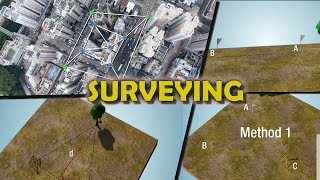
Types of Surveying
Chapter 5 of 5
🔒 Unlock Audio Chapter
Sign up and enroll to access the full audio experience
Chapter Content
The two broad types of land survey used are plane surveying and geodetic surveying, depending upon whether the spherical shape of the Earth is taken into account or not.
Detailed Explanation
Plane surveying treats large areas as flat and is typically used for smaller projects, while geodetic surveying considers the Earth's curvature, which is necessary for larger scale projects. The choice between these methods depends on the project scale and needed accuracy.
Examples & Analogies
Think about drawing a map for a small park versus a country. For the park, you can easily lay it out flat, but for a country, you need to consider the globe's curvature. Surveyors decide which method to use based on the size of the area they are surveying.
Key Concepts
-
Working from Whole to Part: A principle of surveying ensuring error correction is managed effectively.
-
Establishing Control Points: The process of using established points to derive new points through measurements.
-
Types of Surveying: Differentiating between plane and geodetic surveying based on Earth's curvature.
Examples & Applications
Example of Plane Surveying: Measure a small construction site using a theodolite to ensure accuracy in height and angle.
Example of Geodetic Surveying: Using GPS to map out extensive geographic areas for new infrastructure developments.
Memory Aids
Interactive tools to help you remember key concepts
Rhymes
To survey the land with precision and pride, Measure the distances, and angles shall guide.
Stories
Once, a surveyor named Alex used his theodolite, measuring angles and sights, making sure every corner was just right.
Memory Tools
Remember P-G for Plane and Geodetic surveying.
Acronyms
T.A.C.K - Theodolite, Angle, Chain, Knowledge.
Flash Cards
Glossary
- Surveying
The technique of determining the relative position of points or features on or below the Earth's surface.
- Theodolite
An instrument for measuring horizontal and vertical angles.
- Geodetic Surveying
Surveying that considers the curvature of the Earth for accurate measurements over large distances.
- Plane Surveying
A method of surveying that treats the Earth’s surface as flat, suitable for smaller areas.
- Levels
Instruments used to determine the height differences between points.
Reference links
Supplementary resources to enhance your learning experience.