
Location Map
Enroll to start learning
You’ve not yet enrolled in this course. Please enroll for free to listen to audio lessons, classroom podcasts and take practice test.
Interactive Audio Lesson
Listen to a student-teacher conversation explaining the topic in a relatable way.
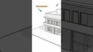
Components of a Sanction Plan
🔒 Unlock Audio Lesson
Sign up and enroll to listen to this audio lesson

Today, we are diving deep into what makes up a sanction plan, specifically highlighting the location map. Who can tell me what a location map is?

Isn't it just a regular map showing where the building will be?
That's partially correct! A location map not only shows the site location but also includes essential details like ward numbers and corporation divisions. Remember, we can use the acronym **'LEAD'**: Location, Engineer details, Area specifics, and Division to recall its important elements.

What kind of details do we need to include about the engineer?
Great question! We need the name of the in-charge engineer and their contact details. It's vital for communication during the building planning process.

What happens if we forget to include these details?
If these details are missing, it could lead to delays in approval. Always double-check your sanction plans! Let's summarize: the location map must include key components like location, engineer details, area specifics, and division.
Mandatory Instructions
🔒 Unlock Audio Lesson
Sign up and enroll to listen to this audio lesson

Now, let's discuss some mandatory instructions that should accompany the sanction plan. Who can recall one of these requirements?

I remember something about parking areas. What is it?
Absolutely right! The basement or parking areas must only be used for their designated purpose. We can remember this with the phrase **'PARK'**, where 'P' stands for parking and 'ARK' stands for Always Reserved for Keeping.
What about the rainwater harvesting structure?
Excellent point! It’s mandatory to maintain them in good condition for water storage or groundwater recharge. This ensures sustainability in our building practices.
Is there a penalty for not following these rules?
Yes, non-compliance could lead to sanctions or revocation of permits. To summarize, remember PARK: Parking areas must be designated only for parking, and rainwater harvesting is crucial!
Importance of Area Details
🔒 Unlock Audio Lesson
Sign up and enroll to listen to this audio lesson
Let’s turn our focus to area details. Why do you think it's important to include area specifics such as plot area and FAR?
I think it's about ensuring we don’t exceed certain limits. Right?
That's exactly correct! Keeping track of plot area, built-up area, and FAR helps in adhering to urban planning regulations. Remember that FAR is the ratio of the total building floor area to the plot area, which can be summarized with the mnemonic **'Floor Over Ratio.'**
How does FAR impact the design?
Great follow-up! It impacts how much floor space you can build on your plot. Too high FAR can lead to overcrowding, while too low may waste valuable space. To wrap up, knowing these areas helps us plan effectively and sustainably.
Introduction & Overview
Read summaries of the section's main ideas at different levels of detail.
Quick Overview
Standard
The location map is a critical component of a sanction plan, providing essential details about the site context including ward numbers, engineering authority, and parking directives, among others. Additionally, it instructs on mandatory requirements like rainwater harvesting and the display of approved plans.
Detailed
Detailed Summary
The Location Map is an integral part of the Sanction Plan for building projects, which serves as an official working plan detailing various aspects necessary for obtaining approval from local authorities. The section emphasizes the components of a location map, which includes:
- Location map and key plan: These provide a visual representation of the project's surroundings.
- Details: It must contain ward numbers, corporation divisions, and the relevant authorities' contact, including the in-charge engineer and the owner's information.
- Sanctioning Authority: This includes designated space for the seal and signature that indicates approval.
- Area Details: It elaborates on the requirements for assessing the plot area, built-up area, plinth area, and Floor Area Ratio (FAR) for both proposed and approved designs.
Furthermore, the section lists mandatory instructions aimed at ensuring compliance with urban planning standards:
- Basement areas and ground floor dimensions stipulated for car parking must not be repurposed for other uses.
- Provisions for utilities such as telephone ducts and garbage disposal areas should be included.
- Displaying licenses and approved plans should be done conspicuously within the premises.
- Rainwater harvesting structures must be well-maintained, ensuring sufficient storage for non-potable uses.
- It emphasizes the prohibition of child labor in construction activities, ensuring ethical practices in building construction.
Collectively, these elements play a crucial role in regulatory compliance and sustainable building practices.
Youtube Videos


Audio Book
Dive deep into the subject with an immersive audiobook experience.
Definition of a Sanction Plan
Chapter 1 of 2
🔒 Unlock Audio Chapter
Sign up and enroll to access the full audio experience
Chapter Content
A working plan having the following additional drawings/details is referred to as a Sanction Plan.
Detailed Explanation
A Sanction Plan is an essential document in building planning that contains various detailed drawings and information required for sanctioning a building project. It serves as an official approval that confirms the project follows local regulations and standards.
Examples & Analogies
Think of a Sanction Plan like a recipe in cooking. Just as a recipe lists all the necessary ingredients and steps to prepare a dish properly, a Sanction Plan outlines the required drawings and details for constructing a building legally and correctly.
Components of the Sanction Plan
Chapter 2 of 2
🔒 Unlock Audio Chapter
Sign up and enroll to access the full audio experience
Chapter Content
- Location map
- Key plan
- Details having ward no., corporation division, details of In-charge Engineer, owner’s name and present address.
- Details of Sanctioning Authority along with the space for seal and signature of approval.
- Details of plot area, built up area, plinth area and FAR (approved and proposed).
Detailed Explanation
The Sanction Plan includes several critical components: the Location Map shows the exact position of the building site, the Key Plan provides a broader view of the surrounding area, and additional details such as the ward number, corporation division, and information about the engineer and owner are necessary for proper identification. Furthermore, it must contain the details of the authority granting the approval and the plot specifics like area measurements and the Floor Area Ratio (FAR), which indicates how much built-up area is permitted in relation to the plot.
Examples & Analogies
Imagine you are planning a party in your house. You make an invite (the Location Map) that tells your friends where to find you. You might include a broader map of your neighborhood (the Key Plan) so they can navigate easily. You would also inform them of who is hosting (your name) and how many guests (plot details) can be in your house at a time, just like how a Sanction Plan specifies all assigned numbers and permits.
Key Concepts
-
Location Map: A crucial part of the sanction plan depicting necessary site details.
-
Sanction Plan: The overall plan required for seeking building permission.
-
Rainwater Harvesting: An essential sustainability feature mandated in building designs.
Examples & Applications
Example of detailed items in a sanction plan includes ward numbers and space for authorities' approval signs.
An urban development project that failed due to non-compliance with required parking specifications.
Memory Aids
Interactive tools to help you remember key concepts
Rhymes
A map to show, a plan to grow, details for building, put on a show!
Stories
Once in a bustling town, a builder named Sam needed approval. He learned quickly that a detailed location map showing his project would win the approval he sought and keep the town happy!
Memory Tools
Remember PARK: Parking Area Reserved, Keep it simple.
Acronyms
Use **LEAD** to recall the critical elements of location mapping.
Flash Cards
Glossary
- Sanction Plan
An official working plan that includes various necessary drawings and details for building approval.
- Location Map
A detailed representation indicating the site location alongside relevant context of the surrounding environment.
- Floor Area Ratio (FAR)
A measure of a building's total floor area in relation to the size of the plot it is on.
- Ward Number
A designated area within a municipality that has specific governance for urban planning.
Reference links
Supplementary resources to enhance your learning experience.