
Criteria for Estimation Method Selection
Enroll to start learning
You’ve not yet enrolled in this course. Please enroll for free to listen to audio lessons, classroom podcasts and take practice test.
Interactive Audio Lesson
Listen to a student-teacher conversation explaining the topic in a relatable way.
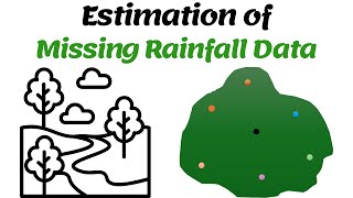
Introduction to Estimation Method Selection
🔒 Unlock Audio Lesson
Sign up and enroll to listen to this audio lesson

Today, we're exploring the criteria for selecting an estimation method for missing rainfall data. Why do you think this selection is important?

I think it affects the accuracy of the data we end up with.
Exactly! Choosing the wrong method can lead to inaccurate analyses. So, what do you think is the first criterion we should consider?

Maybe the length of the missing record?
Correct! The longer the gap, the more critical it is to pick a viable estimation method.
Reviewing Neighboring Stations
🔒 Unlock Audio Lesson
Sign up and enroll to listen to this audio lesson

Let's dive deeper into why the number of neighboring stations matters. How does that influence our estimations?

I guess more stations mean we have more data to work with?
Absolutely! More neighbors with complete data give us a diverse sample to make better estimations. Can anyone think of why homogeneity among these stations is also important?

If they are too different, the data might not make sense together?
Exactly! Homogeneous data ensures we’re comparing apples to apples, reducing potential errors in our estimates.
Evaluating Similarities
🔒 Unlock Audio Lesson
Sign up and enroll to listen to this audio lesson
Let’s talk about topographic and climatic similarities. Why might these matter in our select methods?
Perhaps because rain patterns will be more alike in similar terrains and climates?
Correct! Patterns are influenced heavily by these factors. Now, why is long-term data availability another criterion?
Long-term data helps us to see trends and compare the missing data with historical information, right?
Exactly, great point! Historical context can add significant reliability to our estimations.
Conclusion of Criteria
🔒 Unlock Audio Lesson
Sign up and enroll to listen to this audio lesson
To recap, we discussed the key criteria for selecting an estimation method: length of the missing record, number of neighboring stations, homogeneity, and climatic similarities, along with data availability. Can anyone summarize why these factors are crucial?
They help ensure our estimates are reliable and as accurate as possible!
Exactly right! Choosing the right method based on these criteria keeps our analysis robust and trustworthy.
Introduction & Overview
Read summaries of the section's main ideas at different levels of detail.
Quick Overview
Standard
This section outlines the critical factors influencing the choice of estimation methods for missing rainfall data, including the length and duration of the missing record, the number of neighboring stations with complete data, and similarities in topographical and climatic conditions.
Detailed
Criteria for Estimation Method Selection
Selecting an appropriate estimation method for missing rainfall data is vital for maintaining data integrity in hydrological studies. The choice of method is influenced by several criteria:
- Length and Duration of Missing Record: The longer the missing data spans, the more critical it is to choose a reliable estimation method to ensure accuracy.
- Number of Neighboring Stations with Complete Data: A higher number of neighboring stations provides a more comprehensive context, enhancing the accuracy of the estimation.
- Homogeneity and Proximity of Stations: Estimations are more reliable when nearby stations are homogeneous in terms of climate and geographic features, ensuring that the patterns in rainfall are similar.
- Topographic and Climatic Similarity: Regions with similar topographic and climatic characteristics will yield better estimations as the rainfall patterns are likely to exhibit similarities.
- Availability of Long-term Records: Access to long-term data from nearby stations can improve the reliability of the estimation method chosen. These records help compare current findings against historical data, providing context and validation for estimations.
Understanding these criteria is essential for selecting the most suitable estimation method, thereby reducing biases and uncertainties in hydrological analyses.
Youtube Videos


Audio Book
Dive deep into the subject with an immersive audiobook experience.
Length and Duration of Missing Record
Chapter 1 of 5
🔒 Unlock Audio Chapter
Sign up and enroll to access the full audio experience
Chapter Content
• Length and duration of missing record.
Detailed Explanation
When selecting a method to estimate missing rainfall data, the first criterion to consider is the length and duration of the missing record. If the record is missing for a short period, simpler methods may suffice. However, for longer gaps, more sophisticated methods that consider a wider range of data might be necessary to provide a reliable estimate.
Examples & Analogies
Imagine you're baking a cake and realize you've forgotten to add sugar for just a couple of minutes. You can simply stir it in, and it will be fine. However, if you have to bake the cake without sugar for a longer period, it will affect the end result significantly, and you'll need to find a more complex solution to balance the flavors.
Number of Neighboring Stations
Chapter 2 of 5
🔒 Unlock Audio Chapter
Sign up and enroll to access the full audio experience
Chapter Content
• Number of neighboring stations with complete data.
Detailed Explanation
The availability of neighboring stations with complete rainfall data is a crucial factor when choosing an estimation method. More neighboring stations with reliable data can improve the accuracy of the estimates, as they provide additional context and trends that the estimation method can use.
Examples & Analogies
Think of a group project in school. If you have many classmates to collaborate with, you can gather more diverse ideas and insights, making your final project stronger. However, if you’re working alone or with very few people, it may not reflect a well-rounded perspective.
Homogeneity and Proximity of Stations
Chapter 3 of 5
🔒 Unlock Audio Chapter
Sign up and enroll to access the full audio experience
Chapter Content
• Homogeneity and proximity of stations.
Detailed Explanation
Homogeneity refers to how similar the rainfall data is across different stations—are they experiencing similar weather patterns? Proximity also matters; the closer the neighboring stations are to the one with missing data, the more relevant their information will be. Both factors are significantly influential in determining the reliability of the estimation method chosen.
Examples & Analogies
Consider two friends who live in the same neighborhood. Their everyday experiences, like traffic conditions or local weather, are likely to be quite similar due to their closeness. However, if one friend lives in a vastly different area, their experiences may not apply, just like how distant rain gauges might not provide accurate estimates for one another.
Topographic and Climatic Similarity
Chapter 4 of 5
🔒 Unlock Audio Chapter
Sign up and enroll to access the full audio experience
Chapter Content
• Topographic and climatic similarity.
Detailed Explanation
When selecting an estimation method, assessing the topographic (physical features of the earth’s surface) and climatic (weather patterns) similarities between the station with missing data and the neighboring stations is vital. Similar topography and climate suggest that the rainfall patterns are likely to be comparable, leading to more accurate estimates.
Examples & Analogies
Picture two towns situated in similar valleys. They share similar weather patterns and natural environments, which means when one town experiences rain, the other likely does too. This natural similarity helps in making better predictions about weather conditions in either town.
Availability of Long-Term Records
Chapter 5 of 5
🔒 Unlock Audio Chapter
Sign up and enroll to access the full audio experience
Chapter Content
• Availability of long-term records.
Detailed Explanation
The availability of long-term rainfall records is essential for estimation methods. Long-term data helps establish trends and averages, which can enhance the accuracy of the estimates. Relying solely on short-term data can lead to misleading conclusions, especially if unusual weather events occur.
Examples & Analogies
Think of someone investing in a stock. If they only look at the stock's performance over a few weeks, they might make a hasty decision based on temporary fluctuations. However, by examining the stock’s performance over several years, they can identify long-term trends and make a more informed choice.
Key Concepts
-
Criteria for selecting estimation methods: Factors such as length of missing record, number of neighboring stations, and homogeneity impact the accuracy of estimates.
-
Homogeneity and proximity: Stations should be similar in climate and geography to ensure reliable estimations.
-
Long-term records: Access to historical data significantly improves the estimation process.
Examples & Applications
If rainfall data from a station has two months missing, a method like inverse distance weighting might be chosen based on data from several neighboring stations with similar rain patterns.
In an area with extreme rainfall variability, selecting estimation methods that account for climatic differences is crucial to achieving accurate results.
Memory Aids
Interactive tools to help you remember key concepts
Rhymes
Length of the gap, neighbors galore, homogeneity helps, for accuracy we score!
Stories
Imagine two friends living in different climates but forecasting a joint garden; one plants seeds too early, and the other too late. Just like these friends, our estimation methods must possess similar conditions for fruitful results.
Memory Tools
H.L.N.H (Homogeneity, Length, Neighbors, Homogeneity) – Remember this for selection criteria!
Acronyms
CLEAN - Criteria
Length
Climatic similarity
Estimation
Area's topography
Neighbors.
Flash Cards
Glossary
- Estimation Method
A technique used to infer or predict missing rainfall data based on existing data.
- Homogeneity
The quality of being the same; in this context, it refers to the similarity among neighboring stations regarding climatic conditions.
- Topographic Similarity
The concept that geographical features influence rainfall patterns; similar topographies likely yield similar rainfall patterns.
- Climatic Similarity
The likeness between the climate of different locations; affects rainfall patterns and data estimation accuracy.
- Longterm Records
Historical data collected over an extended period, providing insight necessary for accurate estimation of missing data.
Reference links
Supplementary resources to enhance your learning experience.