
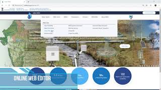
Use of GIS and Software Tools
Enroll to start learning
You’ve not yet enrolled in this course. Please enroll for free to listen to audio lessons, classroom podcasts and take practice test.
Interactive Audio Lesson
Listen to a student-teacher conversation explaining the topic in a relatable way.
Introduction to GIS Tools in Rainfall Estimation
🔒 Unlock Audio Lesson
Sign up and enroll to listen to this audio lesson

Today we'll explore how GIS tools are revolutionizing rainfall data estimation. What do you think GIS stands for?

Geographic Information Systems!
Exactly! GIS tools can map rainfall stations and interpolate data. This means they can fill in gaps by estimating values based on surrounding data points. Why is this important?

It helps keep records consistent, especially when data is missing!
Precisely! It maintains the reliability of hydrological assessments. Now, can anyone tell me the methods GIS tools use for interpolation?

IDW and Kriging?
Great! IDW stands for Inverse Distance Weighting, and Kriging uses advanced statistical techniques. Let's summarize: GIS tools are essential for mapping and interpolation, making rainfall data estimation more accurate.
Automation in Missing Data Estimation
🔒 Unlock Audio Lesson
Sign up and enroll to listen to this audio lesson

Next, we'll look at how software packages like MATLAB and Python can assist in automating the estimation process. Why is automation beneficial?

It saves time and reduces human error!
Correct! Automation allows for handling large datasets efficiently. Python, with libraries like pandas and geopandas, can process data effortlessly. Can someone explain one of the main advantages of using such tools?
They can analyze big data effectively and apply statistical methods quickly.
Exactly right! In summary, software tools not only enhance efficiency but also improve the accuracy of missing data estimation through comprehensive data analysis capabilities.
Conclusion on the Significance of GIS and Software Tools
🔒 Unlock Audio Lesson
Sign up and enroll to listen to this audio lesson
Let's wrap things up. How do GIS and software tools contribute to the future of hydrology?
They make data estimation more reliable and faster, which is crucial for water management!
Very well said! Their use enhances not just estimates but also decision-making in water resource management. Always remember, using advanced technology like GIS and programming languages opens new horizons in hydrology. Any final thoughts?
It seems like technology is really changing how we approach environmental data!
Indeed! Let’s keep an eye on how these advancements continue to evolve in our field.
Introduction & Overview
Read summaries of the section's main ideas at different levels of detail.
Quick Overview
Standard
Recent advancements in technology have enabled the use of GIS tools and software for estimating missing rainfall data. These tools can automate processes like interpolation and ensure accurate spatial and statistical estimations across extensive datasets.
Detailed
Use of GIS and Software Tools
Advancements in technology have significantly transformed the methodologies used for estimating missing rainfall data, which is vital for hydrological analysis and water resource management. Geographic Information Systems (GIS) can effectively map rain gauge stations and interpolate rainfall values both through Inverse Distance Weighting (IDW) and Kriging methods, which account for spatial relationships across the data. Furthermore, software packages such as MATLAB and Python (specifically with libraries like pandas and geopandas) provide robust frameworks for automating the estimation of missing data. These tools enhance the capacity to handle large datasets, ensuring both spatial accuracy and statistical reliability in rain data estimations. The integration of these technologies marks a significant advancement in hydrological assessment, leading to better-informed decision-making processes in water resource management.
Youtube Videos


Audio Book
Dive deep into the subject with an immersive audiobook experience.
Introduction to GIS and Software Tools in Hydrology
Chapter 1 of 4
🔒 Unlock Audio Chapter
Sign up and enroll to access the full audio experience
Chapter Content
With advances in technology:
Detailed Explanation
This introduction highlights that advancements in technology have transformed the way hydrology professionals estimate missing rainfall data. It sets the groundwork for discussing how Geographic Information Systems (GIS) and specialized software have made data processing more efficient and accurate.
Examples & Analogies
Think of GIS and software tools like GPS navigators for driving. Just as a GPS helps you find the best route to your destination with up-to-date maps and traffic information, GIS tools help hydrologists determine accurate rainfall estimates by analyzing various geographical and meteorological data.
GIS Tools for Rainfall Mapping and Interpolation
Chapter 2 of 4
🔒 Unlock Audio Chapter
Sign up and enroll to access the full audio experience
Chapter Content
• GIS tools can map stations and interpolate rainfall using IDW or Kriging.
Detailed Explanation
GIS tools are specialized software that allow users to create, manipulate, and analyze data linked to geographical locations. Interpolation methods like Inverse Distance Weighting (IDW) and Kriging are statistical techniques used within GIS to estimate missing rainfall data based on surrounding stations. IDW estimates the value of unknown points by averaging known values, giving more weight to closer points. Kriging is a more advanced method that takes into account spatial correlation between points and provides estimates with a measure of uncertainty.
Examples & Analogies
Imagine you are trying to find out how much it rains at a spot in a park where no rain gauge exists. By looking at rain data from nearby gauges, GIS tools help estimate the rainfall based on what is known, like how a detective uses clues from the scene to solve a case.
Automation of Missing Data Estimation
Chapter 3 of 4
🔒 Unlock Audio Chapter
Sign up and enroll to access the full audio experience
Chapter Content
• Software packages like MATLAB, Python (with pandas/geopandas), and commercial hydrology tools (e.g., HEC-HMS, SWAT) can automate missing data estimation.
Detailed Explanation
Modern software packages provide automated features that can handle large datasets and apply complex algorithms without manual intervention. For instance, MATLAB and Python libraries such as Pandas and GeoPandas offer tools to process rainfall data efficiently, while commercial tools like HEC-HMS and SWAT are tailored for hydrological modeling. Automation reduces human error and speeds up the estimation process, allowing hydrologists to focus on analysis and decision-making instead of manual calculations.
Examples & Analogies
Consider how online banking apps automate tasks like money transfers. Just as these apps calculate exchange rates and handle transactions with minimal user input, software tools in hydrology take raw data, run algorithms, and produce rainfall estimates almost effortlessly.
Advantages of Using GIS and Software Tools
Chapter 4 of 4
🔒 Unlock Audio Chapter
Sign up and enroll to access the full audio experience
Chapter Content
• These tools ensure spatially accurate and statistically sound estimation across large datasets.
Detailed Explanation
Using GIS and specialized software for rainfall estimation provides significant benefits, such as accuracy and efficiency. With tools designed for spatial analysis, the estimations reflect true geographical variations and patterns, leading to more reliable data for hydrological studies and project designs. This is particularly important in hydrology, where environmental factors can vary significantly over short distances.
Examples & Analogies
Think of using a high-quality camera with advanced features to take landscape photos versus using a basic phone camera. The high-quality camera captures richer details and colors, similar to how GIS and software tools produce more accurate rainfall estimates than manual calculations alone.
Key Concepts
-
GIS Tools: Essential for mapping and interpolating rainfall data.
-
IDW and Kriging: Main methods used for spatial interpolation.
-
Automation: Increases efficiency and accuracy in data estimation.
Examples & Applications
GIS can create rainfall distribution maps that help visualize areas lacking rainfall data.
Using Python to run a script that automatically fills missing rainfall data using IDW interpolation.
Memory Aids
Interactive tools to help you remember key concepts
Rhymes
GIS maps and data align, making rainfall estimates just fine!
Stories
Once upon a time, in a land where rain data was scarce, a magical tool called GIS helped fill the gaps, making water resources fair and square.
Memory Tools
G.I.S. — Grab Information Swiftly, for Rainfall Estimates.
Acronyms
R.A.I.N. — Retrieve And Interpolate Now!
Flash Cards
Glossary
- GIS
Geographic Information Systems; a framework for gathering, managing, and analyzing spatial and geographic data.
- IDW
Inverse Distance Weighting; an interpolation method that assigns values based on the distance from a set of known data points.
- Kriging
A statistical method for interpolation that considers the spatial correlation of the data.
- Automation
The use of technology to perform tasks without human intervention, enhancing efficiency and accuracy.
- MATLAB
A programming platform designed for engineers and scientists, commonly used for data analysis.
- Python
A widely-used programming language known for its readability and efficiency in data manipulation and analysis.
Reference links
Supplementary resources to enhance your learning experience.