
Temporal and Spatial Variability of AET
Enroll to start learning
You’ve not yet enrolled in this course. Please enroll for free to listen to audio lessons, classroom podcasts and take practice test.
Interactive Audio Lesson
Listen to a student-teacher conversation explaining the topic in a relatable way.
Temporal Variation of AET
🔒 Unlock Audio Lesson
Sign up and enroll to listen to this audio lesson

Today we're going to discuss the temporal variation of Actual Evapotranspiration, or AET for short. Can anyone tell me what temporal variation means?

Does it refer to how something changes over time?
Exactly! AET varies daily, seasonally, and annually. For example, AET may increase during summer when plants are actively growing and then decrease in winter. What do you think causes these changes?

I think it's related to weather conditions, like temperature and rainfall?
Correct! Higher temperatures and increased sunlight can lead to higher AET rates. Remember, we summarize this as 'AET follows the rhythm of the seasons.'

What happens during periods of drought?
Great question! During droughts, there's less moisture available, which would lead to a decrease in AET. So, AET is a good indicator of water stress in plants.
In summary, AET is influenced by weather changes and crop growth, fluctuating throughout the year.
Spatial Variation of AET
🔒 Unlock Audio Lesson
Sign up and enroll to listen to this audio lesson

Now let's shift to the spatial variation of AET. Can anyone guess what spatial variation refers to?

Is it about how AET differs across different places or locations?
Exactly! Spatial variation is influenced by land cover types, soil types, and local topography. For example, AET can be higher in forests compared to urban areas due to differences in vegetation and soil moisture.
How does irrigation affect this?
Excellent point! Irrigation practices also play a significant role in AET. Regions with effective irrigation will exhibit higher AET levels compared to dryland farming systems. What's the benefit of mapping AET?
It helps identify areas that might be water-stressed?
Spot on! Mapping AET allows for better understanding and planning for irrigation schedules. In summary, AET varies across space depending on various environmental factors, which can be mapped for better management.
Introduction & Overview
Read summaries of the section's main ideas at different levels of detail.
Quick Overview
Standard
The section highlights how AET varies over time (daily, seasonally, annually) due to climatic changes and crop development, as well as how it differs across space influenced by factors like land cover and topography. Mapping AET spatially can aid in effective water management and irrigation planning.
Detailed
Temporal and Spatial Variability of AET
Actual Evapotranspiration (AET) is not constant but varies with time and space, making its study crucial in hydrology and water resource management. This section covers:
- Temporal Variation: AET fluctuates daily due to weather changes and seasonal variations influenced by climatic changes and different stages of crop growth.
- Spatial Variation: AET is influenced by various factors including land cover type, topography, soil heterogeneity, and irrigation practices. Mapping AET allows for the identification of water-stressed areas, promoting informed decisions in irrigation scheduling and management.
Understanding these variations is key to optimizing water use and improving agricultural productivity.
Youtube Videos


Audio Book
Dive deep into the subject with an immersive audiobook experience.
Temporal Variation of AET
Chapter 1 of 3
🔒 Unlock Audio Chapter
Sign up and enroll to access the full audio experience
Chapter Content
AET varies daily, seasonally, and annually with changes in weather and crop growth stages.
Detailed Explanation
Actual Evapotranspiration (AET) is not constant; it changes over time. Daily variations can occur due to fluctuations in temperature, humidity, and wind speed. For instance, a hot, windy day can lead to a higher rate of evapotranspiration compared to a cool, humid day. Seasonally, AET will be influenced by the growth stages of crops; for example, it typically increases during the growing season when plants are actively transpiring water. Annually, factors like climate variations from year to year can also have a significant impact on AET.
Examples & Analogies
Think of AET like a person’s water intake during the year. In summer, when it’s hot, someone might drink more water daily (high AET), whereas in winter, they might drink much less (low AET). Similarly, during the planting and growing months, crops will use more water through evapotranspiration compared to dormant months.
Spatial Variation of AET
Chapter 2 of 3
🔒 Unlock Audio Chapter
Sign up and enroll to access the full audio experience
Chapter Content
Spatial Variation: Influenced by land cover type, topography, soil heterogeneity, and water management practices.
Detailed Explanation
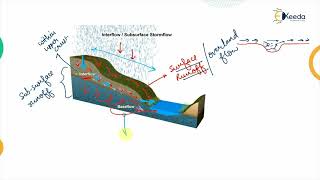
AET can differ based on location, and this is known as spatial variability. Various factors affect this, including:
- Land Cover Type: Different vegetation types (forests, crops, grasslands) have different evapotranspiration rates. For example, dense forest areas will have higher AET than bare soil.
- Topography: Areas with varying elevation can experience different microclimates. For instance, a slope might receive more sunlight and have higher AET than a shaded valley.
- Soil Heterogeneity: Variations in soil texture and moisture content can create different AET rates across a landscape. Sandy soils may drain quickly, resulting in lower AET, while clay soils hold moisture better.
- Water Management Practices: Irrigation methods and water resource management can influence AET levels. Areas with effective irrigation might show higher AET due to sustained moisture availability.
Examples & Analogies
Consider how two neighboring farms can have vastly different amounts of water use for crops. One farm with sandy soil and traditional irrigation methods may struggle to retain moisture, resulting in lower AET. In contrast, a neighboring farm with clay soil and advanced irrigation techniques (like drip irrigation) could maintain better moisture levels, leading to higher AET. This illustrates how spatial factors create variability in water use even over short distances.
Mapping AET Spatially
Chapter 3 of 3
🔒 Unlock Audio Chapter
Sign up and enroll to access the full audio experience
Chapter Content
Mapping AET spatially helps in identifying water-stressed zones and planning irrigation schedules.
Detailed Explanation
Mapping the spatial variability of AET is a crucial tool for water management. By creating AET maps, decision-makers can visually identify areas experiencing water stress. Areas with low AET may indicate insufficient moisture or unfavorable growing conditions, affecting crop yields. This information is essential for farmers and planners to devise appropriate irrigation schedules, ensuring that water resources are used efficiently and crops receive the moisture they need.
Examples & Analogies
Imagine a teacher using a heat map to see where students struggle academically. The map visually presents areas that need more attention and resources. Similarly, AET mapping gives farmers a clear view of which fields require more water or attention, allowing them to plan their irrigation accordingly and support the best crop growth.
Key Concepts
-
Temporal Variation of AET: AET changes over time due to factors like crop growth and weather.
-
Spatial Variation of AET: Differences in AET occur across locations influenced by land cover and irrigational practices.
Examples & Applications
AET is higher in summer in agricultural areas due to increased crop transpiration than in winter.
In a forested region, AET might be significantly higher than in a gravel parking lot due to differences in vegetation cover and soil type.
Memory Aids
Interactive tools to help you remember key concepts
Rhymes
AET will sway and change each day, with weather and crops leading the way.
Stories
Imagine AET as a river that flows differently throughout the seasons, swelling in summer when crops are green and thinning in winter's frost.
Memory Tools
AET - Always Evaporates Time: a reminder that AET changes with time.
Acronyms
P-C-L-S
Plants
Climate
Land cover
Soil type - all impact AET's spatial variations.
Flash Cards
Glossary
- Actual Evapotranspiration (AET)
The amount of water that is actually evaporated and transpired from the soil-plant system.
- Temporal Variation
Changes in AET that occur over different time intervals, including daily, seasonal, and annual variations.
- Spatial Variation
Differences in AET occurring across various geographical locations due to factors like land cover and soil type.
Reference links
Supplementary resources to enhance your learning experience.