
Real-Time Kinematic (RTK) and Post-Processed Kinematic (PPK) Surveying
Enroll to start learning
You’ve not yet enrolled in this course. Please enroll for free to listen to audio lessons, classroom podcasts and take practice test.
Interactive Audio Lesson
Listen to a student-teacher conversation explaining the topic in a relatable way.
Introduction to RTK Surveying
🔒 Unlock Audio Lesson
Sign up and enroll to listen to this audio lesson

Today, we’ll discuss RTK, or Real-Time Kinematic surveying. Does anyone know what RTK stands for?

I think it’s something about real-time positioning?
Correct! RTK allows drones to use GNSS correction data in real-time during their flight, achieving centimeter-level accuracy. This means that the data collected can be very precise. Can anyone think of why that might be important?

It could be crucial for construction or road surveys, right?
Exactly! In construction, for instance, precise measurements are vital for alignment and design. Remember, RTK = Real-Time Accuracy! It’s a helpful acronym to recall!

What happens if the connection is lost during an RTK survey?
Great question! That’s where we need to understand the limitations. If the signal is interrupted, it can affect data accuracy. Let’s summarize: RTK provides instant corrective data, which is essential for many precision tasks.
Explaining PPK Surveying
🔒 Unlock Audio Lesson
Sign up and enroll to listen to this audio lesson

Now, let's shift gears to PPK, or Post-Processed Kinematic surveying. Unlike RTK, this method applies corrections after the flight. What might be an advantage of this?

Maybe if you’re surveying remote areas where the connection isn’t reliable?
Exactly! PPK is beneficial when live data transmissions cannot consistently be maintained. It allows us to correct positions post-flight, enhancing reliability. Can anyone tell me what one of the main limitations of RTK is in this scenario?
If the signal is lost, the data may not be accurate.
Right! PPK sidesteps this issue by ensuring all data can be processed later. Remember: PPK = Post-Flight Precision! This is another useful acronym for you.
What kind of projects would mostly use PPK?
Good question! PPK typically suits projects in remote environments or applications that do not require immediate data. Let’s summarize the differences: RTK for real-time accuracy, and PPK for flexibility and reliability.
Comparing RTK and PPK Surveying
🔒 Unlock Audio Lesson
Sign up and enroll to listen to this audio lesson
Let’s do a comparative analysis of RTK and PPK. Firstly, can anyone explain the primary operational difference?
RTK provides real-time corrections while PPK does so after the data collection.
Correct! Now, how does this affect their reliability?
PPK is more stable due to not depending on continuous communication.
Exactly! For applications, RTK can be used for tasks requiring immediate precision like road alignment. Whereas PPK suits utility corridor surveys, especially in remote places. Let’s recap: RTK is for real-time, immediate needs; PPK is for flexibility after data collection.
Introduction & Overview
Read summaries of the section's main ideas at different levels of detail.
Quick Overview
Standard
RTK and PPK surveying techniques utilize GNSS correction data to improve location accuracy for UAV operations. RTK allows for real-time corrections during flight, while PPK employs post-flight data adjustments, making both methods valuable in various surveying applications.
Detailed
Real-Time Kinematic (RTK) Surveying
RTK surveying utilizes Global Navigation Satellite System (GNSS) correction data transmitted in real-time during the drone's flight. A stationary base station sends correction signals to the UAV, facilitating centimeter-level accuracy in positioning. This is particularly beneficial in scenarios requiring immediate data, such as construction monitoring or geospatial analysis.
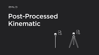
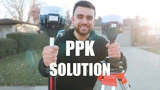
Post-Processed Kinematic (PPK) Surveying
In contrast, PPK surveying processes the GNSS correction data after the flight has concluded. This method is advantageous in environments where live data transmissions may be unreliable, allowing for enhanced accuracy through post-flight adjustments. PPK is commonly used in remote areas or for applications that do not require instant data availability.
Comparison and Applications
Key distinguishing features between RTK and PPK include:
- Data Correction: RTK provides real-time corrections while PPK processes data post-flight.
- Reliability: PPK is deemed more stable in instances of potential communication loss.
- Field Setup: RTK requires a constant connection for its base station, whereas PPK allows for more flexible setups.
Applications
Both RTK and PPK methods find application in road alignment, precision agriculture, and utility corridor surveys, thus enabling enhanced accuracy and efficiency in aerial data collection.
Youtube Videos


Audio Book
Dive deep into the subject with an immersive audiobook experience.
Overview of RTK Surveying
Chapter 1 of 4
🔒 Unlock Audio Chapter
Sign up and enroll to access the full audio experience
Chapter Content
RTK uses GNSS correction data in real-time during drone flight. A base station transmits correction signals to the UAV to achieve centimeter-level accuracy.
Detailed Explanation
Real-Time Kinematic (RTK) surveying is a method that improves the accuracy of location measurements taken by a drone. This method utilizes Global Navigation Satellite System (GNSS) satellites for precise positioning. During the flight of the drone, a base station sends continuous correction signals to the drone. These signals help correct any discrepancies caused by factors such as satellite positioning errors, atmospheric effects, or any other interference that could affect GPS accuracy. As a result, RTK can achieve accuracy levels down to just a few centimeters, making it extremely suitable for tasks that require high precision.
Examples & Analogies
Imagine you are trying to shoot arrows at a target from a distance. If you have a friend with you giving you real-time adjustments on where your arrows land, you'll be able to aim better and hit the target perfectly. Similarly, RTK surveying corrects the drone's position in real time, allowing it to capture data accurately.
Overview of PPK Surveying
Chapter 2 of 4
🔒 Unlock Audio Chapter
Sign up and enroll to access the full audio experience
Chapter Content
In PPK, correction data is applied after the flight. It's beneficial in areas where live data transmission is unreliable.
Detailed Explanation
Post-Processed Kinematic (PPK) surveying differs from RTK in the timing of the data correction. Instead of receiving real-time corrections during the flight, PPK collects all the data and applies correction algorithms after the flight has been completed. This is particularly useful in locations where continuous communication with GNSS base stations might not be possible—such as remote areas or sites with obstructions. Once the drone lands, the recorded data can be corrected using the additional data recorded by the base station. This method allows for high accuracy, similar to RTK, but provides more flexibility regarding communication conditions.
Examples & Analogies
Consider a situation where you're trying to cook without a recipe. You could choose to wait until the end of cooking to adjust the seasoning based on taste. This is like PPK, where you analyze and correct your results after the cooking (or flight) is done. You might not have instant feedback on your dish while cooking, but you can still achieve a great taste by adjusting it later.
Comparison of RTK and PPK
Chapter 3 of 4
🔒 Unlock Audio Chapter
Sign up and enroll to access the full audio experience
Chapter Content
| Parameter | RTK | PPK |
|---|---|---|
| Data Correction | Real-time | Post-flight |
| Reliability | Affected by communication loss | More stable, post-processed |
| Field Setup | Requires constant connection | More flexible |
Detailed Explanation
RTK and PPK methods have their own advantages and limitations. In the 'Data Correction' parameter, RTK provides corrections in real-time, which is beneficial for immediate data accuracy. However, if there is a loss of communication with the base station, accuracy can suffer. On the other hand, PPK applies corrections after the flight, ensuring stability in the results regardless of communication status during the flight. When it comes to 'Field Setup', RTK requires a constant connection to the base station, which can limit operational flexibility. PPK does not require this constant connection, allowing operations in more varied environments.
Examples & Analogies
Think about hiking with a friend using a GPS device. If your friend checks the map (RTK) at every step, you might not know where to go if the GPS signal drops. However, if you track your route and look back at the map after the hike (PPK), you can still reconstruct the entire journey, even if you faced issues along the way.
Applications of RTK and PPK Surveying
Chapter 4 of 4
🔒 Unlock Audio Chapter
Sign up and enroll to access the full audio experience
Chapter Content
Applications include road alignment, precision agriculture, and utility corridor surveys.
Detailed Explanation
Both RTK and PPK surveying techniques have practical applications in various fields. For instance, in road alignment, precise positioning helps engineers plan and design roads that fit the landscape and comply with regulations. In precision agriculture, farmers can use these technologies to optimize planting and harvesting, ensuring the right amount of resources is used in the right places. Utility corridor surveys benefit from these techniques by ensuring that power lines or pipelines are accurately placed, minimizing errors and optimizing resource deployment.
Examples & Analogies
Imagine constructing a perfect pizza. If you want the cheese to be evenly distributed (just like planning road alignments), you'd need precise measurements. Similarly, RTK enables engineers to pinpoint exactly where components need to go, while PPK can help refine the recipe after tasting, ensuring everything is just right.
Key Concepts
-
RTK: A method providing real-time GNSS corrections for surveying.
-
PPK: A method utilizing GNSS corrections post-flight.
-
Centimeter-level accuracy: The high precision achievable with RTK and PPK.
-
Flexibility: PPK allows for post-flight data correction.
Examples & Applications
RTK is used for road alignment surveys where immediate precision is crucial.
PPK is beneficial in remote agricultural surveys where live data is often unavailable.
Memory Aids
Interactive tools to help you remember key concepts
Rhymes
RTK for the quick fix, PPK's data will be your mix!
Stories
Imagine a construction site where workers need quick and precise data to lay foundations. RTK sends real-time signals like a trusty guide, whereas PPK waits till the night to polish and perfect.
Memory Tools
RTPP: Real-Time Precision for PPK.
Acronyms
PPP - PPK for Precision Post-Processing!
Flash Cards
Glossary
- RTK
Real-Time Kinematic; a method using GNSS for real-time positional corrections.
- PPK
Post-Processed Kinematic; a method applying GNSS corrections after data collection.
- GNSS
Global Navigation Satellite System; a system that provides satellite positioning data.
- Centimeterlevel accuracy
Precision level where measurements are accurate to within centimeters.
Reference links
Supplementary resources to enhance your learning experience.