
Aerial Robots (Drones/UAVs)
Enroll to start learning
You’ve not yet enrolled in this course. Please enroll for free to listen to audio lessons, classroom podcasts and take practice test.
Interactive Audio Lesson
Listen to a student-teacher conversation explaining the topic in a relatable way.
Introduction to Drones in Structural Inspection
🔒 Unlock Audio Lesson
Sign up and enroll to listen to this audio lesson

Today, we're discussing the important role that aerial robots, specifically drones, play in the inspection of civil structures. Can anyone tell me why aerial inspectors are useful?

They can reach high places without putting people at risk!
Exactly! Drones can access difficult locations, ensuring a more thorough inspection. They also provide quick deployment. What might that mean for inspection schedules?

It would probably make inspections faster and more efficient!
Right! Fast deployment means we can inspect more structures in a shorter time. Let's remember this with the acronym 'F.A.S.T.' for 'Fast Access for Structural Inspections'.

What about their safety benefits?
Great question! Using drones minimizes disruption and safety risks for humans. Can you think of some specific scenarios where using drones would be safer?

Like checking the roofs of skyscrapers, where you might fall or get injured.
Absolutely! So, to recap, drones are F.A.S.T. and safe. They enhance inspection efficiency while reducing risk.
Technology Used in Drones
🔒 Unlock Audio Lesson
Sign up and enroll to listen to this audio lesson

Let's delve deeper into the technology that makes these drones so efficient. What do you think are some key features of a drone used for inspections?
They probably have cameras, right?
Yes! Drones are equipped with high-resolution cameras for visual inspections and thermal imaging for detecting issues like heat loss. Anyone familiar with thermal imaging?
It helps find leaks and insulation problems, right?
Exactly! This technology allows for early damage detection, which leads to timely repairs. Remember our acronym 'I.M.A.G.E.': 'Inspection Using Multiple Advanced Geophysical Equipment'.
What about GPS in drones?
Great point! GPS enables accurate positioning and allows drones to create detailed maps of inspection areas. Why do you think that matters?
It helps in planning and documenting inspections more effectively.
Exactly! So we have advanced features like I.M.A.G.E. and GPS in drones, enhancing their inspection capabilities.
Case Studies and Practical Applications
🔒 Unlock Audio Lesson
Sign up and enroll to listen to this audio lesson
Let's discuss a few case studies of drones in structural inspections. Has anyone heard about notable successes with drone technology?
I read about the use of drones for inspecting bridges in India.
Exactly! The Ministry of Road Transport and Highways in India employs drones for real-time data upload. What benefits do you think this brings?
It allows for immediate analysis of structural health and quick decision-making.
Well said! It enhances overall efficiency. Remember: 'C.A.S.E.' for 'Case Study Analysis of Structural Evaluations.'
What other structures can drones inspect?
Drones can also inspect towers and roofs. They are invaluable in maintaining infrastructure. Remember, using C.A.S.E. studies helps us understand practical applications better.
Introduction & Overview
Read summaries of the section's main ideas at different levels of detail.
Quick Overview
Standard
This section focuses on the use of aerial robots, notably quadcopters and fixed-wing drones, in the inspection of structures like towers and roofs. Equipped with advanced technologies like high-resolution cameras and GPS, these drones significantly enhance the efficiency and safety of inspection processes compared to traditional methods.
Detailed
Aerial Robots (Drones/UAVs)
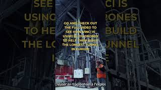
Aerial robots, commonly known as drones, play a pivotal role in the inspection and maintenance of high-rise structures, such as buildings, towers, and roofs. These unmanned aerial vehicles (UAVs) utilize advanced technologies including high-resolution cameras, thermal imaging, and GPS for effective structural inspections. The adoption of drones provides several advantages:
- Fast Deployment: Drones can be quickly launched to conduct inspections, saving time compared to traditional methods.
- Access to Hard-to-Reach Areas: Aerial robots can easily navigate difficult terrains and reach areas that are otherwise unsafe or challenging for human inspectors.
- Minimal Disruption to Traffic: The usage of drones reduces the impact on surrounding traffic and pedestrian activities during inspection tasks, making them an efficient alternative.
Through the integration of robotics, sensors, and data processing technologies, drones offer improved accuracy in damage detection, thereby enhancing safety and reliability in the monitoring of structural integrity.
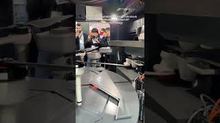
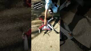
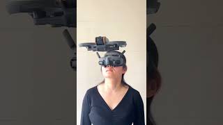
Youtube Videos


Audio Book
Dive deep into the subject with an immersive audiobook experience.
Use of Drones for Inspection
Chapter 1 of 3
🔒 Unlock Audio Chapter
Sign up and enroll to access the full audio experience
Chapter Content
• Use of quadcopters or fixed-wing drones for inspecting high-rise structures, towers, and roofs.
Detailed Explanation
In this chunk, we discuss the use of drones, specifically quadcopters and fixed-wing types, in the context of structural inspection. Drones have capabilities that allow them to reach and inspect areas that are often difficult or dangerous for humans to access, such as high-rise buildings, communication towers, and rooftops. They are equipped for high-flying and maneuvering precisely around large structures, which makes them an invaluable tool in civil engineering inspections.
Examples & Analogies
Imagine needing to check the condition of the roof of a skyscraper. Traditionally, this could involve scaffolding or cranes, which can be expensive and time-consuming. With a drone, you can easily survey the roof from the ground, taking high-resolution photographs that give clear insights into its condition without putting anyone at risk.
Equipped Technology of Drones
Chapter 2 of 3
🔒 Unlock Audio Chapter
Sign up and enroll to access the full audio experience
Chapter Content
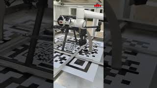
• Equipped with high-resolution cameras, thermal imaging, GPS.
Detailed Explanation
Drones used for inspection come equipped with advanced technology including high-resolution cameras, thermal imaging systems, and Global Positioning System (GPS) capabilities. The high-resolution cameras allow for detailed visual inspections where cracks, surface flaws, or other anomalies can be identified easily. Thermal imaging can detect heat patterns that indicate issues like insulation failure or moisture intrusion, which are not visible to the naked eye. GPS functionality enables precise location tracking for repeat inspections over time, which is crucial for maintaining records and monitoring changes.
Examples & Analogies
Think of the drone like a superhero with advanced vision. Just as a superhero can see through walls and in the dark, drones equipped with high-resolution cameras and thermal imaging can unveil problems in structures that would go unnoticed during a regular inspection. For instance, a hidden leak in a roof wouldn’t show up on a regular camera, but a thermal image can highlight it as a cool spot compared to the warm surroundings.
Advantages of Using Drones
Chapter 3 of 3
🔒 Unlock Audio Chapter
Sign up and enroll to access the full audio experience
Chapter Content
• Advantages: Fast deployment, access to unreachable areas, minimal disruption to traffic.
Detailed Explanation
The use of aerial robots like drones offers several advantages in structural inspection. They can be deployed quickly, which means inspections can be scheduled and completed in a shorter time frame. Their ability to access hard-to-reach areas, like rooftops or tall towers, eliminates the need for extensive scaffolding or ladders, reducing both time and cost. Furthermore, since operations can be conducted from the ground, there's minimal disruption to normal traffic or activities around the structure being inspected, leading to safer and more efficient processes.
Examples & Analogies
Consider how delivery drones are revolutionizing the shipping industry by delivering packages quickly and to remote areas. Similarly, inspection drones quickly survey tall buildings during busy city hours without causing traffic jams or interruptions. They can fly over obstacles and capture necessary data efficiently, just like a drone delivering an important package through busy streets.
Key Concepts
-
Drones: Unmanned aerial vehicles used for structural inspection.
-
Rapid Deployment: Drones can be deployed quickly for efficient inspections.
-
Advanced Imaging: Drones equipped with high-resolution cameras enhance detail in inspections.
-
Thermal Imaging: A technology used to detect heat variations for better assessment of structural conditions.
-
GPS Technology: Provides precise location tracking, aiding in inspection accuracy.
Examples & Applications
Drones inspecting the roofs of skyscrapers without scaffolding or ladders.
Use of thermal imaging drones to identify heat loss in building envelopes.
Memory Aids
Interactive tools to help you remember key concepts
Rhymes
Drones in the sky, oh so high, inspecting the places where others can't fly.
Stories
Once upon a time, in a city with great skyscrapers, intelligent drones flew around, solving the mysteries of structural wear, ensuring public safety and efficiency, making inspections a breeze.
Memory Tools
Remember F.A.S.T. for Drones: Fast Access for Structural Inspections.
Acronyms
I.M.A.G.E.
Inspection Using Multiple Advanced Geophysical Equipment.
Flash Cards
Glossary
- Aerial Robots
Unmanned aerial vehicles (UAVs) designed for inspecting structures from above.
- Drones
Types of aerial robots, including quadcopters and fixed-wing aircraft used for various applications.
- HighResolution Cameras
Advanced imaging devices that capture detailed images for inspection purposes.
- Thermal Imaging
Technology that detects heat differences to identify issues like leaks or structural deficiencies.
- GPS
Global Positioning System; a satellite-based navigation system used for location tracking.
- Fast Deployment
The quick launch and readiness of drones for immediate inspection tasks.
Reference links
Supplementary resources to enhance your learning experience.