
Evidence in Support of the Continental Drift
Enroll to start learning
You’ve not yet enrolled in this course. Please enroll for free to listen to audio lessons, classroom podcasts and take practice test.
Interactive Audio Lesson
Listen to a student-teacher conversation explaining the topic in a relatable way.
Historical Context of Continental Drift
🔒 Unlock Audio Lesson
Sign up and enroll to listen to this audio lesson

Today, we’re going to explore how the idea of continental drift began. Can anyone tell me who proposed that continents were once joined?

Was it Alfred Wegener?
Yes, that's correct! Wegener introduced this concept in 1912. Before him, Abraham Ortelius and Antonio Pellegrini hinted at this idea. Remember, Ortelius was a mapmaker.

What did Wegener call this supercontinent?
He named it Pangaea, which means 'all earth.' This is a great point to remember about continental formations!

And what was the ocean around it called?
That ocean was called Panthalassa! Give me a mnemonic to remember these names!

Pangaea and Panthalassa can be remembered as 'Pasta and Pancakes!'
Excellent mnemonic! Now, let’s summarize the key points. Wegener proposed that continents were once joined in Pangaea, surrounded by Panthalassa.
Evidence of Matching Continents
🔒 Unlock Audio Lesson
Sign up and enroll to listen to this audio lesson

Moving on, let’s examine the evidence related to the matching coastlines of continents. Can anyone point out an example?
Africa and South America fit together like puzzle pieces!
Exactly! The jigsaw fit supports the idea that they were once connected. In 1964, a study by Bullard even mapped this fit on a computer!
What line did they use for the map?
Great question! They used the 1,000-fathom line, which showed a perfect match. This evidence is visually strong, isn't it?
How does this relate to scientific evidence?
It emphasizes that the shapes of continents are not random; they are products of geological movements over time. Let’s summarize this evidence: the coastlines match, indicating past connections.
Rock Age Correlation Across Oceans
🔒 Unlock Audio Lesson
Sign up and enroll to listen to this audio lesson
Next, we’ll focus on the geological evidence. What did scientists find when they looked at rock ages between continents like Africa and South America?
They found rocks of the same age across the oceans!
Exactly! Using radiometric dating, rocks from the Brazil coast and western Africa were found to be 2,000 million years old, suggesting they were part of the same landmass.
How does this scientifically show drift?
It demonstrates that the ocean did not exist when these rocks formed—evidence of continental drift! What can we deduce from this?
That continents have moved over geological time!
Perfect! Summary: The age correlation of rocks supports the idea of continental connection.
Fossil Distribution Evidence
🔒 Unlock Audio Lesson
Sign up and enroll to listen to this audio lesson
Lastly, let’s discuss fossil distribution. Why is it a strong evidence for continental drift?
Because we find the same species in different continents!
Exactly! For example, Mesosaurus fossils are found in Brazil and South Africa, separated by oceans. How does this indicate they were once connected?
These species couldn’t cross oceans, so their presence indicates those landmasses were once together.
Great analysis! This supports Wegener's theory strongly. Let’s recap: the presence of similar fossils across different continents shows that they were once joined.
Post-Wegener Discoveries and New Evidence
🔒 Unlock Audio Lesson
Sign up and enroll to listen to this audio lesson
Now, we will discuss discoveries made after Wegener's initial theory. What were some contributing factors discovered later?
Things like sea floor spreading and tectonic activity?
Correct! The mapping of the ocean floor revealed new insights, showing how plates move! Who can explain how oceanic crust and continental crust differ?
Oceanic crust is younger and thinner compared to continental crust!
Well said! Let’s summarize the key discoveries: sea floor spreading and tectonic movements provided new evidence for the movement of continents.
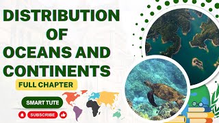
Introduction & Overview
Read summaries of the section's main ideas at different levels of detail.
Quick Overview
Standard
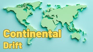
This section discusses the concept of continental drift introduced by Alfred Wegener and various forms of evidence supporting it, such as the matching coastlines, rock formations of the same age across oceans, glacial deposits, and fossil distributions. The text highlights the implications of these findings for understanding the movement of Earth's continents.
Detailed
In this section, evidence supporting the theory of continental drift is elaborated upon. Alfred Wegener's theory suggested that all continents were once part of a single landmass, termed Pangaea, which began to split around 200 million years ago into the continents we recognize today. Key evidence includes the jigsaw fit of continental coastlines, notably between Africa and South America, supporting the idea of their former connection. Geological similarities, such as rocks of the same age and formation across oceans, and glacial deposits indicating past climatic conditions further substantiate this theory. Fossil distributions of species, such as Mesosaurus in Brazil and South Africa, suggest that continents were once joined, supporting the notion of continental drift. The discussion also briefly addresses post-drift studies that introduced new evidence, including sea floor spreading and plate tectonics, which further refine our understanding of the Earth's dynamic surface.
Youtube Videos


Audio Book
Dive deep into the subject with an immersive audiobook experience.
The Matching of Continents (Jig-Saw-Fit)
Chapter 1 of 8
🔒 Unlock Audio Chapter
Sign up and enroll to access the full audio experience
Chapter Content
The shorelines of Africa and South America facing each other have a remarkable and unmistakable match. It may be noted that a map produced using a computer programme to find the best fit of the Atlantic margin was presented by Bullard in 1964. It proved to be quite perfect. The match was tried at 1,000-fathom line instead of the present shoreline.
Detailed Explanation
The coastlines of Africa and South America fit together like pieces of a jigsaw puzzle. In the 1960s, a scientist named Bullard created a computer map that confirmed how well these coastlines matched when positioned at a depth of 1,000 fathoms instead of the current shoreline. This visual similarity led scientists to conclude that these continents were once connected.
Examples & Analogies
Think about how two halves of a broken heart can fit perfectly together, showing they were once joined. Just like finding matching pieces in a puzzle, the coastlines of two continents reveal a connection that existed in the past.
Rocks of Same Age Across the Oceans
Chapter 2 of 8
🔒 Unlock Audio Chapter
Sign up and enroll to access the full audio experience
Chapter Content
The radiometric dating methods developed in the recent period have facilitated correlating the rock formation from different continents across the vast ocean. The belt of ancient rocks of 2,000 million years from Brazil coast matches with those from western Africa. The earliest marine deposits along the coastline of South America and Africa are of the Jurassic age. This suggests that the ocean did not exist prior to that time.
Detailed Explanation
Scientists have used radiometric dating, a technique for determining the age of rocks, to find that ancient rocks from Brazil are similar in age to those from western Africa. These rocks date back about 2,000 million years, and the earliest marine deposits found along the coasts of South America and Africa are from the Jurassic period. This information implies that the ocean between these continents hadn't formed yet.
Examples & Analogies
Imagine finding the same old coins in two different locations — it suggests those places were once together in the past. Just like coins from the same time period tell a story, these matching rocks indicate that the continents were once connected.
Tillite
Chapter 3 of 8
🔒 Unlock Audio Chapter
Sign up and enroll to access the full audio experience
Chapter Content
It is the sedimentary rock formed out of deposits of glaciers. The Gondawana system of sediments from India is known to have its counterparts in six different landmasses of the Southern Hemisphere. At the base, the system has thick tillite indicating extensive and prolonged glaciation. Counterparts of this succession are found in Africa, Falkland Island, Madagascar, Antarctica, and Australia. Overall resemblance of the Gondawana-type sediments clearly demonstrates that these landmasses had remarkably similar histories. The glacial tillite provides unambiguous evidence of palaeoclimates and also of drifting of continents.
Detailed Explanation
Tillite is a type of rock that forms from sediments left behind by glaciers. This rock type is found in regions that were once part of a single landmass called Gondwana, which included India and other southern continents. The presence of similar tillite across various continents indicates they shared similar climatic conditions and glacial activity, supporting the concept that these continents were once joined.
Examples & Analogies
Think of how footprints in the snow can show where someone has walked. Just as those footprints tell a story of movement and conditions, tillite tells us about the history of continents that once shared the same environment.
Placer Deposits
Chapter 4 of 8
🔒 Unlock Audio Chapter
Sign up and enroll to access the full audio experience
Chapter Content
The occurrence of rich placer deposits of gold in the Ghana coast and the absolute absence of source rock in the region is an amazing fact. The gold bearing veins are in Brazil and it is obvious that the gold deposits of Ghana are derived from the Brazil plateau when the two continents lay side by side.
Detailed Explanation
Rich gold deposits found on the Ghana coast are not supported by local source rocks, meaning they couldn't have formed there. Instead, gold found in Brazil aligns with this evidence, suggesting that when Brazil and Ghana were connected, gold eroded from Brazil eventually made its way to Ghana's shores.
Examples & Analogies
Imagine if you found treasure on an island but there was no evidence of it being buried there; it likely washed ashore from somewhere else. Similarly, the gold in Ghana points to its origin in Brazil, linking these two lands' histories.
Distribution of Fossils
Chapter 5 of 8
🔒 Unlock Audio Chapter
Sign up and enroll to access the full audio experience
Chapter Content
When identical species of plants and animals adapted to living on land or in fresh water are found on either side of the marine barriers, a problem arises regarding accounting for such distribution. The observations that Lemurs occur in India, Madagascar and Africa led some to consider a contiguous landmass ‘Lemuria’ linking these three landmasses. Mesosaurus was a small reptile adapted to shallow brackish water. The skeletons of these are found only in two localities: the Southern Cape province of South Africa and Iraver formations of Brazil. The two localities are presently 4,800 km apart with an ocean in between them.
Detailed Explanation
Fossils of the same species, such as certain lemurs found in India, Madagascar, and Africa, are puzzling because how could these animals have spread across the oceans? This has led scientists to theorize the existence of a landmass called 'Lemuria' that once connected these areas. Additionally, fossils of the Mesosaurus, a reptile found only in South Africa and Brazil, further support this idea of continental drift, since these regions are now separated by a vast ocean.
Examples & Analogies
Think of a family that lived on a large estate; after they moved away, signs of their life remained in different parts of the property. Similarly, the distribution of fossils shows that species once lived on connected land.
Force for Drifting
Chapter 6 of 8
🔒 Unlock Audio Chapter
Sign up and enroll to access the full audio experience
Chapter Content
Wegener suggested that the movement responsible for the drifting of the continents was caused by pole-fleeing force and tidal force. The polar-fleeing force relates to the rotation of the earth. You are aware of the fact that the earth is not a perfect sphere; it has a bulge at the equator. This bulge is due to the rotation of the earth. The second force that was suggested by Wegener—the tidal force—is due to the attraction of the moon and the sun that develops tides in oceanic waters. Wegener believed that these forces would become effective when applied over many million years. However, most scholars considered these forces to be totally inadequate.
Detailed Explanation
Wegener proposed two main forces that could cause continents to drift: a polar-fleeing force due to Earth's rotation and tidal forces caused by the gravitational pull of the moon and sun. The earth's shape, like a bulging ball at the equator, is also relevant to understanding this movement. However, many scientists felt that these forces were too weak to explain the observed movements over such long periods.
Examples & Analogies
Think of a spinning top: as it spins, the top may wobble or move slightly due to forces acting on it. Similarly, just as these forces affect how the top spins, the earth's rotation and tides might influence continental movement.
Post-drift Studies
Chapter 7 of 8
🔒 Unlock Audio Chapter
Sign up and enroll to access the full audio experience
Chapter Content
It is interesting to note that for continental drift, most of the evidence was collected from the continental areas in the form of distribution of flora and fauna or deposits, like tillite. A number of discoveries during the post–World War II period added new information to geological literature. Particularly, the information collected from the ocean floor mapping provided new dimensions for the study of distribution of oceans and continents.
Detailed Explanation
After Wegener's initial theory of continental drift, more evidence emerged, especially after World War II when ocean mapping became more advanced. Scientists began to find additional information about how continents and ocean floors work, thus broadening the understanding of continental drift.
Examples & Analogies
Just like how a treasure map reveals more hidden secrets about an island, ocean mapping has uncovered deeper insights into the relationships between oceans and continents.
Convectional Current Theory
Chapter 8 of 8
🔒 Unlock Audio Chapter
Sign up and enroll to access the full audio experience
Chapter Content
Arthur Holmes in 1930s discussed the possibility of convection currents operating in the mantle portion. These currents are generated due to radioactive elements causing thermal differences in the mantle portion. Holmes argued that there exists a system of such currents in the entire mantle portion. This was an attempt to provide an explanation to the issue of force, on the basis of which contemporary scientists discarded the continental drift theory.
Detailed Explanation
In the 1930s, Arthur Holmes proposed that heat from radioactive decay creates convection currents in the Earth's mantle, causing the plates above to move. This gave scientists a new way to explain how the continents could have drifted, leading to a move away from Wegener's original ideas of just two forces.
Examples & Analogies
Think of boiling water: the heat causes movement as the water circulates. These convection currents are similar to how Earth's heat powers movement beneath the surface.
Key Concepts
-
Continental Drift: The movement of Earth's continents relative to each other.
-
Jigsaw Fit: The concept that the coastlines of continents resemble pieces of a puzzle, indicating historical connections.
-
Fossil Evidence: Similar fossils found on different continents suggest they were once joined.
-
Rock Age Correlation: Similar rock formations across oceans provide evidence of a single landmass in the past.
Examples & Applications
The jigsaw fit of South America and Africa demonstrates potential past alignment.
Mesosaurus fossils found in Brazil and South Africa indicate that these continents were once connected.
Memory Aids
Interactive tools to help you remember key concepts
Rhymes
When continents drift, they shift and lift; Pangaea split, that’s the gift!
Stories
Imagine two islands (continents) that were once lovers, joined together as Pangaea, but the tides (oceanic movements) grew strong, pulling them apart over time.
Memory Tools
Remember 'Pangaea and Panthalassa' as 'Pasta and Pancakes' where continents used to dine together.
Acronyms
J-FOR
Jigsaw fit
Fossil evidence
Ocean age correlation
Rocks of same age - to recall evidence of drift!
Flash Cards
Glossary
- Continental Drift
The theory that continents have moved and are still moving across the Earth’s surface.
- Pangaea
The name of the supercontinent that existed approximately 335 million years ago.
- Panthalassa
The vast ocean surrounding Pangaea.
- Radiometric Dating
A method used to date rocks and minerals using the decay of radioactive isotopes.
- Fossil Distribution
The way in which the remains of organisms are spread out or found in different areas, indicating historical connections.
Reference links
Supplementary resources to enhance your learning experience.