
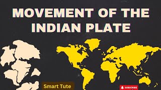
MOVEMENT OF THE INDIAN PLATE
Enroll to start learning
You’ve not yet enrolled in this course. Please enroll for free to listen to audio lessons, classroom podcasts and take practice test.
Interactive Audio Lesson
Listen to a student-teacher conversation explaining the topic in a relatable way.
Introduction to the Indian Plate
🔒 Unlock Audio Lesson
Sign up and enroll to listen to this audio lesson

Today we're going to learn about the Indian Plate. Can anyone tell me what they know about tectonic plates?

I think tectonic plates are pieces of the Earth's crust that move around.
Exactly! The Indian Plate is one of these pieces. It includes Peninsular India and part of Australia.

Why is it important?
Its movement significantly influences geological features, like the Himalayas. Can anyone name the force driving these movements?

Is it the Earth's rotation?
Good try! It's primarily due to convection currents in the mantle. These currents create forces that move the plates. Remember: 'Convection causes plates to race!'
So to recap, the Indian Plate is vital in shaping the land through its movements and interactions with other plates.
Historical Significance
🔒 Unlock Audio Lesson
Sign up and enroll to listen to this audio lesson

Let's dive into the historical movement of the Indian Plate. It began its northward journey about 200 million years ago after being part of Pangaea. What do you think led to this separation?
Was it the splitting of the supercontinent?
Right! Pangaea broke apart, leading to different continents, including our Indian Plate, separating from Australia.

How did this collision with Asia happen?
Over millions of years, the Indian Plate collided with the Eurasian Plate, causing the uplift of the Himalayas. Can anyone think of what geological evidence supports this?
It could be the presence of fossils found in both locations.
Exactly! Fossil distributions and mountain formations are strong evidence of these past movements. Remember this: 'Fossils without borders illustrate plate movements!'
In summary, the Indian Plate’s journey has been vital in shaping Asia's landscape.
Current Geological Activity
🔒 Unlock Audio Lesson
Sign up and enroll to listen to this audio lesson
Now, let's talk about current movements of the Indian Plate. How is it affecting the geography today?
I heard the Himalayas are still rising!
That's correct! The collision is ongoing, and the Himalayas are still growing taller every year.
What other effects does this movement have?
It also influences seismic activity. Can anyone explain what that means?
More earthquakes due to the tension in the plate boundaries?
Exactly, spot on! To remember: 'Years of pressure lead to trembling treasure!'
So, ruling out today's lesson, the Indian Plate is vital for understanding both historical and current geological activities.
Introduction & Overview
Read summaries of the section's main ideas at different levels of detail.
Quick Overview
Standard
The section outlines the major geological events related to the Indian Plate, including its movement from Australia towards Asia and the resultant formation of the Himalayas. It connects these movements to the broader theories of continental drift, plate tectonics, and sea floor spreading.
Detailed
Movement of the Indian Plate
The Indian Plate is a significant geological entity encompassing Peninsular India and parts of Australia. Historically, it was part of the larger supercontinent Pangaea, which began to split around 200 million years ago, leading to India's northward journey, which started approximately 200 million years ago. This journey concluded with the collision of India with the Eurasian Plate, leading to the uplift of the Himalayas and affecting geological activities in the region.
Key Points:
- Geographical Boundaries: The Indian Plate is surrounded by various tectonic boundaries, including subduction zones along the Himalayas and spreading sites near Australia.
- Historical Movement: Prior to its collision with Asia, India was separated by the Tethys Sea, emphasizing the dynamic nature of continental positions.
- Geological Impact: The movement facilitated significant geological processes, including the formation of the Deccan Traps and the rise of the Himalayas, which continues even today.
This section lays the groundwork for understanding the active geological processes and historical movements affecting the Indian subcontinent, highlighting its relevance in the theories of continental drift and plate tectonics.
Youtube Videos


Audio Book
Dive deep into the subject with an immersive audiobook experience.
Boundaries of the Indian Plate
Chapter 1 of 4
🔒 Unlock Audio Chapter
Sign up and enroll to access the full audio experience
Chapter Content
The Indian plate includes Peninsular India and the Australian continental portions. The subduction zone along the Himalayas forms the northern plate boundary in the form of continent – continent convergence. In the east, it extends through Rakinyoma Mountains of Myanmar towards the island arc along the Java Trench. The easter eastern margin is a spreading site lying to the east of Australia in the form of an oceanic ridge in SW Pacific. The Western margin follows Kirthar Mountain of Pakistan.
Detailed Explanation
The Indian Plate is comprised of Peninsular India and parts of Australia. The plate has distinct boundaries, including a northern boundary where it converges with the Eurasian Plate at the Himalayas, leading to mountain formation. In the east, it interacts with the oceanic ridge near Australia, which is a site of new crust formation. On the western side, the boundary is defined by the Kirthar Mountains in Pakistan. Understanding these boundaries is important for studying tectonic activities, such as earthquakes and mountain-building processes.
Examples & Analogies
Think of the Indian Plate as a large puzzle piece that fits into a bigger jigsaw puzzle of the Earth's surface. Just as the edges of the puzzle pieces might meet or overlap, the boundaries of the Indian Plate come together with other plates, which can create features like mountains when they collide.
Historical Context of the Indian Plate Movement
Chapter 2 of 4
🔒 Unlock Audio Chapter
Sign up and enroll to access the full audio experience
Chapter Content
India was a large island situated off the Australian coast, in a vast ocean. The Tethys Sea separated it from the Asian continent till about 225 million years ago. India is supposed to have started her northward journey about 200 million years ago at the time when Pangaea broke. India collided with Asia about 40-50 million years ago causing rapid uplift of the Himalayas.
Detailed Explanation
Around 200 million years ago, during the breakup of the supercontinent Pangaea, India began its movement towards the north. Prior to this, it was an isolated island separated by the Tethys Sea. As it moved northward, it collided with the Eurasian Plate approximately 40-50 million years ago, leading to the dramatic rise of the Himalayas. This movement is an excellent example of how tectonic activity shapes the Earth's landscape over millions of years.
Examples & Analogies
Imagine if two enormous pieces of clay were pushed together. At first, they are separate, but as you push them towards each other, they start to crumble and form new shapes. This is similar to how India and Asia collided, creating the towering Himalayas out of the once flat land.
Formation of the Deccan Traps
Chapter 3 of 4
🔒 Unlock Audio Chapter
Sign up and enroll to access the full audio experience
Chapter Content
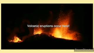
During the movement of the Indian plate towards the Eurasian plate, a major event that occurred was the outpouring of lava and formation of the Deccan Traps. This started somewhere around 60 million years ago and continued for a long period of time.
Detailed Explanation
While the Indian Plate was moving north, volcanic activity resulted in the formation of the Deccan Traps, which are extensive volcanic plateaus located in central India. This event began around 60 million years ago and significantly altered the landscape of the region. The eruptions contributed to the geological history of India and had ecological impacts, influencing climate and biodiversity.
Examples & Analogies
Think of a soda bottle that has been shaken. When you open it, the soda bursts out in a big frothy splash. In a similar way, the volcanic eruptions that formed the Deccan Traps were like an enormous soda bottle bursting, filling the landscape with layers of lava.
Ongoing Movement of the Himalayas
Chapter 4 of 4
🔒 Unlock Audio Chapter
Sign up and enroll to access the full audio experience
Chapter Content
Scientists believe that the process of the Himalayas rising is still continuing and the height of the Himalayas is rising even to this date.
Detailed Explanation
The Himalayas are not static; they continue to grow as the Indian Plate pushes against the Eurasian Plate. This ongoing movement results in frequent seismic activity and geologic changes in the region. The height of the mountain range slowly increases due to this tectonic pressure, indicating that our planet is constantly changing.
Examples & Analogies
Imagine how a pile of snow looks when a gentle wind keeps blowing more flakes onto it. The snow pile keeps growing, just like how the Himalayas are still rising today due to the pressure from tectonic plates.
Key Concepts
-
Indian Plate: The tectonic plate that forms the geography of Peninsular India.
-
Continental Drift: The theory suggesting continents have moved over geological time.
-
Subduction Zone: An area where one tectonic plate slides under another, contributing to geological activity.
-
Plate Tectonics: The theory that describes the movement and interaction of Earth's plates.
Examples & Applications
The formation of the Himalayas as a result of the Indian Plate colliding with the Eurasian Plate.
The presence of similar fossils on either side of the Atlantic Ocean supports the theory of continental drift.
Memory Aids
Interactive tools to help you remember key concepts
Rhymes
Indian Plate's rise, meets the Eurasian skies; Himalayas so high, as continents goodbye.
Stories
Once upon a time, India and Asia were friends, separated by an ocean but destined to blend. Their journey began as they drifted apart, colliding to create a grand mountain's start.
Memory Tools
Remember 'DC' for Drift and Collision – the phases of the Indian Plate’s journey leading to the Himalayas.
Acronyms
IPS for Indian Plate Significance – 'I' for India, 'P' for Plates, 'S' for the Significance in geological shaping.
Flash Cards
Glossary
- Indian Plate
A tectonic plate that includes Peninsular India and parts of Australia.
- Pangaea
The supercontinent that existed approximately 300 million years ago.
- Tethys Sea
The ancient ocean that separated the Indian Plate from the Asian continent.
- Himalayas
A major mountain range formed due to the collision of the Indian Plate and the Eurasian Plate.
- Convection Currents
Flow of molten rock in the mantle, which drives the movement of tectonic plates.
Reference links
Supplementary resources to enhance your learning experience.