
Contemporary Developments in Seismic Scaling
Enroll to start learning
You’ve not yet enrolled in this course. Please enroll for free to listen to audio lessons, classroom podcasts and take practice test.
Interactive Audio Lesson
Listen to a student-teacher conversation explaining the topic in a relatable way.
Introduction to ShakeMap Systems
🔒 Unlock Audio Lesson
Sign up and enroll to listen to this audio lesson

Today we’re discussing the ShakeMap systems developed by USGS. Can anyone tell me why real-time intensity maps are important during an earthquake?

They help in understanding how severe the shaking is across different areas, right?
Exactly! These maps allow emergency responders to allocate resources effectively. Now, ShakeMap combines magnitude and ground motion data; who can explain how this data is crucial?

It gives a quick overview of where the earthquake had the most effect, helping to prioritize areas for help.
Perfect! So remember, ShakeMap = real-time + data synthesis. Let’s recap: ShakeMap systems are vital for emergency response and communication.
Internet-Based Macroseismic Data Collection
🔒 Unlock Audio Lesson
Sign up and enroll to listen to this audio lesson

Now, let’s discuss the Did You Feel It? program. How do you think public input can enhance our understanding of earthquakes?

It might give us information on shaking effects in places where we don’t have instruments.
Exactly! This program takes subjective experiences from the public and turns them into objective intensity values. Why is this useful?

It creates a more complete picture of the earthquake's impact, especially in under-instrumented areas.
Well stated! Remember this: DYFI = public + scientific data, which helps in understanding seismic events better.
Applications of ShakeMap and DYFI in Disaster Response
🔒 Unlock Audio Lesson
Sign up and enroll to listen to this audio lesson
Let’s analyze how ShakeMap and DYFI can improve disaster response during an earthquake. Can anyone provide a scenario where these would be critical?
If a major quake hits a city, responders can use ShakeMap to see which areas are hardest hit.
And with DYFI, they can gather immediate feedback from residents to assess damage.
Great connection! Combining immediate data with public reports forms a strong basis for action. Let’s summarize: ShakeMap + DYFI = effective disaster management.
Introduction & Overview
Read summaries of the section's main ideas at different levels of detail.
Quick Overview
Standard
The section explores contemporary developments in seismic scaling, emphasizing the development and application of ShakeMap systems for real-time intensity mapping and the integration of public engagement in seismic data collection through initiatives like Did You Feel It? (DYFI). These tools enhance disaster response and improve our understanding of seismic events.
Detailed
Contemporary Developments in Seismic Scaling
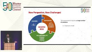
This section addresses important recent advancements in how seismic data is scaled and interpreted. The first notable development is the ShakeMap system, created by the USGS, which synthesizes instrumental data, such as magnitude and ground motion, into real-time maps that display earthquake intensity across different regions. This system plays a crucial role in disaster response by assisting in resource allocation and enhancing communication about seismic events.
Additionally, the Did You Feel It? (DYFI) program represents a significant leap in collecting macroseismic data by utilizing the public's observations of earthquakes to supplement scientific data. By converting subjective eyewitness accounts into quantitative intensity values, this initiative helps to create a more comprehensive picture of earthquake impacts, especially in areas where instrumental data is sparse. Such developments are pivotal in refining our understanding of seismic events and improving engineering protocols and community safety strategies.
Youtube Videos


Audio Book
Dive deep into the subject with an immersive audiobook experience.
ShakeMap Systems
Chapter 1 of 2
🔒 Unlock Audio Chapter
Sign up and enroll to access the full audio experience
Chapter Content
• Developed by USGS and adopted worldwide.
• Combine instrumental data (magnitude, ground motion) and IPEs to produce real-time intensity maps.
• Used for disaster response, resource allocation, and communication.
Detailed Explanation
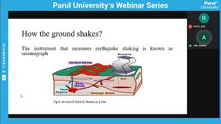
ShakeMap Systems are advanced tools created by the U.S. Geological Survey (USGS) to provide real-time data about seismic events. They work by combining information from instruments that measure the magnitude of earthquakes and the actual ground motion experienced during those events. By integrating this data with Intensity Prediction Equations (IPEs), ShakeMaps produce detailed maps that show the intensity of shaking in various locations following an earthquake. These maps are crucial for informing emergency responders, aiding in resource allocation, and communicating relevant information to the public during disaster situations.
Examples & Analogies
Think of ShakeMap Systems as a weather app for earthquakes. Just like a weather app provides real-time updates on storms, temperatures, and alerts, ShakeMaps deliver updates on the intensity of ground shaking after an earthquake. This allows first responders to quickly understand where help is needed most and ensures that resources are allocated efficiently.
Internet-Based Macroseismic Data Collection
Chapter 2 of 2
🔒 Unlock Audio Chapter
Sign up and enroll to access the full audio experience
Chapter Content
• Did You Feel It? (DYFI) program gathers public input.
• Converts subjective observations into intensity values.
• Enhances data granularity in low-instrumentation areas.
Detailed Explanation
The 'Did You Feel It?' (DYFI) program is an initiative that allows the general public to report their experiences during an earthquake. When an earthquake occurs, individuals can submit their observations regarding how strong they felt the shaking, how long it lasted, and any damage they noticed. This input is then converted into quantifiable intensity values that contribute to the overall understanding of the earthquake's impact. Particularly in areas with few seismic instruments, this program is invaluable as it provides a rich source of data that helps to create a more detailed picture of the earthquake's effects.
Examples & Analogies
Imagine you are at a concert and it's so loud that you can barely hear yourself think. If someone asked you how loud it was, your description based on your feelings would vary from someone sitting far away who might say it was only moderately loud. The DYFI program operates in a similar way; it gathers these personal accounts and translates them into measurable data, giving researchers a fuller understanding of how different communities experienced the earthquake's shaking.
Key Concepts
-
ShakeMap: A system that provides real-time intensity mapping of earthquakes using instrumental data.
-
Did You Feel It? (DYFI): A program that leverages public input to improve seismic data collection and enhance understanding of earthquake impacts.
Examples & Applications
ShakeMap is used during significant earthquakes like the 2011 earthquake in Japan, providing real-time information on shaking intensity to aid in rescue efforts.
The DYFI program saw thousands of responses during the 2014 Napa earthquake, allowing researchers to assess areas affected by shaking even in regions without many seismic stations.
Memory Aids
Interactive tools to help you remember key concepts
Rhymes
ShakeMap shows where the quake is strong, helping responders to carry on.
Stories
Imagine a town shaken by an earthquake. First, the ShakeMap tells the rescuers where to go, then the local folks share their feelings through DYFI, adding more details to the map.
Memory Tools
Remember 'SAY' for ShakeMap: S for Synthesis of data, A for Allocation of resources, Y for Yielding real-time information.
Acronyms
DYFI = Did You Feel It? First responders can collect 'Yes' or 'No' to gauge impact.
Flash Cards
Glossary
- ShakeMap
A system created by the USGS that produces real-time maps showing earthquake intensity based on ground motion data.
- Did You Feel It? (DYFI)
A program that collects public reports of earthquakes to convert subjective observations into intensity values.
- Intensity Maps
Visual representations of earthquake intensity across different geographical areas, computed from instrumental and observational data.
Reference links
Supplementary resources to enhance your learning experience.