
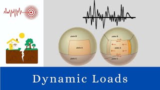
Plate Tectonics and Engineering Considerations
Enroll to start learning
You’ve not yet enrolled in this course. Please enroll for free to listen to audio lessons, classroom podcasts and take practice test.
Interactive Audio Lesson
Listen to a student-teacher conversation explaining the topic in a relatable way.
Seismic Hazard Mapping
🔒 Unlock Audio Lesson
Sign up and enroll to listen to this audio lesson

Today, we'll discuss how seismic hazard mapping is influenced by tectonic activity. Can someone tell me what seismic hazard mapping involves?

It's about figuring out where earthquakes are likely to happen, right?
Yes! Seismic hazard mapping aims to identify fault lines and regions that are vulnerable to earthquakes. This involves understanding tectonic plate boundaries. Who can explain the types of plate boundaries?

There are divergent, convergent, and transform boundaries!
Correct! Each of these boundaries behaves differently. For example, at convergent boundaries, where plates collide, seismic risks are often higher. Let’s remember: 'Dancing Plates' for Divergent, 'Clashing Plates' for Convergent, and 'Sliding Plates' for Transform. Can anyone give an example of a location with a convergent boundary?

The Nazca and South American Plates!
Exactly! Understanding these dynamics helps engineers prepare better. Recap: Seismic hazard mapping helps us understand risk by looking at plate activities.
Building Codes and Standards
🔒 Unlock Audio Lesson
Sign up and enroll to listen to this audio lesson

Next, let’s talk about building codes. Why do you think building codes are crucial in earthquake-prone areas?
To make sure buildings don’t fall during an earthquake?
Exactly! Building codes, like IS 1893, establish the foundation for frameworks to ensure structures can withstand seismic forces. They are informed by seismic hazard assessments. Any thoughts on what might be included in an earthquake-resistant design?
Um, maybe things like flexible materials or special foundations?
Great points! Foundation isolation allows buildings to move independently for minimal shaking. Remember: 'Flexibility is Key to Parity and Durability.' Can someone summarize these components?

We need to use flexible materials and designs to keep buildings standing during earthquakes!
Spot on! Understanding the geology and engineering standards saves lives.
Earthquake-Resistant Design
🔒 Unlock Audio Lesson
Sign up and enroll to listen to this audio lesson
Finally, let’s discuss earthquake-resistant design techniques. What kind of mechanisms can be integrated into buildings?
Energy dissipating systems?
Absolutely! Energy-dissipating mechanisms help absorb the energy from seismic waves. Can anyone define foundation isolation?
It’s a way to separate the building from ground motion.
Exactly! Both strategies reduce the impact of quakes. To remember, think: 'ICE'—Isolation, Control energy, Enhance structural integrity. Why is this relevant for engineers?
So we can design safer buildings?
Yes! In summary, engineers study plate tectonics to enhance safety and resilience in design.
Introduction & Overview
Read summaries of the section's main ideas at different levels of detail.
Quick Overview
Standard
The interaction of tectonic plates significantly influences seismic hazards, thus understanding these dynamics is crucial for civil engineers. Key aspects include seismic hazard mapping, the formulation of relevant building codes, and the implementation of earthquake-resistant design practices.
Detailed
Detailed Summary
The interplay between tectonic plates plays a critical role in civil engineering, especially in the realm of earthquake preparedness and structural resilience. Engineers leverage an understanding of tectonic movements to:
- Seismic Hazard Mapping: Identifying fault lines and vulnerable regions helps assess risk levels in various geographic areas prone to earthquakes. This mapping serves as a foundational step in disaster preparedness and mitigation strategies.
- Building Codes: Engineering standards, such as IS 1893 in India, are essential for defining the minimum requirements for building designs to withstand specific seismic loads. These codes integrate local geological and tectonic information to enhance safety.
- Earthquake-Resistant Design: The design can incorporate techniques such as foundation isolation, ductile design, and energy-dissipating mechanisms that allow structures to absorb and mitigate seismic forces.
In essence, the knowledge gained from studying plate tectonic interactions equips civil engineers with the tools necessary to design structures that are not only robust but capable of saving lives during seismic events.
Youtube Videos


Audio Book
Dive deep into the subject with an immersive audiobook experience.
Importance of Understanding Plate Tectonics for Engineers
Chapter 1 of 4
🔒 Unlock Audio Chapter
Sign up and enroll to access the full audio experience
Chapter Content
Understanding plate tectonics aids civil engineers in:
Detailed Explanation
This chunk highlights the significance of plate tectonics knowledge for civil engineers. By understanding how tectonic plates interact, engineers can make better decisions when designing buildings and infrastructure in areas at risk for earthquakes. This is crucial in all phases of construction, from planning to execution.
Examples & Analogies
Think of building a house in areas known for heavy rainfall. Just like you would ensure proper drainage and waterproofing to prevent water damage, engineers must consider tectonic movements in earthquake-prone areas to build structures that can withstand those forces.
Seismic Hazard Mapping
Chapter 2 of 4
🔒 Unlock Audio Chapter
Sign up and enroll to access the full audio experience
Chapter Content
• Seismic Hazard Mapping: Identifying fault lines, vulnerable zones.
Detailed Explanation
Seismic hazard mapping is a process where engineers and geologists come together to identify areas more likely at risk for earthquakes. This involves mapping out existing fault lines and identifying zones that may be more vulnerable to seismic activity. Such maps help in planning and can guide engineers on where to build and how to improve safety measures.
Examples & Analogies
It's similar to how meteorologists create weather maps that show where storms are likely to hit. By using these maps, they can warn residents in those areas to prepare accordingly. In engineering, seismic hazard maps serve a similar purpose for earthquake preparedness.
Building Codes
Chapter 3 of 4
🔒 Unlock Audio Chapter
Sign up and enroll to access the full audio experience
Chapter Content
• Building Codes: Designing structures to withstand seismic loads (e.g., IS 1893).
Detailed Explanation
Building codes are guidelines established to ensure that structures can withstand specific loads, including seismic loads from earthquakes. For example, IS 1893 is an Indian standard that outlines how buildings should be designed to resist earthquakes. These codes stipulate materials and methods that provide extra stability and reduce the risk of collapse during an earthquake.
Examples & Analogies
Imagine if you had to design a bridge that is safe enough for heavy trucks to pass over. You'd need to consider the weight it must support, similar to how buildings need to be designed for the shaking and forces caused by an earthquake.
Earthquake-Resistant Design
Chapter 4 of 4
🔒 Unlock Audio Chapter
Sign up and enroll to access the full audio experience
Chapter Content
• Earthquake-Resistant Design: Foundation isolation, ductile design, and energy-dissipating mechanisms.
Detailed Explanation
Earthquake-resistant design utilizes various methods to make buildings more resilient. Foundation isolation involves technologies that allow the base of a building to move separately from the ground motion during an earthquake. Ductile design refers to the ability of a building material to deform without breaking, allowing it to absorb energy. Energy-dissipating mechanisms help absorb and minimize the force of an earthquake, protecting the structure.
Examples & Analogies
It's like setting a cup on a rubber mat instead of directly on the table. The mat absorbs some bumps or shakes, similar to how an isolated foundation can absorb seismic forces, safeguarding the structure above.
Key Concepts
-
Seismic Hazard Mapping: Identifying vulnerable zones crucial for disaster management.
-
Building Codes: Standards ensuring structural integrity against earthquakes.
-
Earthquake-Resistant Design: Techniques designed to minimize quake impact.
Examples & Applications
Seismic hazard mappings direct urban planning to mitigate risks in places like California.
Building codes like IS 1893 ensure buildings in seismic zones can withstand expected earthquakes.
Memory Aids
Interactive tools to help you remember key concepts
Rhymes
When first we feel the quake, buildings must not break.
Stories
Imagine a wise old architect who always checks seismic maps to protect his village from earthquakes, ensuring every home is built strong and safe.
Memory Tools
Remember ICE for earthquake design: Isolation, Control Energy, Enhance durable structures.
Acronyms
SEISMIC for Seismic Engineering
Safety
Engineering
Integrity
Strength
Mitigation
Inspection
Construction.
Flash Cards
Glossary
- Seismic Hazard Mapping
The process of identifying fault lines and assessing regions prone to earthquakes.
- Building Codes
Standards set to ensure structures can withstand seismic forces, such as IS 1893.
- EarthquakeResistant Design
Engineering techniques aimed at minimizing damage from seismic events, including foundation isolation.
Reference links
Supplementary resources to enhance your learning experience.