
Error Handling in Remote Sensing and Image Processing
Enroll to start learning
You’ve not yet enrolled in this course. Please enroll for free to listen to audio lessons, classroom podcasts and take practice test.
Interactive Audio Lesson
Listen to a student-teacher conversation explaining the topic in a relatable way.
Introduction to Errors in Remote Sensing
🔒 Unlock Audio Lesson
Sign up and enroll to listen to this audio lesson

Today, we'll explore the concept of errors in remote sensing. Errors can originate from various sources, impacting the accuracy of our images. Can anyone tell me why we might encounter errors in satellite or aerial images?

Maybe because of the way satellites move? They might shift when taking images.
Exactly! Platform motion is one of the factors. We also have sensor characteristics and atmospheric conditions that distort images. This is very important for ensuring the quality of data we analyze.

What kind of distortions are we talking about?
Good question! We mainly focus on geometric distortions, which affect spatial representation, and radiometric errors, which impact pixel brightness.

So, what can we do about these errors?
We can apply various correction techniques. Let’s dive into geometric distortions and see how we can address these issues.
Geometric Distortions and Corrections
🔒 Unlock Audio Lesson
Sign up and enroll to listen to this audio lesson

Now, let's focus on geometric errors. These distort the spatial representation of features. Can anyone list some common causes?

I think Earth curvature and sensor alignment might be a part of it.
That’s correct! Other factors include terrain-induced displacements and issues with satellite motion. To fix these, we utilize correction techniques such as systematic geometric corrections and orthorectification. Can someone explain what orthorectification does?
It's when we use a Digital Elevation Model to correct for terrain effects, right?
Exactly! That helps achieve true spatial accuracy.
What is image-to-image registration?
It's aligning one image to a reference image using Ground Control Points. This method ensures multiple images can be compared accurately.
Radiometric Errors and Correction Methods
🔒 Unlock Audio Lesson
Sign up and enroll to listen to this audio lesson
Let’s discuss radiometric errors, which affect the pixel brightness and spectral fidelity of images. What might some sources of radiometric errors be?
Could it be sensor noise or variations in the sun angle?
Great! Those are indeed sources. Atmospheric scattering and absorption also contribute to these errors. To minimize these inconsistencies, we can normalize radiometric values using reference targets. What can you tell me about atmospheric correction models?
Models like DOS and FLAASH help reduce the atmospheric effects on images!
Exactly! And histogram matching helps adjust pixel values across different images, especially useful in change detection.
Introduction & Overview
Read summaries of the section's main ideas at different levels of detail.
Quick Overview
Standard
Errors are inevitable in remote sensing due to factors like platform motion and atmospheric conditions. This section outlines common geometric and radiometric distortions, their causes, and the techniques used to correct these errors to optimize the integrity of remote sensing data.
Detailed
Error Handling in Remote Sensing and Image Processing
In remote sensing, it’s crucial to recognize that errors stem from a variety of sources, including platform motion, sensor characteristics, and atmospheric influences. This section emphasizes the importance of error handling for deriving meaningful spatial data. It begins by defining geometric and radiometric errors, detailing their origins, and explaining essential correction methods.
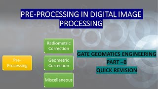
1. Geometric Distortions
Geometric errors distort how features are spatially represented. Common causes include:
- Earth curvature and rotation: Affecting the accuracy of images.
- Sensor alignment issues: Leading to misrepresentation of features.
- Terrain-induced displacement: Such as relief displacement where hills cause the image to distort.
- Satellite motion and instability: Impacting the positioning of the captured images.
Correction Techniques:
- Systematic geometric corrections: Use calibration models to adjust images precisely.
- Image-to-image registration: Involves aligning images to a reference image through Ground Control Points (GCPs).
- Orthorectification: Employs a Digital Elevation Model (DEM) to remove terrain effects to ascertain true spatial locations.
2. Radiometric Errors
Radiometric errors deal with pixel brightness and spectral fidelity issues, influenced by factors such as:
- Sensor noise: Random variations in sensor output.
- Sun angle variation: Causes differences in reflectance.
- Atmospheric scattering and absorption: Altering how light interacts with the atmosphere before reaching the sensor.
Correction Methods:
- Radiometric normalization: Uses reference targets to standardize pixel values across images.
- Atmospheric correction models: Applications like Dark Object Subtraction (DOS) and the Fast Line-of-sight Atmospheric Analysis of Spectral Hypercubes (FLAASH) are standard methods.
- Histogram matching: A technique for aligning pixel values between images used for change detection.
Effective error handling ensures enhanced data integrity, increasing the relevance of remote sensing applications in diverse fields.
Youtube Videos


Audio Book
Dive deep into the subject with an immersive audiobook experience.
Inherent Errors in Remote Sensing
Chapter 1 of 3
🔒 Unlock Audio Chapter
Sign up and enroll to access the full audio experience
Chapter Content
Errors are inherent in satellite and aerial imagery due to a variety of factors such as platform motion, sensor characteristics, and atmospheric conditions. Efficient error handling and correction are crucial to derive meaningful information.
Detailed Explanation
This chunk explains that satellite and aerial images are subject to errors because of various factors. These include the movement of the platform (like satellites or drones), variations in how sensors operate, and conditions in the atmosphere that can interfere with data capture. To make the images useful, it is important to identify and correct these errors effectively.
Examples & Analogies
Imagine you're taking a picture with your smartphone, and the wind is blowing. If you don’t hold your phone steady, the picture can be blurry. Similarly, if a satellite is moving while capturing an image, it can distort the final image. Just like you would adjust the focus or retake the picture for better clarity, similar corrections are applied in remote sensing.
Geometric Distortions
Chapter 2 of 3
🔒 Unlock Audio Chapter
Sign up and enroll to access the full audio experience
Chapter Content
Geometric errors distort the spatial representation of features. Common causes include:
- Earth curvature and rotation.
- Sensor alignment issues.
- Terrain-induced displacement (relief displacement).
- Satellite motion and attitude instability.
Correction Techniques:
- Systematic geometric corrections: Applied using sensor calibration models.
- Image-to-image registration: Aligns one image to a reference using Ground Control Points (GCPs).
- Orthorectification: Removes terrain effects using a Digital Elevation Model (DEM) and sensor metadata.
Detailed Explanation
Geometric distortions affect how accurately we can represent places in digital images. Factors causing these distortions include the curvature and rotation of the Earth, problems in how sensors are positioned, changes in the landscape, and the movement or tilt of the satellite themselves. To correct these, different techniques are used:
1. Systematic geometric corrections utilize models that relate to how the sensor should ideally behave.
2. Image-to-image registration involves aligning a new image with a reference using known points, which ensures accuracy across images.
3. Orthorectification corrects terrain effects to make measurements on the map align correctly with real-world locations.
Examples & Analogies
Think about using a map while hiking. If the map isn't aligned right because of hills or valleys, it can lead you in the wrong direction. Just like you use a compass to align your map accurately, similar processes are used to adjust satellite images so we can understand the Earth correctly.
Radiometric Errors
Chapter 3 of 3
🔒 Unlock Audio Chapter
Sign up and enroll to access the full audio experience
Chapter Content
Radiometric inconsistencies affect pixel brightness and spectral fidelity. Sources include:
- Sensor noise.
- Sun angle variation.
- Atmospheric scattering and absorption.
Correction Methods:
- Radiometric normalization using reference targets.
- Atmospheric correction models (e.g., DOS, FLAASH).
- Histogram matching between images for mosaic making or change detection.
Detailed Explanation
Radiometric errors pertain to how well the colors and brightness levels in images represent true conditions. These inconsistencies can arise from sensor noise (random variations in sensor response), changes in the sun's angle (which can cast different shadows), and atmospheric conditions (that can scatter or absorb light before it reaches the sensor). To correct these errors, methods like using known reference targets for calibration, applying atmospheric correction models if the atmospheric influences are known, and histogram matching are performed to ensure that images can be compared accurately or combined into a mosaic.
Examples & Analogies
Consider a day where the sunlight is stronger; pictures taken under such conditions might appear very bright or washed out. If you were to use filters or adjust the brightness and contrast while editing, you would improve the image quality just like radiometric corrections improve the data captured by remote sensors.
Key Concepts
-
Geometric Distortions: Errors in spatial representation.
-
Radiometric Errors: Issues affecting pixel brightness.
-
Correction Techniques: Methods used to rectify errors.
Examples & Applications
An example of geometric distortion is relief displacement where hilly areas cause images to appear skewed.
Radiometric error can occur due to sensor noise, impacting the accuracy of spectral data captured.
Memory Aids
Interactive tools to help you remember key concepts
Rhymes
To keep the images right, calibrate with all your might!
Stories
Imagine a satellite flying over tall mountains; it takes photos, but the peaks make the pictures look off. The clever scientist uses a DEM to straighten the visuals so we can understand the landscape beneath.
Acronyms
Remember the acronym CAR
Correction
Adjustment
Registration.
GRIP
Geometry
Radiometric
Integration
Processing - the key elements of image correction.
Flash Cards
Glossary
- Geometric Distortions
Errors that distort the spatial representation of features in satellite and aerial imagery.
- Radiometric Errors
Inconsistencies in pixel brightness and spectral fidelity caused by environmental factors.
- Orthorectification
A process that removes terrain effects from images using a Digital Elevation Model.
- ImagetoImage Registration
Aligning one image to another using Ground Control Points for accurate comparison.
- Atmospheric Correction
Techniques that adjust imagery to account for atmospheric scattering and absorption.
Reference links
Supplementary resources to enhance your learning experience.