
Error Propagation in Geospatial Data
Enroll to start learning
You’ve not yet enrolled in this course. Please enroll for free to listen to audio lessons, classroom podcasts and take practice test.
Interactive Audio Lesson
Listen to a student-teacher conversation explaining the topic in a relatable way.
Introduction to Error Propagation
🔒 Unlock Audio Lesson
Sign up and enroll to listen to this audio lesson

Today, we’ll explore error propagation, which tells us how uncertainties in data can affect our results in geospatial analysis. Can anyone explain why understanding this is essential?

It helps ensure the accuracy of data we use and the decisions we make.

If we don’t understand errors, we might make mistakes in our conclusions!
Exactly! Errors can arise from various sources, and if we don’t account for them properly, we risk misleading information. Let's dig deeper into how these errors propagate.
How Errors Accumulate
🔒 Unlock Audio Lesson
Sign up and enroll to listen to this audio lesson

Errors can amplify or accumulate during operations like overlaying or transforming coordinates. Who can give me an example of such operations?

When we overlay different maps, the inaccuracies can stack up and affect what we see.

And in buffering, if the original data has errors, the buffer zones will be inaccurate too.
Great insights! So, understanding where these errors arise and how they propagate is vital for analyzing our geospatial data accurately.
Analytical Approaches to Error Propagation
🔒 Unlock Audio Lesson
Sign up and enroll to listen to this audio lesson
In the context of understanding error propagation, we use analytical methods like Taylor Series Expansion. Can anyone explain what that entails?
Isn't it about approximating how small changes in input affect the output?
Exactly, well done! Additionally, we also use first-order error propagation equations to estimate the output variance from known variances in inputs. Why do you think these methods are critical?
They help us predict how much uncertainty we might expect in our results!
Monte Carlo Simulations
🔒 Unlock Audio Lesson
Sign up and enroll to listen to this audio lesson
Let's talk about Monte Carlo simulations. They are especially useful when dealing with the randomness of input errors. Who can tell me what this simulation involves?
It means you run many simulations with random inputs to see the variability of results!
Yeah! This helps us understand the range of possible outcomes based on different input scenarios!
Great understanding! Monte Carlo simulations allow us to visualize the uncertainty in our outputs, effectively complementing the analytical methods we discussed.
Recap and Importance of Error Propagation
🔒 Unlock Audio Lesson
Sign up and enroll to listen to this audio lesson
To wrap up our session on error propagation, can anyone summarize the key concepts we explored today?
We learned that errors in input data can magnify during computations, and understanding this is crucial for accurate geospatial analysis.
Also, we discussed analytical methods like Taylor Series and first-order equations, along with Monte Carlo simulations for visualizing outcomes!
Excellent recap! Understanding error propagation helps us make better decisions based on our geospatial analyses.
Introduction & Overview
Read summaries of the section's main ideas at different levels of detail.
Quick Overview
Standard
This section explains error propagation in geospatial data, detailing how inaccuracies in input data can amplify through various operations such as overlaying, buffering, and transformations. It introduces analytical methods and Monte Carlo simulations as key approaches to understanding and estimating output variability.
Detailed
Error Propagation in Geospatial Data
Error propagation is a critical concept in geospatial analysis that describes how uncertainties and errors in input data can significantly impact the results generated from geospatial computations. These inaccuracies may arise from measurement errors, instrument limitations, or environmental factors, and understanding their propagation is essential for ensuring the reliability of spatial analysis outcomes.
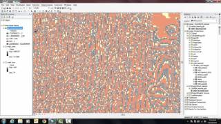
Input data errors can accumulate or amplify during various operations, including overlay operations, buffering, interpolation, and coordinate transformations. The processes by which these errors affect the results require careful examination and quantification.
Analytical Methods
To analyze and predict how errors propagate through computations, two primary methods are often employed:
- Taylor Series Expansion: This method linearizes non-linear models to approximate how small changes in input data affect the output.
- First-order Error Propagation Equations: These equations estimate the variance of output based on known variances in input data, providing a way to quantify uncertainty in results.
Monte Carlo Simulations
For cases where input errors are random or when dealing with non-linear models, Monte Carlo simulations are utilized. These simulations involve generating a wide range of random inputs to evaluate the distribution and variability of possible outcomes, helping researchers understand the range of potential results based on different input scenarios.
In summary, comprehending error propagation is vital for data integrity in geospatial analysis, facilitating the adoption of rigorous methods to evaluate and mitigate errors in analyses.
Youtube Videos


Audio Book
Dive deep into the subject with an immersive audiobook experience.
Concept of Error Propagation
Chapter 1 of 4
🔒 Unlock Audio Chapter
Sign up and enroll to access the full audio experience
Chapter Content
Error propagation refers to how input data uncertainties affect the final result of a computation.
Detailed Explanation
Error propagation is a critical concept in geospatial analysis, focusing on how uncertainties in the input data influence the accuracy of the output results. This means that if the initial data used for calculations has errors, these errors can accumulate or amplify as they move through different computational processes.
Examples & Analogies
Imagine baking a cake. If you measure 1 cup of flour but accidentally only put in 3/4 of a cup due to a measuring error, the cake won’t rise as it should. As you add more ingredients, the initial shortfall multiplies, leading to a cake that is flat and dense. Similarly, in geospatial analysis, small errors can significantly affect the final outcome.
How Errors Accumulate
Chapter 2 of 4
🔒 Unlock Audio Chapter
Sign up and enroll to access the full audio experience
Chapter Content
In spatial analysis and GIS operations, input data errors can accumulate or amplify due to:
• Overlay operations.
• Buffering and interpolation.
• Coordinate transformations.
Detailed Explanation
In GIS operations, several processes can cause errors to accumulate. When different layers of data are overlaid, any inaccuracies in those layers can lead to compounded errors in the final analysis. Buffering, which creates areas around features, can also stretch and multiply these errors, depending on the size of the buffer. Additionally, when coordinate transformations are performed (changing data from one coordinate system to another), errors can propagate through the transformation process, leading to greater inaccuracies.
Examples & Analogies
Think of an old-fashioned photocopying machine. The first copy might look fine, but if you make a copy of that copy, the quality degrades further. Each time you copy, small imperfections multiply, resulting in a final product that might look nothing like the original. In geospatial data analysis, if you don't mind the initial errors, each step taken with that data can lead to outputs that are significantly worse than the original information.
Analytical Methods for Error Propagation
Chapter 3 of 4
🔒 Unlock Audio Chapter
Sign up and enroll to access the full audio experience
Chapter Content
• Taylor Series Expansion for linearizing non-linear models.
• First-order error propagation equations to estimate output variance.
Detailed Explanation
To manage and understand error propagation, analytical methods are utilized. The Taylor Series Expansion is a mathematical tool that helps in simplifying complex, non-linear models by approximating them with linear functions. This makes it easier to analyze how changes in input affect the output. Additionally, first-order error propagation equations are employed to estimate the output variance based on the uncertainties in the input data. These equations provide a straightforward way to quantify potential errors in computational results.
Examples & Analogies
Consider driving a car on a winding road. If you know how much your steering can vary, you can predict how much it will affect your path. Using Taylor Series to simplify your path understanding is like calculating how slight misalignments in steering can lead to larger directional changes. Similarly, in error propagation, by estimating the impacts of small input uncertainties, we can better anticipate where results may deviate.
Monte Carlo Simulations
Chapter 4 of 4
🔒 Unlock Audio Chapter
Sign up and enroll to access the full audio experience
Chapter Content
Used when input errors are stochastic or the model is non-linear. Randomized simulations help in understanding probable output variability.
Detailed Explanation
Monte Carlo Simulations serve as a powerful computational technique for exploring how uncertainties in input data can affect output results. This method involves running numerous simulations with varied inputs to account for randomness and non-linearity in real-world systems. Consequently, by examining a wide array of possible outcomes, we can calculate the likelihood of different results and better understand the degree of certainty associated with our findings.
Examples & Analogies
Imagine playing a board game, where dice rolls create unpredictable outcomes. If you wanted to determine your chances of winning based on different strategies, you might simulate multiple games using various approaches. Monte Carlo Simulations work similarly by running many scenarios to see how different uncertainties affect the outcome, allowing analysts to predict the likelihood of achieving certain results.
Key Concepts
-
Error Propagation: Understanding how input errors affect outputs is essential for data integrity.
-
Taylor Series Expansion: A method to approximate how changes in inputs affect outputs in calculations.
-
Monte Carlo Simulations: Useful in visualizing the variability in outputs based on random inputs.
Examples & Applications
When calculating the area of land using geospatial data, if there are measurement errors in the coordinates, these errors can magnify in the area calculation.
In a climate model that uses temperature data as input, an error in the temperature readings could lead to significant differences in predicted climate outcomes.
Memory Aids
Interactive tools to help you remember key concepts
Rhymes
Errors grow when inputs flow, through numbers coarse and fine, measure well and tell the tale of data's true design.
Stories
Imagine a chef adding spices to a soup; each pinch influences the taste. If the chef adds too much salt (error), the soup is salty, just as input errors can dramatically change our results.
Memory Tools
PEM (Propagation, Error, Measure): Remember to Propagate errors through your measurements to see how they change outcomes.
Acronyms
TAM (Taylor, Analyze, Monte Carlo)
Use Taylor series to Analyze the data
then employ Monte Carlo for variability.
Flash Cards
Glossary
- Error Propagation
The process by which uncertainties in input data affect the final results of computations in geospatial analysis.
- Taylor Series Expansion
A mathematical method used to approximate functions, mainly to estimate how small changes in input affect the output.
- Monte Carlo Simulations
A statistical technique that uses random samples to estimate the distribution and variability of possible outcomes in computational models.
- Input Data Errors
Uncertainties or inaccuracies present in the data used for computations, originating from measurement errors, instrument limitations, or environmental factors.
- Variance
A statistical measurement that indicates how much the data points differ from the mean of the data set, used to quantify uncertainty.
Reference links
Supplementary resources to enhance your learning experience.