
Errors and Adjustments
Enroll to start learning
You’ve not yet enrolled in this course. Please enroll for free to listen to audio lessons, classroom podcasts and take practice test.
Interactive Audio Lesson
Listen to a student-teacher conversation explaining the topic in a relatable way.
Types of Errors
🔒 Unlock Audio Lesson
Sign up and enroll to listen to this audio lesson

Today, we will learn about the three main types of errors that affect data in geo-informatics: systematic, random, and gross errors. Let's start with systematic errors. Can anyone tell me what they think these errors might be?

Are they the errors that follow a pattern, like a mistake you can predict?
Exactly! Systematic errors have a predictable source. They often arise from calibration issues or environmental factors. For example, temperature changes can affect measurements. What about random errors?

Are those the ones that just happen at random and vary a lot?
Right again! These errors can fluctuate due to human factors or instrument sensitivity. Lastly, what can you tell me about gross errors?

Those would be the mistakes humans make, like typing in the wrong number!
Yes, good job! These are often due to carelessness and can be reduced through double-checking. Let's summarize: systematic errors are predictable, random errors vary unpredictably, and gross errors are human mistakes.
Sources of Errors
🔒 Unlock Audio Lesson
Sign up and enroll to listen to this audio lesson

Now that we've covered types of errors, let's discuss the sources of errors. These can occur at various stages in the data workflow. Who can name some examples of data acquisition errors?

Maybe things like GPS signal interruptions or sensor issues?
Correct! GPS signals can be affected by multipath interference. How about data processing errors?
Are those problems happening when we analyze or manipulate the data?
Exactly! Errors can arise from incorrect transformations or manual digitizing errors. Lastly, can anyone discuss data integration errors?
I think those happen when we combine different data sources, right?
Yes! Mismatched scales or formats can lead to integration errors. In sum, we've learned that errors can emerge from acquisition, processing, and integration stages.
Measurement Precision and Accuracy
🔒 Unlock Audio Lesson
Sign up and enroll to listen to this audio lesson
Let's take a moment to distinguish between accuracy and precision. Can anyone define what accuracy means in measurements?
I think it's how close a measurement is to the true value.
Exactly! And precision refers to the consistency of measurements. Can you think of a scenario where a survey can be precise but inaccurate?
If you consistently measure the same wrong value, it would be precise but not accurate.
Correct! If all measurements are close together but away from the true value, it shows high precision but poor accuracy. It's important to consider both to ensure reliable data.
Error Propagation and Adjustment Techniques
🔒 Unlock Audio Lesson
Sign up and enroll to listen to this audio lesson
Moving on to error propagation and adjustments. Who can explain how the uncertainty in input data can affect our results?
I guess if the input data has errors, those errors can build up and affect the final output.
That's right! When we analyze spatial data, uncertainties can accumulate. One method we use for adjusting measurements is the Principle of Least Squares. Who can explain what that involves?
Is it about minimizing the differences between observed and adjusted values?
Precisely! It minimizes the sum of the squares of the residuals. Also, remember that we can assign weights to observations based on their reliability. What do you think this accomplishes?
It would help give more importance to more accurate measurements!
Exactly! This is crucial for obtaining reliable data outputs. In our next review, let's summarize the importance of accuracy, precision, and adjustment techniques.
Introduction & Overview
Read summaries of the section's main ideas at different levels of detail.
Quick Overview
Standard
In Geo-Informatics, errors arise from various sources and can significantly impact data accuracy and reliability. This section categorizes errors into systematic, random, and gross errors, explores their origins, and discusses adjustment techniques such as the Principle of Least Squares and network adjustments to enhance measurement reliability.
Detailed
Detailed Summary
In Geo-Informatics, maintaining data accuracy is critical, and understanding errors is essential to ensure data integrity. This section delves into the various types of errors that can occur in geospatial measurements:
Types of Errors
- Systematic Errors: These predictable errors stem from factors like instrument calibration and environmental conditions.
- Random Errors: Unpredictable variations arising from observational skill or instrument sensitivity, which can only be minimized.
- Gross Errors: Typical human mistakes such as misreading instruments, often mitigated through careful validation processes.
Sources of Errors
Errors can arise during data acquisition (e.g., GPS errors), data processing (e.g., software limitations), and data integration (e.g., inconsistencies in datasets).
Measurement Precision and Accuracy
The difference between accuracy (closeness to the true value) and precision (repeatability of measurements) is vital for assessing measurement reliability.
Error Propagation and Adjustment Techniques
When input data uncertainties impact output results, methods like the Principle of Least Squares are employed to adjust measurements. Various adjustment methodologies, including weighted observations and network adjustments, help enhance accuracy in large data sets.
By understanding sources of errors and applying appropriate correction techniques, stakeholders can ensure higher quality outputs in Geo-Informatics.
Youtube Videos


Audio Book
Dive deep into the subject with an immersive audiobook experience.
Introduction to Errors in Geo-Informatics
Chapter 1 of 15
🔒 Unlock Audio Chapter
Sign up and enroll to access the full audio experience
Chapter Content
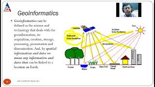
In Geo-Informatics, data accuracy and precision are of paramount importance. Measurements derived from field observations, instruments, and remote sensing techniques are never entirely free from inaccuracies. These inaccuracies or errors may arise due to instrument limitations, observer mistakes, environmental factors, or the inherent uncertainty of natural measurements. Understanding errors, their classification, propagation, and how to minimize or adjust them is vital to ensure data integrity. This chapter delves into the nature of errors in surveying and geospatial data collection, types of errors, error propagation, adjustment techniques using mathematical models, and statistical tools for reliability and accuracy assessment.
Detailed Explanation
In Geo-Informatics, which deals with the collection and analysis of geographic data, it's essential that the data we use is accurate and precise. However, no measurement is perfect; various factors can lead to errors in our data. These can be due to the limitations of our instruments (like a malfunctioning GPS), mistakes made by the person taking the measurements, or changes in environmental conditions (like weather affecting readings). Understanding the types of errors and how we can correct or mitigate them is crucial for maintaining the integrity of our data. Throughout this chapter, we will explore these errors, how they occur, and methods to adjust our data to minimize their effects.
Examples & Analogies
Think of a bow and arrow. The goal is to hit the target (representing the true value), but various things can go wrong: the bow may be poorly calibrated (instrument error), you might not aim well (observer error), or wind might blow the arrow off course (environmental error). Just as an archer learns to adjust their aim based on these factors, data scientists must learn to adjust their measurements to achieve accurate results.
Types of Errors in Geospatial Measurements
Chapter 2 of 15
🔒 Unlock Audio Chapter
Sign up and enroll to access the full audio experience
Chapter Content
Errors in geospatial measurements are generally classified into three categories:
13.1.1 Systematic Errors
Systematic errors follow a predictable pattern and are often due to calibration faults, instrument imperfections, or procedural flaws. Examples include:
• Instrumental errors due to defective equipment.
• Errors due to temperature and pressure changes.
• Refraction and curvature errors in long-distance measurements.
13.1.2 Random Errors
These occur unpredictably and vary in magnitude and direction. They are caused by:
• Fluctuations in observational skill.
• Environmental noise.
• Instrument sensitivity limits.
While random errors cannot be eliminated completely, they can be minimized by repeating measurements and applying statistical analysis.
13.1.3 Gross Errors
These are human mistakes such as:
• Misreading instruments.
• Wrong data entry.
• Misidentification of survey stations.
Gross errors are reduced through rigorous checking, cross-verification, and automation.
Detailed Explanation
In geospatial measurements, we categorize errors into three main types:
1. Systematic Errors: These errors are consistent and predictable. For example, if a GPS device is not calibrated properly, every measurement it takes will consistently be off by a certain amount.
2. Random Errors: Unlike systematic errors, random errors vary in their impact and can occur unpredictably. These might result from things like nearby noises or variations in how different people understand measurement techniques. They can't be completely removed, but we can reduce their impact by taking multiple measurements and averaging them.
3. Gross Errors: These are typically human errors resulting from mistakes like misreading measurements or entering incorrect data. Establishing thorough processes and checks can help reduce these mistakes.
Examples & Analogies
Imagine you're baking a cake. If you always use a faulty scale that under-weighs your flour (systematic error), your cakes will always be denser than they should be. If you occasionally spill sugar while pouring (random error), some cakes might be too sweet. Finally, if you accidentally use salt instead of sugar (gross error), that cake will be spoiled! Just as using the right tools and processes in baking ensures a great cake, understanding and managing these errors helps ensure accurate geospatial measurements.
Sources of Errors in Geo-Informatics
Chapter 3 of 15
🔒 Unlock Audio Chapter
Sign up and enroll to access the full audio experience
Chapter Content
Errors in Geo-Informatics may originate from various stages:
13.2.1 Data Acquisition Errors
• GPS signal multipath interference.
• Satellite image geometric distortions.
• Remote sensing sensor limitations.
13.2.2 Data Processing Errors
• Incorrect transformation parameters during coordinate conversion.
• Inaccurate interpolation techniques.
• Digitizing errors from manual tracing.
13.2.3 Data Integration Errors
• Mismatch of scales and projections.
• Temporal inconsistency in datasets.
• Incompatibility of data formats or coordinate systems.
Detailed Explanation
Errors in Geo-Informatics can occur at different stages:
1. Data Acquisition Errors refer to issues arising when we first collect data, such as interference with GPS signals or distortions in satellite images. For example, if buildings reflect GPS signals in unpredictable ways, the data we get can be inaccurate.
2. Data Processing Errors occur during the analysis stage, like when we convert coordinate systems incorrectly or use unsuitable methods to estimate missing data.
3. Data Integration Errors take place when combining data from different sources, which might not match up in format, scale, or time. For instance, if one dataset is from 2020 and another from 2015, they may not align correctly, leading to inaccuracies in analysis.
Examples & Analogies
Think of assembling a puzzle. If the pieces (data) collected have wrong shapes (acquisition errors), they won't fit together. If you try using pieces from different puzzles (integration errors) or force them into shapes they don’t match (processing errors), you’ll create a messy result that doesn't accurately represent the picture. Just like each stage of assembling a puzzle requires careful attention to fit, data in Geo-Informatics needs careful handling at each step to maintain accuracy.
Understanding Measurement Precision and Accuracy
Chapter 4 of 15
🔒 Unlock Audio Chapter
Sign up and enroll to access the full audio experience
Chapter Content
• Accuracy refers to the closeness of a measurement to the true value.
• Precision refers to the consistency or repeatability of measurements.
Understanding the difference is critical:
• A survey can be precise but inaccurate.
• High accuracy with low precision is unreliable in repetitive tasks.
Graphical plots and statistical measures like Mean Error, Standard Deviation, and Root Mean Square Error (RMSE) are used to quantify these aspects.
Detailed Explanation
In measurement terms, accuracy refers to how close a measurement is to the actual or true value. For instance, if you're measuring the length of a table that is exactly 2 meters long, an accurate measurement would be close to 2 meters. Precision, on the other hand, measures how consistent measurements are. If you measure the table several times and always get around 2.01 meters, your measurements are precise, but not accurate because they don’t match the true length.
It's essential to understand both concepts because a measurement can be precise without being accurate. Think of a dart player who consistently hits the same spot on the board, but it's far from the bullseye; they are precise but not accurate. An accurate measurement that lacks precision wouldn’t be helpful in tasks that require repeatability.
Examples & Analogies
Consider a player trying to shoot basketball hoops. If they always score from the same spot but miss the target entirely (high precision, low accuracy), that wouldn’t help the team win. However, if they shoot from all over the court and occasionally get it in (high accuracy, low precision), they might have a chance at scoring often but might not score every time. Understanding these differences helps players improve their game, just as it helps geo-scientists improve the quality of their data.
Error Propagation in Geospatial Data
Chapter 5 of 15
🔒 Unlock Audio Chapter
Sign up and enroll to access the full audio experience
Chapter Content
Error propagation refers to how input data uncertainties affect the final result of a computation. In spatial analysis and GIS operations, input data errors can accumulate or amplify due to:
• Overlay operations.
• Buffering and interpolation.
• Coordinate transformations.
13.4.1 Analytical Methods
• Taylor Series Expansion for linearizing non-linear models.
• First-order error propagation equations to estimate output variance.
13.4.2 Monte Carlo Simulations
Used when input errors are stochastic or the model is non-linear. Randomized simulations help in understanding probable output variability.
Detailed Explanation
Error propagation is an important concept in Geo-Informatics and refers to how errors in your input data can carry through and affect the final results of any computations you perform. For example, if you are overlaying two maps that each have their inaccuracies, those errors can accumulate, leading to a final incorrect representation of the data.
1. Overlay Operations might combine multiple data layers; if each layer has its own error, the final output can be significantly off.
2. Buffering and Interpolation involve estimating values between known data points, which can introduce further error.
3. Coordinate Transformations can also introduce errors if not calculated accurately.
Analytical methods like the Taylor series can help linearize complex problems, and Monte Carlo simulations allow for testing variations in data and seeing the potential range of outcomes based on those inputs.
Examples & Analogies
Consider a recipe that calls for several ingredients. If the measurements for some ingredients are off (errors in data), the final dish will likely not taste as intended. If you mix those ingredients together, any small inaccuracies can combine to result in a very different flavor and texture than expected, just as data errors can compound in geospatial analysis. Monte Carlo simulations are like making many variations of the dish with slight tweaks to see which one comes out best, helping you understand how variations can impact the final result.
Adjustment of Observations
Chapter 6 of 15
🔒 Unlock Audio Chapter
Sign up and enroll to access the full audio experience
Chapter Content
Adjustments are mathematical techniques used to minimize the effect of errors and improve measurement reliability.
13.5.1 Principle of Least Squares
The most widely used method for adjustment, it minimizes the sum of the squares of the residuals (differences between observed and adjusted values).
General Equation:
Minimize (v²), where v = observed value−adjusted value
The method assumes:
• Random error distribution.
• Equal or weighted precision among observations.
13.5.2 Weighting of Observations
Different observations may have different reliabilities. Weights are assigned inversely proportional to the variance:
wi = 1/σ²_i
More reliable data points are given higher weight in the adjustment process.
Detailed Explanation
When we have measurements that contain errors, adjustments help us refine those measurements to make them more reliable. The Principle of Least Squares is a popular method for this; it works by attempting to minimize the differences (or residuals) between the actual measurements and the adjusted values we calculate. By minimizing these differences, we aim to get the most accurate overall representation of our data.
The adjustments rely on the assumption that errors are random and can be treated statistically. Additionally, we may need to assign weights to different observations based on their reliability. For example, if one measurement is taken with a high-accuracy device while another is taken with a less reliable one, we would give more weight to the more accurate measurement during the adjustment process.
Examples & Analogies
Think of a classroom where students are taking a math test. If one student often scores higher (more reliable), their score should be weighted more when calculating the average class score to account for their better understanding of the material. The least-squares method is like finding the best average that balances all the different results while minimizing the impact of outliers (students who guessed on questions) to ensure the average reflects the true performance of the class.
Network Adjustment Techniques
Chapter 7 of 15
🔒 Unlock Audio Chapter
Sign up and enroll to access the full audio experience
Chapter Content
In surveying and satellite positioning, a network of measurements is often adjusted together. Key techniques include:
13.6.1 Free Network Adjustment
No constraints are applied to fix control points. Used during preliminary analysis.
13.6.2 Constrained Adjustment
Control points with known coordinates are used to stabilize the network.
13.6.3 Block Adjustment
Common in aerial photogrammetry. Overlapping images are adjusted simultaneously using tie-points.
Detailed Explanation
When we collect measurements from multiple sources in surveying or satellite positioning, it can be important to adjust them as a unified network rather than individually. This helps ensure that all measurements are coherent with one another.
1. Free Network Adjustment allows for adjustments without fixing any control points; it’s often an initial step in analysis where we don’t want to impose constraints.
2. Constrained Adjustment incorporates points with known positions to provide a stable reference, ensuring that other measurements align correctly with these fixed points.
3. Block Adjustment is frequently used in aerial photography, where multiple images overlap. By adjusting these images simultaneously based on common tie-points, we can create more accurate visual representations of the surveyed area.
Examples & Analogies
Think of arranging a large group photo where some individuals are standing in front of known landmarks (control points). If you adjust everyone based on their proximity to these landmarks (constrained adjustment), the overall picture becomes clearer and more coherent. If you let everyone stand freely without using the landmarks for alignment (free network adjustment), the photo may not represent the intended view properly. Adjusting multiple images together in a block adjustment is similar to making sure everyone’s head is turned to the camera, even if they were standing at different distances from the camera, to ensure a uniform and cohesive group photo.
Statistical Testing of Adjusted Data
Chapter 8 of 15
🔒 Unlock Audio Chapter
Sign up and enroll to access the full audio experience
Chapter Content
After adjustment, statistical tests are used to validate the model and identify outliers.
13.7.1 Chi-Square Test
Used to test the goodness-of-fit of the adjustment:
χ² = Σ (v²/σ²)
Compared with a critical value to assess if the residuals are within expected limits.
13.7.2 t-Test and F-Test
Used to detect whether a particular residual or group of observations significantly deviates from the expected error range.
Detailed Explanation
Once we’ve adjusted our measurements, it’s crucial to verify that our adjustments are reliable. This is where statistical testing comes in.
1. The Chi-Square Test evaluates the fit of the adjusted model against the observed data. It checks whether the residuals (the differences between observed and adjusted values) behave as expected; if they deviate significantly, this might indicate issues with the model.
2. t-Tests and F-Tests help determine if certain measurements are outliers—that is, if any data points differ significantly from the average or expected values. These tests provide a statistical framework to confirm that our adjustments did not produce significant errors.
Examples & Analogies
Imagine a teacher grading a math exam. After grading (adjusting), the teacher checks the scores to see if any individual scores are unusually high or low (outliers). The Chi-Square Test is like comparing how well the entire class performed against what was expected based on previous tests. If significantly more students scored particularly well or poorly than anticipated, the teacher would know that something unusual occurred in the test or grading process, triggering a review.
Practical Considerations in Error Minimization
Chapter 9 of 15
🔒 Unlock Audio Chapter
Sign up and enroll to access the full audio experience
Chapter Content
• Instrument Calibration: Regular checks and calibration improve measurement consistency.
• Environmental Controls: Shielding equipment from temperature and humidity fluctuations.
• Redundancy in Measurements: Taking more measurements than strictly necessary to detect and correct errors.
• Automation and Digital Logging: Reduces human-induced gross errors.
Detailed Explanation
To minimize errors in geospatial measurements, several practical steps can be taken:
1. Instrument Calibration involves regularly checking and tuning equipment to ensure that it’s measuring accurately. This helps maintain uniformity across data collected over time.
2. Environmental Controls mean protecting measuring instruments from external factors, such as temperature and humidity changes that could affect readings.
3. Redundancy in Measurements suggests that taking more measurements than needed can help identify errors, allowing for corrections based on repeated data collection.
4. Automation and Digital Logging reduce human error: By automating data recording, the potential for mistakes introduced by manual entry is minimized.
Examples & Analogies
Think of a musician tuning their guitar before a performance. Regular tuning (instrument calibration) ensures that the guitar sounds just right. If they also play the songs several times to check for any inaccurate notes (redundancy), they’ll be better prepared for the show. Finally, if they use a digital tuner to help ensure they’re always in tune (automation), they reduce the chances of playing a wrong note in front of an audience. Similarly, taking careful steps to minimize errors in data collection reinforces the reliability of the final results.
Software Tools for Adjustment and Error Analysis
Chapter 10 of 15
🔒 Unlock Audio Chapter
Sign up and enroll to access the full audio experience
Chapter Content
Modern Geo-Informatics systems offer built-in modules for error detection and adjustment:
• GIS Software (e.g., ArcGIS, QGIS): Provide transformation, georeferencing, and topology tools with error feedback.
• Surveying Software (e.g., Leica Geo Office, Trimble Business Center): Used for network adjustment and statistical validation.
• Mathematical Software (e.g., MATLAB, R): Implement least squares, Monte Carlo simulations, and custom adjustment models.
Detailed Explanation
To facilitate error detection and adjustment, there is a variety of software available in the field of Geo-Informatics:
1. GIS Software, like ArcGIS or QGIS, helps with tasks such as transforming data formats, georeferencing maps to the correct spatial location, and checking topology (the arrangement and relationship of points, lines, and polygons) while providing feedback on potential errors.
2. Surveying Software, such as Leica Geo Office or Trimble Business Center, specializes in network adjustment, enabling surveyors to validate and adjust their measurements statistically based on the gathered data.
3. Mathematical Software like MATLAB and R is used for more complex computations, including running least squares adjustments and simulations to estimate uncertainty and validate data.
Examples & Analogies
Imagine a chef who uses specialized kitchen appliances (software tools) to help with cooking. A blender (GIS software) prepares ingredients a certain way, while an oven thermometer (surveying software) ensures the temperature is just right. A recipe book (mathematical software) provides guidelines on how to combine these tools effectively. In Geo-Informatics, various software serve as tools that enable more accurate data processing, just like a well-equipped kitchen enables chefs to prepare great meals.
Error Handling in Remote Sensing and Image Processing
Chapter 11 of 15
🔒 Unlock Audio Chapter
Sign up and enroll to access the full audio experience
Chapter Content
Errors are inherent in satellite and aerial imagery due to a variety of factors such as platform motion, sensor characteristics, and atmospheric conditions. Efficient error handling and correction are crucial to derive meaningful information.
13.10.1 Geometric Distortions
Geometric errors distort the spatial representation of features. Common causes include:
• Earth curvature and rotation.
• Sensor alignment issues.
• Terrain-induced displacement (relief displacement).
Correction Techniques:
• Systematic geometric corrections: Applied using sensor calibration models.
• Image-to-image registration: Aligns one image to a reference using Ground Control Points (GCPs).
• Orthorectification: Removes terrain effects using a Digital Elevation Model (DEM) and sensor metadata.
13.10.2 Radiometric Errors
Radiometric inconsistencies affect pixel brightness and spectral fidelity. Sources include:
• Sensor noise.
• Sun angle variation.
• Atmospheric scattering and absorption.
Correction Methods:
• Radiometric normalization using reference targets.
• Atmospheric correction models (e.g., DOS, FLAASH).
• Histogram matching between images for masking or change detection.
Detailed Explanation
In the field of remote sensing and image processing, errors commonly arise from multiple sources, and handling these is vital for accuracy.
1. Geometric Distortions affect how we interpret spatial features in an image. For instance, the curvature of the Earth can create issues, as can misalignment of the sensor when taking images. To correct these, various techniques are employed, like systematic geometric corrections where calibration models are applied, or image registration to align images accurately using Ground Control Points.
2. Radiometric Errors impact the brightness of the pixels in an image and can be caused by the sensor itself or external conditions like the angle of the sun. Methods such as normalization, atmospheric correction models, and histogram matching can rectify these issues to ensure accurate and usable imagery.
Examples & Analogies
Think of a camera taking a photo of a landscape during uneven lighting conditions. Just as the inconsistent lighting can distort the colors and shapes of your image, satellite images face similar issues with geometric and radiometric errors. A good photographer would adjust their camera settings or choose the right time for optimal lighting. Similarly, remote sensing experts use correction methods to ensure that the data captured represents the true earth surface accurately.
Real-Time Error Correction in GNSS
Chapter 12 of 15
🔒 Unlock Audio Chapter
Sign up and enroll to access the full audio experience
Chapter Content
Global Navigation Satellite Systems (GNSS) like GPS, GLONASS, Galileo, and NavIC are prone to multiple sources of error such as:
• Satellite clock error.
• Ionospheric and tropospheric delay.
• Multipath error.
13.11.1 Differential GNSS (DGNSS)
DGNSS enhances accuracy by using a network of reference stations that provide real-time correction data to receivers.
13.11.2 Real-Time Kinematic (RTK)
RTK uses carrier-phase measurements and provides centimeter-level accuracy using a base station and a mobile receiver.
13.11.3 Precise Point Positioning (PPP)
PPP techniques remove systematic and random GNSS errors using correction services without needing a local base station. These methods are essential in applications like UAV-based surveying, autonomous navigation, and high-precision mapping.
Detailed Explanation
Global Navigation Satellite Systems (GNSS), essential for positioning and navigation, are susceptible to various errors. These can arise from the satellite's clock not being perfectly accurate, delays caused by signals passing through the Earth's atmosphere, and multi-path errors where signals reflect off surfaces before reaching the receiver.
To address these, several techniques have been developed:
1. Differential GNSS (DGNSS) uses a network of reference stations to send correction data to GNSS receivers, enhancing accuracy.
2. Real-Time Kinematic (RTK) takes it further by measuring the phase of satellite signals, allowing for centimeter-level accuracy through a fixed base station and a moving receiver.
3. Precise Point Positioning (PPP) helps to mitigate both systematic and random errors without needing a local base station, making it useful in various applications like surveying with drones or autonomous vehicle navigation.
Examples & Analogies
Consider a person using a map on a road trip who checks in with a local guide (DGNSS) to confirm they are heading in the right direction, ensuring they are on track. With additional technology, such as a detailed GPS tracking device that updates constantly (RTK), they can precisely adjust their route down to the correct lane. Finally, having an excellent navigation app that recalibrates based on the type of journey (PPP) can help avoid detours and re-routing, just like GNSS can help navigate through complex environments accurately.
Error Budgeting and Quality Assurance in Geo-Informatics Projects
Chapter 13 of 15
🔒 Unlock Audio Chapter
Sign up and enroll to access the full audio experience
Chapter Content
Before beginning a geospatial project, an error budget is developed to estimate and allocate allowable errors across all stages.
13.12.1 Components of an Error Budget
• Instrumental tolerance.
• Observer and procedural accuracy.
• Expected environmental variability.
• Cumulative processing errors.
13.12.2 Quality Assurance Measures
• Metadata documentation: Record of accuracy, resolution, source, and processing steps.
• Field validation: Comparing GIS data with ground truth surveys.
• Automated QA/QC scripts: Checking for topology errors, attribute mismatch, and projection issues.
Detailed Explanation
In any geospatial project, it's essential to plan for potential errors through an error budget. This budget helps project managers estimate the acceptable limits of errors in measurements, accounting for different sources:
1. Instrumental Tolerance refers to the specifications or limits of the instruments being used.
2. Observer and Procedural Accuracy add human factors into the mix, acknowledging that different methods can yield varying accuracy levels.
3. Expected Environmental Variability takes into account changes in the environment that might affect data, like weather.
4. Cumulative Processing Errors consider the accumulation of errors through various stages of data processing.
In terms of quality assurance, measures must be in place, like maintaining metadata that records the accuracy and processing of data, verifying data in the field, and employing automated scripts to check for errors in the dataset.
Examples & Analogies
Consider a builder planning to construct a house. They need to keep track of the budget, including potential costs for unexpected issues (the error budget). Just as they document each material’s quality and cost (metadata), they ensure the construction complies with local building codes through inspections (field validation). Employing consistent quality checks throughout the construction process (automated QA/QC) can help prevent costly mistakes. Similarly, a well-thought-out error budgeting and quality assurance strategy is crucial for successful geospatial projects.
International Standards for Error and Adjustment Practices
Chapter 14 of 15
🔒 Unlock Audio Chapter
Sign up and enroll to access the full audio experience
Chapter Content
Compliance with international standards ensures interoperability and credibility of geospatial data.
13.13.1 ISO Standards
• ISO 19113: Quality principles for geographic information.
• ISO 19115: Metadata standards.
• ISO 19157: Data quality measures and reporting.
13.13.2 FGDC and OGC Guidelines
• FGDC (Federal Geographic Data Committee) accuracy standards for digital geospatial data.
• OGC (Open Geospatial Consortium) ensures open interfaces and encodings for data sharing.
Adhering to these frameworks ensures that data is traceable, repeatable, and legally defensible, especially in engineering, legal, and disaster response contexts.
Detailed Explanation
To ensure that geospatial data is credible and can be effectively shared and used across different platforms and organizations, compliance with international standards is critical. These standards help establish a framework:
1. ISO Standards set guidelines for quality principles (ISO 19113), for metadata that describes data (ISO 19115), and for reporting on data quality (ISO 19157).
2. FGDC and OGC Guidelines provide additional guidelines for maintaining accuracy in digital geospatial data (FGDC) and ensure that geospatial data can be shared easily and standardized across platforms (OGC). Following these standards creates databases that are reliable and can be trusted in contexts, such as engineering or disaster response.
Examples & Analogies
Imagine an international company expanding its operations to different countries. To maintain quality and reputation, it must follow certain quality standards recognized globally, just like ISO standards provide a framework for geospatial data quality. This ensures that no matter where their products are produced or sold, consumers receive the same high standard of quality, similar to how compliance with geo-data standards guarantees reliable information across different contexts.
Case Studies and Applications
Chapter 15 of 15
🔒 Unlock Audio Chapter
Sign up and enroll to access the full audio experience
Chapter Content
13.14.1 Land Parcel Mapping
In cadastral surveying, high accuracy is needed. Least square adjustment methods combined with GNSS RTK provide exact parcel boundaries with confidence intervals.
13.14.2 Urban Infrastructure Planning
Integration of multiple data layers (transport, water, electricity) in GIS requires topological accuracy. Spatial adjustment tools are used to correct misalignments before modeling.
13.14.3 Environmental Monitoring
Satellite-derived indices like NDVI or LST (Land Surface Temperature) must be radiometrically corrected. Accuracy affects decision-making in agriculture and climate studies.
Detailed Explanation
In applying the principles discussed throughout the chapter, we see various real-world scenarios:
1. Land Parcel Mapping entails high accuracy, essential for legal property boundaries. This often employs least square adjustment methods alongside GNSS RTK technology to ensure that property lines are correctly calculated with specific confidence intervals.
2. Urban Infrastructure Planning necessitates the merging of various data layers (like transport and utilities). Spatial adjustment tools help identify and resolve any inaccuracies or misalignments to create a reliable model of the urban landscape.
3. Environmental Monitoring utilizes satellite data to track environmental changes. For example, indices like NDVI (Normalized Difference Vegetation Index) rely on accurate measurements and require robust corrections for radiometric inconsistencies to influence critical decisions in agriculture and climate initiatives.
Examples & Analogies
Think about a community planning a new park. Experts need to make sure they accurately define the boundaries of the park while avoiding overlaps with private properties (land parcel mapping). They’ll use different data sources to understand how the park will fit into the area (urban infrastructure planning), ensuring they consider factors like plants and wildlife (environmental monitoring) to create a space that benefits both the community and the environment. By applying these geospatial principles, the planning process will result in a well-designed park that meets everyone’s needs.
Key Concepts
-
Types of Errors: Classification of errors into systematic, random, and gross errors.
-
Sources of Errors: Understanding how errors can originate from data acquisition, processing, and integration.
-
Precision vs. Accuracy: Differentiating between these two crucial concepts to understand measurement integrity.
-
Error Propagation: Awareness of how input data errors affect final output results.
-
Adjustment Techniques: Methods like the Principle of Least Squares to improve measurement reliability.
Examples & Applications
A GPS measurement may show consistent values each time (precision), but if it consistently records 5 meters off the true location, it is not accurate.
In a photogrammetry survey, errors can arise from the camera angle leading to systematic errors, while human errors during data entry can be gross errors.
Memory Aids
Interactive tools to help you remember key concepts
Rhymes
If you're precise but not exact, your results will have quite an impact!
Stories
Once upon a time in a lab, a student kept measuring his plants with a ruler. He always got the same measurement, but it was wrong! This taught him the importance of accuracy alongside precision.
Memory Tools
Remember 'S-R-G', which stands for Systematic, Random, and Gross errors. These types will help you remember the main categories of errors in measurements.
Acronyms
USE the 'P-A' method for Precision and Accuracy
'P' for consistent numbers
'A' for true targets.
Flash Cards
Glossary
- Systematic Errors
Errors that follow a predictable pattern, often due to instrument calibration or environmental factors.
- Random Errors
Errors that occur unpredictably and vary in magnitude and direction, often due to observational skills or environmental noise.
- Gross Errors
Human mistakes, such as misreading instruments or incorrect data entry, that can be minimized through careful validation.
- Error Propagation
The process through which uncertainties in input data affect the final results of a computation.
- Principle of Least Squares
A mathematical technique that minimizes the sum of the squares of residuals in order to adjust measurements.
Reference links
Supplementary resources to enhance your learning experience.