
Applications in Geotechnical Engineering and Slope Stability Analysis
Enroll to start learning
You’ve not yet enrolled in this course. Please enroll for free to listen to audio lessons, classroom podcasts and take practice test.
Interactive Audio Lesson
Listen to a student-teacher conversation explaining the topic in a relatable way.
Role of Robotics and Automation
🔒 Unlock Audio Lesson
Sign up and enroll to listen to this audio lesson

Today we will explore how robotics and automation are transforming geotechnical engineering. Can someone explain why automation might be necessary in this field?

I think it helps reduce human exposure to dangerous conditions, right?
Exactly! Not only that, but it enhances precision and allows for quicker decision-making. Remember the acronym 'SAFETY': Safety, Accuracy, Fast data collection, Efficiency, Time-saving, and Yielding better data.

SAFETY is easy to remember! But what kind of robotic systems are we talking about?
Great question! We have autonomous drilling rigs, mobile ground robots, and UAVs. Each has specific roles in soil investigation and monitoring.
Robotic Systems for Soil Investigation
🔒 Unlock Audio Lesson
Sign up and enroll to listen to this audio lesson

Let's dive deeper into some of these robotic systems. What do autonomous drilling rigs do?

They bore holes and collect soil samples, right?
Yes! They are equipped with advanced technology like GPS and LiDAR. Why is that beneficial?

Because it makes them reliable even in hard-to-reach places!
Exactly! And mobile ground robots equipped with sensors can also transmit data wirelessly. What sensors do you think they might use?
Cone penetrometers and shear vanes?
Right again! This data is vital in understanding soil mechanics.
Instrumentation and Sensors in Soil Monitoring
🔒 Unlock Audio Lesson
Sign up and enroll to listen to this audio lesson
Now let's talk about instrumentation. Who can tell me what a piezometer does?
It measures pore-water pressure!
Correct! And why is pore-water pressure important in slope stability?
Because if pressure is too high, it can lead to slope failure!
Perfect! Automated systems help monitor these conditions in real-time, allowing for immediate action if thresholds are exceeded.
AI and Automation in Stability Analysis
🔒 Unlock Audio Lesson
Sign up and enroll to listen to this audio lesson
AI is playing a massive role in slope stability analysis. What can you tell me about AI's use with real-time data?
AI can help predict slope failures using historical data, right?
Exactly! AI models combine various data types to predict outcomes effectively. What are some examples of these models?
Support Vector Machines and Artificial Neural Networks?
Yes! Remember 'SVM' and 'ANN' as acronyms for these models. They are very valuable for risk assessment.
Challenges and Future Trends
🔒 Unlock Audio Lesson
Sign up and enroll to listen to this audio lesson
As we conclude, let's consider some challenges. What challenges do you think robotic systems face in geotechnical engineering?
Maybe the harsh conditions they operate in?
Yes! Other issues include high initial costs and the need for interdisciplinary knowledge. But on the bright side, what's a future trend we can expect?
Swarm robotics for analyzing larger areas?
Absolutely! The future looks promising with technology continually evolving.
Introduction & Overview
Read summaries of the section's main ideas at different levels of detail.
Quick Overview
Standard
The section discusses the significant impact of automation and robotic systems in geotechnical engineering, particularly in soil investigation and slope stability analysis. It covers various technologies, including UAVs, mobile ground robots, and real-time monitoring systems, that enhance data accuracy and safety.
Detailed
Detailed Summary
Geotechnical engineering is pivotal in the design and safety of civil infrastructure. This section centers on how the infusion of robotics and automation has transformed traditional practices.
Key Points:
- Automation Needs: Automation minimizes hazardous exposure, enhances accuracy, and supports real-time data-driven decision-making.
- Robotic Technologies: Technologies such as autonomous drilling rigs, mobile ground robots equipped with geotechnical sensors, and UAVs provide innovative solutions for soil investigation, monitoring terrain, and predicting slope failures.
- Instrumentation: Real-time sensors like piezometers and fiber optic sensors are essential for monitoring soil conditions and slope stability.
- AI and Automation in Stability Analysis: Integrated systems analyze data with AI, allowing for predictive modeling and risk zoning, enhancing safety during assessments.
- Case Studies: Practical implementations illustrate the impact of these technologies on disaster prevention, particularly in landslide scenarios.
- Challenges and Future Trends: Despite the advancements, challenges such as harsh field conditions and costs exist. The future hints at developing more sophisticated robotic systems using AI and blockchain technology for better geotechnical data management.
This section emphasizes that the evolution of robotic systems not only facilitates data collection but also enhances the reliability and safety of geotechnical assessments.
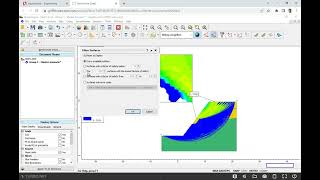
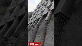
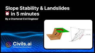
Youtube Videos


Audio Book
Dive deep into the subject with an immersive audiobook experience.
Introduction to Geotechnical Engineering
Chapter 1 of 5
🔒 Unlock Audio Chapter
Sign up and enroll to access the full audio experience
Chapter Content
Geotechnical engineering plays a crucial role in the safe and economic design of civil infrastructure by analyzing soil behavior, sub-surface conditions, and slope stability. The integration of robotics and automation in geotechnical engineering has revolutionized traditional practices by enabling higher precision, efficiency, real-time data acquisition, and enhanced safety.
Detailed Explanation
Geotechnical engineering is essential for designing buildings, roads, and bridges safely. It focuses on understanding how soil behaves under different conditions and how it affects the structures built on it. The advent of robotics and automation in this field has transformed how engineers perform their work. For example, automated systems can collect data in real-time, ensuring that engineers get accurate information quickly, which leads to better decision-making. This technology also allows for safer working conditions as it reduces the need for humans to conduct potentially dangerous investigations.
Examples & Analogies
Imagine you are baking a cake. If you relied solely on your intuition to measure the ingredients, the cake might not turn out right. However, if you use a digital scale (akin to automated systems), you get exact measurements that result in a perfect cake. Similarly, robots in geotechnical engineering provide precise measurements to ensure that infrastructure is sound and safe.
Role of Robotics and Automation in Geotechnical Engineering
Chapter 2 of 5
🔒 Unlock Audio Chapter
Sign up and enroll to access the full audio experience
Chapter Content
• Need for Automation: Geotechnical investigations involve hazardous and time-consuming processes. Automation reduces human exposure, increases accuracy, and enables data-driven decision-making.
• Advantages:
– Real-time monitoring of soil conditions.
– Autonomous data collection and processing.
– Reduction in manpower and human error.
– Increased safety during hazardous site evaluations.
Detailed Explanation
The need for automation in geotechnical engineering arises because many tasks are dangerous and time-consuming. By integrating robotic systems, engineers can minimize human risk and improve precision. The advantages of this technology include the ability to monitor soil conditions in real-time, which helps engineers make timely decisions. Autonomous systems can collect and process data without requiring much human involvement, which reduces errors that can result from manual data entry. This leads to safer evaluations of hazardous sites because robots can undertake the most dangerous tasks.
Examples & Analogies
Think of a firefighter who uses a drone to assess a burning building. Instead of entering the dangerous environment, the drone provides vital information about the situation from a safe distance. Similarly, automation in geotechnical engineering allows for the assessment of potentially hazardous areas without putting human lives at risk.
Robotic Systems for Soil Investigation
Chapter 3 of 5
🔒 Unlock Audio Chapter
Sign up and enroll to access the full audio experience
Chapter Content
• Autonomous Drilling Rigs:
– Capable of boring holes and collecting soil samples.
– Integrated with GPS, LiDAR, and force sensors.
– Used in inaccessible or dangerous locations.
• Mobile Ground Robots:
– Equipped with geotechnical sensors like cone penetrometers, shear vanes, and resistivity probes.
– Suitable for flat terrains and embankments.
– Data transmission using wireless protocols to remote stations.
• Unmanned Aerial Vehicles (UAVs):
– Used for mapping terrain, digital elevation models, and landslide-prone zones.
– Equipped with photogrammetry tools and thermal cameras.
– Capable of rapid surveillance and aerial soil analysis.
Detailed Explanation
There are several robotic systems designed specifically for soil investigation. Autonomous drilling rigs are equipped with advanced technology like GPS and sensors, allowing them to collect soil samples even in challenging environments. Mobile ground robots can navigate through various terrains and are fitted with sophisticated sensors to assess soil properties. UAVs, or drones, provide aerial perspectives for mapping and monitoring terrains, capturing data that informs engineers about potential instability, such as possible landslide zones.
Examples & Analogies
Consider spacecraft that explore other planets. Instead of sending humans, we use robots to collect samples and take measurements. Similarly, the automated systems in geotechnical engineering operate in challenging and dangerous terrains, collecting critical data without risking human lives.
Instrumentation and Sensors in Soil Monitoring
Chapter 4 of 5
🔒 Unlock Audio Chapter
Sign up and enroll to access the full audio experience
Chapter Content
• Piezometers:
– Automated piezometers with real-time telemetry.
– Measure pore-water pressures to assess slope stability.
• Inclinometers and Tilt Sensors:
– Monitor lateral soil movement in slopes and embankments.
– Robotics-based systems can auto-trigger alerts based on threshold displacement.
• Fiber Optic Sensors:
– Embedded in soil or geotextiles.
– Provide strain, pressure, and temperature data continuously.
– Highly durable and immune to electromagnetic interference.
• MEMS-Based Geotechnical Sensors:
– Micro-Electro-Mechanical Systems used for miniaturized sensing.
– High sensitivity, low power consumption, suitable for wireless deployment.
Detailed Explanation
Various instruments and sensors are essential for monitoring soil conditions. Piezometers are used to measure water pressure within soil, providing insights into its stability. Inclinometers track any horizontal shifts in the soil, which could signal movement that poses a risk. Fiber optic sensors offer continuous monitoring of strain, pressure, and temperature, enhancing understanding of soil behavior. MEMS sensors are tiny yet highly sensitive, delivering data without requiring much energy, making them ideal for remote conditions.
Examples & Analogies
Think of a smoke detector in your home. It continuously monitors the environment for signs of fire and alerts you immediately if smoke is detected. Likewise, these geotechnical sensors keep a constant check on soil conditions, allowing engineers to respond quickly to any signs of instability.
Slope Stability Analysis using Automation
Chapter 5 of 5
🔒 Unlock Audio Chapter
Sign up and enroll to access the full audio experience
Chapter Content
• Automated Monitoring Stations:
– Installed in landslide-prone areas with integrated cameras, inclinometers, and rainfall sensors.
– Data logged and analyzed using AI models for early warning.
• GIS and Remote Sensing Integration:
– Geographic Information System (GIS) used with robotic terrain data.
– Enables identification of potential slope failure zones.
• Real-Time Data Interpretation using AI/ML:
– Predictive modeling using algorithms such as ANN, SVM, and Random Forest.
– Combines historical slope failures, geotechnical data, and climatic conditions.
– Automation in risk zoning and hazard mapping.
• Robotic Total Stations:
– Used in surveying slopes and monitoring movement with millimeter precision.
– Automatic target recognition and continuous feedback to monitoring software.
Detailed Explanation
Automation plays a critical role in slope stability analysis. Automated monitoring stations equipped with cameras and sensors gather data on soil conditions and rain, which is then analyzed using artificial intelligence to predict potential slopes at risk of failure. Geographic Information Systems (GIS) help visualize this data, making it easier to identify danger zones. AI and machine learning algorithms process historical and current data to enhance risk assessment, while robotic total stations ensure precise surveying of slope movements.
Examples & Analogies
Imagine a weather forecasting system that combines satellite data with historical patterns to provide accurate weather predictions. In a similar way, automated slope stability analysis uses past and present data to predict soil behavior and prevent disasters.
Key Concepts
-
Robotics in Geotechnical Engineering: Robotics enhances data collection while ensuring safety during site evaluations.
-
Real-Time Monitoring: Automated systems provide continuous data on soil conditions, crucial for slope stability assessments.
-
AI in Slope Stability: AI technologies integrate various data sources to future predict and analyze slope stability.
-
Challenges of Automation: Harsh field conditions and investment costs pose challenges for industry adoption.
Examples & Applications
Case Study: The use of UAVs in Uttarakhand for real-time landslide monitoring showcased the effectiveness of automated systems in disaster prevention.
Robotic drilling rigs are employed in inaccessible areas to gather soil samples without risking human safety.
Memory Aids
Interactive tools to help you remember key concepts
Rhymes
Robots drill, sensors feel, keeping us safe under steel.
Stories
Imagine a brave little robot venturing into remote mountainous regions to gather soil samples, with its trusty sensors tracking the water pressure and stability of slopes, always keeping the engineers informed and safe.
Memory Tools
Remember 'SAFETY' for what automation brings: Safety, Accuracy, Fast data, Efficiency, Time-saving, Yielding trustable data.
Acronyms
Use 'RAISE' for Robotics
Reliable
Accurate
Innovative
Safe
Efficient.
Flash Cards
Glossary
- Geotechnical Engineering
A branch of civil engineering that analyzes soil behavior and sub-surface conditions for the design of infrastructure.
- Automation
The use of technology to perform tasks with minimal human intervention, increasing efficiency and safety.
- UAV (Unmanned Aerial Vehicle)
A type of drone used for aerial surveys and monitoring.
- Piezometer
An instrument for measuring the pore-water pressure within the soil.
- Artificial Neural Network (ANN)
A computational model inspired by the human brain, used in machine learning to recognize patterns and make predictions.
- Support Vector Machine (SVM)
A supervised machine learning model used for classification tasks.
Reference links
Supplementary resources to enhance your learning experience.