
Robotic Systems for Soil Investigation
Enroll to start learning
You’ve not yet enrolled in this course. Please enroll for free to listen to audio lessons, classroom podcasts and take practice test.
Interactive Audio Lesson
Listen to a student-teacher conversation explaining the topic in a relatable way.
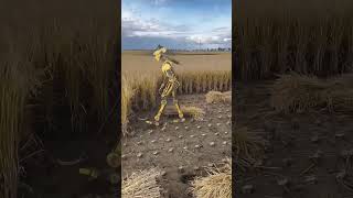
Autonomous Drilling Rigs
🔒 Unlock Audio Lesson
Sign up and enroll to listen to this audio lesson

Let's start with autonomous drilling rigs. These are specialized machines capable of boring holes and collecting soil samples even in hazardous or difficult-to-reach locations. Can someone tell me why using these rigs is beneficial in geotechnical engineering?

They can reduce the risk to human workers by operating in unsafe environments.
Exactly! They improve safety by minimizing human exposure to dangerous areas. Additionally, they are integrated with technologies like GPS and LiDAR. Can anyone explain how these technologies contribute?

GPS helps in accurately locating drilling sites, and LiDAR can help create topographical maps of the area.
Well said! These technologies not only enhance accuracy but also allow for better planning and execution of drilling operations. What do we think is an example of an application for these rigs?

Maybe in construction projects where soil needs to be tested before foundation laying?
Exactly! They are essential in pre-construction soil assessments, ensuring that foundations are built on stable ground. Great job, everyone!
Mobile Ground Robots
🔒 Unlock Audio Lesson
Sign up and enroll to listen to this audio lesson

Moving on, let's talk about mobile ground robots. These machines are equipped with various geotechnical sensors like cone penetrometers. What can someone tell me about these sensors and their purposes?

Cone penetrometers measure soil resistance, which helps determine soil type and strength.
Exactly! By using these sensors, the robots can provide detailed data on soil properties in real time. How do these robots communicate the data back to the engineers?
They use wireless protocols to transmit data back to remote stations, right?
Correct! This allows for immediate access to important information, which can be critical during site evaluations, especially when dealing with flat terrains and embankments. Can anyone give an example where this technology is particularly useful?
In areas where traditional surveying would be too dangerous or slow, like in unstable slopes?
Exactly! Mobile ground robots are invaluable in such scenarios. Great insights from everyone!
Unmanned Aerial Vehicles (UAVs)
🔒 Unlock Audio Lesson
Sign up and enroll to listen to this audio lesson
Now, let's shift our focus to UAVs. UAVs, or drones, are utilized for various applications in soil investigation. What are some of the tasks they can perform?
They can map terrains and identify areas that might be prone to landslides.
Exactly! They create digital elevation models and can rapidly survey large areas, making them perfect for preliminary assessments. What technology do UAVs use to collect information, and how does it benefit analysis?
They often use thermal cameras and photogrammetry tools, which allow for detailed aerial analysis.
Good point! The use of thermal imaging can help identify moisture content in the soil, which is critical in assessing stability. Can someone think of when we'd particularly need this technology?
During a heavy rainfall season, to monitor changes in slope stability?
Great application! UAVs definitely enable quicker response times during critical weather conditions. Fantastic discussion today!
Introduction & Overview
Read summaries of the section's main ideas at different levels of detail.
Quick Overview
Standard
Robotic systems play a significant role in soil investigation, with autonomous drilling rigs, mobile ground robots, and UAVs enhancing precision and efficiency. They collect data in challenging environments while ensuring safety and reducing human error.
Detailed
Robotic Systems for Soil Investigation
This section delves into the innovative robotic systems employed in soil investigation, detailing their key characteristics and applications in the field of geotechnical engineering. The technologies discussed include:
- Autonomous Drilling Rigs: Capable of boring holes and collecting soil samples in hazardous or inaccessible locations. These rigs leverage advanced technologies such as GPS, LiDAR, and force sensors, enabling precise operations in environments where traditional methods may pose significant risks.
- Mobile Ground Robots: These robots are equipped with geotechnical sensors, including cone penetrometers and shear vanes, making them suitable for assessing soil conditions on flat terrains and embankments. They utilize wireless protocols for efficient data transmission to remote stations, thus facilitating real-time analysis and decision-making.
- Unmanned Aerial Vehicles (UAVs): UAVs are instrumental in mapping terrains, creating digital elevation models, and identifying landslide-prone zones. With the integration of photogrammetry tools and thermal cameras, they can conduct rapid aerial surveys and soil analyses, aiding in timely assessments and interventions.
The deployment of these robotic systems significantly enhances the efficiency and safety of soil investigations, paving the way for improved precision in geotechnical assessments and slope stability monitoring.
Youtube Videos
![How to get started with Robotics? [MUST KNOW TIPS] Building Robots for Beginners](https://img.youtube.com/vi/NRj6gzah7JA/mqdefault.jpg)


Audio Book
Dive deep into the subject with an immersive audiobook experience.
Autonomous Drilling Rigs
Chapter 1 of 3
🔒 Unlock Audio Chapter
Sign up and enroll to access the full audio experience
Chapter Content
- Capable of boring holes and collecting soil samples.
- Integrated with GPS, LiDAR, and force sensors.
- Used in inaccessible or dangerous locations.
Detailed Explanation
Autonomous drilling rigs are advanced machines designed to automatically drill into the ground to collect soil samples. This is particularly useful in locations that are hard to reach or pose dangers to human workers, such as deep sites or unstable terrains. These rigs are equipped with technologies like GPS for navigation, LiDAR to understand the environment around them, and force sensors to measure the resistance of the soil as they drill, ensuring they can operate effectively and safely.
Examples & Analogies
Think of autonomous drilling rigs like a robot that can venture into a deep cave to take samples of rock without putting any human at risk. Just like how explorers use drones to map hard-to-reach areas, these rigs explore beneath the surface of the earth.
Mobile Ground Robots
Chapter 2 of 3
🔒 Unlock Audio Chapter
Sign up and enroll to access the full audio experience
Chapter Content
- Equipped with geotechnical sensors like cone penetrometers, shear vanes, and resistivity probes.
- Suitable for flat terrains and embankments.
- Data transmission using wireless protocols to remote stations.
Detailed Explanation
Mobile ground robots are another type of robotic system equipped with specialized scientific instruments. These include cone penetrometers which measure soil resistance, shear vanes for assessing the shear strength of the soil, and resistivity probes for understanding soil composition. They are designed to move on different types of ground, especially flat surfaces and embankments, and can transmit data wirelessly to remote locations, enabling real-time analysis without human presence at the site.
Examples & Analogies
Consider mobile ground robots as the 'delivery drones' of soil testing; they transport tools, perform tests, and send back the results quickly without anyone having to go to the location, much like how drones deliver packages directly to your doorstep.
Unmanned Aerial Vehicles (UAVs)
Chapter 3 of 3
🔒 Unlock Audio Chapter
Sign up and enroll to access the full audio experience
Chapter Content
- Used for mapping terrain, digital elevation models, and landslide-prone zones.
- Equipped with photogrammetry tools and thermal cameras.
- Capable of rapid surveillance and aerial soil analysis.
Detailed Explanation
UAVs, or drones, are versatile tools utilized for aerial reconnaissance and data collection in geotechnical investigations. They can create detailed maps of the terrain and models that represent the elevation of the land. These drones are fitted with high-tech tools like photogrammetry cameras for capturing detailed imagery and thermal cameras for detecting temperature variations, which can help identify areas at risk of landslides. The ability to quickly cover large areas makes them invaluable for swift soil analysis.
Examples & Analogies
Imagine UAVs as the 'eyes in the sky' for engineers. Just as pilotless planes can take stunning aerial photos, these aerial vehicles help visualize complex land and soil conditions from above, identifying problems before they become serious.
Key Concepts
-
Robotic Systems: Devices used for various applications in soil investigation, enhancing precision and safety during geotechnical data collection.
-
Autonomous Drilling Rigs: Specialized rigs capable of collecting soil samples in hazardous environments using advanced sensors.
-
Mobile Ground Robots: Robots equipped with geotechnical sensors, suitable for terrain evaluations and soil property analysis.
-
UAVs: Essential tools for aerial mapping and soil investigation, using thermal and photogrammetry technologies.
Examples & Applications
An autonomous drilling rig is used on a construction site where underground utilities make manual drilling dangerous.
A mobile ground robot is deployed in an embankment area to assess soil strength using a cone penetrometer.
UAVs are utilized to monitor landslide areas post-storm, rapidly providing data to engineers for assessment.
Memory Aids
Interactive tools to help you remember key concepts
Rhymes
Robots drill, fly, and roam, to find soil data while away from home.
Stories
Imagine a brave robot named Drilly, who goes to job sites full of muck and hills. With his GPS and LIDAR eyes, he explores safely, where humans fear to go, collecting samples and aiding the flow.
Memory Tools
Acronym 'RUM' for remembering 'Robots, UAVs, Mobile ground robots' as essential tools in soil investigation.
Acronyms
R.A.I.D. - Robotics, Automation, Innovation, Drilling - key components in modern geotechnical engineering.
Flash Cards
Glossary
- Autonomous Drilling Rig
A self-operating machine designed to bore holes and collect soil samples in hazardous areas.
- Mobile Ground Robots
Robotic systems equipped with geotechnical sensors for soil investigation in various terrains.
- UAVs (Unmanned Aerial Vehicles)
Drones used for terrain mapping and aerial surveying to assess soil conditions.
- GPS
Global Positioning System; technology used for location tracking and accurate site mapping.
- LiDAR
Light Detection and Ranging; a remote sensing method used to examine the surface of the Earth.
Reference links
Supplementary resources to enhance your learning experience.