
Slope Stability Analysis using Automation
Enroll to start learning
You’ve not yet enrolled in this course. Please enroll for free to listen to audio lessons, classroom podcasts and take practice test.
Interactive Audio Lesson
Listen to a student-teacher conversation explaining the topic in a relatable way.
Automated Monitoring Stations
🔒 Unlock Audio Lesson
Sign up and enroll to listen to this audio lesson

Automated Monitoring Stations are crucial for monitoring landslide-prone areas. They integrate various sensors and technologies to gather and analyze data in real-time.

What kind of sensors are we talking about?
Great question! We have cameras, inclinometers, and rainfall sensors. Each serves a purpose in gathering data to predict slope stability.

How does AI come into play with these stations?
AI models analyze the logged data to provide early warnings. It can predict potential failures before they happen, enhancing safety.

That sounds advanced! How accurate are these predictions?
The accuracy is significantly improved through continuous data input and machine learning algorithms adjusting predictions based on real-time information.
To summarize, Automated Monitoring Stations leverage various sensors to provide real-time data that AI models use for early warnings, which is essential in preventing disasters.
GIS and Remote Sensing Integration
🔒 Unlock Audio Lesson
Sign up and enroll to listen to this audio lesson

Now, let’s talk about GIS integration. Geographic Information Systems are crucial for analyzing spatial data related to slopes.
How does GIS help with slope stability?
GIS helps in mapping terrain and identifying potential slope failure zones by integrating various data sets, including topography and historical failure locations.

Can we automate this process too?
Absolutely! Robotics can gather data that GIS platforms analyze to provide insights on slope stability and risk areas.
That's impressive! What other data does GIS consider?
GIS can include climatic conditions, vegetation types, and soil characteristics, offering a comprehensive overview of the slope's health.
In conclusion, GIS integration enhances slope stability analysis by mapping and providing critical insights for identifying risks.
Real-Time Data Interpretation using AI/ML
🔒 Unlock Audio Lesson
Sign up and enroll to listen to this audio lesson
Moving on, let’s discuss Real-Time Data Interpretation through AI and Machine Learning. Why is this significant in slope stability?
It probably helps in making data actionable, right?
Exactly! Algorithms like ANN and SVM can analyze huge amounts of data to predict slope failures based on various factors.
What type of data do these models use?
They consider historical failures, soil data, rainfall patterns, and temperature changes, integrating all this information to foresee potential issues.
That means we could prevent disasters before they happen!
Precisely! Automation in interpreting data allows us to conduct risk zoning and hazard mapping effectively.
To wrap up, AI and ML play a critical role in transforming real-time data into actionable insights for better slope stability management.
Robotic Total Stations
🔒 Unlock Audio Lesson
Sign up and enroll to listen to this audio lesson
Lastly, let’s cover Robotic Total Stations and their impact on slope monitoring.
What makes them different from traditional total stations?
Robotic Total Stations offer automatic target recognition and continuous feedback to monitoring systems, allowing for millimeter precision.
Does this mean we have less manual work to do?
Correct! The automation reduces human error and enhances efficiency during monitoring.
How does this affect decision-making?
With accurate continuous data, engineers can make quicker and more informed decisions regarding slope safety.
In conclusion, Robotic Total Stations significantly enhance both the precision and efficiency of slope monitoring, contributing to a safer infrastructure.
Introduction & Overview
Read summaries of the section's main ideas at different levels of detail.
Quick Overview
Standard
The section elaborates on the methodologies used in automated slope stability analysis, detailing the implementation of automated monitoring stations, GIS and remote sensing integration, real-time data interpretation via AI and ML techniques, and the use of robotic total stations for precise surveying and monitoring.
Detailed
Slope Stability Analysis using Automation
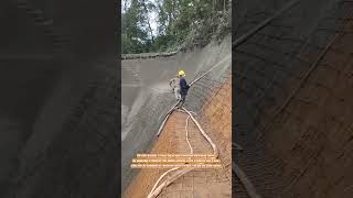
Slope stability analysis is critical for assessing potential landslides and ensuring the safety of infrastructures built on or near slopes. With the advent of automation, geotechnical engineers can employ various technologies for this purpose. Automated Monitoring Stations have been installed in landslide-prone zones, integrating cameras, inclinometers, and rainfall sensors to gather real-time data which can be analyzed using AI models for early warning systems.
The integration of Geographic Information Systems (GIS) allows the utilization of robotic terrain data, aiding in the identification of high-risk slope failure areas. Furthermore, machine learning algorithms like Artificial Neural Networks (ANNs), Support Vector Machines (SVM), and Random Forest are used for predictive modeling, combining historical slope failures with relevant geotechnical and climatic data to automate risk zoning and hazard mapping.
Robotic Total Stations provide precise surveying abilities, equipped with automatic target recognition, enabling millimeter-level monitoring of slope movement. This section highlights how these advancements in automation significantly enhance the predictive accuracy and effectiveness of slope stability assessments, pushing the boundaries of traditional geotechnical practices.
Youtube Videos


Audio Book
Dive deep into the subject with an immersive audiobook experience.
Automated Monitoring Stations
Chapter 1 of 4
🔒 Unlock Audio Chapter
Sign up and enroll to access the full audio experience
Chapter Content
• Automated Monitoring Stations:
– Installed in landslide-prone areas with integrated cameras, inclinometers, and rainfall sensors.
– Data logged and analyzed using AI models for early warning.
Detailed Explanation
Automated monitoring stations are technological setups placed in regions that are at risk for landslides. These stations utilize several types of equipment, including cameras and sensors, to constantly collect data on environmental conditions. By monitoring variables like rainfall and soil movement through inclinometers, these systems can provide real-time information about the stability of slopes. The data gathered is then processed using artificial intelligence models, which can help predict potential landslides, thus providing early warnings to prevent disasters.
Examples & Analogies
Think of these automated monitoring stations like a high-tech security system for a house in a flood-prone area. Just like a security system monitors your home for suspicious activity, these stations monitor and alert about possible landslide risks due to environmental changes.
GIS and Remote Sensing Integration
Chapter 2 of 4
🔒 Unlock Audio Chapter
Sign up and enroll to access the full audio experience
Chapter Content
• GIS and Remote Sensing Integration:
– Geographic Information System (GIS) used with robotic terrain data.
– Enables identification of potential slope failure zones.
Detailed Explanation
GIS, or Geographic Information Systems, is a technology that captures, stores, analyzes, and manages spatial or geographic data. When integrated with robotic data collection techniques, GIS assists engineers in visualizing terrain and identifying areas that might be vulnerable to slope failures. By overlaying various datasets, including soil conditions and topographical features, professionals can pinpoint specific zones where landslides are more likely to occur.
Examples & Analogies
Imagine using an interactive map that shows different risk levels for landslides in your community. By highlighting areas prone to failure, like shaded regions on the map, decision-makers can take preventive actions, similar to how town planners use maps to decide where to build roads safely.
Real-Time Data Interpretation using AI/ML
Chapter 3 of 4
🔒 Unlock Audio Chapter
Sign up and enroll to access the full audio experience
Chapter Content
• Real-Time Data Interpretation using AI/ML:
– Predictive modeling using algorithms such as ANN, SVM, and Random Forest.
– Combines historical slope failures, geotechnical data, and climatic conditions.
– Automation in risk zoning and hazard mapping.
Detailed Explanation
This chunk discusses how artificial intelligence (AI) and machine learning (ML) can analyze data in real time to predict slope stability. Techniques such as Artificial Neural Networks (ANN), Support Vector Machines (SVM), and Random Forest algorithms process large sets of data that include past slope failures and current conditions. By analyzing this information, these models provide insights into potential risks, helping to zone areas based on their likelihood of danger and create hazard maps.
Examples & Analogies
Consider this process as a weather forecast service that not only predicts the weather based on past patterns but also adjusts in real-time with incoming data from weather satellites. Just as a weather service warns you of a storm, these AI models warn engineers about the risks of landslides.
Robotic Total Stations
Chapter 4 of 4
🔒 Unlock Audio Chapter
Sign up and enroll to access the full audio experience
Chapter Content
• Robotic Total Stations:
– Used in surveying slopes and monitoring movement with millimeter precision.
– Automatic target recognition and continuous feedback to monitoring software.
Detailed Explanation
Robotic Total Stations are advanced surveying instruments combining the functions of a total station (for measuring angles and distances) with automated tracking capabilities. They can continuously monitor slope movements with high accuracy (within millimeters), making them invaluable for understanding shifts in terrain. By automatically recognizing targets, these devices feed data back to monitoring software, allowing for ongoing assessment of slope stability.
Examples & Analogies
Think of Robotic Total Stations like a smart camera surveyor that can follow a moving target, ensuring it always captures the most precise readings. Just as a camera can focus on a subject, these total stations keep track of shifts in slopes, helping engineers ensure safety.
Key Concepts
-
Automated Monitoring: Refers to the systems established in landslide-prone areas to continuously monitor slope conditions.
-
GIS Integration: Utilizes spatial data for better predictions and assessments of slope stability.
-
Real-Time Data Interpretation: Involves AI techniques to analyze data for immediate decision-making.
-
Predictive Modeling: The application of data-driven models to forecast potential slope failures.
-
Robotic Total Stations: Instruments that enhance surveying precision through automation.
Examples & Applications
An automated monitoring station uses inclinometers to measure soil movement continuously and alerts engineers in real-time if displacements exceed safe thresholds.
Implementing GIS in a mountainous region allows engineers to visualize historical landslide incidences alongside current topographic data to identify areas at risk.
AI models can predict failures based on rainfall data combined with soil characteristics, leading to quicker evacuation responses in susceptible zones.
Memory Aids
Interactive tools to help you remember key concepts
Rhymes
For stable slopes, sensors in place, keep landslides away, a monitoring race!
Stories
Once upon a hill, sensors stood tall, watching the slopes to prevent a great fall. They alerted engineers when patterns arose, keeping everyone safe from nature's pose.
Memory Tools
Remember 'G-P-A-M' for Slope Stability: G for GIS, P for Predictive models, A for Automated monitoring, M for Machine learning.
Acronyms
AAMBI
Automated Analysis and Monitoring for Slope Stability.
Flash Cards
Glossary
- Automated Monitoring Stations
Facilities equipped with sensors and cameras for real-time data collection and analysis in landslide-prone areas.
- Geographic Information Systems (GIS)
Frameworks for gathering, managing, and analyzing spatial data related to geographical locations.
- Artificial Neural Networks (ANNs)
Computational models inspired by the human brain that are used for predictive analysis based on extensive data inputs.
- Support Vector Machines (SVM)
A type of supervised machine learning model used for classification and regression tasks.
- Robotic Total Stations
Advanced surveying instruments that automate measurements and provide continuous feedback to monitoring systems.
Reference links
Supplementary resources to enhance your learning experience.