
Drone-Assisted Soil Sensing
Enroll to start learning
You’ve not yet enrolled in this course. Please enroll for free to listen to audio lessons, classroom podcasts and take practice test.
Interactive Audio Lesson
Listen to a student-teacher conversation explaining the topic in a relatable way.
Introduction to Drone-Assisted Soil Sensing
🔒 Unlock Audio Lesson
Sign up and enroll to listen to this audio lesson

Today we'll talk about drone-assisted soil sensing. Can anyone explain what drones are and how they can help in analyzing soil?

Drones are flying machines controlled remotely, and they can take images and collect data.
Exactly! Drones, or UAVs, use hyperspectral imaging. This means they can capture a range of wavelengths beyond what our eyes can see. What do you think are some benefits of using drones for soil sensing?

They can cover large areas quickly and provide detailed data.
Right! This efficiency combined with the detail helps us understand soil properties better.
Quick memory aid: Think of 'Drones = Data Rapidly Over New Environments' to remember their advantages.
Hybrid Systems in Soil Analysis
🔒 Unlock Audio Lesson
Sign up and enroll to listen to this audio lesson

Let's discuss hybrid systems, which combine drones and ground robots. Can someone tell me what this means?

It means using both types of machines together to gather better soil data.
Exactly! The synergy between these devices allows us to gather comprehensive data on soil health. How do they typically work together?

I think drones map out areas while ground robots take samples or do tests.
Great answer! The drones can first identify areas of interest using hyperspectral imaging, and then the ground robots can verify and collect samples from those targeted areas.
Remember: 'Drones for Detection, Robots for Research.' It’s a handy mnemonic to recall their roles!
Applications of Drone-Assisted Soil Sensing
🔒 Unlock Audio Lesson
Sign up and enroll to listen to this audio lesson
Now, let's talk about real-world applications of drone-assisted soil sensing. Can anyone name where this technology is used?
Agriculture! Farmers can use it to check crop health.
Absolutely! Additionally, it’s used in environmental monitoring and urban planning. Can anyone explain why this is crucial?
It helps in making better decisions about resource management and conservation.
Spot on! In short, efficient soil analysis leads to informed decisions that benefit both agriculture and the environment.
Here's a quick memory aid: Picture 'Healthy Soil, Healthy Plants' to remember the impact of good soil management.
Introduction & Overview
Read summaries of the section's main ideas at different levels of detail.
Quick Overview
Standard
The section explores the integration of drone technology and ground robots in soil sensing, focusing on hyperspectral imaging to analyze surface properties and the collaboration between UAVs and terrestrial systems for efficient data collection and environmental monitoring.
Detailed
Drone-Assisted Soil Sensing
Drone-assisted soil sensing represents a revolutionary step in soil analysis, utilizing advanced aerial technologies. This method focuses on deploying Unmanned Aerial Vehicles (UAVs) equipped with hyperspectral imaging sensors to assess surface properties of the soil. One of the significant trends is the synergy between UAVs and ground-based robotic systems, creating hybrid systems that enhance data accuracy, efficiency, and the ability to cover large areas in less time. Hyperspectral imaging provides detailed information about soil composition, moisture content, and nutrient levels, therefore improving agricultural practices and environmental monitoring. The integration of these technologies not only facilitates precise soil assessments but also contributes to more effective land management and optimization of agricultural inputs.
Youtube Videos


Audio Book
Dive deep into the subject with an immersive audiobook experience.
Hyperspectral Imaging for Surface Properties
Chapter 1 of 2
🔒 Unlock Audio Chapter
Sign up and enroll to access the full audio experience
Chapter Content
• Hyperspectral imaging for surface properties
Detailed Explanation
Hyperspectral imaging is an advanced technology that captures a wide spectrum of light from an object (in this case, soil) across multiple wavelengths. This allows us to identify various surface properties such as soil composition, moisture content, and the presence of certain minerals. Unlike traditional imaging that captures only three colors (red, green, blue), hyperspectral imaging can provide detailed information from hundreds of spectral bands. This depth of information helps in analyzing the health and quality of the soil at a much finer level.
Examples & Analogies
Think of hyperspectral imaging like a super-powered camera that can see not just the visible colors of a rainbow but can also detect nuances in temperature or humidity. Just as a camera can take stunning photos of landscapes from different angles, hyperspectral imaging can capture detailed information about soil properties from the air, allowing farmers to understand their fields better without ever stepping foot on the ground.
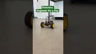
UAVs Combined with Ground Robots
Chapter 2 of 2
🔒 Unlock Audio Chapter
Sign up and enroll to access the full audio experience
Chapter Content
• UAVs combined with ground robots for hybrid systems
Detailed Explanation
UAVs, or Unmanned Aerial Vehicles (commonly known as drones), can be equipped with a variety of sensors to perform aerial assessments of soil conditions. When these UAVs are integrated with ground robots, the system creates a hybrid approach to soil sensing. The UAV can cover large areas quickly, capturing detailed aerial data, while ground robots can perform more precise, localized investigations such as soil sampling and testing. This teamwork allows for comprehensive analysis and efficient data collection, optimizing both the time and labor involved in soil sensing.
Examples & Analogies
Imagine a soccer team where each player has a specific role. The drone acts like a speedy forward running up the field, providing critical information about what’s happening at a macro level, while the ground robot is like a precise defender, examining specifics in the soil that need careful attention. Together, they efficiently analyze the field and keep track of the game, leading to better outcomes for farmers who manage their crops.
Key Concepts
-
Drone Technology: The use of UAVs for data collection.
-
Hyperspectral Imaging: Technique that captures spectral information for analysis.
-
Hybrid Systems: Integration of UAVs and ground robots for comprehensive analysis.
Examples & Applications
Farmers utilize drone technology for monitoring crop health, identifying areas requiring attention.
Environmental scientists deploy UAVs equipped with sensors to assess land degradation.
Memory Aids
Interactive tools to help you remember key concepts
Rhymes
Drones survey from the sky, to know the soil, oh my!
Stories
Once upon a time, a farmer used a drone to fly over his fields. He discovered patches of thirsty crops and saved his harvest with wise watering.
Memory Tools
Remember: 'Drones Guide Data' to recall the role of drones in data collection.
Acronyms
DRONE
Data Retrieval of Nutrient Evaluations for soil analysis.
Flash Cards
Glossary
- Drone (UAV)
An Unmanned Aerial Vehicle that can be controlled remotely and is used for various applications, including data collection.
- Hyperspectral Imaging
A method of capturing images across various wavelengths, enabling detailed analysis of materials, including soil types and conditions.
- Hybrid Systems
A combination of different technologies, such as drones and ground robots, working together to enhance data collection and analysis.
Reference links
Supplementary resources to enhance your learning experience.