
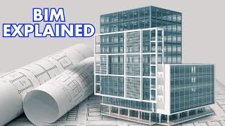
Role in Building Information Modelling (BIM)
Enroll to start learning
You’ve not yet enrolled in this course. Please enroll for free to listen to audio lessons, classroom podcasts and take practice test.
Interactive Audio Lesson
Listen to a student-teacher conversation explaining the topic in a relatable way.
Integrating Soil Data into BIM Models
🔒 Unlock Audio Lesson
Sign up and enroll to listen to this audio lesson

Today, we'll explore how automated soil sampling integrates with Building Information Modelling or BIM. Can anyone explain what BIM is?

BIM is a digital representation of physical and functional characteristics of a facility.
Exactly! And how can real-time geotechnical data enhance BIM?

It can provide accurate insights into soil conditions, which is crucial for foundation design.
Right! We can think of this process as a dynamic data loop. The soil data updates continuously, ensuring that the BIM model represents the current conditions. How does this help predict foundation issues?

It uses predictive analytics which helps identify potential problems before they happen.
Great point! So, remember the acronym R.A.P. for Real-time, Accurate, Predictive. In what ways can inaccurate soil data impact construction projects?

It can lead to structural failures, increased costs, and delays.
Exactly! Keeping soil data accurate and up-to-date helps avoid these issues.
To summarize, integrating soil data with BIM allows for continuous assessment of conditions and predictive modeling of foundation behavior, leading to safer and more efficient construction.
Digital Twin Environments
🔒 Unlock Audio Lesson
Sign up and enroll to listen to this audio lesson

Let's delve into the concept of digital twin environments and their connection to soil sampling data. What is a digital twin?
A digital twin is a virtual model of a physical object or system.
Exactly! And how does soil data fit into this model?
It allows the digital twin to simulate physical behavior based on actual geotechnical conditions.
Right! This means any changes in soil conditions can be reflected in the digital twin. Can anyone think of a practical example?
If the soil moisture level changes, the digital twin can update and predict how it affects foundation stability.
Perfect! To help remember this, think of the mnemonic 'D.A.R.E.' - Data-Adapt-Reflect-Enhance. This emphasizes how soil data adapts real-time conditions in BIM. Why is it critical to have this integration in construction?
It optimizes project outcomes and safety by allowing for reactive changes based on accurate data.
Excellent! In summary, integrating soil data within digital twins enhances decision-making in construction by ensuring real-time adaptations to changing conditions.
Predictive Analytics in Foundation Design
🔒 Unlock Audio Lesson
Sign up and enroll to listen to this audio lesson
Now, let's analyze the role of predictive analytics in foundation design. Why is it important to predict soil behavior?
It allows engineers to design foundations that can withstand environmental conditions over time.
Exactly! Predictive analytics interprets soil data to forecast how foundations might respond during their lifespan. Can anyone cite examples where this has been beneficial?
In regions prone to earthquakes, predicting soil liquefaction can lead to safer foundation designs.
Great example! Let’s use the acronym S.A.F.E - Stability, Adaptability, Forecasting, Efficiency. Why is using automated data preferable to manual methods in this context?
Automated data gives continuous updates, reducing human error and improving reliability.
Correct! So, to summarize, utilizing predictive analytics through real-time soil data leads to safer and more efficient foundation designs in construction.
Introduction & Overview
Read summaries of the section's main ideas at different levels of detail.
Quick Overview
Standard
The section discusses the crucial role that automated soil sampling and testing play in enhancing Building Information Modelling (BIM). It emphasizes how real-time geotechnical data improves the accuracy of digital models and informs foundational design through predictive analytics.
Detailed
Role in Building Information Modelling (BIM)
In the realm of civil engineering, integrating soil sampling data into Building Information Modelling (BIM) has become increasingly vital. Automated systems for soil testing enable the real-time feeding of geotechnical data into BIM applications, enhancing decision-making processes throughout construction workflows.
Real-time geotechnical data from automated soil sampling provides essential insights that overlay with digital twin environments, allowing for accurate simulations of physical conditions in project planning. This includes predictive analytics that inform foundation design and stability assessments by analyzing current soil conditions and their implications on structural integrity. As a result, projects can achieve higher efficiencies, reduce risks, and ensure compliance with safety standards.
Youtube Videos


Audio Book
Dive deep into the subject with an immersive audiobook experience.
Real-Time Data Integration
Chapter 1 of 3
🔒 Unlock Audio Chapter
Sign up and enroll to access the full audio experience
Chapter Content
• Feeding real-time geotechnical data into BIM models
Detailed Explanation
This point highlights how real-time data gathered from the field, particularly relating to soil conditions, can be immediately incorporated into Building Information Modelling (BIM) systems. This integration allows engineers and architects to have up-to-date information that informs their design and construction processes, leading to better decision-making.
Examples & Analogies
Imagine a chef who constantly checks the freshness of ingredients while preparing a dish. Just as the chef adjusts the recipe according to the quality of the ingredients, engineers can modify their designs in response to changing soil conditions, enhancing the safety and efficiency of construction.
Soil Test Data Overlay
Chapter 2 of 3
🔒 Unlock Audio Chapter
Sign up and enroll to access the full audio experience
Chapter Content
• Soil test data overlay on digital twin environments
Detailed Explanation
This point discusses the ability to overlay soil testing results directly onto a digital twin model of a construction site. A digital twin is a virtual representation of a physical object or system, which in this case is the building site. By overlaying soil data, stakeholders can visualize how different soil properties affect the structure, enabling them to design foundations that are tailored to the specific conditions of the site.
Examples & Analogies
Think of a video game where players can apply different strategies based on the terrain they encounter. Similar to that situation, architects and engineers use overlaid data to strategize the best type of foundation and structural supports required for the specific conditions of the site, ensuring successful project outcomes.
Predictive Analytics in Design
Chapter 3 of 3
🔒 Unlock Audio Chapter
Sign up and enroll to access the full audio experience
Chapter Content
• Predictive analytics for foundation design within BIM workflows
Detailed Explanation
This section emphasizes the use of predictive analytics techniques within BIM to enhance foundation design. By analyzing soil data patterns and trends, engineers can predict how the soil will behave under load and over time, thereby optimizing the foundation's design to prevent potential issues such as settling or failure in the future.
Examples & Analogies
Consider a weather forecast predicting a storm. Just as people prepare their homes based on the forecast to avoid damage, engineers use predictive analytics to foresee potential problems with the foundation, allowing them to reinforce designs and mitigate construction risks.
Key Concepts
-
BIM: A digital model representing a construction project, enabling collaboration and informed decision-making.
-
Real-time Data: Automatic updates utilized for accurate representation of current conditions in BIM.
-
Predictive Analytics: Forecasting future behaviors based on geotechnical data for better design outcomes.
-
Digital Twin: A representation that mirrors a physical object, allowing for real-time simulations and adjustments.
Examples & Applications
Using real-time soil moisture data within BIM to adjust construction schedules based on environmental conditions.
Applying predictive analytics to forecast potential ground settlement over time for a specific foundation design.
Integrating soil sampling data into digital twins to visually depict the impact of soil conditions on various engineering projects.
Memory Aids
Interactive tools to help you remember key concepts
Rhymes
In BIM we trust for accurate data must be a must, for it builds the future that we adjust.
Stories
Imagine an engineer named Sam, who uses BIM daily. One day, he noticed a crack forming in a building's foundation due to unexpected soil behavior. With the help of real-time soil data in his digital twin, he simulated the scenario and adjusted the design before it became a disaster.
Memory Tools
To remember the benefits of BIM, think 'A.A.P.E.': Accurate data, Adaptability, Predictive analysis, Efficiency.
Acronyms
R.A.P. for Real-time, Accurate, Predictive data in BIM contexts.
Flash Cards
Glossary
- Building Information Modelling (BIM)
A digital representation of the physical and functional characteristics of a facility.
- Geotechnical Data
Information about soil and rock properties used for foundation design and construction.
- Digital Twin
A virtual model that mirrors a physical object, allowing for real-time updates and simulations.
- Predictive Analytics
The use of data analysis techniques to predict future outcomes based on historical data.
- Foundation Design
The process of creating a supporting base for structures, ensuring stability and safety.
Reference links
Supplementary resources to enhance your learning experience.