
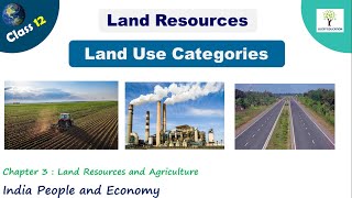
Land-use Categories
Enroll to start learning
You’ve not yet enrolled in this course. Please enroll for free to listen to audio lessons, classroom podcasts and take practice test.
Interactive Audio Lesson
Listen to a student-teacher conversation explaining the topic in a relatable way.
Introduction to Land-use Categories
🔒 Unlock Audio Lesson
Sign up and enroll to listen to this audio lesson

Today, we will discuss land-use categories. Can anyone tell me why it's important to categorize land uses?

To understand how we can manage land resources better!
Exactly! Categorizing helps in planning and ensures resources are used efficiently. There are several main categories, such as forests, barren land, and agricultural uses.

What are barren lands?
Barren lands are areas that cannot be cultivated with current technology due to conditions like steep terrain or desert. An easy way to remember them is to think 'bare land' meaning unusable.

What about the land used for cities and roads?
Good question! That falls under non-agricultural uses. This category is growing as our economy expands, especially with urbanization. Remember the acronym 'FBNPM' for Forests, Barren, Non-agricultural, Pastures, and Miscellaneous tree crops.

Can each category change over time?
Yes, shifts in economy and technology often change land use. It's vital to analyze these changes to prevent land degradation.
In summary, land-use categories help us manage our resources, with significant growth in non-agricultural uses as urbanization increases.
Significance of Forests and Wastelands
🔒 Unlock Audio Lesson
Sign up and enroll to listen to this audio lesson

Let's dive deeper into the forests and wastelands. Why might forests be significant?
Forests provide timber and homes for wildlife!
Absolutely! They also help with oxygen production and soil conservation. Keep in mind that 'not all classified forests have actual trees.' This distinction is crucial!
Why are wastelands considered unproductive?
Wastelands consist of rough terrains, deserts, or areas that can't support crop growth. Remember, they can't be farmed without new technologies or methods.
How can we convert wastelands into productive land?
Through reclamation practices, like improving soil quality. This process is essential for maximizing our land resources!
In summary, forests are essential for the ecosystem, while wastelands offer potential if managed properly.
Trends in Land-use Categories
🔒 Unlock Audio Lesson
Sign up and enroll to listen to this audio lesson
Now, let's look at the trends in land use from 1950 to 2014. What major changes do you think occurred?
There likely was more land turning into urban areas.
That's correct! The shift toward non-agricultural uses highlights how our society changes. As populations grow, less land is devoted to agriculture.
What about forests, did they also change?
Yes! While the area classified as forest has increased, this doesn't necessarily mean that the actual forest cover increased. This is a critical takeaway!
What do these changes mean for farmers?
Farmers face high pressure for agricultural land due to urban expansion. It's vital for us to balance land use for sustainability.
In summary, review the historical changes in land use to understand economic and societal impacts.
Introduction & Overview
Read summaries of the section's main ideas at different levels of detail.
Quick Overview
Standard
The section discusses how land is utilized for various purposes like forests, agriculture, and infrastructure in India. It further explains the distinctions between land-use categories, including current trends, changes in land utilization, and their implications for the economy and environment.
Detailed
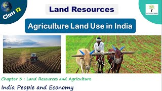
Land-use Categories in India
Land in India is utilized for diverse purposes, reflecting its role as a vital resource in human activities. The primary categories of land use include forests, barren lands, non-agricultural lands, and grazing areas, among others. The Survey of India oversees the measurement of geographical areas, while land use records are maintained by the Land Revenue Department.
Main Land-use Categories:
- Forests: Areas designated for forest growth, which may differ from actual forest cover. Government designations may increase without a rise in the actual forest area.
- Barren and Wastelands: Territories that are unsuitable for cultivation due to natural constraints such as terrain or climate.
- Non-agricultural Uses: Includes urban settlements, infrastructure, and industrial lands. Economic activities influence land utilization patterns over time.
- Permanent Pastures and Grazing Lands: Primarily village or government-owned lands for livestock grazing.
- Miscellaneous Tree Crops and Groves: Areas with orchards not included in net sown area.
- Culturable Wasteland: Land left uncultivated for over five years, requiring reclamation efforts to be farmable again.
- Current Fallow: Cultivated land that is left unused for one year or less to recover fertility.
- Fallow Other than Current Fallow: Cultivated land unused for one to five years.
- Net Area Sown: The actual land used for crop production, indicative of agricultural productivity.
Changes in these categories from 1950 to 2014 highlight a significant shift towards urbanization and non-agricultural uses, often at the cost of agricultural lands. This discussion encapsulates the complex interplay between land use, economic activity, and environmental conservation.
Youtube Videos

Audio Book
Dive deep into the subject with an immersive audiobook experience.
Observation of Land Uses
Chapter 1 of 4
🔒 Unlock Audio Chapter
Sign up and enroll to access the full audio experience
Chapter Content
You must have observed that the land around you is put to different uses. Some land is occupied by rivers, some may have trees and on some parts roads and buildings have been built. Different types of lands are suited to different uses. Human beings thus, use land as a resource for production as well as residence and recreation. Thus, the building of your school, roads on which you travel, parks in which you play, fields in which crops are grown and the pastures where animals graze represent different uses to which land is put.
Detailed Explanation
The land serves various purposes depending on its characteristics. We often see various natural features (like rivers and trees) and human-made structures (like schools and roads) around us, showcasing the multiple uses of land. Different types of land like agricultural fields and pastures are exploited to meet human needs for food, housing, and recreation. This reflects how human beings actively manage land as a resource for their societal and economic activities.
Examples & Analogies
Imagine your neighborhood: where you see a playground (for recreation), fields with crops (for food production), and buildings (for shelter and education). Each area serves a specific purpose, just like the various uses of land on a larger scale.
Land-use Records and Categories
Chapter 2 of 4
🔒 Unlock Audio Chapter
Sign up and enroll to access the full audio experience
Chapter Content
Land-use records are maintained by the land revenue department. The land use categories add up to the reporting area, which is somewhat different from the geographical area. The Survey of India is responsible for measuring the geographical area of administrative units in India. The difference between the two concepts is that while the former changes somewhat depending on the estimates of the land revenue records, the latter does not change and stays fixed as per Survey of India measurements. You may be familiar with land use categories as they are also included in your Social Science textbook of Class X.
Detailed Explanation
Land-use records are crucial for understanding how land is categorized and used in a given area. The land revenue department maintains these records, which tally up to a 'reporting area.' This is different from the 'geographical area,' which remains constant. Understanding these distinctions helps in planning and managing land resources effectively, and students often encounter these concepts in their academic studies.
Examples & Analogies
Think of land records like a detailed map of a city's land use. Some areas are marked as parks, schools, or farms. These categories can change based on new developments (like building new roads), but the overall size of the city (geographical area) remains the same.
Types of Land-use Categories
Chapter 3 of 4
🔒 Unlock Audio Chapter
Sign up and enroll to access the full audio experience
Chapter Content
The land-use categories as maintained in the Land Revenue Records are as follows: (i) Forests: It is important to note that area under actual forest cover is different from area classified as forest. (ii) Barren and Wastelands. (iii) Land put to Non-agricultural Uses. (iv) Area under Permanent Pastures and Grazing Lands. (v) Area under Miscellaneous Tree Crops and Groves. (vi) Culturable Wasteland. (vii) Current Fallow. (viii) Fallow other than Current Fallow. (ix) Net Area Sown.
Detailed Explanation
Different land-use categories help classify the land based on its current use. For example, 'Forests' includes areas designated for forest growth, which may not necessarily correspond to planted trees. 'Barren and Wastelands' are areas unsuitable for agriculture, whereas 'Non-agricultural Uses' refer to urban developments like housing and roads. It is essential to understand these categories for effective land management and resource planning.
Examples & Analogies
Picture a large puzzle where each piece represents a different type of land use—like forests, fields, and roads. Each piece fits together to show the complete picture of land utilization in your area. Just like each piece is crucial to the whole puzzle, each land-use category plays a vital role in our environment and economy.
Issues of Land Use
Chapter 4 of 4
🔒 Unlock Audio Chapter
Sign up and enroll to access the full audio experience
Chapter Content
Land-use in a region, to a large extent, is influenced by the nature of economic activities carried out in that region. However, while economic activities change over time, land, like many other natural resources, is fixed in terms of its area. This creates a need to appreciate three types of changes that an economy undergoes, which affect land-use.
Detailed Explanation
The land's fixed area can be a limiting factor as economic activities evolve, leading to changes in land use. For instance, an increase in industrial activities might require land previously used for agriculture, causing a transition in how land is utilized. Recognizing these changes is crucial to manage land resources sustainably and ensure that land use adapts to the shifting economic landscape.
Examples & Analogies
Imagine a growing city that needs more space for factories. Previously agricultural land might be repurposed for this use. While the city grows and changes, the actual land area does not expand. Just like a game board that has a fixed size, the available land must be utilized strategically.
Key Concepts
-
Land Use Categories: Different ways land is utilized.
-
Urban Expansion: Shift of agricultural land to urban settings.
-
Forests vs. Actual Cover: Classified forests may not reflect real forest areas.
-
Pressure on Agricultural Land: Urban growth reduces farming areas.
Examples & Applications
The expansion of cities leading to the decline of agricultural fields.
The classification of wastelands and their potential for reclamation.
Memory Aids
Interactive tools to help you remember key concepts
Rhymes
For land use, here’s the scoop, forests and farms, in one big group. Barren lands lie bare and dry, non-agricultural uses reach the sky!
Stories
Once, in a vast land of green and brown, farmers grew crops while cities crowned. But as the towns grew bigger and wide, less land for farms could they abide.
Memory Tools
To remember land categories, think of 'FBNPM': Forests, Barren, Non-agricultural, Pastures, Miscellaneous.
Acronyms
The classification of land can be remembered by 'FBNPM'. F for Forests, B for Barren, N for Non-agricultural, P for Pastures, M for Miscellaneous.
Flash Cards
Glossary
- Forests
Areas classified for forest growth, which may differ from the actual forest cover.
- Barren Lands
Territories that cannot be cultivated due to natural constraints.
- Current Fallow
Cropped land left uncultivated for one agricultural year.
- Culturable Wasteland
Uncultivated land that can potentially be brought under cultivation after reclamation.
- Net Area Sown
The actual area of land on which crops are sown and harvested.
Reference links
Supplementary resources to enhance your learning experience.