
PROJECT /ACTIVITY
Enroll to start learning
You’ve not yet enrolled in this course. Please enroll for free to listen to audio lessons, classroom podcasts and take practice test.
Interactive Audio Lesson
Listen to a student-teacher conversation explaining the topic in a relatable way.
Introduction to India's Physical Features
🔒 Unlock Audio Lesson
Sign up and enroll to listen to this audio lesson

Today, we will explore the diverse physical features of India, including mountains, plains, and plateaus. Understanding these features is vital as they significantly influence the climate, culture, and economy of the country. Can anyone tell me the major landforms found in India?

Mountains, plains, plateaus, deserts, and islands!
Exactly! Remember, we can use the acronym 'MPPID' to recall Mountains, Plains, Plateaus, Islands, and Deserts. Let's dive deeper into the Himalayas.
The Himalayan Mountains
🔒 Unlock Audio Lesson
Sign up and enroll to listen to this audio lesson

The Himalayas are one of the youngest mountain ranges and are home to some of the highest peaks in the world. Can someone name a famous peak?

Mt. Everest!
Yes! Mt. Everest, which is 8848 meters high, is the tallest. To remember the height, think of the number 8, which reminds us of 8,848! Now, why are the Himalayas important?

They provide water resources and influence the climate!
Great observation! The Himalayas are crucial for water supply and ecological balance.
The Northern Plains
🔒 Unlock Audio Lesson
Sign up and enroll to listen to this audio lesson
Next, let’s discuss the Northern Plains, formed by the alluvial deposits from major rivers. What does 'alluvial' mean?

Does it mean soil deposited by rivers?
Correct! This fertile land supports agriculture. Remember, a 'Doab' refers to a region between two rivers. Can anyone tell me an example of a doab?
Punjab, the land between the five rivers!
Absolutely! The Punjab doab is a vital agricultural region. Keep it up!
The Peninsular Plateau
🔒 Unlock Audio Lesson
Sign up and enroll to listen to this audio lesson
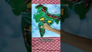
Moving on to the Peninsular Plateau, which is characterized by old crystalline rocks. Can anyone name its two divisions?
The Central Highlands and the Deccan Plateau!
Well done! The Deccan Plateau is higher in the west and slopes eastwards. We can remember this with the mnemonic 'High West, Low East!' What minerals can we find here?
Coal and iron ore!
Exactly! This region is rich in mineral resources.
Islands and Their Importance
🔒 Unlock Audio Lesson
Sign up and enroll to listen to this audio lesson
Finally, let’s turn to the islands. Can someone tell me the differences between the Lakshadweep and Andaman Islands?
Lakshadweep is a coral island group while the Andaman Islands are mountainous.
Excellent distinction! The Lakshadweep Islands are known for their biodiversity, while the Andaman Islands are strategically important. Can anyone summarize the significance of these islands?
They support unique ecosystems and are important for marine resources!
Well summed up! Understanding these features provides insight into India's natural wealth.
Introduction & Overview
Read summaries of the section's main ideas at different levels of detail.
Quick Overview
Standard
The section dives into the major physiographic divisions of India, discussing the Himalayas, Northern Plains, Peninsular Plateau, Indian Desert, Coastal Plains, and Islands. Each division is described in terms of its geological composition, formation processes, and geographical significance, highlighting the regional characteristics and their natural resources.
Detailed
PROJECT /ACTIVITY
Overview
India's geography is marked by remarkable physical diversity, comprising various landforms such as mountains, plains, plateaus, deserts, and islands. This section provides an in-depth look at these features, focusing on their characteristics, origins, and the role they play in the ecology and economy of the country.
Major Physiographic Divisions
- The Himalayan Mountains: These young, fold mountains stretch across India's northern border and are characterized by their towering heights and rugged terrain, with notable peaks like Mt. Everest and Kanchenjunga.
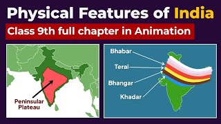
- The Northern Plains: Formed by alluvial deposits from the Indus, Ganga, and Brahmaputra rivers, this region supports a dense population and robust agriculture.
- The Peninsular Plateau: Comprising old crystalline rocks and divided into the Central Highlands and Deccan Plateau, this area features rounded hills and valleys.
- The Indian Desert: Located on the western edge of the Aravali Hills, this dry region has minimal rainfall and limited vegetation.
- The Coastal Plains: Stretching along the Arabian Sea and Bay of Bengal, these plains are characterized by fertile lands due to river deltas.
- The Islands: India has two significant island groups, the Lakshadweep Islands and the Andaman and Nicobar Islands, each rich in biodiversity.
Each physiographic division complements one another, contributing to India’s rich natural resources and potential for development.
Youtube Videos


Audio Book
Dive deep into the subject with an immersive audiobook experience.
Finding Geographical Features
Chapter 1 of 1
🔒 Unlock Audio Chapter
Sign up and enroll to access the full audio experience
Chapter Content
Locate the peaks, passes, ranges, plateaus, hills, and duns hidden in the puzzle. Try to find where these features are located. You may start your search horizontally, vertically or diagonally.
Detailed Explanation
This activity encourages students to engage with geographical vocabulary by searching for various features like peaks, ranges, and plateaus in a puzzle format. It's designed to enhance their understanding of the geographical layout of India and helps reinforce memorization of important terms related to its physical geography.
Examples & Analogies
Think of it like a treasure hunt where you are looking for specific items—here, instead of treasure, you're finding geographical features! Just as a treasure map guides you to hidden gems, this puzzle helps you discover the hidden 'gems' of India’s physical geography.
Key Concepts
-
Physiographic Divisions: Major divisions of landforms in India include the Himalayas, Northern Plains, Peninsular Plateau, Indian Desert, Coastal Plains, and Islands.
-
Formation of Northern Plains: Comprised mainly of alluvial soil from river deposits and important for agriculture.
-
Characteristics of Himalayas: Young fold mountains with the highest peaks, crucial for climate and water resources.
-
Peninsular Plateau: Composed of old crystalline rocks, rich in minerals, and subdivided into Central Highlands and Deccan Plateau.
Examples & Applications
The Himalayas are home to peaks like Mt. Everest and Kanchenjunga, which are significant for tourism and ecology.
The Northern Plains support about 40% of India's population due to fertile land and ideal farming conditions.
The Deccan Plateau is noted for its black soil, which is excellent for cotton cultivation.
Memory Aids
Interactive tools to help you remember key concepts
Rhymes
In the north, the Himalayas rise, / Northern plains are farming wise. / Plateaus stand high, so rich in ore, / Deserts sparse, but they explore!
Stories
Imagine a traveler who journeys through India. They first climb the towering Himalayas, then traverse the fertile Northern Plains, and finally rest on the smooth Peninsular Plateau, feeling the rich minerals beneath their feet.
Memory Tools
To remember the major physiographic divisions, think 'HPPDI' - Himalayas, Peninsular, Plains, Deserts, Islands.
Acronyms
Use 'MCPRID' (Mountains, Coastal, Plains, Rivers, Islands, Deserts) to remember the key landforms.
Flash Cards
Glossary
- Alluvial
Soil deposited by rivers, highly fertile.
- Doab
Land between two rivers.
- Peninsular Plateau
Tableland formed from old crystalline rocks.
- Coral Islands
Islands formed from coral deposits, such as those in Lakshadweep.
- Physiography
The study of physical geography and landforms.
Reference links
Supplementary resources to enhance your learning experience.