
The Himalayan Mountains
Enroll to start learning
You’ve not yet enrolled in this course. Please enroll for free to listen to audio lessons, classroom podcasts and take practice test.
Interactive Audio Lesson
Listen to a student-teacher conversation explaining the topic in a relatable way.
Introduction to the Himalayan Mountains
🔒 Unlock Audio Lesson
Sign up and enroll to listen to this audio lesson

Welcome everyone! Today, we're diving into the remarkable Himalayan Mountains, which stretch across the northern edge of India. Can anyone tell me how long these mountains are?

Are they about 2,400 kilometers long?
That's correct! The Himalayas cover roughly 2,400 kilometers. Now, what do we mean by 'geologically young' when referring to these mountains?

Does it mean they haven't been around for very long, like older mountain ranges?
Exactly! They form a youthful topography with high peaks and steep valleys. To remember this, think of 'Himalaya' as a story of youth—youthful mountains standing tall!

What are some features of the Great Himalayas?
Great question! The Great Himalayas, or Himadri, contain the highest peaks like Mt. Everest. Picture them as nature's skyscrapers!
Three Major Ranges
🔒 Unlock Audio Lesson
Sign up and enroll to listen to this audio lesson

Let's explore the three major ranges of the Himalayas. Who can name them?

The Great Himalayas, Lesser Himalayas, and Shiwaliks!
Excellent! The Great Himalayas are the highest and most continuous, while the Lesser Himalayas feature rugged terrains. How tall do you think the peaks in the Lesser Himalayas reach?
Maybe between 3,700 and 4,500 meters?
Right! And the Shiwaliks are the outermost, lower-altitude range. To keep them straight, remember: Great = Great Heights, Lesser = Lower Heights, Shiwaliks = Short and Sweet!
Important Landforms and Features
🔒 Unlock Audio Lesson
Sign up and enroll to listen to this audio lesson
Now, let's discuss some of the important peaks of the Himalayas. Can anyone list a few?
Mt. Everest and Kanchenjunga are two of them!
Absolutely! Mt. Everest is the tallest at 8,848 meters. Which country is Kanchenjunga located in?
It's in India!
Spot on! The Himalayas are not just peaks; they also host many valleys with rich ecosystems. Who can tell me the significance of these valleys?
They provide habitats for wildlife and help in agriculture!
Great insight! Remember, the Himalayas support diverse life forms and provide essential resources, including water.
Regional Names and Divisions
🔒 Unlock Audio Lesson
Sign up and enroll to listen to this audio lesson
How are the Himalayas divided based on region?
By the river valleys, like from Indus to Ganga!
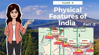
Correct! From west to east, they are known as Punjab Himalayas, Kumaon Himalayas, Nepal Himalayas, and Assam Himalayas. To help remember, think of P, K, N, A — like 'Peeking Kanoon Ahead!'
What about the eastern edge near Bhutan?
Good point! Beyond the Dihang gorge, they morph into the Purvachal or Eastern Hills. This region features strong sandstone and dense forests.
Impact of the Himalayas
🔒 Unlock Audio Lesson
Sign up and enroll to listen to this audio lesson
Finally, why are the Himalayas so vital to India?
They supply water and affect our climate!
Exactly! They are critical watersheds for major rivers. Also, think about biodiversity—what unique ecosystems do we find here?
They support a variety of plants and animals!
Right you are! Mountains are not just barriers; they form lifelines for agriculture and wildlife. To remember this, simply say, 'Himalayas—Nature's Reservoir!'
Introduction & Overview
Read summaries of the section's main ideas at different levels of detail.
Quick Overview
Standard
The Himalayan Mountains are a complex system of fold mountains characterized by their geological youth and impressive height, playing a crucial role in India's geography. Their three main ranges, the Great Himalayas, the Lesser Himalayas, and the Shiwaliks, present distinct features and ecosystems, along with many peaks that are among the tallest in the world.
Detailed
The Himalayan Mountains
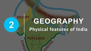
The Himalayan Mountains, an extraordinary geological feature, stretch approximately 2,400 km across northern India, forming a significant topographical boundary. The mountains are relatively young in geological terms and are composed of three major ranges: the Great Himalayas (Himadri), the Lesser Himalayas (Himachal), and the Shiwaliks. The Great Himalayas house the tallest peaks, including Mt. Everest and Kanchenjunga, with elevations typical of 6,000 metres and above. The Lesser Himalayas offer rugged terrain and lower altitudes, while the Shiwaliks represent the outermost range consisting of softer sediments and lower elevations.
Physiographic Importance
The Himalayas not only impact weather patterns through the monsoon but also serve as watersheds for major rivers such as the Indus, Ganga, and Brahmaputra. The mountains are essential for biodiversity, offering unique ecosystems along varying altitudes. This section's geography illustrates the diverse landscapes and climates that can exist within a single region, paving the way for agriculture and various forms of habitation.
Youtube Videos


Audio Book
Dive deep into the subject with an immersive audiobook experience.
Overview of the Himalayas
Chapter 1 of 8
🔒 Unlock Audio Chapter
Sign up and enroll to access the full audio experience
Chapter Content
The Himalayas, geologically young and structurally fold mountains stretch over the northern borders of India. These mountain ranges run in a west-east direction from the Indus to the Brahmaputra. The Himalayas represent the loftiest and one of the most rugged mountain barriers of the world.
Detailed Explanation
The Himalayas, which means 'abode of snow' in Sanskrit, are a major mountain range forming the northern boundary of India. They run from west to east, spanning across several countries, and are known for being the highest mountain range in the world. The term 'geologically young' indicates that these mountains are still forming and changing compared to older mountain ranges.
Examples & Analogies
Think of the Himalayas like a towering wall, built recently compared to ancient walls found in historical sites. They are like nature's skyscrapers, constantly being shaped by the forces of the earth.
Dimensions and Structure
Chapter 2 of 8
🔒 Unlock Audio Chapter
Sign up and enroll to access the full audio experience
Chapter Content
They form an arc, which covers a distance of about 2,400 Km. Their width varies from 400 Km in Kashmir to 150 Km in Arunachal Pradesh. The altitudinal variations are greater in the eastern half than those in the western half.
Detailed Explanation
The Himalayas stretch over 2,400 kilometers and their width changes as you move along the range. In Kashmir, it's much wider (about 400 km) but narrows down to around 150 km in Arunachal Pradesh. Interestingly, the eastern part of the Himalayas is taller compared to the western part, showcasing a varied elevation that contributes to different climates and ecosystems in these regions.
Examples & Analogies
Imagine a giant ribbon that narrows as it goes along; that's similar to how the Himalayas spread across the north, beginning wide at one end and gradually getting narrower while still being really tall and impressive!
The Three Parallel Ranges
Chapter 3 of 8
🔒 Unlock Audio Chapter
Sign up and enroll to access the full audio experience
Chapter Content
The Himalaya consists of three parallel ranges in its longitudinal extent. A number of valleys lie between these ranges. The northern-most range is known as the Great or Inner Himalayas or the Himadri.
Detailed Explanation
The main body of the Himalayas is made up of three distinct ranges: the Great Himalayas, the Lesser Himalayas (Himachal), and the Outer Himalayas (Shiwaliks). These ranges create beautiful valleys where various rivers flow. The highest and most prominent range, Himadri, contains the tallest peaks of the Himalayas, including Mount Everest.
Examples & Analogies
If you think of the Himalayas as a layered cake, the Great Himalayas would be the top layer—very elevated and rich in peaks—while the other two ranges would be like the middle and bottom layers, each with their own unique flavor and characteristics.
Highest Peaks of the Himalayas
Chapter 4 of 8
🔒 Unlock Audio Chapter
Sign up and enroll to access the full audio experience
Chapter Content
The folds of the Great Himalayas are asymmetrical in nature. The core of this part of Himalayas is composed of granite. It is perennially snow bound, and a number of glaciers descend from this range.
Detailed Explanation
The peaks of the Great Himalayas are made mostly of granite and are characterized by their steep, uneven shapes. They remain covered in snow all year round. Glaciers, which are large masses of ice, flow down from these peaks, feeding into rivers and providing water to millions of people downstream.
Examples & Analogies
Think of a giant ice cube sliding down an incline; the glaciers behave in a similar way as they slowly move down from the snowy peaks, maintaining the water cycle crucial for life below.
The Lesser and Outer Himalayas
Chapter 5 of 8
🔒 Unlock Audio Chapter
Sign up and enroll to access the full audio experience
Chapter Content
The range lying to the south of the Himadri forms the most rugged mountain system and is known as Himachal or lesser Himalaya. The outer-most range of the Himalayas is called the Shiwaliks.
Detailed Explanation
Located just south of the Great Himalayas, the Lesser Himalayas (Himachal) feature more rugged terrain with varied landscapes and valleys, and generally lower altitudes. Following this, the Shiwaliks are the outermost range and consist of lower hills that are made from sediments eroded from the massive ranges to the north.
Examples & Analogies
Picture an elaborate dish with layers; the Great Himalayas are the main portion with the richest flavors, the Lesser Himalayas provide the crunchy texture, and the Shiwaliks act as a light garnish, bringing the dish together.
Valleys and Duns
Chapter 6 of 8
🔒 Unlock Audio Chapter
Sign up and enroll to access the full audio experience
Chapter Content
These ranges are composed of unconsolidated sediments brought down by rivers from the main Himalayan ranges. These valleys are covered with thick gravel and alluvium. The longitudinal valley lying between lesser Himalaya and the Shiwaliks are known as Duns.
Detailed Explanation
The valleys, or Duns, are unique depressions found between the different ranges of the Himalayas. They are primarily filled with sediments carried down by rivers, creating fertile land which is suitable for agriculture. Some well-known Duns include Dehra Dun, Kotli Dun, and Patli Dun.
Examples & Analogies
Consider a natural trough where rainwater collects and spills over nutrients; these valleys gather the rich soil brought from the higher peaks, creating lush farmland that contrasts with the rugged mountains around.
Regional Divisions of the Himalayas
Chapter 7 of 8
🔒 Unlock Audio Chapter
Sign up and enroll to access the full audio experience
Chapter Content
The Himalayas have been divided on the basis of regions from west to east. These divisions have been demarcated by river valleys. For example, the part of Himalayas lying between Indus and Satluj has been traditionally known as Punjab Himalaya.
Detailed Explanation
The Himalayas are also divided into different regions based on the rivers that run through them. This organization not only helps in understanding the various ecosystems present but also in managing resources more effectively. The Punjab Himalaya, Kumaon Himalaya, and Assam Himalaya are a few examples of these regional divisions.
Examples & Analogies
Imagine a large park that is split into sections by trails. Each section has its unique characteristics and popular spots; similarly, the river valleys define the different regions of the Himalayas, each with its unique landscape and biodiversity.
Eastern Extension - Purvachal
Chapter 8 of 8
🔒 Unlock Audio Chapter
Sign up and enroll to access the full audio experience
Chapter Content
The Brahmaputra marks the eastern-most boundary of the Himalayas. Beyond the Dihang gorge, the Himalayas bend sharply to the south and spread along the eastern boundary of India. They are known as the Purvachal or the Eastern hills and mountains.
Detailed Explanation
As you move eastward, the Himalayas transition into the Purvachal region, where they take a turn southwards after the Brahmaputra River. These mountains are generally less known but are rich in biodiversity and a crucial component of the northeastern Indian landscape.
Examples & Analogies
Think of riding a bike and reaching a fork in the road; one path leads to familiar terrain while the other leads into uncharted areas. The technology and knowledge about the eastern Himalayas might not be as widespread, making it feel like a new adventure waiting to be explored.
Key Concepts
-
Himalayan Range: Major mountain chain separating India from Tibet.
-
Geological Youth: Refers to the relative youth of the Himalayan Mountains compared to older features.
-
Physiographic Divisions: Split into three main ranges based on altitude and structure.
Examples & Applications
Mt. Everest, towering at 8,848 meters, is the highest peak in the world and part of the Himalayas.
The valleys of Kashmir are known for their stunning beauty and unique ecosystems.
Memory Aids
Interactive tools to help you remember key concepts
Rhymes
Himalayas rise up high, with peaks that touch the sky!
Stories
Once upon a time, mighty mountains gathered together, building three strong hills. The tallest, Himadri, reached for the clouds, while Himachal and the Shiwaliks stood by, each playing their part in nature's beauty.
Memory Tools
Himalayas: H = High (Great), L = Lower (Lesser), S = Small (Shiwaliks).
Acronyms
HPE - Himalayas Provide Ecosystems.
Flash Cards
Glossary
- Himalayan Mountains
A mountain range separating India from Tibet, known for its high peaks and rugged terrain.
- Fold Mountains
Mountains formed by tectonic plate boundaries where layers of rock are folded.
- Himadri
The northernmost and highest range of the Himalayas, hosting the tallest peaks.
- Himachal
The middle range of the Himalayas, characterized by rugged terrains and significant biodiversity.
- Shiwaliks
The southernmost range of the Himalayas, made up of unconsolidated sediments.
- Peak
The pointed top of a mountain.
- Valley
Low areas between mountains often formed by erosion.
Reference links
Supplementary resources to enhance your learning experience.