
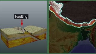
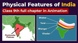
The Peninsular Plateau
Enroll to start learning
You’ve not yet enrolled in this course. Please enroll for free to listen to audio lessons, classroom podcasts and take practice test.
Interactive Audio Lesson
Listen to a student-teacher conversation explaining the topic in a relatable way.
Introduction to the Peninsular Plateau
🔒 Unlock Audio Lesson
Sign up and enroll to listen to this audio lesson

Today, we're going to learn about the Peninsular Plateau, which is one of the oldest and most stable landmasses of India. This plateau is primarily composed of crystalline igneous and metamorphic rocks. Can anyone tell me what that implies?

It means the rocks are very old and have been formed under intense heat and pressure?
Exactly! So, the stability of this plateau makes it distinct from other regions, such as the Himalayan Mountains, which are still actively forming. Why do you think this is significant for us?

Maybe it means the soil is good for farming since ancient rock formations often lead to richer soil?
Great point! And it also explains why the region is rich in minerals. Let’s remember that stability can often indicate a wealth of resources. Now, can anyone remind us of the two main subdivisions of this plateau?

The Central Highlands and the Deccan Plateau!
Correct! Remember that by associating 'Central Highlands' with 'Central' and 'Deccan' with 'South'—it helps keep track of their positions!
Central Highlands
🔒 Unlock Audio Lesson
Sign up and enroll to listen to this audio lesson

Alright, let's dive deeper into the Central Highlands. This area lies north of the Narmada River. Can anyone describe the geographical features?

It’s bounded by the Vindhyan range and the Satpura range. Is there a river system there too?
Yes! Rivers like Chambal and Betwa flow through this region from southwest to northeast indicating the slope. Which other geographical features do you think might be important here?
Maybe the vegetation since it affects agriculture?
Absolutely! The vegetation here is diverse and plays an important role in agriculture as well as in local ecosystems. Can someone name a notable plateau in this region?
The Chotanagpur Plateau?
Excellent! It's crucial as it is rich in resources and homes to a variety of flora and fauna.
Deccan Plateau
🔒 Unlock Audio Lesson
Sign up and enroll to listen to this audio lesson
Now let’s shift our focus to the Deccan Plateau. How is it defined geographically?
It’s triangular and lies south of the Narmada River, right?
Yes! And it has a distinct slope higher in the west and more gently sloping to the east. What kind of economic activities do you think are prevalent here?
I think agriculture due to the black soil, right?
Correct! The black soil is famous for its fertility, especially for cotton cultivation. This can help us remember the mnemonic: 'Black is best for growing west!' Now, what are some notable features of the Western and Eastern Ghats?
The Western Ghats are higher and continuous while the Eastern Ghats are more scattered!
Right again! The continuous nature of the Western Ghats influences rainfall patterns significantly.
Introduction & Overview
Read summaries of the section's main ideas at different levels of detail.
Quick Overview
Standard
The Peninsular Plateau, a significant landform in India, is primarily composed of old crystalline, igneous, and metamorphic rocks. It includes two main subdivisions: the Central Highlands and the Deccan Plateau, each distinguished by unique geological formations and ecological features.
Detailed
The Peninsular Plateau
The Peninsular Plateau is an ancient tableland in India, largely formed by the fragmentation of Gondwana land, making it one of the oldest landmasses in the country. Composed primarily of crystalline, igneous, and metamorphic rocks, it displays a unique topography of rounded hills and broad valleys. It can be subdivided into two primary regions:
1. Central Highlands
This region lies north of the Narmada River and constitutes the larger portion of the Malwa plateau.
- Geographical Features: Bounded by the Vindhyan and Satpura ranges, it features rivers such as Chambal and Betwa flowing from southwest to northeast.
- Key Divisions: The eastern extensions include Bundelkhand and Baghelkhand, while the Chotanagpur plateau serves as the further eastern extension, known for being drained by the Damodar River.
2. Deccan Plateau
This triangular area lies south of the Narmada River and is flanked by the Western and Eastern Ghats.
- Geographical Orientation: Higher elevation on the western side, sloping gently eastward, with notable hills including the Western Ghats approaching 1600 meters.
- Ecological Importance: The plateau's geological setting contributes to the black soil formation, crucial for agriculture.
Importance in Context
The Peninsular Plateau plays a crucial role as a mineral storehouse, influences agricultural viability due to its black soil, and affects the climatic conditions due to its elevated geography.
Youtube Videos


Audio Book
Dive deep into the subject with an immersive audiobook experience.
Overview of the Peninsular Plateau
Chapter 1 of 5
🔒 Unlock Audio Chapter
Sign up and enroll to access the full audio experience
Chapter Content
The Peninsular plateau is a tableland composed of the old crystalline, igneous and metamorphic rocks. It was formed due to the breaking and drifting of the Gondwana land and thus, making it a part of the oldest landmass.
Detailed Explanation
The Peninsular Plateau is a highland area in India made up of very old rocks, including crystalline, igneous, and metamorphic types. These rocks formed from intense heat and pressure over millions of years. The plateau was created during the breaking apart of a supercontinent known as Gondwana, which existed hundreds of millions of years ago. This makes the plateau one of the oldest land formations on Earth.
Examples & Analogies
Think of the Peninsular Plateau like an ancient book. Just as books capture knowledge from the past, the plateau contains geological history that tells us about the Earth’s formation when the Gondwana land split apart.
Divisions of the Peninsular Plateau
Chapter 2 of 5
🔒 Unlock Audio Chapter
Sign up and enroll to access the full audio experience
Chapter Content
The plateau has broad and shallow valleys and rounded hills. This plateau consists of two broad divisions, namely, the Central Highlands and the Deccan Plateau.
Detailed Explanation
The Peninsular Plateau can be divided into two main areas: the Central Highlands and the Deccan Plateau. The Central Highlands are found in the northern part, characterized by wide valleys and rounded hills. The Deccan Plateau is located to the south, shaped like a triangle and formed by a series of hills and valleys.
Examples & Analogies
Imagine the Peninsular Plateau as a large flat cake, where the Central Highlands are the top layer with a smooth surface, and the Deccan Plateau is the wider, triangular bottom layer. Both layers together make up the delicious cake that is the Peninsular land.
Central Highlands
Chapter 3 of 5
🔒 Unlock Audio Chapter
Sign up and enroll to access the full audio experience
Chapter Content
The part of the Peninsular plateau lying to the north of the Nar mada river, covering a major area of the Malwa plateau, is known as the Central Highlands.
Detailed Explanation
The Central Highlands are a region of the plateau situated above the Narmada River. They include the Malwa plateau. This area features both hills and plateaus and is important for its unique geographical and ecological features. The region is also bordered by various mountain ranges, such as the Vindhyan and the Aravalis.
Examples & Analogies
Think of the Central Highlands as the northern layer of a layered dessert, where the Malwa plateau represents a rich filling layered with subtle flavors of hills and scenic beauty.
Deccan Plateau
Chapter 4 of 5
🔒 Unlock Audio Chapter
Sign up and enroll to access the full audio experience
Chapter Content
The Deccan Plateau is a triangular landmass that lies to the south of the river Narmada. The Satpura range flanks its broad base in the north, while the Mahadev, the Kaimur hills and the Maikal range form its eastern extensions.
Detailed Explanation
To the south of the Narmada River lies the Deccan Plateau. Its triangular shape gives it a distinct geographical outline. The northern side is bordered by the Satpura range, while the Mahadev, Kaimur, and Maikal ranges cut across the east, providing the plateau with a unique landscape, including hills and valleys.
Examples & Analogies
If you picture the Deccan Plateau as a triangular slice of pizza, the Satpura range forms the crust at the top, while the toppings represented by the Mahadev, Kaimur, and Maikal hills make it deliciously diverse.
Geological Significance
Chapter 5 of 5
🔒 Unlock Audio Chapter
Sign up and enroll to access the full audio experience
Chapter Content
One of the distinct features of the Peninsular plateau is the black soil area known as Deccan Trap. This is of volcanic origin, hence, the rocks are igneous.
Detailed Explanation
A notable feature of the Peninsular Plateau is the Deccan Trap, which is an area characterized by black soil that originates from volcanic activity. The soil is rich in minerals and is excellent for farming. The term 'Trap' relates to the step-like formations resulting from the layers of lava that once flowed through the region.
Examples & Analogies
Imagine the Deccan Trap like a volcanic cake that, instead of baking in the oven, was formed from the lava poured out and cooled down – layer upon layer, each contributing to the richness of the 'soil' cake.
Key Concepts
-
Geological Composition: The Peninsular Plateau consists mainly of ancient igneous and metamorphic rocks.
-
Two Major Divisions: The plateau is divided into the Central Highlands and the Deccan Plateau, each with unique characteristics.
-
Soil Fertility: Black soil, formed from volcanic rocks, is found in the Deccan Plateau and is beneficial for agriculture.
Examples & Applications
The Peninsular Plateau is home to minerals like coal and iron ore, crucial for India's industrial sector.
The Deccan Plateau supports the cultivation of cotton, which is predominantly produced in this region.
Memory Aids
Interactive tools to help you remember key concepts
Rhymes
In the south, the Deccan is high, with black soil underneath the sky.
Stories
Long ago, a wise farmer knew that planting in black soil helped his crops grow tall in the warm Southern sun.
Memory Tools
Use 'CD' to remember Central Highlands and Deccan; 'C' for Central and 'D' for Deccan in the south.
Acronyms
P.C.D
Plateau's Composition is Deccan.
Flash Cards
Glossary
- Peninsular Plateau
A vast tableland in India, formed from ancient crystalline igneous and metamorphic rocks.
- Central Highlands
The northern part of the Peninsular Plateau, characterized by the Vindhyan and Satpura ranges.
- Deccan Plateau
A triangular plateau in southern India, distinct for its geological and ecological features.
- Black Soil
Fertile volcanic soil commonly found in the Deccan Plateau, ideal for cotton cultivation.
Reference links
Supplementary resources to enhance your learning experience.