
Fault Hazard Assessment and Risk Mitigation
Enroll to start learning
You’ve not yet enrolled in this course. Please enroll for free to listen to audio lessons, classroom podcasts and take practice test.
Interactive Audio Lesson
Listen to a student-teacher conversation explaining the topic in a relatable way.
Fault Avoidance Zoning
🔒 Unlock Audio Lesson
Sign up and enroll to listen to this audio lesson

Today, we're diving into fault avoidance zoning. Why do you think we need to maintain a distance from fault lines in urban planning?

To protect buildings and lives from potential earthquakes!
Exactly! By setting setback distances from known fault lines, we reduce the risk of damage. This is often a legal requirement in earthquake-prone areas.

What kind of distances are we talking about?
It varies, but regulations often specify distances based on the fault's characteristics and local seismic risk. Think of it as a safety buffer.

So, if I'm designing a building near a fault, I should always refer to these setbacks?
Absolutely! Remember the acronym SAFETY: Setbacks Are Fundamental to Engaging Tectonic Yields. This is crucial for planning.

Got it! So, it’s not just about the building, but about the community’s safety too.
Correct! To summarize, fault avoidance zoning is about assessing risks to protect human lives and property.
Microzonation Studies
🔒 Unlock Audio Lesson
Sign up and enroll to listen to this audio lesson

Now, shifting gears to microzonation studies – can anyone explain what these are?
Are they about studying small areas to see how much danger they’re in for earthquakes?
Exactly! Microzonation allows us to identify seismic risk variations across different regions, helping engineers prioritize areas for detailed examinations.
How do we conduct these studies?
We use geological data, past seismic records, and ground response studies. Think of microzonation as a 'seismic map' segmented further into smaller risk areas.
This must affect zoning laws too, right?
Absolutely! Local governments can enforce specific regulations in high-risk zones based on these assessments. Remember, the acronym SCALE: Seismic Community Assessment for Localized Evaluations!
Understood! It helps in making informed decisions about where and how to build.
Well said! Microzonation is critical for urban planning in seismic regions.
Building Codes
🔒 Unlock Audio Lesson
Sign up and enroll to listen to this audio lesson
Let’s talk about building codes. Why do you think they are vital in earthquake-prone areas?
They help ensure buildings can withstand seismic forces!
Right! Building codes are guidelines that set minimum standards for safety. They evolve based on new research and seismic studies.
What examples can you give of what those codes might require?
Codes may require specific materials, design techniques, or structural reinforcements. Think of it as a cookbook for building safety.
So, if a city updates its building codes, all new buildings must comply with that, right?
Yes! Compliance ensures that even new developments can cope with potential earthquakes. Remember the mnemonic BARS: Building Codes Are Regulations for Safety.
It makes sense now; these codes can save lives.
Precisely! Building codes play a crucial role in earthquake risk mitigation.
Lifeline Safety Planning
🔒 Unlock Audio Lesson
Sign up and enroll to listen to this audio lesson
Lastly, let’s discuss lifeline safety planning. What do you think falls under this category?
Things like bridges and water pipelines?
Exactly! Lifelines are crucial for a community's functionality. Planning for these ensures they remain stable during seismic events.
What’s the main goal of lifeline safety planning?
The goal is to minimize disruptions and ensure critical services remain operational during emergencies. Think of it as the backbone of urban safety.
What kind of assessments do we need to do for lifeline safety?
We assess potential fault lines, historical seismic activity, and infrastructure vulnerability. Remember the acronym SCOPE: Safety of Critical On-going Public Essentials.
Got it! So all these factors come together to create a safer environment.
Exactly! Lifeline safety is vital for community resilience during earthquakes.
Introduction & Overview
Read summaries of the section's main ideas at different levels of detail.
Quick Overview
Standard
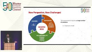
Civil engineers use various techniques, including fault avoidance zoning, microzonation studies, building codes, and lifeline safety planning, to evaluate and mitigate the seismic risks posed by fault lines in their infrastructures. These measures are essential in urban planning, especially in tectonically active areas.
Detailed
Fault Hazard Assessment and Risk Mitigation
In the realm of earthquake engineering, assessing fault hazard is paramount to mitigating seismic risks effectively. Engineers adopt a series of strategies to safeguard infrastructure from potential earthquakes originating along fault lines. The strategies include:
- Fault Avoidance Zoning: Implementing setback distances from known fault lines to minimize risks to human life and property.
- Microzonation Studies: Conducting in-depth analyses to identify variations in seismic risk across different regions, allowing for targeted mitigation efforts in areas most at risk.
- Building Codes: Establishing construction standards that ensure structures can withstand expected ground shakes, thus enhancing their resilience against seismic events.
- Lifeline Safety Planning: Ensuring the stability of critical infrastructure such as bridges and pipelines that cross fault lines, which is vital for maintaining essential services during and after seismic activities.
Understanding and implementing these strategies equips civil engineers with the necessary tools to design safer urban environments, particularly in regions vulnerable to tectonic movements.
Youtube Videos


Audio Book
Dive deep into the subject with an immersive audiobook experience.
Fault Avoidance Zoning
Chapter 1 of 4
🔒 Unlock Audio Chapter
Sign up and enroll to access the full audio experience
Chapter Content
Fault Avoidance Zoning: Setback distances from known fault lines.
Detailed Explanation
Fault Avoidance Zoning involves the practice of maintaining a safe distance from known fault lines to minimize the risk of earthquake damage. When civil engineers plan new buildings or infrastructure, these setback distances are calculated based on the location and type of fault, ensuring that structures are built far enough away to avoid direct impact from potential fault movements. This precaution helps to safeguard human life and property in earthquake-prone areas.
Examples & Analogies
Imagine building a house near a river. If the river is prone to flooding, you would choose to build your house on higher ground to avoid damage when floods occur. Similarly, Fault Avoidance Zoning is like building your home away from the floodplain to keep it safe from potential disaster.
Microzonation Studies
Chapter 2 of 4
🔒 Unlock Audio Chapter
Sign up and enroll to access the full audio experience
Chapter Content
Microzonation Studies: Identify seismic risk variations across regions.
Detailed Explanation
Microzonation Studies are detailed assessments that categorize different regions based on their seismic risk levels. Engineers study factors such as soil types, historical seismic activity, and fault lines to identify areas that are more or less vulnerable to earthquakes. The findings help in creating tailored construction codes and strategies for each specific area, ensuring that buildings can withstand local seismic risks.
Examples & Analogies
Think of microzonation like a weather forecast. Just as some areas may be at risk for heavy rain while others are sunny, different parts of the same city may experience varying levels of earthquake risk. This means engineers can apply different safety measures based on the specific 'weather' of seismic activity in each area.
Building Codes
Chapter 3 of 4
🔒 Unlock Audio Chapter
Sign up and enroll to access the full audio experience
Chapter Content
Building Codes: Design structures for expected ground shaking.
Detailed Explanation
Building Codes are legal standards that set the minimum requirements for construction practices to ensure safety and resilience against seismic activities. These codes specify design strategies, materials, and construction methods that structures must follow to withstand expected ground shaking during an earthquake. Adherence to these codes is crucial for protecting lives and property.
Examples & Analogies
Consider building a sandcastle. If you make it too tall without strengthening the structure, a wave may knock it down easily. By following building codes, like using stronger materials and broad bases, your sandcastle can endure bigger waves, just as buildings can withstand more intense earthquakes when constructed according to established safety standards.
Lifeline Safety Planning
Chapter 4 of 4
🔒 Unlock Audio Chapter
Sign up and enroll to access the full audio experience
Chapter Content
Lifeline Safety Planning: Ensuring stability of bridges, pipelines, etc., crossing faults.
Detailed Explanation
Lifeline Safety Planning focuses on the stability and functionality of essential services—like bridges, water pipelines, and electrical grids—that must remain operational during an earthquake. Engineers design lifelines with special considerations for potential fault movements, ensuring that these critical infrastructures can withstand seismic forces, which is vital for emergency response and recovery after an earthquake.
Examples & Analogies
Think of lifeline safety planning like planning a road trip through mountainous terrain where landslides are common. If you know a section of the road is prone to sliding, you would reinforce that part or find an alternative safe route to ensure your journey is unimpeded. Similarly, engineers reinforce lifelines aware of fault locations to maintain functionality during earthquakes.
Key Concepts
-
Fault Avoidance Zoning: Establishing safe distances from fault lines to reduce risks.
-
Microzonation Studies: Research to understand localized seismic risks.
-
Building Codes: Requirements for ensuring structures can withstand earthquakes.
-
Lifeline Safety Planning: Strategies to maintain functionality of critical infrastructure during seismic events.
Examples & Applications
In California, laws require setbacks from active fault lines, ensuring buildings are located at a safe distance to reduce earthquake risk.
Microzonation studies in San Francisco have identified areas with varying risk levels, leading to tailored construction approaches.
The implementation of rigorous building codes in Japan has significantly reduced earthquake damage in urban areas, showcasing the effectiveness of engineering standards.
After assessing lifeline safety, New Zealand reinforced bridges and pipelines to withstand anticipated seismic forces following assessments of known fault lines.
Memory Aids
Interactive tools to help you remember key concepts
Rhymes
Set back your walls, keep danger at bay, / Plan for the quakes, don't let them stay!
Stories
In a small town, an earthquake loomed. The wise planner designated zones safe from harm, ensuring buildings stood strong and lifelines remained unharmed.
Memory Tools
REMEMBER: SAFE - Strategies for Avoiding Fault Exposure.
Acronyms
BOLD - Building On Lifelines Daily, ensuring safety against earthquake shocks.
Flash Cards
Glossary
- Fault Avoidance Zoning
The practice of establishing setback distances from known fault lines to minimize risks to structures and human life.
- Microzonation Studies
Research aimed at identifying localized variations in seismic risk across different regions to inform urban planning.
- Building Codes
Regulations that set minimum safety standards for construction, particularly in earthquake-prone areas.
- Lifeline Safety Planning
Planning strategies to ensure that critical infrastructures remain operational during seismic events.
Reference links
Supplementary resources to enhance your learning experience.