
Cloud Computing in Remote Sensing
Enroll to start learning
You’ve not yet enrolled in this course. Please enroll for free to listen to audio lessons, classroom podcasts and take practice test.
Interactive Audio Lesson
Listen to a student-teacher conversation explaining the topic in a relatable way.
Introduction to Cloud Computing in Remote Sensing
🔒 Unlock Audio Lesson
Sign up and enroll to listen to this audio lesson

Today, we're going to talk about cloud computing in remote sensing. Can anyone tell me what they think cloud computing might be used for in this context?

I think it might be used to store a lot of satellite data.
Exactly! Cloud computing allows for the storage and processing of massive datasets generated by satellites. This leads us to our first key point: efficiency in data management. Why do you think efficiency is crucial here?

Because there’s so much data, and we need to analyze it quickly for real-time applications!
That's right! Rapid analysis is essential for applications like disaster response where time is of the essence. Let's remember that with the acronym 'FAST' for the need for 'Fast Analysis and Storage Technology'.
Key Platforms in Cloud-Based Remote Sensing
🔒 Unlock Audio Lesson
Sign up and enroll to listen to this audio lesson

Now let's dive into specific platforms. Who has heard of Google Earth Engine?

I have! It’s used for processing satellite data, right?
Correct, Student_3! GEE is valuable for analyzing large-scale geospatial datasets. What kind of applications do you think it supports?

I think it can be used for environmental monitoring and flood mapping, as well as classifying land use.
Excellent points! GEE helps in tasks like vegetation monitoring and LULC classification. For easier recall, we can remember its capabilities with the mnemonic 'HAVE' for 'Health, Assessment, Vegetation, and Environment.' Now, what about AWS?
AWS provides on-demand access to a lot of datasets, right?
Absolutely! AWS enables scalable pipelines with AI capabilities, allowing users to harness powerful processing tools for analysis.
The Impact of Cloud Computing on Remote Sensing Applications
🔒 Unlock Audio Lesson
Sign up and enroll to listen to this audio lesson
Finally, let's consider how these cloud computing tools impact remote sensing overall. What benefits do you think they might provide?
They probably make data more accessible and easier to analyze!
Exactly! Greater accessibility leads to enhanced analysis capabilities. Additionally, these platforms provide the foundational tools for many applications in civil engineering and environmental management.
So, they help in making smarter decisions based on real-time data?
Exactly, Student_3! Real-time data can improve decision-making in urban planning and environmental monitoring practices. To summarize, we’ve touched upon speed, accessibility, and the comprehensive nature of data analysis today.
Introduction & Overview
Read summaries of the section's main ideas at different levels of detail.
Quick Overview
Standard
The advent of cloud computing in remote sensing allows for efficient management of vast amounts of data produced by satellites. Platforms like Google Earth Engine, AWS, and Microsoft Planetary Computer facilitate the analysis and accessibility of geospatial datasets, enabling users to perform complex environmental and civil engineering analyses at scale.
Detailed
Cloud Computing in Remote Sensing
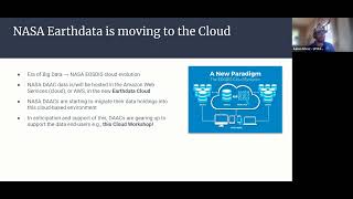
Cloud computing represents a significant advancement for remote sensing, particularly due to the ever-increasing volume of data generated by Earth observation satellites. As remote sensing technologies have progressed, the quantity of data available from various sources, such as satellites, has exploded. Cloud platforms provide essential solutions for managing, processing, and analyzing these large datasets efficiently.
Key Platforms
- Google Earth Engine (GEE): A cloud-based platform designed specifically for processing large-scale geospatial datasets. Users leverage GEE for various applications, including vegetation monitoring, flood mapping, and land use/land cover (LULC) classification, dramatically enhancing operational efficiency and research capabilities.
- Amazon Web Services (AWS) & Microsoft Planetary Computer: These platforms offer on-demand access to extensive archives of satellite imagery and facilitate the creation of scalable processing pipelines that incorporate AI/ML-based analyses. This enables users to harness the power of machine learning for tasks such as classification, change detection, and predictive analytics.
The integration of cloud computing in remote sensing not only enhances data accessibility but also empowers researchers and practitioners in fields like civil engineering, environmental monitoring, and urban planning, leading to more informed decision-making and sustainable practices.
Youtube Videos


Audio Book
Dive deep into the subject with an immersive audiobook experience.
Introduction to Cloud Computing in Remote Sensing
Chapter 1 of 3
🔒 Unlock Audio Chapter
Sign up and enroll to access the full audio experience
Chapter Content
With the explosion of data from Earth observation satellites, cloud platforms have become essential for storage, processing, and analysis.
Detailed Explanation
This chunk emphasizes the role of cloud computing in managing vast amounts of data generated by Earth observation satellites. As satellite technology improves, the volume of data being collected increases significantly. Traditional methods of data storage and analysis may not be sufficient to handle this volume effectively. Therefore, cloud computing offers scalable solutions that allow users to store, process, and analyze these large datasets efficiently and effectively.
Examples & Analogies
Think of cloud computing in remote sensing like a massive virtual library. Just as a library provides space for countless books and makes them accessible to readers, cloud platforms store extensive satellite data and allow scientists, engineers, and researchers to access and analyze the information quickly, no matter where they are.
Google Earth Engine (GEE)
Chapter 2 of 3
🔒 Unlock Audio Chapter
Sign up and enroll to access the full audio experience
Chapter Content
A cloud-based platform for processing large-scale geospatial datasets.
Useful for vegetation monitoring, flood mapping, LULC classification.
Detailed Explanation
Google Earth Engine (GEE) is a cloud computing platform specifically designed for geospatial analysis. It allows users to access powerful computing resources and a vast repository of satellite imagery and other geospatial data. With GEE, researchers can process and analyze data for various applications such as monitoring how vegetation changes over time, mapping floods, or classifying land use and land cover (LULC). This environment simplifies analytical tasks that would otherwise require significant computational resources.
Examples & Analogies
Imagine that you are a detective trying to solve a mystery with an enormous amount of evidence scattered around. Instead of sifting through all the evidence manually, you have a high-tech assistant (GEE) that helps you organize and analyze the evidence efficiently, allowing you to spot crucial clues much faster.
Amazon Web Services (AWS) & Microsoft Planetary Computer
Chapter 3 of 3
🔒 Unlock Audio Chapter
Sign up and enroll to access the full audio experience
Chapter Content
Provide on-demand access to petabytes of satellite imagery.
Enable scalable processing pipelines for AI/ML-based analysis.
Detailed Explanation
Both Amazon Web Services (AWS) and Microsoft Planetary Computer offer powerful storage and processing capabilities for remote sensing data. These platforms provide on-demand access to vast amounts of satellite imagery—potentially petabytes, or millions of megabytes—making it easier for researchers and businesses to find and analyze the data they need. Additionally, they allow the development of scalable processing pipelines that integrate artificial intelligence (AI) and machine learning (ML), making it possible to conduct sophisticated analyses such as predicting changes in land use or detecting anomalies in environmental data.
Examples & Analogies
Consider AWS and Microsoft Planetary Computer as high-tech kitchens equipped with advanced tools and appliances. Chefs (researchers) can come in and cook (analyze data) using any ingredients (satellite images) they need, with the kitchen's tools helping them whip up complex dishes (detailed analyses) quickly and easily.
Key Concepts
-
Cloud Computing: Provides storage and processing capabilities for large datasets.
-
Google Earth Engine: A platform for analyzing geospatial data efficiently.
-
Amazon Web Services: Offers scalable solutions for satellite imagery processing.
-
Real-Time Data Processing: Enhances decision-making in environmental and civil applications.
Examples & Applications
Using Google Earth Engine for monitoring deforestation rates over time.
Employing AWS for real-time flood mapping to aid disaster response.
Memory Aids
Interactive tools to help you remember key concepts
Rhymes
In the cloud, data flows, accessibility grows, analysis glows, with tools like GEE, the insights we see.
Stories
Imagine a scientist using a magical cloud that stores all Earth’s data. They can instantly check vegetation or monitor floods, all at their fingertips!
Memory Tools
Remember 'CATS' for Cloud, Accessibility, Technology, Scalability in remote sensing.
Acronyms
Use 'GEE' to recall Google Earth Engine for Geospatial analysis, Environmental monitoring, and Earth data management.
Flash Cards
Glossary
- Cloud Computing
The delivery of computing services—including storage, processing, and analysis—over the internet ('the cloud').
- Geospatial Data
Data that is associated with a geographic location and can be analyzed to understand patterns or trends.
- Google Earth Engine (GEE)
A cloud-based platform designed for processing and analyzing large-scale geospatial datasets.
- Amazon Web Services (AWS)
A cloud computing platform that offers a variety of services including data storage, machine learning, and analysis capabilities.
- Land Use/Land Cover (LULC)
The characterization of land types and their uses, often studied using remote sensing data.
Reference links
Supplementary resources to enhance your learning experience.