
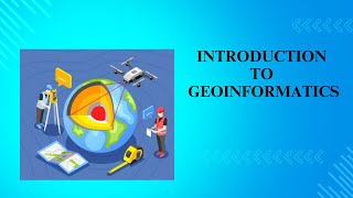
Introduction to Geo-Informatics
Enroll to start learning
You’ve not yet enrolled in this course. Please enroll for free to listen to audio lessons, classroom podcasts and take practice test.
Interactive Audio Lesson
Listen to a student-teacher conversation explaining the topic in a relatable way.
Definition of Geo-Informatics
🔒 Unlock Audio Lesson
Sign up and enroll to listen to this audio lesson

Today, we will explore the definition of Geo-Informatics. Can anyone share what they think it means?

Is it about collecting geographic data?
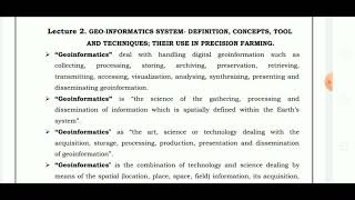
Yes, that's part of it! Geo-Informatics is actually the science and technology that focuses on acquiring, processing, analyzing, and disseminating spatial data. Remember, GPS, GIS, and remote sensing are a few key aspects of this field.

So, it sounds like it combines a lot of different technologies, right?
Exactly! We can think of it like a Venn diagram where science, engineering, and information technology overlap to create powerful tools for spatial analysis. That's where the magic happens!
Key Components of Geo-Informatics
🔒 Unlock Audio Lesson
Sign up and enroll to listen to this audio lesson

Now, let's discuss the key components of Geo-Informatics. Who can name a few?

Data acquisition systems?
Correct! We have data acquisition systems like remote sensing and LiDAR. We also have data management, processing, and visualization. Each component plays a vital role. For example, visualization helps us make sense of complex data through maps and 3D models.

How do we process the data once we acquire it?
Great question! We use image processing and spatial modeling techniques to analyze the data. Remember the acronym 'APV' for Acquisition, Processing, and Visualization!
Applications in Civil Engineering
🔒 Unlock Audio Lesson
Sign up and enroll to listen to this audio lesson
Geo-Informatics has various applications in civil engineering. Can anyone give an example?
It can help with disaster management?
Yes! Disaster management is a crucial application. Additionally, it's used in urban planning, transportation, and environmental monitoring. Why do you think spatial information is essential in these areas?
Because it helps to make better decisions based on data!
Exactly, better decisions lead to more efficient and sustainable outcomes in infrastructure projects.
Introduction & Overview
Read summaries of the section's main ideas at different levels of detail.
Quick Overview
Standard
This section introduces Geo-Informatics as an interdisciplinary field that merges science, engineering, and technology for spatial data management. It covers the definition, components, evolution, key technologies, and applications in civil engineering, emphasizing the importance of spatial decision-making.
Detailed
Introduction to Geo-Informatics
Geo-Informatics is a multifaceted domain combining science, engineering, and information technology to effectively handle spatial and geographic data. The section defines Geo-Informatics, detailing its main components such as data acquisition systems like remote sensing, GIS, GNSS, and their critical applications in civil engineering. It also elaborates on the evolution of traditional surveying methods into modern practices reliant on digital mapping, GIS, and drones. Furthermore, it discusses fundamental concepts of spatial data, including types of spatial data and coordinate systems, key technologies in Geo-Informatics, spatial data infrastructure (SDI), and the diverse applications across various facets of civil engineering. Through this exploration, the significance of Geo-Informatics in enhancing spatial decision-making and infrastructure development is particularly highlighted.
Youtube Videos


![What is MSc Geoinformatics course? – [Hindi] – Quick Support](https://img.youtube.com/vi/QC6cEfNk1aQ/mqdefault.jpg)
Audio Book
Dive deep into the subject with an immersive audiobook experience.
What is Geo-Informatics?
Chapter 1 of 4
🔒 Unlock Audio Chapter
Sign up and enroll to access the full audio experience
Chapter Content
Geo-Informatics is an interdisciplinary field that integrates science, engineering, and information technology to collect, process, analyze, manage, and disseminate spatial and geographic data.
Detailed Explanation
Geo-Informatics combines various disciplines, particularly science, engineering, and technology, to work with spatial data. This means it deals with data associated with physical locations and can involve tasks such as gathering this data, organizing it, analyzing it for insights, and sharing it with others. The aim is to improve decision-making related to geographic information.
Examples & Analogies
Think of Geo-Informatics like a puzzle. You have various pieces (data) that come from different disciplines (science, engineering). By figuring out how these pieces fit together, you can create a complete picture that helps in understanding and solving problems related to locations or land.
Importance in Civil Engineering
Chapter 2 of 4
🔒 Unlock Audio Chapter
Sign up and enroll to access the full audio experience
Chapter Content
In civil engineering, Geo-Informatics plays a crucial role in surveying, planning, infrastructure development, environmental monitoring, and resource management.
Detailed Explanation
Civil engineering relies heavily on accurate spatial data for various processes. For instance, when planning roads or bridges, engineers use Geo-Informatics to survey the land and ensure that their designs will fit well with the existing environment. This technology helps in visualizing how a project will impact and interact with surrounding areas.
Examples & Analogies
Imagine planning to build a new road in your neighborhood. Rather than just guessing where it might go, you would use maps and technology to see where the land is flat, where existing buildings are located, and how the road would affect traffic. That's how engineers use Geo-Informatics!
Technological Integration
Chapter 3 of 4
🔒 Unlock Audio Chapter
Sign up and enroll to access the full audio experience
Chapter Content
Geo-Informatics encompasses technologies such as Geographic Information Systems (GIS), Global Navigation Satellite Systems (GNSS), Remote Sensing (RS), and Image Processing, which help engineers analyze the earth's surface and design infrastructure projects accordingly.
Detailed Explanation
The field of Geo-Informatics includes several advanced technologies that work together. For example, GIS is used to manage and analyze geographic data, GNSS helps in determining precise locations on Earth, while remote sensing involves collecting data from satellites or aircraft. These technologies help engineers make informed decisions based on solid data.
Examples & Analogies
Consider a chef preparing a large banquet. They wouldn't just start cooking random dishes. Instead, they plan using various tools – recipes (GIS), precise measurements (GNSS), and tasting samples (Remote Sensing) – to ensure everything comes together perfectly. Likewise, engineers use these technologies to ensure their projects are well-planned and efficient.
Goals of the Chapter
Chapter 4 of 4
🔒 Unlock Audio Chapter
Sign up and enroll to access the full audio experience
Chapter Content
This chapter explores the fundamental concepts and scope of Geo-Informatics, highlighting its applications in civil engineering and allied fields.
Detailed Explanation
The goals of this chapter are to introduce the basic ideas behind Geo-Informatics and show how its principles and technologies are applied in civil engineering. It sets the stage for deeper learning and application of these concepts in various engineering tasks.
Examples & Analogies
Think of this chapter as an introduction to a new subject in school. Just like how you learn the basics before diving into complex topics, this chapter aims to give you a solid foundation of what Geo-Informatics is and why it's important, especially in civil engineering.
Key Concepts
-
Geo-Informatics: The science and technology for managing spatial data.
-
GIS: Tool for creating and analyzing maps.
-
Remote Sensing: Data collection without contact.
-
GNSS: Navigation and positioning systems based on satellites.
-
SDI: A framework for sharing and utilizing geospatial data.
Examples & Applications
Using GIS software to analyze urban development patterns.
Employing remote sensing to monitor agricultural land use changes.
Memory Aids
Interactive tools to help you remember key concepts
Rhymes
Geo-Informatics, it's a great mix, with science, tech, and data tricks.
Stories
Imagine a city planner, equipped not with rulers but with powerful software, visualizing entire neighborhoods from above, making informed decisions that shape the community.
Memory Tools
Remember the acronym 'G.I.S.' for Gathering Information on the Surface.
Acronyms
APV
Acquisition
Processing
Visualization - the steps in Geo-Informatics.
Flash Cards
Glossary
- GeoInformatics
Interdisciplinary field that combines science, engineering, and technology for managing spatial data.
- GIS
Geographic Information System, a tool for storing, analyzing, and visualizing spatial data.
- Remote Sensing
Acquisition of information about the Earth's surface without direct contact, often via satellites or drones.
- GNSS
Global Navigation Satellite Systems, such as GPS, used for determining precise locations anywhere on Earth.
- Spatial Data Infrastructure (SDI)
Framework that facilitates the effective sharing and use of geospatial data.
Reference links
Supplementary resources to enhance your learning experience.