
Applications of Rainfall Data in Civil Engineering
Enroll to start learning
You’ve not yet enrolled in this course. Please enroll for free to listen to audio lessons, classroom podcasts and take practice test.
Interactive Audio Lesson
Listen to a student-teacher conversation explaining the topic in a relatable way.
Design of Storm Water Drains
🔒 Unlock Audio Lesson
Sign up and enroll to listen to this audio lesson

Today, we will explore how rainfall data influences the design of stormwater drains. Rainfall data helps us understand the amount of rain that can be expected in a given area, which is crucial for adequate drainage design.

How does the rainfall data actually affect stormwater drains?
Great question! By analyzing data about past rainfall events, engineers can forecast peak flows in a drainage system and design accordingly to handle that volume.

What happens if the drains aren’t designed properly?
Undersized drains can lead to flooding, infrastructure damage, and even risks to public safety. That's why we rely heavily on this data!

Is there a formula or method to determine the size of the drains?
Yes, engineers often use the Rational Method, which relates the rainfall intensity to the runoff coefficient to calculate peak discharge.
In summary, accurate rainfall data is essential for designing effective stormwater drainage systems to prevent flooding and ensure urban safety.
Reservoir and Dam Design
🔒 Unlock Audio Lesson
Sign up and enroll to listen to this audio lesson

Now let's discuss reservoirs and dams. Rainfall data is critical in estimating inflow rates to reservoirs.

But how do we make sure the reservoirs can hold enough water?
That's where rainfall statistics come into play! Engineers use historical data to determine peak inflows and design the reservoir volume accordingly.
What about in regions with inconsistent rainfall?
Excellent point! In such cases, we might use multiple years of rainfall data to develop better models for reservoir capacity, ensuring they can capture floodwaters and store them during dry periods.
To summarize, sufficient and accurate rainfall data is vital for the successful design of reservoirs, ensuring they meet both current and future demands.
Flood Control Systems
🔒 Unlock Audio Lesson
Sign up and enroll to listen to this audio lesson
Next, we’ll look at flood control systems. Rainfall data is vital for understanding flood risks and designing mitigation measures.
Can you give me an example of a flood control measure?
Certainly! Flood walls and levees are common measures that depend on rainfall data for optimal design. They must be high enough to withstand the maximum expected flood levels.
How do we assess rainfall intensity for these measures?
Engineers use statistical analysis and historical data to estimate the frequency of certain intensity events, often utilizing the concept of return periods.
In summary, the data collected informs flood control designs to protect communities effectively from potential flooding.
Drought and Flood Forecasting
🔒 Unlock Audio Lesson
Sign up and enroll to listen to this audio lesson
One of the crucial applications of rainfall data is in forecasting droughts and floods.
How does this work?
Meteorologists analyze patterns in historical rainfall data to develop predictive models. These models can indicate upcoming dry spells or potential flood events.
Isn't that important for planning as well?
Absolutely! Effective forecasting helps in making decisions about water resource management, emergency preparedness, and agricultural planning.
To summarize, accurate rainfall data enables advanced forecasting, allowing communities to prepare and respond to droughts and floods effectively.
Introduction & Overview
Read summaries of the section's main ideas at different levels of detail.
Quick Overview
Standard
The applications of rainfall data in civil engineering are crucial for various projects such as stormwater drains, reservoirs, and flood control systems. This data is vital for effective drought and flood forecasting, as well as ensuring efficient urban water supply schemes.
Detailed
Applications of Rainfall Data in Civil Engineering
In civil engineering, rainfall data plays a pivotal role in the design, planning, and management of various water-related infrastructures. This section highlights the numerous applications of rainfall data, with a specific focus on:
- Design of Water Structures:
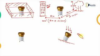
- Storm Water Drains: Engineers utilize rainfall data to design effective stormwater drainage systems that can handle peak rainfall events, thereby preventing urban flooding.
- Reservoirs and Dams: Accurate rainfall data is essential for calculating inflow rates, designing reservoir capacities, and ensuring structural integrity against potential flood scenarios.
- Flood Control Systems:
- Rainfall data aids in developing flood control measures, allowing engineers to analyze the frequency and intensity of rainfall that could lead to flooding.
- Irrigation Planning:
- Agricultural engineers depend on rainfall data to formulate irrigation plans, ensuring optimal water usage and crop yield.
- Drought and Flood Forecasting:
- With the aid of rainfall data, predictive models are created for forecasting droughts and floods, which are critical for disaster management and contingency planning.
- Urban Water Supply Schemes:
- Rainfall data is integral in designing urban water supply systems, ensuring sustainable resource management for growing populations.
By understanding these applications, water resource professionals can make informed decisions that enhance sustainability, safety, and efficiency in civil engineering projects.
Youtube Videos


Audio Book
Dive deep into the subject with an immersive audiobook experience.
Design of Storm Water Drains
Chapter 1 of 6
🔒 Unlock Audio Chapter
Sign up and enroll to access the full audio experience
Chapter Content
- Design of:
- Storm water drains
Detailed Explanation
Storm water drains are essential infrastructure systems designed to manage excess rainwater and prevent flooding in urban areas. Engineers use rainfall data to determine how much rain to expect in a region and to design drains that can handle that volume. By analyzing historical rainfall data, they can estimate peak flow rates—this helps in sizing the drains appropriately.
Examples & Analogies
Think of storm water drains like a safety valve on a pressure cooker. Just as the valve releases steam to prevent the cooker from exploding due to too much pressure, storm water drains help channel accumulated rainwater safely away to prevent flooding.
Design of Reservoirs and Dams
Chapter 2 of 6
🔒 Unlock Audio Chapter
Sign up and enroll to access the full audio experience
Chapter Content
- Reservoirs and dams
Detailed Explanation
Reservoirs and dams are built to store water for various uses, including drinking water supply, irrigation, and hydroelectric power generation. Engineers rely heavily on rainfall data to predict the amount of water that can be stored based on past rainfall patterns and likely future rainfall scenarios. This ensures that these structures can effectively manage water resources over time.
Examples & Analogies
Imagine filling a bathtub. If you know how much water usually comes from the faucet based on your past usage, you can better decide how deep to fill the tub. Similarly, engineers use rainfall data to predict how much water a reservoir should hold to meet future demands.
Flood Control Systems Design
Chapter 3 of 6
🔒 Unlock Audio Chapter
Sign up and enroll to access the full audio experience
Chapter Content
- Flood control systems
Detailed Explanation
Flood control systems are designed to mitigate the impact of excessive rainfall that can lead to flooding. Utilizing rainfall data, engineers can model potential flood scenarios and develop systems such as levees, floodwalls, and spillways. These structures help redirect or contain floodwaters safely away from populated areas.
Examples & Analogies
Consider a large sponge that absorbs water; when too much water is added, it eventually spills over. Flood control systems act similarly by managing excess water flows, preventing neighborhoods from becoming submerged, just like keeping the sponge from overflowing.
Irrigation Planning
Chapter 4 of 6
🔒 Unlock Audio Chapter
Sign up and enroll to access the full audio experience
Chapter Content
- Irrigation planning
Detailed Explanation
Irrigation systems are vital for agricultural efficiency, particularly in areas that experience irregular rainfall. By analyzing rainfall data, engineers can design irrigation systems that optimize water usage, align planting schedules with expected rainfall, and ensure crops receive adequate water even during dry spells.
Examples & Analogies
Think of someone trying to keep potted plants alive. By knowing when to expect rain, they can decide when to water the plants themselves without wasting water or overwatering. Similarly, smart irrigation planning helps farmers maintain healthy crops.
Drought and Flood Forecasting
Chapter 5 of 6
🔒 Unlock Audio Chapter
Sign up and enroll to access the full audio experience
Chapter Content
- Drought and flood forecasting
Detailed Explanation
Forecasting tools, which rely on historical and current rainfall data, help predict both droughts and floods. Accurate forecasting aids communities in preparation and risk management, allowing for timely responses to climate challenges.
Examples & Analogies
It's like a weather app that alerts you to an upcoming storm. Just as people check the weather to prepare for rain, communities use forecasting based on rainfall data to make decisions that can save lives and property from drought or flood damage.
Urban Water Supply Schemes
Chapter 6 of 6
🔒 Unlock Audio Chapter
Sign up and enroll to access the full audio experience
Chapter Content
- Urban water supply schemes
Detailed Explanation
Urban water supply schemes are critical for providing a reliable water source to city dwellers. Engineers use rainfall data to plan the infrastructure needed to collect, store, and distribute water effectively, especially in areas that are prone to water shortages.
Examples & Analogies
Imagine planning a big party where many guests will need drinks. You’d need to calculate how much beverage to prepare based on the number of guests and their thirst levels. Similarly, urban planners assess population sizes and rainfall patterns to ensure there’s enough water for everyone in the city.
Key Concepts
-
Storm Water Drainage: Essential for urban flood management.
-
Reservoir Design: Critical for ensuring water supply during dry periods.
-
Flood Control: Protects communities from flood risks.
-
Drought Forecasting: Helps in planning resource allocation during dry spells.
-
Flood Forecasting: Vital for emergency management and response.
Examples & Applications
Designing a stormwater drain system for a new urban development based on 30 years of rainfall data.
Calculating reservoir capacity to hold excess water during a major storm expected in the monsoon season.
Memory Aids
Interactive tools to help you remember key concepts
Rhymes
For flooding, have a drain that's not a strain, to keep the water in its lane.
Stories
Once upon a time, in a village plagued with floods, engineers used rainfall data to design grand dams that saved the village from disaster every monsoon.
Memory Tools
Remember 'FDR' for Flood, Drainage, and Reservoir, to associate them with rain management.
Acronyms
DRAIN - Design, Rainfall, Analysis, Infra(Nstructure), Network.
Flash Cards
Glossary
- Storm Water Drain
A system designed to manage and control the flow of stormwater runoff.
- Reservoir
A large natural or artificial lake used for the storage and management of water.
- Flood Control System
Infrastructure designed to prevent or mitigate the impact of flooding on populated areas.
- Drought Forecasting
The process of predicting the likelihood and severity of a drought event based on various data, including rainfall data.
- Flood Forecasting
The process of predicting flood events and outcomes based on predicted rainfall intensities and flood models.
Reference links
Supplementary resources to enhance your learning experience.