
Case Studies in UAV-based Civil Site Monitoring
Enroll to start learning
You’ve not yet enrolled in this course. Please enroll for free to listen to audio lessons, classroom podcasts and take practice test.
Interactive Audio Lesson
Listen to a student-teacher conversation explaining the topic in a relatable way.
Delhi-Mumbai Expressway Case Study
🔒 Unlock Audio Lesson
Sign up and enroll to listen to this audio lesson

Today, we'll discuss a fascinating case study focusing on the Delhi-Mumbai Expressway. Can anyone tell me what the objective of using UAVs in this project was?

To monitor the roadbed formation and bridge construction continuously!
Correct! Continuous monitoring is vital. What specific method did they use to achieve this monitoring?

They used UAVs equipped with RTK GNSS systems for precise data.
That's right. RTK GNSS stands for Real-Time Kinematic Global Navigation Satellite System. Why do you think using UAVs resulted in an 80% reduction in manual inspection effort?

Because drones can cover large areas quickly and safely, right?
Exactly! UAVs allow for efficient data gathering. They also identified issues like embankment settlement early on. Can anyone name the tools used in this project?

They used the DJI Matrice 300 and Pix4Dmapper, among others.
Well done! These tools are essential for effective data collection and analysis.
To summarize, the case study illustrates how UAVs can enhance monitoring efficiency and reduce risks on major construction projects.
Pune Smart City Case Study
🔒 Unlock Audio Lesson
Sign up and enroll to listen to this audio lesson

Next, let’s look at the Pune smart city surveillance project. What was the primary objective here?
To track the real-time progress of various infrastructure elements like drainage and roads.
Exactly. This approach updates 3D BIM models weekly. Why is regular updating of these models important?
It probably helps stakeholders keep track of the project's progress better!
Exactly, and it enables efficient decision-making. What challenges did they encounter during this project?
They faced GPS interference in dense building zones.
Right! They resolved this issue by using an RTK base station. This shows the significance of addressing challenges for effective UAV operations. Can someone summarize what we learned from both case studies?
UAVs significantly improve site monitoring efficiency and can overcome challenges with the right tools and methods.
Excellent summary! UAVs are indeed revolutionizing civil engineering monitoring.
Introduction & Overview
Read summaries of the section's main ideas at different levels of detail.
Quick Overview
Standard
The section presents two detailed case studies focusing on UAV-based monitoring in the Delhi-Mumbai Expressway highway expansion project and the smart city surveillance in Pune, highlighting their objectives, methods, outcomes, and challenges.
Detailed
Case Studies in UAV-based Civil Site Monitoring
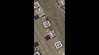
In this section, we explore two pivotal case studies that illustrate the use of UAV technology in monitoring civil engineering projects in India. The first case focuses on the Delhi-Mumbai Expressway highway expansion, where UAVs were deployed for continuous monitoring of roadbed formation and bridge construction. Utilizing RTK GNSS systems, the drones achieved an 80% reduction in manual inspection efforts while allowing for early detection of issues such as embankment settlements. Tools like the DJI Matrice 300, Pix4Dmapper, and ArcGIS facilitated accurate data collection and analysis.
The second case study emphasizes the Urban Smart City Surveillance initiative in Pune, where UAVs were utilized to track the real-time progress of drainage, roads, and utility line work. The integration provided weekly updates of 3D BIM models, supporting centralized dashboard monitoring for stakeholders. Despite facing challenges such as GPS interference in densely built areas, the project successfully overcame this by deploying RTK base stations. This section underscores the transformative potential of UAVs in site monitoring, showcasing their efficiency, precision, and the various technical tools integrated into modern civil engineering practices.
Youtube Videos


Audio Book
Dive deep into the subject with an immersive audiobook experience.
Highway Expansion Project – Delhi-Mumbai Expressway
Chapter 1 of 2
🔒 Unlock Audio Chapter
Sign up and enroll to access the full audio experience
Chapter Content
Highway Expansion Project – Delhi-Mumbai Expressway
- Objective: Continuous monitoring of roadbed formation and bridge construction.
- Method: UAVs equipped with RTK GNSS systems for precise data.
- Outcome:
- 80% reduction in manual inspection effort.
- Issues like embankment settlement detected early.
- Tools Used: DJI Matrice 300, Pix4Dmapper, ArcGIS.
Detailed Explanation
In this case study, the focus was on the Delhi-Mumbai Expressway project where UAVs (drones) were used to monitor construction activities continuously. The objective was to ensure that the roadbed formation and bridge construction were proceeding as planned. To achieve this, UAVs equipped with RTK GNSS systems provided highly accurate positioning data.
As a result of using UAVs, there was an 80% reduction in the amount of manual inspection that was normally required, freeing up resources and speeding up the inspection process. Furthermore, potential issues such as embankment settlement were detected much earlier than would have been possible without UAVs, allowing for timely interventions to fix problems before they escalated.
Examples & Analogies
Imagine you are monitoring a large construction project, like building a new highway. Traditionally, this would involve inspectors walking through the site with clipboards, which can be slow and labor-intensive. Using drones is like having a bird's eye view: you can see everything at once and quickly identify any problems. It’s similar to having a camera on a remote-controlled car that lets you see the entire neighborhood without leaving your home. The drones in this project acted swiftly, providing crucial data that would save time and reduce costs.
Urban Smart City Surveillance – Pune, Maharashtra
Chapter 2 of 2
🔒 Unlock Audio Chapter
Sign up and enroll to access the full audio experience
Chapter Content
Urban Smart City Surveillance – Pune, Maharashtra
- Objective: Tracking real-time progress in drainage, road, and utility lines.
- Result:
- 3D BIM models updated weekly with drone data.
- Central dashboard monitoring for project stakeholders.
- Challenge Faced: GPS interference in dense building zones, resolved via RTK base station.
Detailed Explanation
This case study highlights the implementation of UAVs in Pune, Maharashtra, specifically targeting urban development as part of a smart city initiative. The UAVs were used to monitor the progress of projects related to drainage systems, road construction, and utility lines. The significant outcome was that 3D Building Information Modeling (BIM) models were updated weekly with the data collected by the drones, providing current and accurate information to project stakeholders.
One challenge encountered was GPS interference caused by the density of buildings in urban areas, which can hinder the UAV’s navigation. This issue was effectively addressed by setting up an RTK (Real-Time Kinematic) base station that enhanced positioning accuracy.
Examples & Analogies
Think about trying to navigate a busy city where tall buildings may block GPS signals, making it difficult to find your way. Now, picture how a drone in this situation acts like a smart guide; by using a nearby RTK base station, it can pinpoint its exact location even in dense areas. This capability is vital, just as a GPS system in your car needs clear signals to guide you accurately through city streets. The drones in Pune provided accurate insights into the ongoing city projects, just as your GPS system helps you locate the quickest route to your destination.
Key Concepts
-
UAV Efficiency: UAVs significantly reduce inspection time and improve monitoring of construction activities.
-
Case Study Insights: Real-world applications confirm UAV effectiveness across various civil engineering projects.
-
Challenges in Implementation: Common obstacles include GPS interference and adaptation of technology to urban environments.
Examples & Applications
In the Delhi-Mumbai Expressway project, UAVs facilitated continuous monitoring, leading to early detection of potential issues.
The Pune smart city initiative showcased the integration of UAVs for real-time progress tracking, demonstrating how technology can enhance infrastructure management.
Memory Aids
Interactive tools to help you remember key concepts
Rhymes
UAVs in flight, monitoring construction in sight, reducing the manual plight!
Stories
Imagine a bustling city where drones fly over construction sites, capturing every detail below. One day, a drone spots a sinking roadbed, alerting the engineers before any accident happens. This is the magic of UAVs!
Memory Tools
Remember DRON: D for Data collection, R for Real-time monitoring, O for Observing areas, N for Navigating efficiently.
Acronyms
UAV
Uplifting Aerial Vigilance.
Flash Cards
Glossary
- UAV
Unmanned Aerial Vehicle, an aircraft operated without a human pilot onboard.
- RTK GNSS
Real-Time Kinematic Global Navigation Satellite System used for precise positioning.
- 3D BIM
3D Building Information Modeling, a digital representation of the physical and functional characteristics of a project.
- DJI Matrice 300
A model of UAV known for its versatility in various professional applications.
- Pix4Dmapper
A software for processing UAV imagery into 3D models and maps.
Reference links
Supplementary resources to enhance your learning experience.