
UAVs for Site Inspection and Monitoring
Enroll to start learning
You’ve not yet enrolled in this course. Please enroll for free to listen to audio lessons, classroom podcasts and take practice test.
Interactive Audio Lesson
Listen to a student-teacher conversation explaining the topic in a relatable way.
Introduction to UAV Technology
🔒 Unlock Audio Lesson
Sign up and enroll to listen to this audio lesson

Today, we're discussing UAV technology in civil engineering. Can anyone tell me what UAV stands for?

Unmanned Aerial Vehicle!
Exactly! Now, UAVs include various components. Can someone name a few?

There's the airframe, and I think they also have cameras and sensors?

And GPS systems, right?
Correct! So the main components of a UAV include the airframe, propulsion system, flight controller, GPS, cameras, and communication links. Let's remember them using the acronym 'APGCCS' – Airframe, Propulsion, GPS, Camera, Communication, Sensor. How does each of these components contribute to UAV functionality?

They all work together to allow the UAV to fly and collect data!
Great! UAVs come in different types as well. What types do you think are commonly used in civil engineering?
Fixed-wing and multi-rotor UAVs?
Yes! Fixed-wing UAVs are best for mapping large areas, while multi-rotor UAVs are better for detailed inspections. Remember, fixed-wing = 'flying far,' multi-rotor = 'hovering close.'
To summarize, UAVs integrate several components like 'APGCCS' and can be of different types for specific tasks in civil engineering.
Applications of UAVs in Civil Engineering
🔒 Unlock Audio Lesson
Sign up and enroll to listen to this audio lesson

Let’s dive into the applications of UAVs. How do you think UAVs help in construction progress tracking?
They can capture images regularly to see how much progress has been made!
Exactly! Regular flight missions allow for comparison with Building Information Models or scheduling plans. Can anyone think of any advantages of using UAVs for this instead of traditional methods?
It's safer since you don't have to put people in dangerous spots, and it's much faster!
Right! UAVs allow for quicker, safer inspections and can even help identify hazards before they become serious problems. Plus, they can cover hard-to-reach areas more effectively. Can anyone think of what sensors might be used for hazard identification?
Maybe thermal sensors to find heat leaks or problems with electrical systems?
Exactly! Thermal and infrared sensors are crucial for identifying issues like electrical faults and moisture intrusion. Let’s remember this with the mnemonic 'H.E.A.T.' for Hazard identification: Heat leaks, Electrical faults, and Analysis of thermal data.
To summarize, UAVs enhance safety and efficiency in construction through advanced monitoring applications and sensors.
Data Processing with UAVs
🔒 Unlock Audio Lesson
Sign up and enroll to listen to this audio lesson
Now let's talk about how data from UAVs is processed. What do you think happens after a UAV collects images?
They need to be stitched together to create maps or models?
Exactly! This process is called photogrammetry. Can anyone mention some software used for this?
I know Pix4D is one of them!
Correct! We also have DroneDeploy and Agisoft Metashape. How do you think this information can be integrated into GIS or BIM?
It can help with spatial analysis and check for conflicts in building plans.
Perfect! GIS helps spatially analyze the data, and BIM aids in model visualization and clash detection. Let’s remember this integration using the acronym 'G-BIM': GIS for Geographic Information Systems and BIM for Building Information Modeling. Can anyone think of how UAVs support this integration?
They make it easier to visualize construction progress in 3D!
Absolutely! So remember, UAVs not only collect data but also play a crucial role in processing it through tools like GIS and BIM.
Introduction & Overview
Read summaries of the section's main ideas at different levels of detail.
Quick Overview
Standard
The integration of UAVs in civil engineering has transformed site inspection and monitoring, providing tools for real-time data collection, safety analysis, and efficient project management. The section details UAV technology, types, applications, sensors, data processing, and future trends.
Detailed
UAVs for Site Inspection and Monitoring
In recent years, Unmanned Aerial Vehicles (UAVs), commonly known as drones, have become vital tools in civil engineering, providing innovative solutions for site inspection and monitoring. By integrating UAV technology into engineering practices, project managers can conduct real-time observations and data analysis, ensuring project efficiency and safety. This section delves into the various components that make up UAV systems, the types of UAVs prevalent in civil engineering, and how they enhance aerial surveying, progress tracking, and hazard identification. Furthermore, the use of different sensors and data processing methodologies is explored, showcasing how UAVs can integrate with Geographic Information Systems (GIS) and Building Information Modeling (BIM). Applications in highway construction, bridge inspection, and urban planning demonstrate the practical use of UAVs, while regulatory considerations highlight the importance of safe operational practices. Challenges such as weather dependency and the need for skilled operators are discussed, alongside a look towards future trends like AI-driven analytics and swarm technology.
Youtube Videos


Audio Book
Dive deep into the subject with an immersive audiobook experience.
Introduction to UAVs in Civil Engineering
Chapter 1 of 6
🔒 Unlock Audio Chapter
Sign up and enroll to access the full audio experience
Chapter Content
In modern civil engineering, the integration of robotics and automation has revolutionized the way infrastructure projects are planned, executed, and monitored. Among these technologies, Unmanned Aerial Vehicles (UAVs), commonly known as drones, have emerged as a transformative tool for site inspection and monitoring. UAVs enable engineers and project managers to perform real-time observation, data collection, and analysis from a safe and efficient vantage point. This chapter explores the principles, technologies, applications, and operational frameworks that govern the use of UAVs in construction and civil site management.
Detailed Explanation
This introduction summarizes how UAVs (or drones) have modernized civil engineering by improving the processes of planning, executing, and monitoring infrastructure projects. Using UAVs allows professionals to collect data and observe ongoing projects in real time, which enhances safety and efficiency. The chapter aims to delve into the various components that contribute to this transformation, such as technology, applications, and operational guidelines.
Examples & Analogies
Think of UAVs as a new pair of glasses for civil engineers. Just like a good pair of glasses can help you see fine details from a distance, UAVs allow engineers to see the details of a construction site safely from above, providing them with vital information that isn't otherwise easily accessible.
Overview of UAV Technology
Chapter 2 of 6
🔒 Unlock Audio Chapter
Sign up and enroll to access the full audio experience
Chapter Content
19.1 Overview of UAV Technology
19.1.1 Definition and Components
- UAV (Unmanned Aerial Vehicle) refers to an aircraft without a human pilot onboard, operated remotely or autonomously.
- Basic components:
- Airframe (fixed-wing or multirotor)
- Propulsion system
- Flight controller
- GPS and inertial measurement units (IMUs)
- Cameras and sensors
- Communication link (remote control and telemetry)
Detailed Explanation
In this section, we define what a UAV is and its main components. A UAV is essentially a drone that can fly without a pilot on board, controlled either from the ground or programmed to fly autonomously. Key components of a UAV include the airframe, which can either be fixed-wing or multirotor depending on its intended use; a propulsion system to generate thrust; a flight controller that manages its navigation; GPS for location tracking; cameras and sensors for data collection; and a communication link that allows remote operation.
Examples & Analogies
Imagine building a robot that can fly around like a bird. For this robot, you'd need a body (the airframe), wings (the propulsion system), a brain to control it (the flight controller), and eyes to see (the cameras and sensors). Just like this robot, UAVs have all these components to function autonomously.
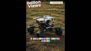
Types of UAVs Used in Civil Engineering
Chapter 3 of 6
🔒 Unlock Audio Chapter
Sign up and enroll to access the full audio experience
Chapter Content
19.1.2 Types of UAVs Used in Civil Engineering
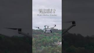
- Fixed-Wing UAVs: Suitable for large area mapping and longer flight durations.
- Multirotor UAVs: Ideal for detailed inspection and hovering tasks.
- Hybrid VTOL UAVs: Combine vertical takeoff and fixed-wing flight capabilities.
Detailed Explanation
Different types of UAVs serve different purposes in civil engineering. Fixed-wing UAVs are best for covering large areas faster and are ideal for mapping projects. Multirotor UAVs, on the other hand, are perfect for detailed inspections because they can hover over specific points. Hybrid VTOL (Vertical Take-Off and Landing) UAVs provide flexibility by allowing vertical takeoff while also providing the capability for longer flights much like fixed-wing UAVs.
Examples & Analogies
Think of these UAV types like different tools in a toolbox. A fixed-wing UAV is like a long-handled broom, great for sweeping large areas quickly. A multirotor UAV is like a magnifying glass, perfect for looking closely at small details. Finally, a hybrid UAV is like a Swiss Army knife — it has multiple functions, adapting to whatever situation you need it for.
Integration of UAVs in Civil Site Monitoring
Chapter 4 of 6
🔒 Unlock Audio Chapter
Sign up and enroll to access the full audio experience
Chapter Content
19.2 Integration of UAVs in Civil Site Monitoring
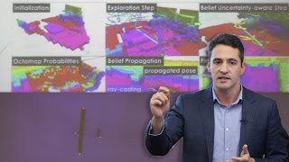
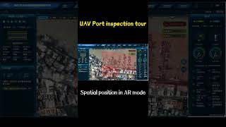
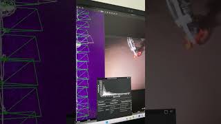
19.2.1 Aerial Surveying and Mapping
- Generation of orthophotos, Digital Elevation Models (DEM), and 3D maps.
- Use of Photogrammetry and LiDAR to capture site features.
Detailed Explanation
This section discusses how UAVs can be integrated into civil site monitoring through aerial surveying and mapping. UAVs can generate various maps and models, such as orthophotos (detailed aerial images), Digital Elevation Models (3D representations of terrain), and full 3D maps of structures and landscapes. Photogrammetry and LiDAR are technologies that enable the UAVs to gather accurate site data, allowing for a precise understanding of the geography and topography of the area.
Examples & Analogies
Consider UAVs as artists creating a large mural. Each drone acts like a painter, using special tools (photogrammetry and LiDAR) to capture different aspects of the area, much like an artist would mix colors and textures on a canvas to create a beautiful and detailed picture of a landscape.
Progress Tracking with UAVs
Chapter 5 of 6
🔒 Unlock Audio Chapter
Sign up and enroll to access the full audio experience
Chapter Content
19.2.2 Progress Tracking
- Regular flight missions scheduled for:
- Capturing construction progress
- Comparing with Building Information Modeling (BIM) or Gantt charts
- Early identification of schedule delays
Detailed Explanation
UAVs can be used for progress tracking in construction projects by performing scheduled flights to document ongoing work. These flights allow for direct comparisons between actual construction progress and plans laid out in Building Information Modeling (BIM) or Gantt charts. This regular documentation helps project managers identify any delays in the construction schedule early, facilitating timely interventions to keep the project on track.
Examples & Analogies
Imagine the regular progress checks on a school project. If you check in every week to see how much of your project is done compared to the initial plan, you can notice right away if you're falling behind. UAVs do the same for construction projects, ensuring they remain on schedule.
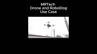
Safety and Hazard Identification
Chapter 6 of 6
🔒 Unlock Audio Chapter
Sign up and enroll to access the full audio experience
Chapter Content
19.2.3 Safety and Hazard Identification
- UAVs used for remote inspection of hazardous zones.
- Detection of:
- Unsafe slopes
- Material instability
- Obstructions and overhead hazards
Detailed Explanation
UAVs greatly enhance safety in construction by allowing for remote inspections of hazardous areas where it's unsafe for humans to enter. They are equipped to detect hazards like unstable slopes, materials that might not be secure, and obstacles such as overhead dangers, providing a safer way to assess risky zones.
Examples & Analogies
Think of UAVs as safety scouts. Just like a scout who goes ahead to check for dangers in a forest trail, drones fly over construction sites to spot hazards that could put workers at risk, allowing workers to avoid those areas until they are deemed safe.
Key Concepts
-
UAV Components: UAVs are composed of several key components, including airframe, propulsion system, sensors, and communication links.
-
Types of UAVs: There are different types of UAVs such as fixed-wing, multi-rotor, and hybrid VTOL, each suited for specific tasks.
-
Applications: UAVs improve site inspections, progress tracking, and safety assessments in civil engineering projects.
-
Data Processing: UAVs use software for data processing through techniques like photogrammetry, integrating with BIM and GIS.
Examples & Applications
UAVs are used for aerial mapping and creating 3D models of construction sites.
Multi-rotor UAVs can hover and provide close-up images for infrastructure inspections.
UAVs equipped with LiDAR can generate precise topographic maps for planning purposes.
Memory Aids
Interactive tools to help you remember key concepts
Rhymes
Drones in the skies, collecting data wise, from photos to maps, they help us realize.
Stories
Imagine a crew using a drone to inspect a bridge. They fly high above, capturing detailed images, spotting issues before they become risky.
Memory Tools
To remember UAV components, think 'APGCCS': Airframe, Propulsion, GPS, Camera, Communication, Sensor.
Acronyms
Use 'G-BIM' to remember GIS integration with Building Information Modeling.
Flash Cards
Glossary
- UAV
Unmanned Aerial Vehicle, an aircraft without a human pilot onboard.
- Photogrammetry
The process of obtaining reliable measurements through the interpretation of photographs.
- BIM
Building Information Modeling, a digital representation of the physical and functional characteristics of a facility.
- GIS
Geographic Information Systems, systems designed to capture, store, analyze, and manage spatial or geographic data.
- LiDAR
Light Detection and Ranging, a method for measuring distances using laser light.
Reference links
Supplementary resources to enhance your learning experience.