
UAV Flight Planning and Automation
Enroll to start learning
You’ve not yet enrolled in this course. Please enroll for free to listen to audio lessons, classroom podcasts and take practice test.
Interactive Audio Lesson
Listen to a student-teacher conversation explaining the topic in a relatable way.
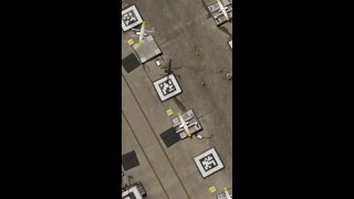
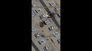
Pre-Flight Planning
🔒 Unlock Audio Lesson
Sign up and enroll to listen to this audio lesson

Let's start with pre-flight planning. What do you think is the first thing we need to do before sending a drone out?

We should choose where to fly.
Exactly! We define the Area of Interest or AOI. This helps to outline the specific area we want to survey. Can anyone tell me why altitude matters during this phase?

It affects how clear the images will be, right?
Right! If we fly too high, we get a broad view but less detail. Ideal altitudes balance the need for detail with efficiency. Now, what about overlap?

It needs to be high enough so that images can be stitched together?
Correct! Typical overlaps are 70% frontlap and 60% sidelap. This ensures we capture comprehensive data. Lastly, we need to decide on the flight path. What patterns can we follow?

We could use a grid or a circular pattern.
Perfect! Grids are great for covering large areas efficiently, while circular patterns may suit specific sites. Let's wrap up this session: Pre-flight planning involves defining the AOI, altitude, overlap, and determining the flight path. These elements ensure that our UAV collects quality data effectively.
Autonomous Flights
🔒 Unlock Audio Lesson
Sign up and enroll to listen to this audio lesson

Now, let's transition to autonomous flights. What do you think it means when we say UAVs can fly autonomously?
It means they can fly without a pilot controlling them?
Great insight! Autonomous flights are programmed through waypoints, which guide the UAV along a predefined path. Why do you think accuracy is crucial here?
So we can get precise data! Is that where RTK technology comes in?
Exactly! Real-Time Kinematic technology offers centimeter-level precision, which is essential for tasks such as mapping. Can anyone think of why we also need emergency return protocols?
To make sure the UAV comes back safely if something goes wrong?
Yes! These protocols are crucial for safety to avoid losing the UAV or overflying restricted areas. Lastly, what is geofencing?
It's to prevent drones from flying into no-fly zones.
Precisely! It enhances safety by setting virtual boundaries. To summarize, autonomous flights involve waypoint navigation, RTK for precision, emergency protocols, and geofencing ensuring safety and accuracy in operations.
Introduction & Overview
Read summaries of the section's main ideas at different levels of detail.
Quick Overview
Standard
In UAV Flight Planning and Automation, we explore the essential steps necessary for successful UAV operations, including defining areas of interest, altitude selection, and utilizing automated flight paths. The importance of tools like DJI Ground Station Pro and real-time kinematic (RTK) systems for precision and safety in autonomous operations is also covered.
Detailed
Detailed Summary
In this section on UAV Flight Planning and Automation, we cover two main subsections: Pre-Flight Planning and Autonomous Flights.
Pre-Flight Planning
Before launching a UAV, it is crucial to define several parameters:
- Area of Interest (AOI): This is the designated space where the UAV will operate, typically outlined in specific software.
- Altitude: Proper altitude must be selected as it significantly affects image resolution; higher altitudes yield a broader view but reduce detail.
- Overlap: Refers to the overlap of images captured during the flight. The typical overlap ranges from 70% frontlap (forward image overlap) and 60% sidelap (side image overlap), ensuring that enough data is collected for effective stitching and mapping.
- Flight Path Pattern: Determining whether the UAV's flight will follow a grid or circular pattern is vital for comprehensive area coverage.
Tools such as DJI Ground Station Pro, DroneDeploy, and UgCS are commonly used to facilitate this planning process, allowing operators to map out missions effectively.
Autonomous Flights
UAV automation involves programming the flights based on predefined waypoints and altitude profiles. Features such as real-time kinematic (RTK) technology provide centimeter-level accuracy for UAV navigation, leading to high-precision data collection. Additionally, UAVs can have emergency return protocols and geofencing capabilities to enhance safety, preventing flights from entering restricted areas.
Overall, this section highlights the importance of thoughtful flight planning and the role of automation in enhancing operational efficiency and safety in UAV operations.
Youtube Videos


Audio Book
Dive deep into the subject with an immersive audiobook experience.
Pre-Flight Planning
Chapter 1 of 2
🔒 Unlock Audio Chapter
Sign up and enroll to access the full audio experience
Chapter Content
Pre-Flight Planning
- Define area of interest (AOI) in software.
- Determine:
- Altitude (affects resolution)
- Overlap (frontlap and sidelap – typical: 70% and 60%)
- Flight path pattern (grid or circular)
- Use of tools: DJI Ground Station Pro, DroneDeploy, UgCS.
Detailed Explanation
Pre-flight planning involves several critical steps to ensure a successful UAV operation. First, the operator needs to define the Area of Interest (AOI) using specialized software. This is essentially the geographic area that the UAV will survey or monitor. Next, the altitude of the flight must be determined since it directly affects the resolution of the imagery captured; higher altitudes can cover more area but with less detail, while lower altitudes provide higher resolution images but cover less area.
Furthermore, overlap is another essential parameter. This involves setting frontlap (overlap in the direction of flight) and sidelap (overlap perpendicular to the flight path). Typical values are about 70% frontlap and 60% sidelap to ensure enough data is captured for creating accurate maps and models.
Finally, the flight path pattern needs to be decided, which can either be a grid pattern for systematic coverage or a circular pattern, depending on the job requirements. Tools like DJI Ground Station Pro, DroneDeploy, and UgCS can be utilized to assist in planning these parameters effectively.
Examples & Analogies
Imagine planning a road trip. Before hitting the road, you'd want to know the best route to take (the area of interest), how high you can elevate your view (altitude), how often you'll stop to take in the sights (overlap), and whether you'll take a straight highway or a scenic byway (flight path pattern). Just like the roadmap ensures you don’t miss anything important during your journey, pre-flight planning ensures the UAV captures all necessary data effectively.
Autonomous Flights
Chapter 2 of 2
🔒 Unlock Audio Chapter
Sign up and enroll to access the full audio experience
Chapter Content
Autonomous Flights
- Programmed via waypoints and altitude profiles.
- Real-time kinematic (RTK) enabled UAVs offer centimeter-level precision.
- Emergency return protocols and geofencing enabled.
Detailed Explanation
Once the pre-flight planning is complete, the next step is to execute autonomous flights. UAVs can be programmed to follow predetermined paths via waypoints, which are specific points in space that the drone should travel to. The altitude profile is also set during this process, ensuring that the UAV maintains the appropriate height throughout the flight.
Additionally, many modern UAVs are equipped with Real-Time Kinematic (RTK) positioning technology. This technology allows the UAV to achieve centimeter-level precision in its location. This is particularly important in applications requiring high accuracy, such as surveying.
Furthermore, safety and reliability are enhanced with features like emergency return protocols that instruct the UAV to return to a set location if communication is lost, and geofencing, which prevents the UAV from flying into restricted areas.
Examples & Analogies
Think of programming an autonomous vacuum cleaner. You set up the vacuum’s path by determining where it needs to go (waypoints) and set it to clean at a particular height from the floor (altitude profile). It knows to return to its charging station if the battery runs low (emergency return protocols) and stays within the walls of your home (geofencing) to avoid getting stuck outside. Similarly, UAVs use advanced programming to ensure they operate effectively and safely in their environment.
Key Concepts
-
Pre-Flight Planning: Essential steps before UAV operation include defining the area of interest, altitude selection, and flight path determination.
-
Autonomous Flight: UAVs can operate without manual control, utilizing waypoints for navigation and RTK for precision.
-
Safety Features: Emergency return protocols and geofencing enhance the safety and reliability of UAV operations.
Examples & Applications
In an urban construction project, UAVs can autonomously survey the area at a specified altitude, ensuring comprehensive data collection with minimal human intervention.
During a landscape mapping project, optimized flight paths and image overlaps ensure high-resolution imagery for detailed analysis.
Memory Aids
Interactive tools to help you remember key concepts
Rhymes
For planning a flight, do it right, define your area, keep it in sight.
Stories
Imagine a drone named 'Auto' who loved to fly. Before each flight, Auto made sure to plan where to go. It considered Altitude, and overlap too, ensuring its maps would be clear and true!
Memory Tools
Acronym A.O.F. for Area, Overlap, Flight path - the three key points in UAV planning.
Acronyms
P.E.A.F. for Pre-flight, Elevation, Area, Flight path. Key points to remember!
Flash Cards
Glossary
- Area of Interest (AOI)
A specific geographic area that a UAV is tasked to survey.
- Altitude
The height at which the UAV operates above ground level, affecting data resolution.
- Overlap
The percentage of overlap between images captured by the UAV during a flight.
- Flight Path
The trajectory that a UAV follows during its operation, which can be grid or circular.
- RealTime Kinematic (RTK)
A technology that provides high-precision location data for UAV navigation.
- Geofencing
A virtual boundary set to prevent UAVs from entering restricted areas.
Reference links
Supplementary resources to enhance your learning experience.