
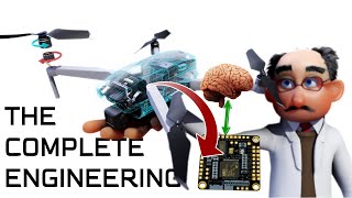
UAV Sensors and Payloads
Enroll to start learning
You’ve not yet enrolled in this course. Please enroll for free to listen to audio lessons, classroom podcasts and take practice test.
Interactive Audio Lesson
Listen to a student-teacher conversation explaining the topic in a relatable way.
Introduction to Optical Sensors
🔒 Unlock Audio Lesson
Sign up and enroll to listen to this audio lesson

Today we're discussing optical sensors in UAVs. Can anyone tell me what type of imagery these sensors provide?

They provide high-resolution images.
That's correct! Optical sensors, like RGB cameras, capture detailed visual data. And what do we use zoom lenses for?

For focused inspections on specific areas?
Exactly! Remember the acronym RIG: Resolution, Inspection, and Geometry. It helps us recall the main uses of optical sensors. Let’s summarize: Optical sensors provide high-resolution imagery, essential for thorough inspections.
Thermal and Infrared Sensors
🔒 Unlock Audio Lesson
Sign up and enroll to listen to this audio lesson

Next, let's discuss thermal and infrared sensors. What do you think these sensors detect?

They can detect heat leaks and electrical faults?
Great! These sensors are essential for identifying problems before they escalate. Can someone explain how they influence the maintenance of buildings?

They help in finding issues, like moisture, which could lead to bigger problems down the road.
Exactly! Just remember the acronym THE: Thermal abnormalities, Heat leaks, and Electrical faults. They play a vital role in building diagnostics.
LiDAR Technology
🔒 Unlock Audio Lesson
Sign up and enroll to listen to this audio lesson
Let’s talk about LiDAR, which stands for Light Detection and Ranging. Can anyone explain how it works?
It captures 3D point cloud data, right?
Correct! LiDAR is extremely precise and is used for topographic surveys. What advantages does this precision offer?
It provides more accurate measurements than traditional methods?
That's right! Think of the acronym TSV - Topographic Surveys and Volumes. This helps remember its main applications. To summarize, LiDAR is key for accurate civil engineering data.
Multispectral and Hyperspectral Cameras
🔒 Unlock Audio Lesson
Sign up and enroll to listen to this audio lesson
Finally, let’s discuss multispectral and hyperspectral cameras. What are these typically used for?
They monitor environmental factors like vegetation health.
Exactly! These cameras help inform our understanding of the environment. Can anyone think of another application in civil engineering?
They could be used to monitor water runoff too?
Perfect! Remember the acronym MEW: Monitoring Environment and Water. They provide essential data for resource management.
Introduction & Overview
Read summaries of the section's main ideas at different levels of detail.
Quick Overview
Standard
UAVs are equipped with a variety of sensors and payloads that enhance their capability for detailed inspections and data collection. This section covers optical, thermal, LiDAR, and multispectral sensors, explaining their specific uses and importance in civil engineering projects.
Detailed
UAV Sensors and Payloads
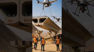
In civil engineering, Unmanned Aerial Vehicles (UAVs) have become integral for site inspection and monitoring, largely thanks to the sophisticated sensors and payloads they carry. This section delves into different types of sensors used in UAVs, highlighting their applications and significance:
19.3.1 Optical Sensors
- RGB cameras are used for high-resolution imagery, enabling detailed visual inspections of structures.
- Zoom lenses allow for focused inspections, offering engineers the ability to assess areas of interest closely without physical access.
19.3.2 Thermal and Infrared Sensors
- These sensors are crucial for detecting anomalies such as heat leaks in buildings, electrical faults, and moisture intrusion. By identifying these issues early, they help in maintaining the integrity of structures.
- The use of thermal imaging is invaluable in energy efficiency assessments and building diagnostics.
19.3.3 LiDAR (Light Detection and Ranging)
- LiDAR technology facilitates the capture of highly accurate 3D point cloud data. This data is essential for conducting topographic surveys, road alignment studies, and grading assessments. The precision of LiDAR data surpasses traditional surveying methods, making it indispensable in modern civil engineering.
19.3.4 Multispectral and Hyperspectral Cameras
- These cameras are utilized in environmental monitoring applications, such as assessing vegetation health and water runoff. They provide critical data that can inform resource management and environmental protection strategies.
The right combination of sensors allows UAVs to be versatile tools for civil engineers, providing critical data that assists in both ongoing monitoring and planning of infrastructure projects.
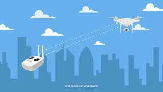
Youtube Videos

Audio Book
Dive deep into the subject with an immersive audiobook experience.
Optical Sensors
Chapter 1 of 4
🔒 Unlock Audio Chapter
Sign up and enroll to access the full audio experience
Chapter Content
Optical Sensors
- RGB cameras for high-resolution imagery.
- Zoom lenses for detailed inspection of structures.
Detailed Explanation
Optical sensors are essential components of UAVs that capture visual data. RGB cameras, which operate similarly to regular digital cameras, are used to take high-resolution images of various sites. This imagery is crucial for documenting conditions and detecting structural issues. The addition of zoom lenses enhances the ability to view specific areas closely, such as inspecting buildings or bridges without needing to approach them physically.
Examples & Analogies
Imagine using a powerful DSLR camera to take photos of a building from a distance. The clearer and sharper the images, the easier it is to spot things like cracks in the walls or roof damage. Just like having a zoom lens on your camera allows you to see details up close, UAVs equipped with zoom optical sensors can inspect hard-to-reach structures in detail.
Thermal and Infrared Sensors
Chapter 2 of 4
🔒 Unlock Audio Chapter
Sign up and enroll to access the full audio experience
Chapter Content
Thermal and Infrared Sensors
- Used for detecting:
- Heat leaks
- Electrical faults
- Moisture intrusion in buildings.
Detailed Explanation
Thermal and infrared sensors detect heat patterns and temperature variations. They are instrumental in finding heat leaks in buildings, which can indicate poor insulation or faults in heating systems. Additionally, these sensors can locate electrical issues by identifying overheating components and moisture intrusion, which can lead to mold growth and structural problems.
Examples & Analogies
Think of thermal sensors like a special pair of glasses that allow you to see temperature changes. If you’ve ever boiled water and noticed steam rising, you know heat moves differently than cold. Just as you can see these heat changes with your eyes, thermal sensors on UAVs can visualize temperature differences across surfaces, helping to identify problems before they become serious.
LiDAR (Light Detection and Ranging)
Chapter 3 of 4
🔒 Unlock Audio Chapter
Sign up and enroll to access the full audio experience
Chapter Content
LiDAR (Light Detection and Ranging)
- Captures highly accurate 3D point cloud data.
- Essential for:
- Topographic surveys
- Road alignment and grading studies.
Detailed Explanation
LiDAR is a remote sensing technology that uses lasers to measure distances to the Earth. When mounted on UAVs, it can create detailed three-dimensional representations of the terrain and structures. This technology is vital for topographic surveys, where accurate elevation data is needed, and for road alignment studies, ensuring proper planning and grading.
Examples & Analogies
Using LiDAR is like having a laser pointer that can measure distances incredibly accurately. Imagine shining a laser at a distant wall and knowing exactly how far away it is. Similarly, UAVs use LiDAR to collect precise measurements over large areas, creating a 3D map that helps engineers design and implement infrastructure projects effectively.
Multispectral and Hyperspectral Cameras
Chapter 4 of 4
🔒 Unlock Audio Chapter
Sign up and enroll to access the full audio experience
Chapter Content
Multispectral and Hyperspectral Cameras
- For environmental monitoring (e.g., vegetation health, water runoff).
Detailed Explanation
Multispectral and hyperspectral cameras are advanced imaging devices that capture a wide range of wavelengths beyond the visible spectrum. This capability is critical in environmental monitoring, as these cameras can analyze vegetation health, detect pollutants, and assess water runoff by identifying different materials and conditions in the landscape. The information gathered can help in managing natural resources and studying ecosystems.
Examples & Analogies
Think of multispectral cameras as a super-powered pair of eyes that can see not just what we see but also how healthy plants are and where there might be pollution. It’s similar to being able to use different colored filters on a camera to get different information about a scene; these cameras can give insights that are invisible to the naked eye, allowing researchers and managers to make better-informed decisions about land and resource use.
Key Concepts
-
Optical Sensors: Capture high-resolution images for detailed inspections.
-
Thermal Sensors: Detect heat leaks and other structural issues.
-
LiDAR: Captures precise 3D point cloud data for various surveys.
-
Multispectral Cameras: Aid in environmental monitoring and assessment.
Examples & Applications
An RGB camera mounted on a UAV can capture high-quality images of a bridge to identify cracks.
A UAV equipped with a thermal sensor can help in diagnosing heat loss areas in an office building.
LiDAR technology can be beneficial for topographic mapping of potential construction sites.
Memory Aids
Interactive tools to help you remember key concepts
Rhymes
If it's red and hot, thermal sensors got it; For images fine, optical's your slot!
Stories
Imagine a UAV flying over a construction site, using its RGB camera to document every detail, while it also checks for thermal leaks, keeping the structures safe and sound.
Memory Tools
Remember the acronym TLOM: Thermal leaks, Optical images, LiDAR mapping.
Acronyms
Think of the acronym MEE - Multispectral for Environment, Evaluating health.
Flash Cards
Glossary
- Optical Sensors
Devices that capture high-resolution imagery for inspections in UAV applications.
- Thermal Sensors
Sensors used for detecting heat leaks, electrical faults, and moisture intrusion.
- LiDAR
Light Detection and Ranging technology used to capture highly accurate 3D point cloud data.
- Multispectral Cameras
Cameras that capture data at different wavelengths for environmental monitoring.
Reference links
Supplementary resources to enhance your learning experience.